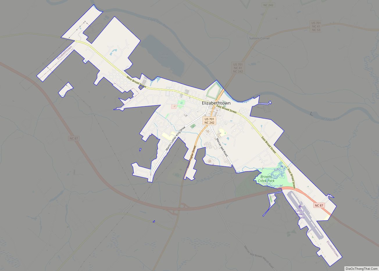
Elizabethtown is a town in Bladen County, North Carolina, United States. The population was 3,583 at the 2010 census. It is the county seat of Bladen County.
| Name: | Elizabethtown town |
|---|---|
| LSAD Code: | 43 |
| LSAD Description: | town (suffix) |
| State: | North Carolina |
| County: | Bladen County |
| Elevation: | 108 ft (33 m) |
| Total Area: | 5.11 sq mi (13.24 km²) |
| Land Area: | 5.07 sq mi (13.13 km²) |
| Water Area: | 0.04 sq mi (0.11 km²) |
| Total Population: | 3,296 |
| Population Density: | 650.23/sq mi (251.05/km²) |
| ZIP code: | 28337 |
| FIPS code: | 3720600 |
| GNISfeature ID: | 1025308 |
| Website: | www.elizabethtownnc.org |
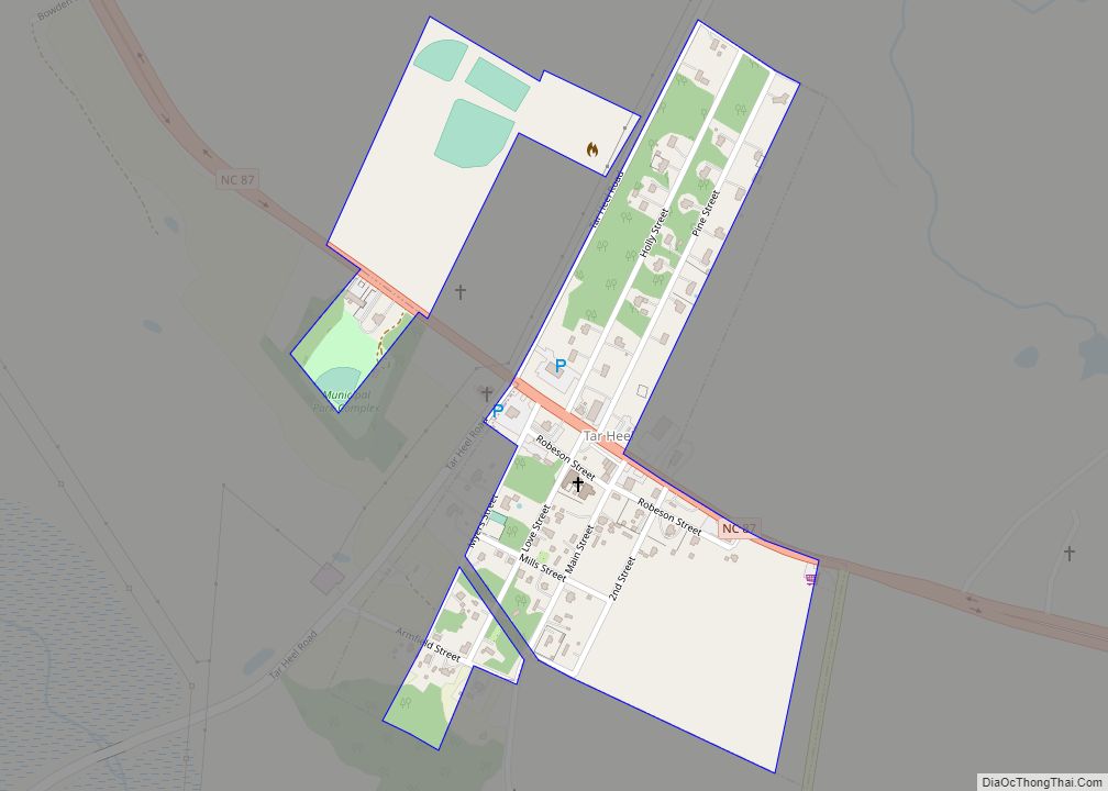
Online Interactive Map
Click on ![]() to view map in "full screen" mode.
to view map in "full screen" mode.
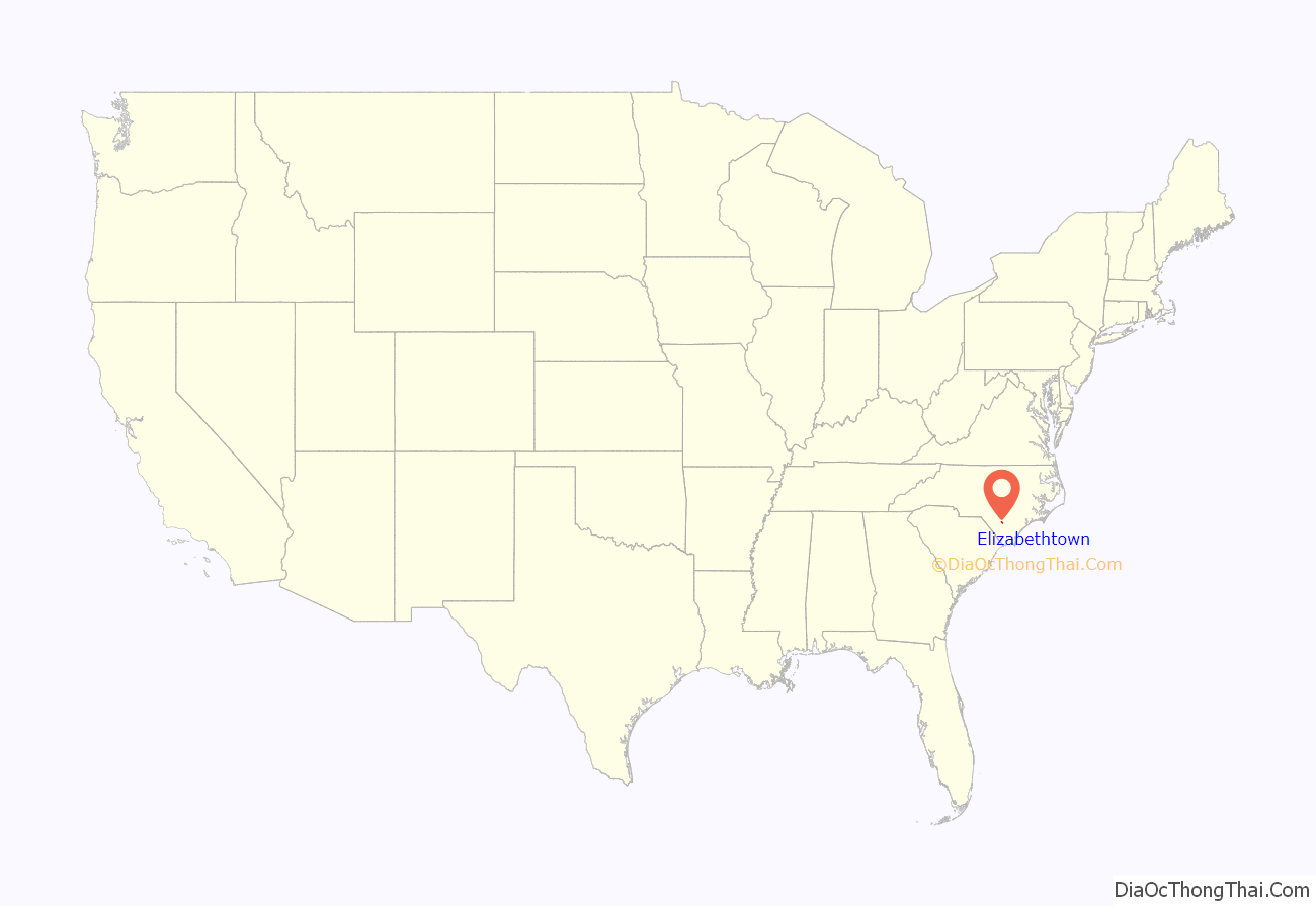
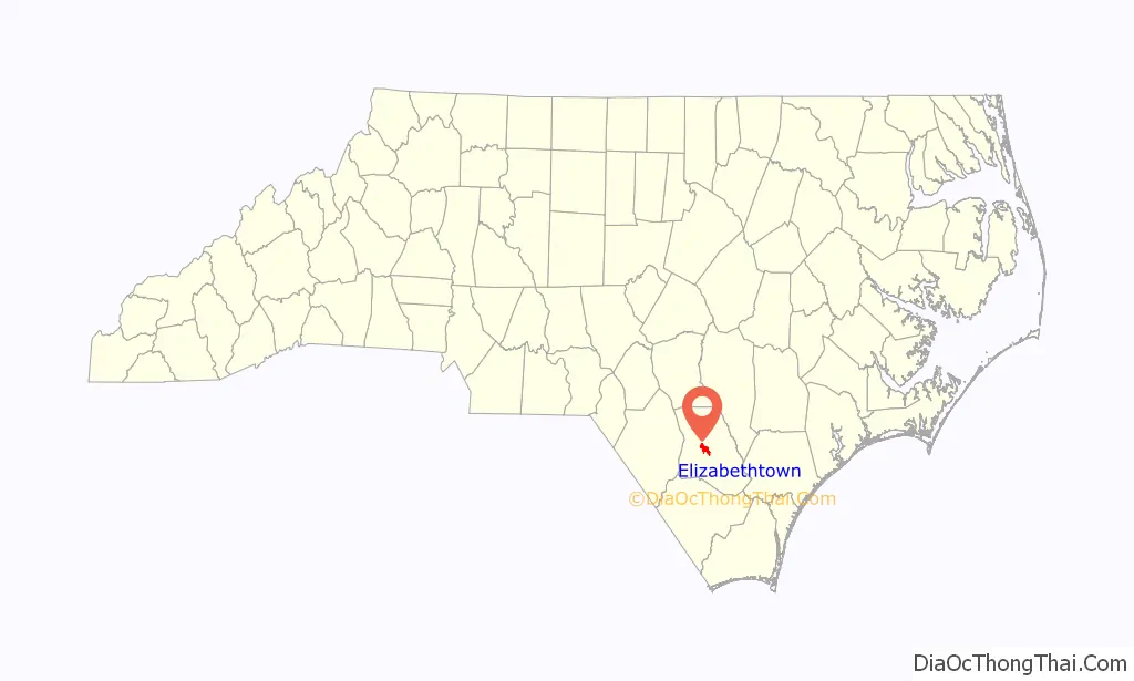
Elizabethtown location map. Where is Elizabethtown town?
History
Some hold Elizabethtown is named for Elizabeth, the wife of George Carteret, while others believe it was named for the love interest of a local landowner.
In the 1970s Elizabethtown more than doubled its size through annexation, increasing from about 1400 square feet to 3700 square feet in area.
The Mt. Horeb Presbyterian Church and Cemetery and Trinity Methodist Church are listed on the National Register of Historic Places.
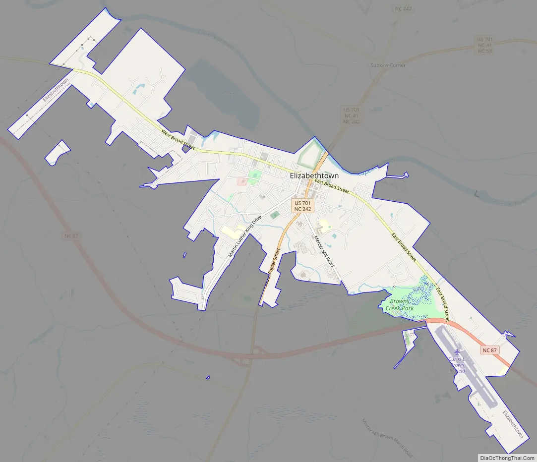
Elizabethtown Road Map
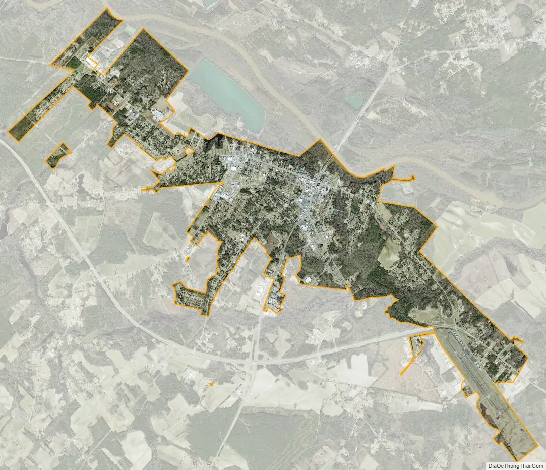
Elizabethtown city Satellite Map
Geography
Elizabethtown is located at 34°37′32″N 78°36′44″W / 34.62556°N 78.61222°W / 34.62556; -78.61222 (34.625691, −78.612270).
According to the United States Census Bureau, the town has a total area of 4.7 square miles (12.1 km), of which 4.6 square miles (12.0 km) is land and 0.039 square miles (0.1 km), or 0.73%, is water.
Browns Creek, a tributary to the Cape Fear River, drains the south side of Elizabethtown.
See also
Map of North Carolina State and its subdivision:- Alamance
- Alexander
- Alleghany
- Anson
- Ashe
- Avery
- Beaufort
- Bertie
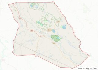
- Bladen
- Brunswick
- Buncombe
- Burke
- Cabarrus
- Caldwell
- Camden
- Carteret
- Caswell
- Catawba
- Chatham
- Cherokee
- Chowan
- Clay
- Cleveland
- Columbus
- Craven
- Cumberland
- Currituck
- Dare
- Davidson
- Davie
- Duplin
- Durham
- Edgecombe
- Forsyth
- Franklin
- Gaston
- Gates
- Graham
- Granville
- Greene
- Guilford
- Halifax
- Harnett
- Haywood
- Henderson
- Hertford
- Hoke
- Hyde
- Iredell
- Jackson
- Johnston
- Jones
- Lee
- Lenoir
- Lincoln
- Macon
- Madison
- Martin
- McDowell
- Mecklenburg
- Mitchell
- Montgomery
- Moore
- Nash
- New Hanover
- Northampton
- Onslow
- Orange
- Pamlico
- Pasquotank
- Pender
- Perquimans
- Person
- Pitt
- Polk
- Randolph
- Richmond
- Robeson
- Rockingham
- Rowan
- Rutherford
- Sampson
- Scotland
- Stanly
- Stokes
- Surry
- Swain
- Transylvania
- Tyrrell
- Union
- Vance
- Wake
- Warren
- Washington
- Watauga
- Wayne
- Wilkes
- Wilson
- Yadkin
- Yancey
- Alabama
- Alaska
- Arizona
- Arkansas
- California
- Colorado
- Connecticut
- Delaware
- District of Columbia
- Florida
- Georgia
- Hawaii
- Idaho
- Illinois
- Indiana
- Iowa
- Kansas
- Kentucky
- Louisiana
- Maine
- Maryland
- Massachusetts
- Michigan
- Minnesota
- Mississippi
- Missouri
- Montana
- Nebraska
- Nevada
- New Hampshire
- New Jersey
- New Mexico
- New York
- North Carolina
- North Dakota
- Ohio
- Oklahoma
- Oregon
- Pennsylvania
- Rhode Island
- South Carolina
- South Dakota
- Tennessee
- Texas
- Utah
- Vermont
- Virginia
- Washington
- West Virginia
- Wisconsin
- Wyoming