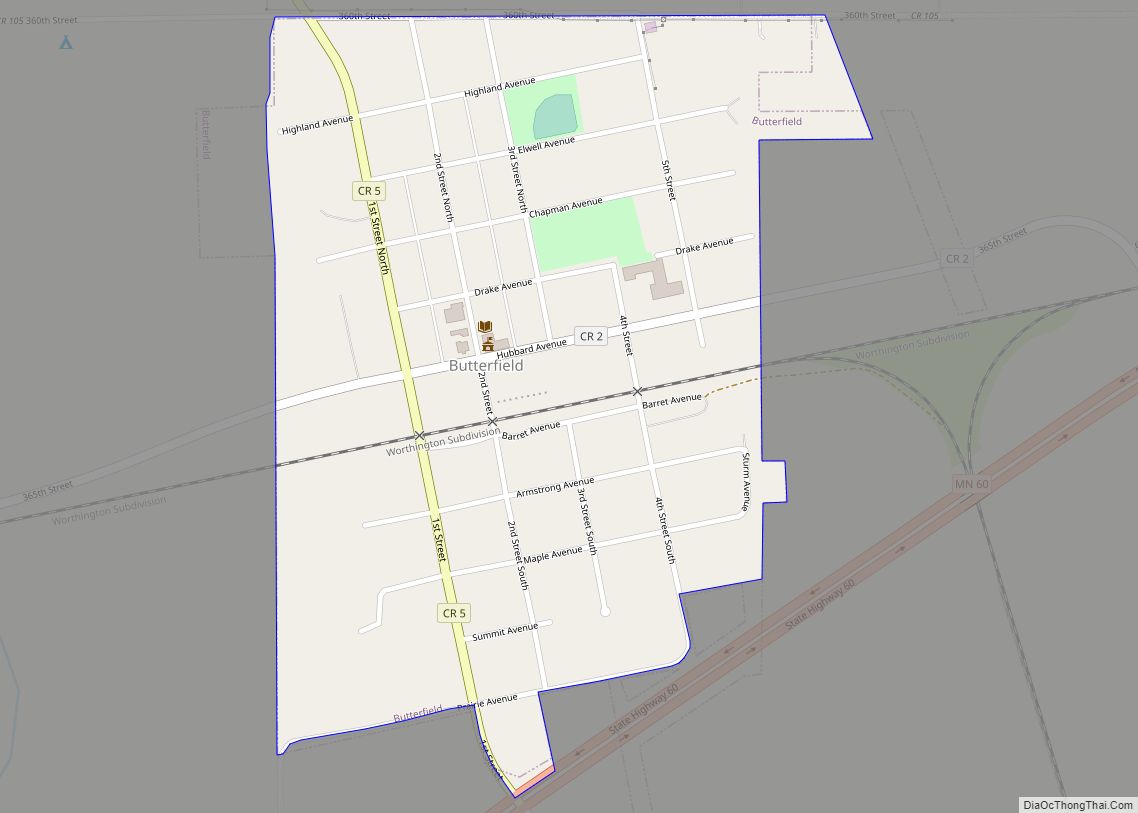
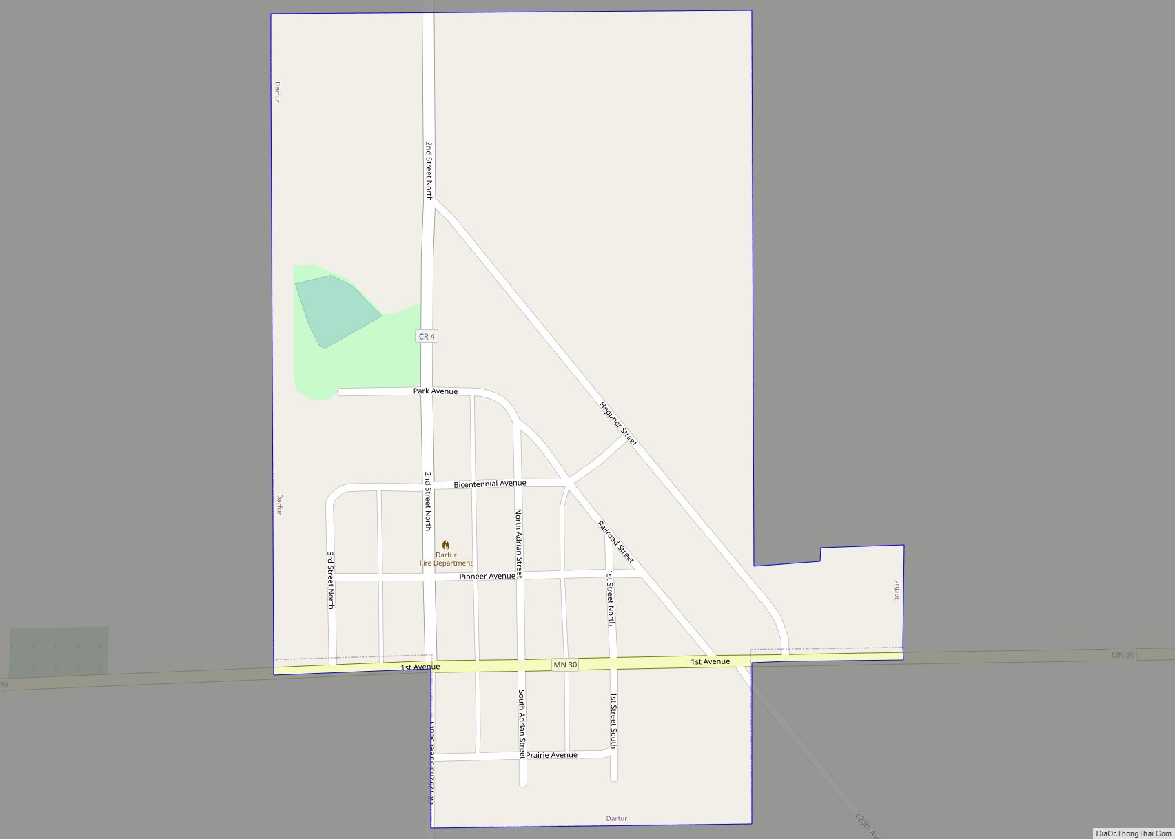
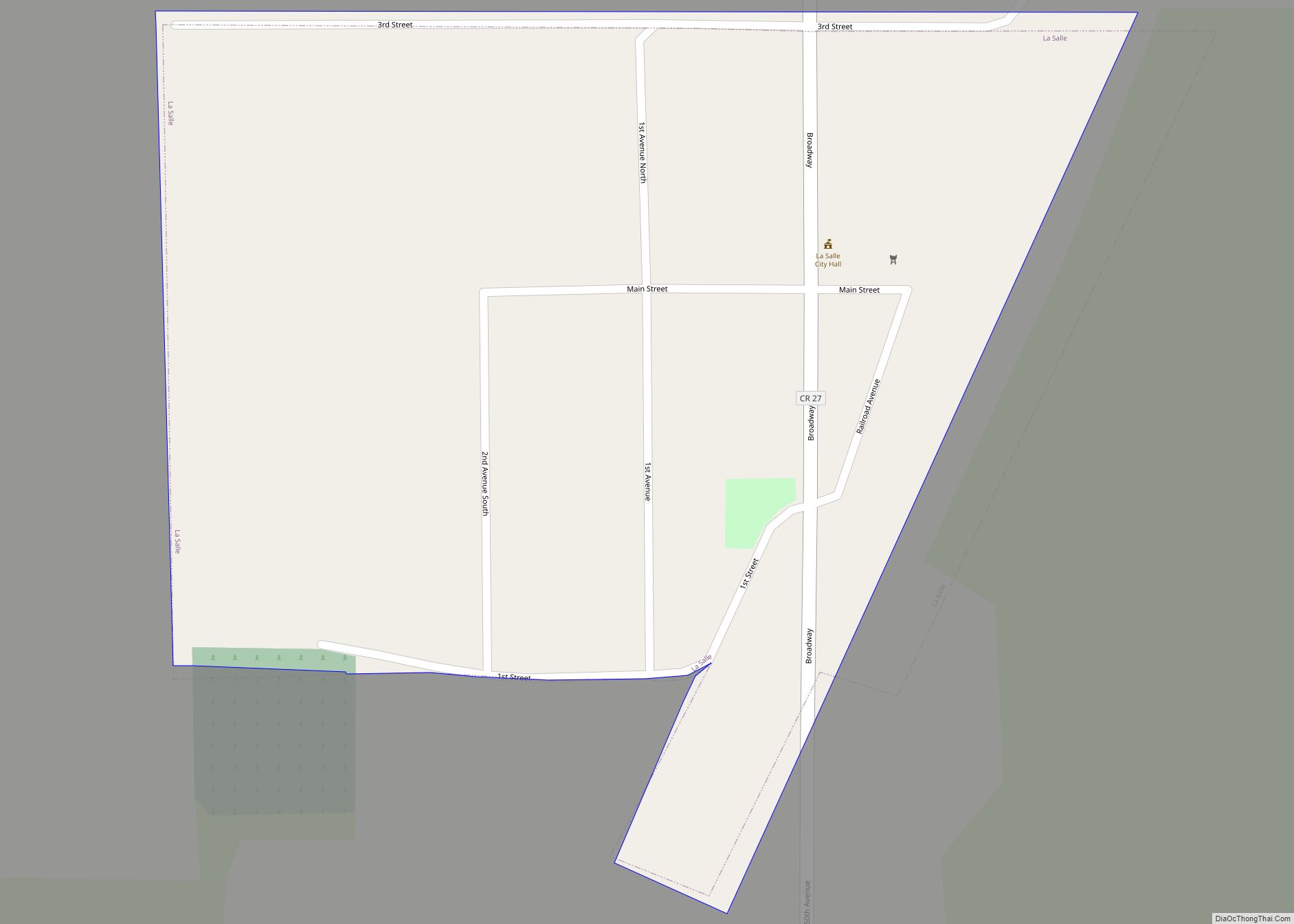
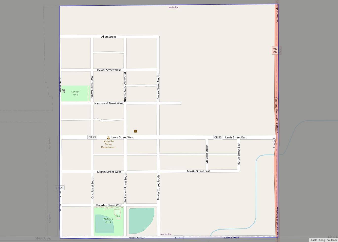
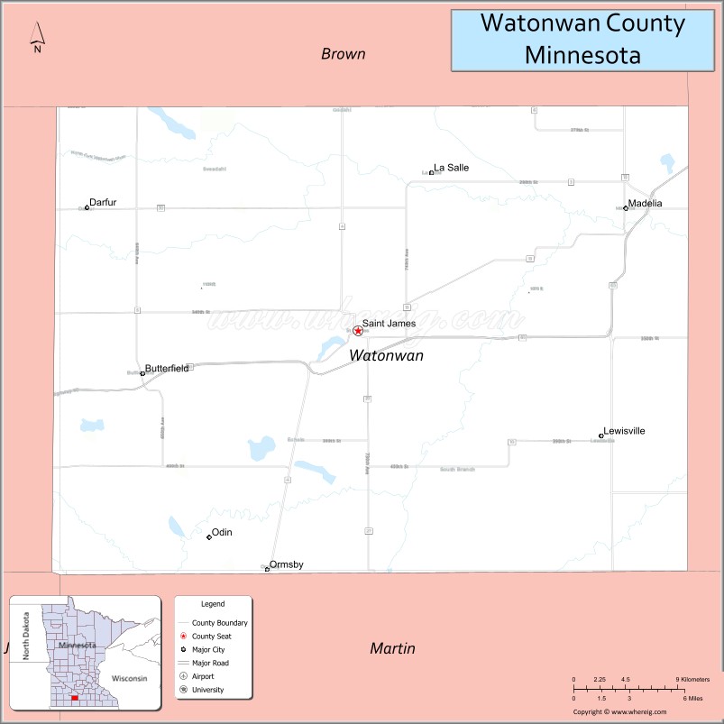
Watonwan County is a county in the U.S. state of Minnesota. As of the 2020 census, the population was 11,253. Its county seat is St. James.
| Name: | Watonwan County |
|---|---|
| FIPS code: | 27-165 |
| State: | Minnesota |
| Founded: | February 25, 1860 |
| Named for: | Watonwan River |
| Seat: | St. James |
| Largest city: | St. James |
| Total Area: | 440 sq mi (1,100 km²) |
| Land Area: | 435 sq mi (1,130 km²) |
| Total Population: | 11,253 |
| Population Density: | 25.9/sq mi (10.0/km²) |
| Time zone: | UTC−6 (Central) |
| Summer Time Zone (DST): | UTC−5 (CDT) |
| Website: | www.co.watonwan.mn.us |
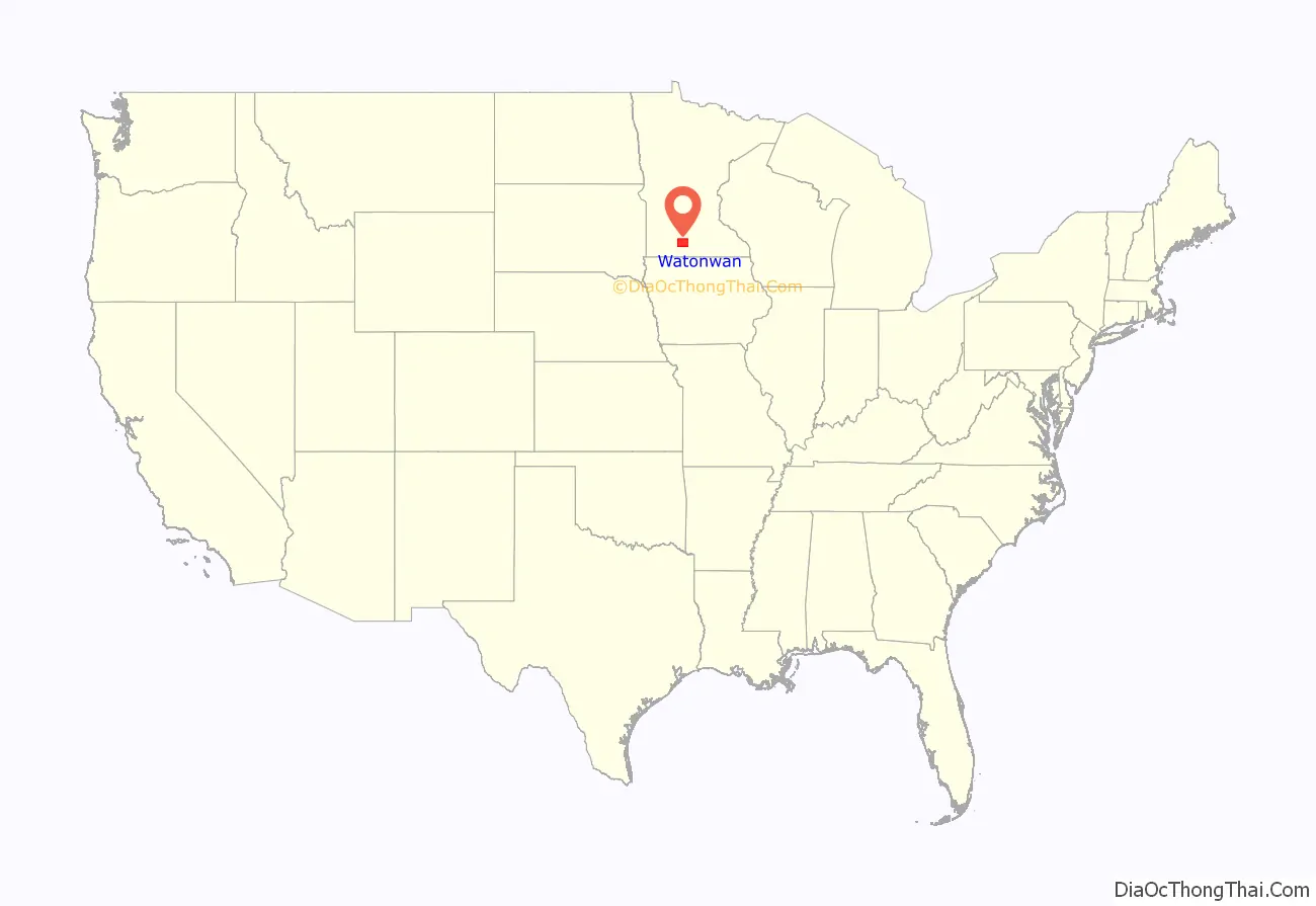
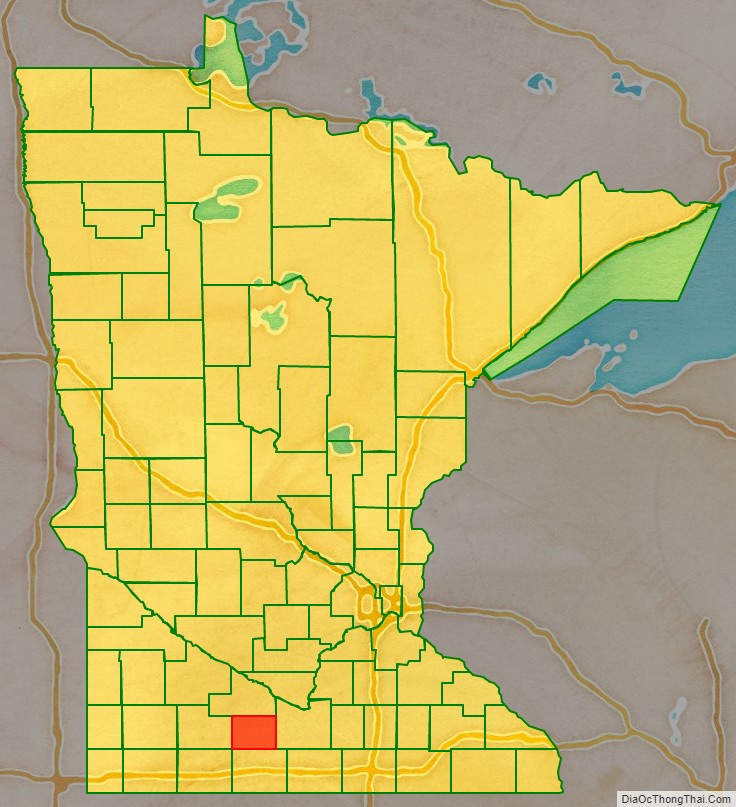
Watonwan County location map. Where is Watonwan County?
History
In 1849, the recently organized Minnesota Territory legislature authorized the creation of nine large counties across the territory. In 1853, one of those original counties, Dakota, had a large area partitioned off to create Blue Earth County. In 1855 the western part of Blue Earth was partitioned to create Brown County. On February 25, 1860, the southern part of Brown was partitioned to create this county, with Madelia as the designated county seat. The county was named for its eponymous river, whose name reflects the Dakota word “watanwan,” meaning “fish bait” or “plenty of fish.” The word first appears in the written record on an 1843 map of the area so naming the river.
In 1869 the first settlers arrived in the area of the future Saint James, and the area began growing. In 1870 an extension of the St. Paul and Sioux City Railway was terminated at the village, and railway officials decided to name the terminus Saint James. By 1878 the town had grown to the extent that a vote was taken to move the county seat there.
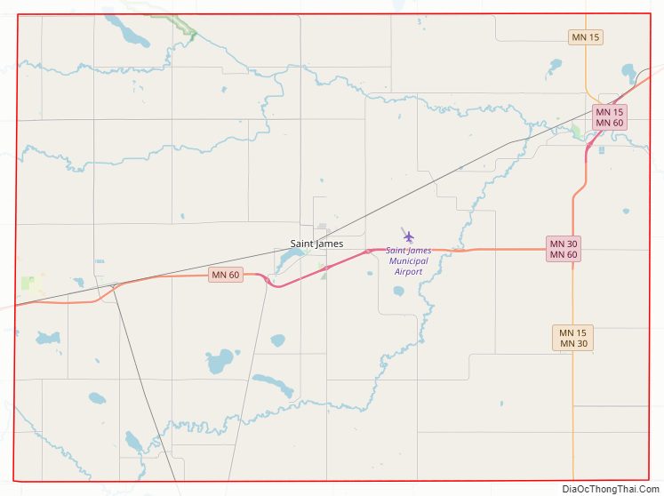
Watonwan County Road Map
Geography
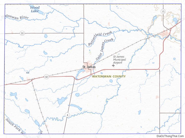
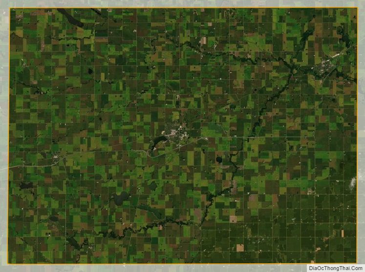
The terrain of Watonwan County consists of low rolling hills, carved by drainages and dotted with lakes and ponds. The area is completely devoted to agriculture where possible. The terrain slopes to the north and east, with its highest point near its southwest corner, at 1,293′ (394m) ASL. The county has an area of 440 square miles (1,100 km), of which 435 square miles (1,130 km) is land and 4.8 square miles (12 km) (1.1%) is water. The county is drained by the Watonwan River and its tributaries; the river flows eastward through the northern part of the county.
Major highways
- Minnesota State Highway 4
- Minnesota State Highway 15
- Minnesota State Highway 30
- Minnesota State Highway 60
Airports
- St. James Municipal Airport (JYG, LID) – 3 miles (5 km) east of St. James
Adjacent counties
- Brown County – north
- Blue Earth County – east
- Martin County – south
- Jackson County – southwest
- Cottonwood County – west
Protected areas
- Bergdahl State Wildlife Management Area
- Lewisville State Wildlife Management Area
- Turtle Marsh State Wildlife Management Area
- Wilson State Wildlife Management Area
- Woodlake State Wildlife Management Area
Lakes
- Bergdahl Lake
- Bullhead Lake
- Butterfield Lake
- Case Lake
- Cottonwood Lake
- Ewy Lake
- Fedji Lake
- Irish Lake
- Long Lake
- Mary Lake
- Mud Lake
- Kansas Lake
- Saint James Lake
- School Lake
- Sulem Lake
- Wilson Lake (“School Lake” in some records)
- Wood Lake (part)
Watonwan County Topographic Map
Watonwan County Satellite Map
Watonwan County Outline Map