Le Sueur County is a county located in the south central portion of the U.S. state of Minnesota. As of the 2020 census, the population was 28,674. Its county seat is Le Center.
Le Sueur County is part of the Minneapolis–St. Paul–Bloomington, MN-WI Metropolitan Statistical Area.
| Name: | Le Sueur County |
|---|---|
| FIPS code: | 27-079 |
| State: | Minnesota |
| Founded: | March 5, 1853 |
| Named for: | Pierre-Charles Le Sueur |
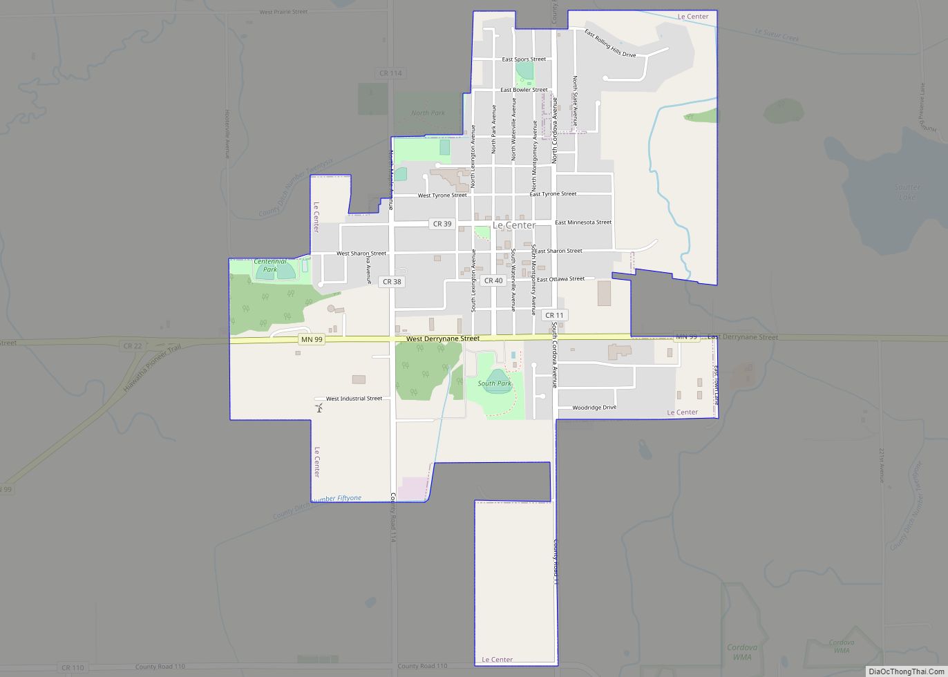
| Seat: | Le Center |
| Largest city: | Le Sueur |
| Total Area: | 474 sq mi (1,230 km²) |
| Land Area: | 449 sq mi (1,160 km²) |
| Total Population: | 28,674 |
| Population Density: | 63.9/sq mi (24.7/km²) |
| Time zone: | UTC−6 (Central) |
| Summer Time Zone (DST): | UTC−5 (CDT) |
| Website: | www.co.le-sueur.mn.us |
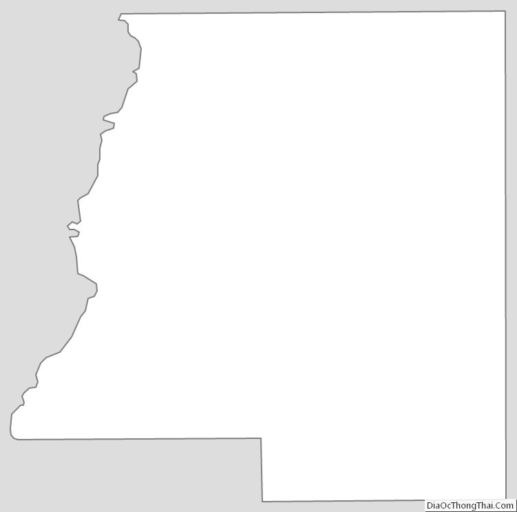
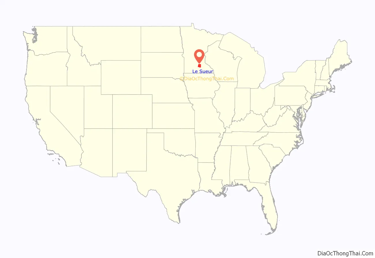
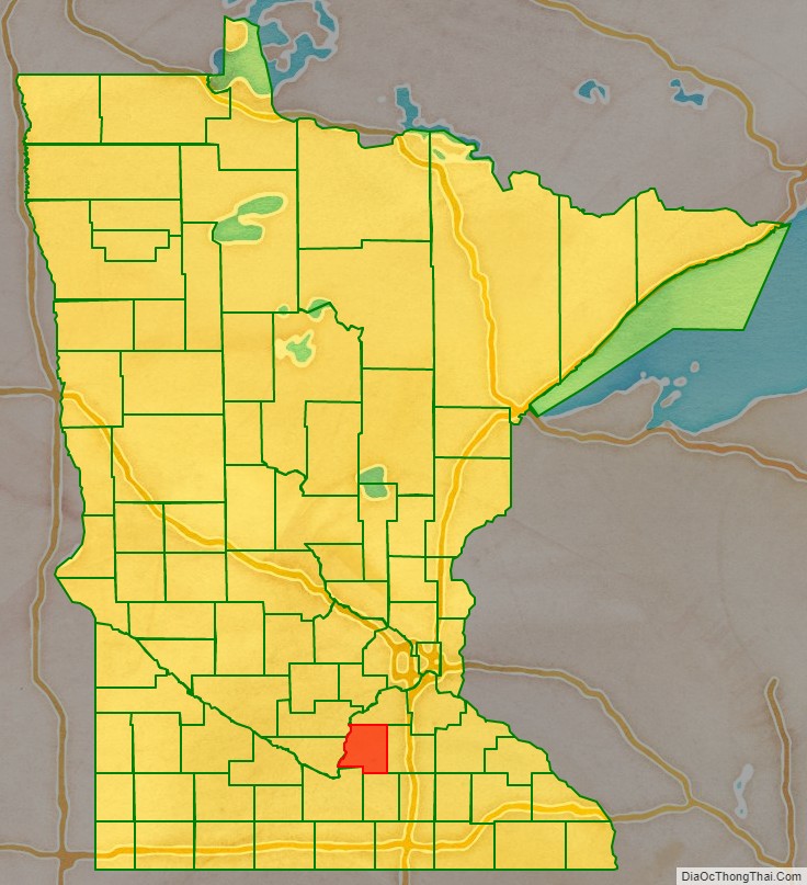
Le Sueur County location map. Where is Le Sueur County?
History
The Minnesota Territory legislature established several counties in 1853. This county was created on March 5 of that year. It was named for French explorer Pierre-Charles Le Sueur, who visited the area in 1700.
The settlement of Le Sueur (actually two competing settlements, Le Sueur and Le Sueur City) had sprung up on the east bank of the Minnesota River, both being platted in 1852. The legislature named the combined area as the first county seat. However, its remoteness from most of the county meant hardship for most of the area’s residents since the county was covered with dense hardwood forest and existing roads were impassable when wet.
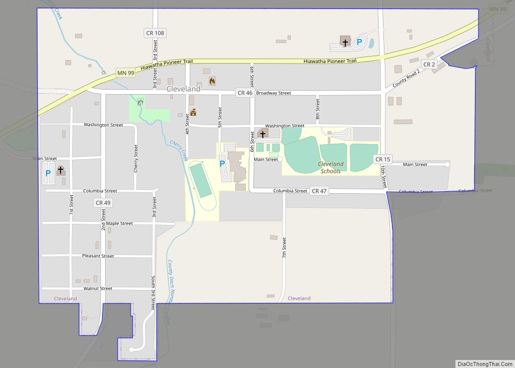
Several efforts were made to acquire a more central location. In the early 1870s, Cleveland (established in 1857, inland from the river in the SW part of the county) held a referendum to become the county seat. The referendum passed, but was challenged due to voting irregularities. In 1875 another referendum made Cleveland the county seat (1875-1876). In 1876, another referendum approved moving the seat to the newly created town of Le Sueur Center; the seat was promptly moved there. In the 1870s, businessmen from Waterville gained ownership of a quarter-section of land near the county’s center, cleared the timber, and platted the city of Le Sueur Center (1876). The seat was moved there after a county referendum approved it. The county seat has remained in Le Sueur Center (renamed Le Center in 1930) since 1876.
The first railroad entered the county in 1867. This began the era of greater access and mobility. The first purpose-built courthouse in Le Sueur Center was constructed in 1896–7. It has been extensively remodeled and enlarged two times since.
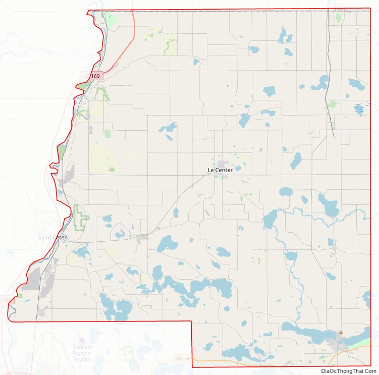
Le Sueur County Road Map
Geography
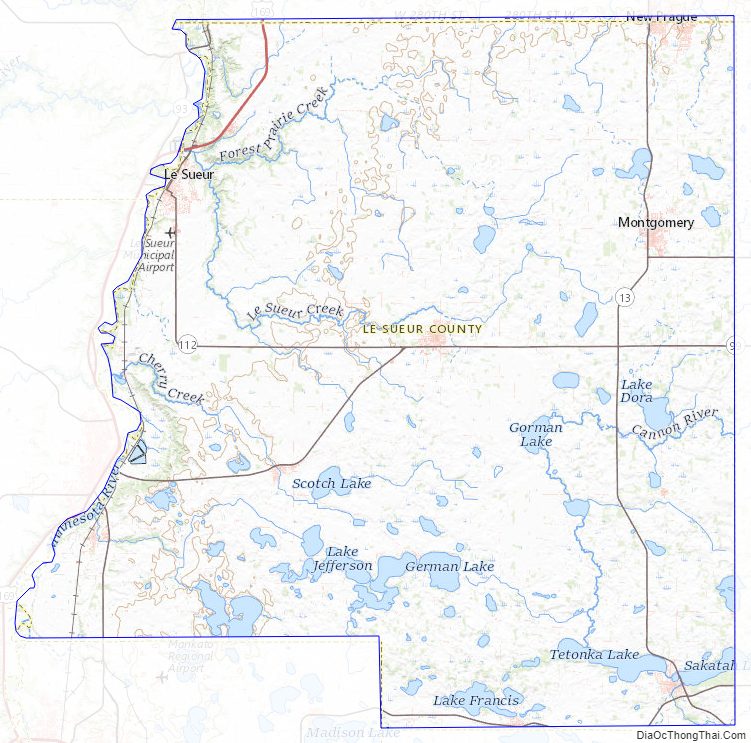
The Minnesota River flows northeastward along the west border of Le Sueur County, on its way to discharge into the Mississippi. The terrain consists of low rolling hills, dotted with lakes and ponds. The soil is rich and black. The terrain slopes to the north and east, with its highest point near the midpoint of its east border, at 1,145′ (349m) ASL. The county has an area of 474 square miles (1,230 km), of which 449 square miles (1,160 km) is land and 25 square miles (65 km) (5.3%) is water. Le Sueur is one of seven Minnesota savanna region counties where no forest soils exist and one of 17 counties where savanna soils dominate.
Lakes
The following lakes are partially or completely within Le Sueur County:
- Borer Lake
- Bossuot Lake
- Clear Lake
- Decker Lake
- Diamond Lake
- Dietz Lake
- Dog Lake
- Dora Lake
- Eggert Lake
- Ely Lake
- Emily Lake
- Fish Lake
- German Lake
- Goldsmith Lake
- Goose Lake (Cordova Township)
- Goose Lake (Waterville Township)
- Gorman Lake
- Greenleaf Lake
- Harkridge Lake
- Horseshoe Lake (part)
- Huoy Lake
- Lake Emily
- Lake Frances
- Lake Henry
- Lake Jefferson
- Lake Mabel
- Lake Pepin
- Lake Sanborn
- Lake Tustin
- Lake Volney
- Lake Washington
- Mareks Lake
- Mary Lake
- Mud Lake (Cordova Township)
- Mud Lake (Lanesburgh Township)
- Mud Lake (Lexington Township)
- North Goldsmith Lake
- Perch Lake
- Rays Lake
- Rice Lake
- Roemhildts Lake
- Round Lake
- Sabre Lake
- Sakatah Lake (part)
- Sanborn Lake
- Sasse Lake
- Savidge Lake
- School Lake
- Scotch Lake
- Shanghai Lake
- Sheas Lake
- Silver Lake (Cleveland Township)
- Silver Lake (Elysian Township)
- Sleepy Eye Lake
- Steele Lake
- Sunfish Lake
- Tetonka Lake (headwaters of Cannon River)
- Thomas Lake
- Tyler Lake
Protected areas
The following protected areas are within Le Sueur County:
- Bardel State Wildlife Management Area
- Chadderdon State Wildlife Management Area
- Chamberlain Woods Scientific and Natural Area
- Diamond Lake State Wildlife Management Area
- Minnesota Valley National Wildlife Refuge (part)
- Ottawa State Wildlife Management Area
- Paddy Marsh State Wildlife Management Area
- Saint Thomas State Wildlife Management Area
- Sakatah Lake State Park (part)
- Seven Mile Creek State Park (part)
- Shanghai State Wildlife Area
- Sheas Lake State Wildlife Area
Major highways
- US Highway 169
- Minnesota State Highway 13
- Minnesota State Highway 19
- Minnesota State Highway 21
- Minnesota State Highway 22
- Minnesota State Highway 60
- Minnesota State Highway 93
- Minnesota State Highway 99
- List of county roads
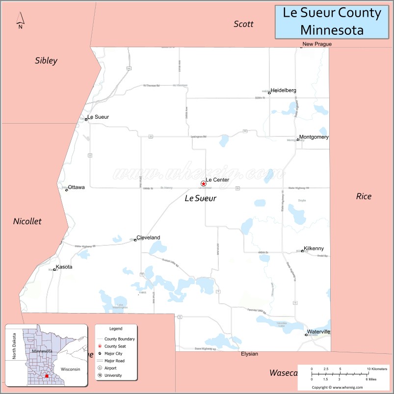
Adjacent counties
- Scott County – north
- Rice County – east
- Waseca County – south
- Blue Earth County – southwest
- Nicollet County – west
- Sibley County – northwest
Le Sueur County Topographic Map
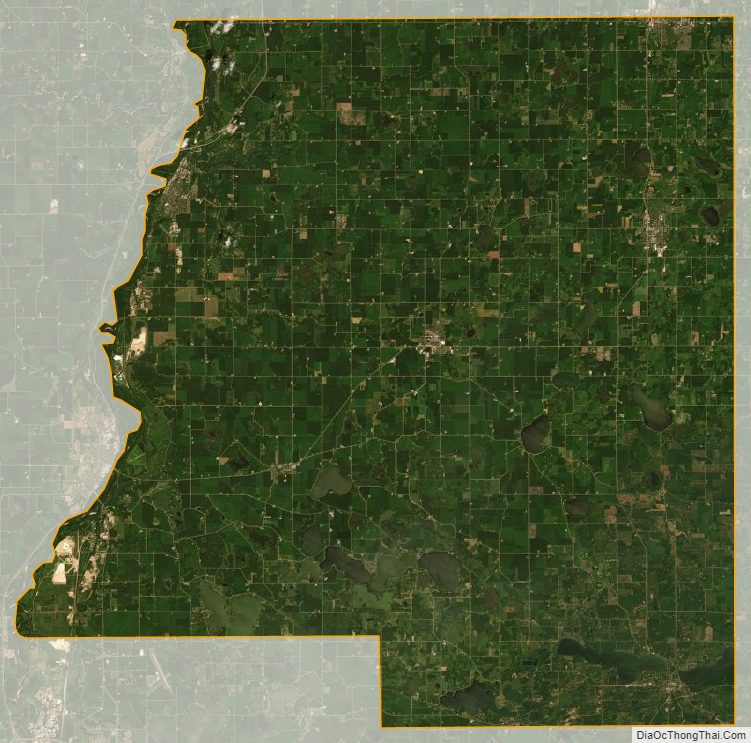
Le Sueur County Satellite Map
Le Sueur County Outline Map