Alliance is a city and the county seat of Box Butte County, in the western part of the state of Nebraska, in the Great Plains region of the United States. Its population was 8,151 at the 2020 census.
Alliance is the home to Carhenge, a replica of Stonehenge constructed with automobiles, which is located north of the city. It is also the location of Alliance Municipal Airport, the least-used airport in the mainland United States.
| Name: | Alliance city |
|---|---|
| LSAD Code: | 25 |
| LSAD Description: | city (suffix) |
| State: | Nebraska |
| County: | Box Butte County |
| Elevation: | 3,966 ft (1,209 m) |
| Total Area: | 4.91 sq mi (12.71 km²) |
| Land Area: | 4.89 sq mi (12.68 km²) |
| Water Area: | 0.01 sq mi (0.03 km²) |
| Total Population: | 8,151 |
| Population Density: | 1,665.51/sq mi (643.05/km²) |
| ZIP code: | 69301 |
| Area code: | 308 |
| FIPS code: | 3100905 |
| GNISfeature ID: | 0834978 |
| Website: | cityofalliance.net |
Online Interactive Map
Click on ![]() to view map in "full screen" mode.
to view map in "full screen" mode.
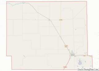
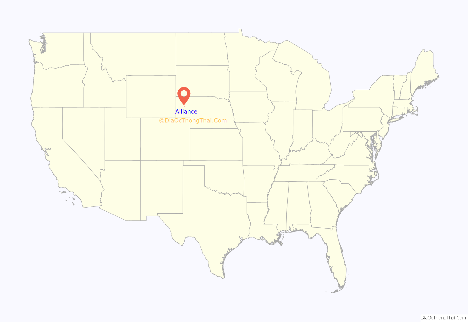
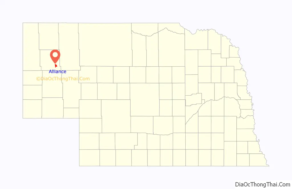
Alliance location map. Where is Alliance city?
History
The town was originally named Grand Lake. When the Chicago, Burlington and Quincy Railroad came to Grand Lake in 1888, the railroad superintendent, G.W. Holdrege, wanted to change it to a simple one-word name closer to the beginning of the alphabet, which he thought would be better for business. The U.S. Post Office gave Holdrege permission, and he picked “Alliance” for the new name of the town. Alliance was incorporated as a city in 1891.
The Alliance Army Airfield was established in 1942. Construction was completed in August 1943 and the Army Air Corps used the facility as a training base until the end of World War II. The facility was transferred from the federal government to the City of Alliance in 1953 and is currently in use as the Alliance Municipal Airport.
In the Lakota language, Alliance is known as čhasmú okáȟmi, meaning “Sand River Bend”.
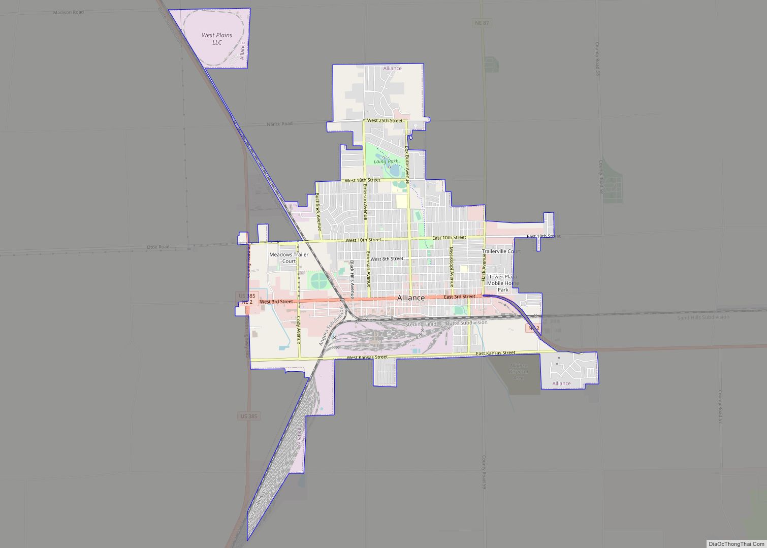
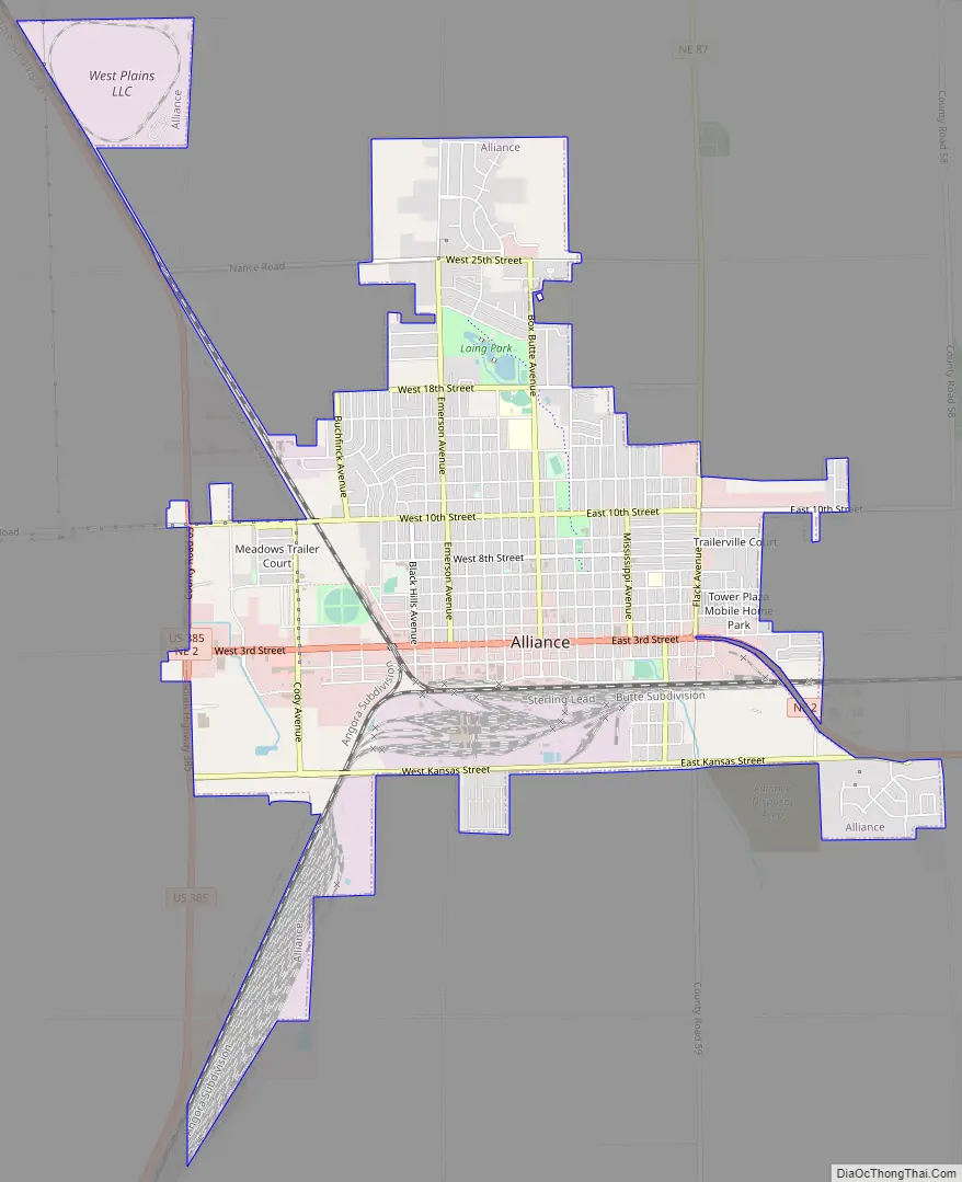
Alliance Road Map
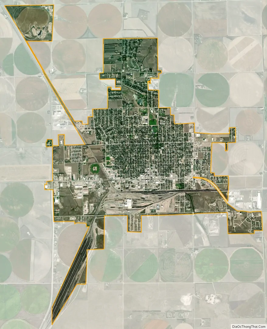
Alliance city Satellite Map
Geography
Alliance is located at the western edge of Nebraska’s Sand Hills. According to the United States Census Bureau, the city has a total area of 4.73 square miles (12.25 km), of which 4.72 square miles (12.22 km) is land and 0.01 square miles (0.03 km) is water.
Climate
Located in the High Plains, Alliance’s climate is rather typical of the surrounding region. Under the Köppen climate classification, the town features a BSk climate, commonly described as a “Cold Steppe”, with winters just below the −3 °C (26.6 °F) threshold needed to be classified as a Continental climate, if it had enough precipitation to not be arid or semi-arid.
The all-time record high for Alliance is 110 °F (43 °C), set in 1983, and the all-time record low is −42 °F (−41 °C), set in 1989. Precipitation is significantly higher in summer than in winter, with the wettest month being June, and the driest month being January.
See also
Map of Nebraska State and its subdivision:- Adams
- Antelope
- Arthur
- Banner
- Blaine
- Boone
- Box Butte
- Boyd
- Brown
- Buffalo
- Burt
- Butler
- Cass
- Cedar
- Chase
- Cherry
- Cheyenne
- Clay
- Colfax
- Cuming
- Custer
- Dakota
- Dawes
- Dawson
- Deuel
- Dixon
- Dodge
- Douglas
- Dundy
- Fillmore
- Franklin
- Frontier
- Furnas
- Gage
- Garden
- Garfield
- Gosper
- Grant
- Greeley
- Hall
- Hamilton
- Harlan
- Hayes
- Hitchcock
- Holt
- Hooker
- Howard
- Jefferson
- Johnson
- Kearney
- Keith
- Keya Paha
- Kimball
- Knox
- Lancaster
- Lincoln
- Logan
- Loup
- Madison
- McPherson
- Merrick
- Morrill
- Nance
- Nemaha
- Nuckolls
- Otoe
- Pawnee
- Perkins
- Phelps
- Pierce
- Platte
- Polk
- Red Willow
- Richardson
- Rock
- Saline
- Sarpy
- Saunders
- Scotts Bluff
- Seward
- Sheridan
- Sherman
- Sioux
- Stanton
- Thayer
- Thomas
- Thurston
- Valley
- Washington
- Wayne
- Webster
- Wheeler
- York
- Alabama
- Alaska
- Arizona
- Arkansas
- California
- Colorado
- Connecticut
- Delaware
- District of Columbia
- Florida
- Georgia
- Hawaii
- Idaho
- Illinois
- Indiana
- Iowa
- Kansas
- Kentucky
- Louisiana
- Maine
- Maryland
- Massachusetts
- Michigan
- Minnesota
- Mississippi
- Missouri
- Montana
- Nebraska
- Nevada
- New Hampshire
- New Jersey
- New Mexico
- New York
- North Carolina
- North Dakota
- Ohio
- Oklahoma
- Oregon
- Pennsylvania
- Rhode Island
- South Carolina
- South Dakota
- Tennessee
- Texas
- Utah
- Vermont
- Virginia
- Washington
- West Virginia
- Wisconsin
- Wyoming