Jefferson County is a county located in the U.S. state of Colorado. As of the 2020 census, the population was 582,910, making it the fourth-most populous county in Colorado. The county seat is Golden, and the most populous city is Lakewood.
Jefferson County is included in the Denver–Aurora-Lakewood, CO Metropolitan Statistical Area. Located along the Front Range of the Rocky Mountains, Jefferson County is adjacent to the state capital of Denver.
In 2010, the center of population of Colorado was located in Jefferson County.
The county’s slogan is the “Gateway to the Rocky Mountains”, and it is commonly nicknamed Jeffco. The name Jeffco is incorporated in the name of the Jeffco School District, the Jeffco Business Center Metropolitan District No. 1, and several businesses located in Jefferson County. Jeffco is also incorporated in the unofficial monikers of many Jefferson County agencies. The Rocky Mountain Metropolitan Airport operated by Jefferson County was previously known as the Jeffco Airport.
A major employer in Jefferson County is the large Coors Brewing Company in Golden. Also, the state-supported Colorado School of Mines, a university specializing in mining, geology, chemistry, and engineering is located in Jefferson County.
| Name: | Jefferson County |
|---|---|
| FIPS code: | 08-059 |
| State: | Colorado |
| Founded: | November 1, 1861 |
| Named for: | Thomas Jefferson |
| Seat: | Golden |
| Largest city: | Lakewood |
| Total Area: | 774 sq mi (2,000 km²) |
| Land Area: | 764 sq mi (1,980 km²) |
| Total Population: | 579,581 |
| Population Density: | 763/sq mi (295/km²) |
| Time zone: | UTC−7 (Mountain) |
| Summer Time Zone (DST): | UTC−6 (MDT) |
| Website: | www.jeffco.us |
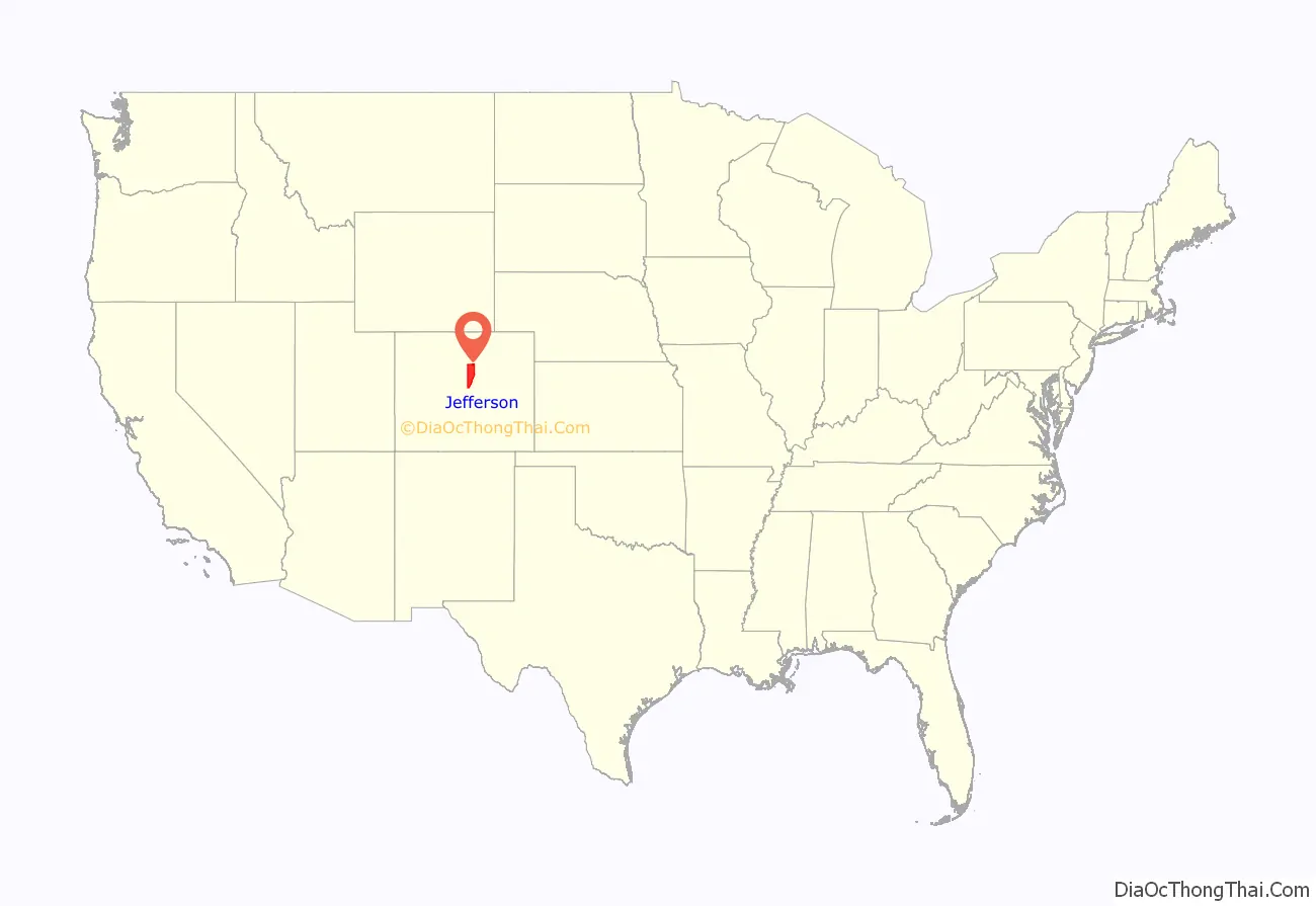
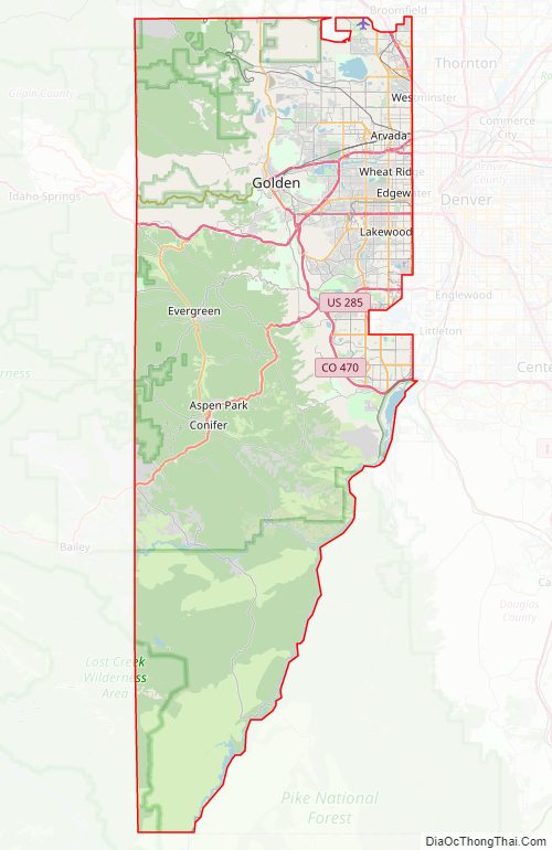
Jefferson County location map. Where is Jefferson County?
History
On August 25, 1855, the Kansas Territorial Legislature created Arapahoe County to govern the entire western portion of the territory. The county was named for the Arapaho Nation of Native Americans who lived in the region.
On June 22, 1858, gold was discovered along the South Platte River in Arapahoe County (in present-day Englewood). This discovery precipitated the Pike’s Peak Gold Rush. Many residents of the mining region felt disconnected from the remote territorial governments of Kansas and Nebraska, so they voted to form their own Territory of Jefferson on October 24, 1859. The following month, the Jefferson Territorial Legislature organized 12 counties for the new territory, including Jefferson County. Jefferson County was named for the namesake of the Jefferson Territory, Thomas Jefferson, the principal author of the Declaration of Independence and the nation’s third president. Golden City served as the county seat of Jefferson County. Robert Williamson Steele, Governor of the Provisional Government of the Territory of Jefferson from 1859 to 1861, built his home in the county at Mount Vernon and later at Apex.
The Jefferson Territory never received federal sanction, but during his last week in office, President James Buchanan signed an act which organized the Territory of Colorado on February 28, 1861. That November 1, the new Colorado General Assembly organized the 17 original counties of Colorado, including a new Jefferson County. In 1908, the southern tip of Jefferson County was transferred to Park County, reducing Jefferson County to its present length of 54 miles (87 km). Several annexations by the City & County of Denver and the 2001 consolidation of the City & County of Broomfield removed the east and extreme northeastern corner of the county, respectively.
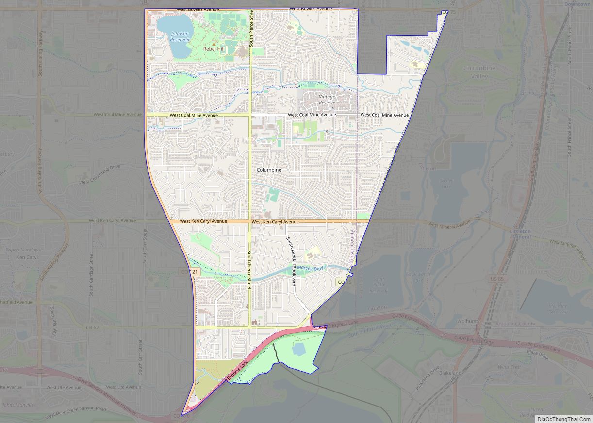
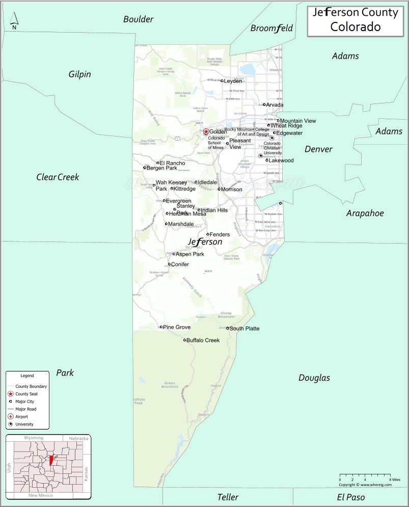
Jefferson County Road Map
Geography
According to the U.S. Census Bureau, the county has a total area of 774 square miles (2,000 km), of which 764 square miles (1,980 km) is land and 9.8 square miles (25 km) (1.3%) is water.
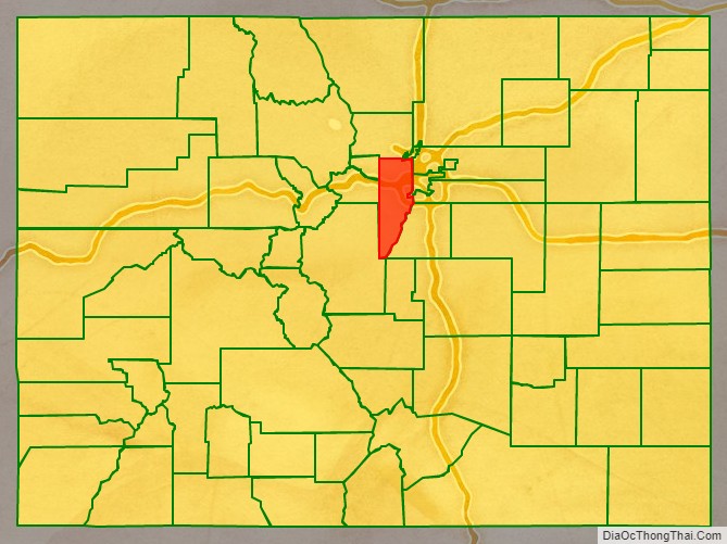
Adjacent counties
Jefferson County is one of the few counties in the United States to border as many as ten counties.
- Boulder County – north
- City and County of Broomfield – northeast
- Adams County – east
- City and County of Denver – east
- Arapahoe County – east
- Douglas County – east
- Teller County – south
- Park County – southwest
- Clear Creek County – west
- Gilpin County – northwest
Major highways
- Interstate 70
- I-70 BS
- U.S. Highway 6
- U.S. Highway 40
- U.S. Highway 285
- State Highway 8
- State Highway 58
- State Highway 72
- State Highway 74
- State Highway 75
- State Highway 93
- State Highway 121
- State Highway 391
- State Highway 470
- Chatfield Ave
- 44th Ave
Recreational areas
- Alderfer/Three Sisters Park
- Apex Park
- Bear Creek Lake Park
- Centennial Cone Park
- Clear Creek Canyon Park
- Coal Creek Canyon
- Crown Hill Park
- Deer Creek Canyon Park
- Elk Meadow Park
- Evergreen Lake
- Fairmount Trail
- Flying J Ranch Park
- Hildebrand Ranch Park
- Hiwan Homestead Museum
- Lair o’ the Bear Park
- Lewis Meadows Park
- Lookout Mountain Nature Center
- Matthews/Winters Park
- Meyer Ranch Park
- Mount Falcon Park
- Mount Galbraith Park
- Mount Glennon
- Mount Lindo
- North Table Mountain Park
- Pine Valley Ranch Park
- Ranson/Edwards Homestead Ranch
- Reynolds Park
- Sister City Park
- South Table Mountain Park
- South Valley Park
- Standley Lake Regional Park
- Van Bibber Park
- Welchester Tree Grant Park
- White Ranch Park
- Windy Saddle Park
- Urban Trails
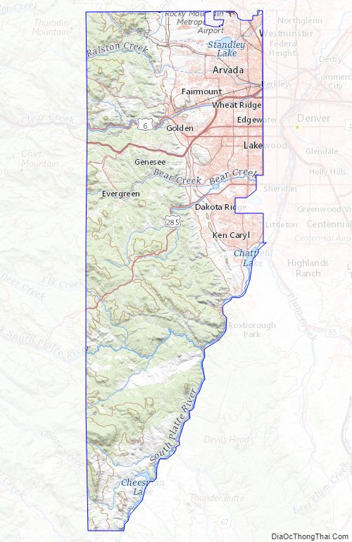
Jefferson County Topographic Map
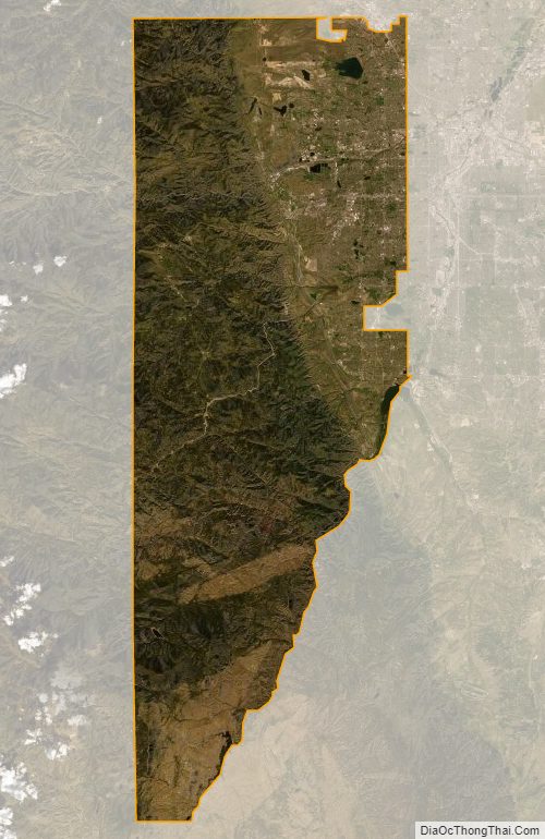
Jefferson County Satellite Map
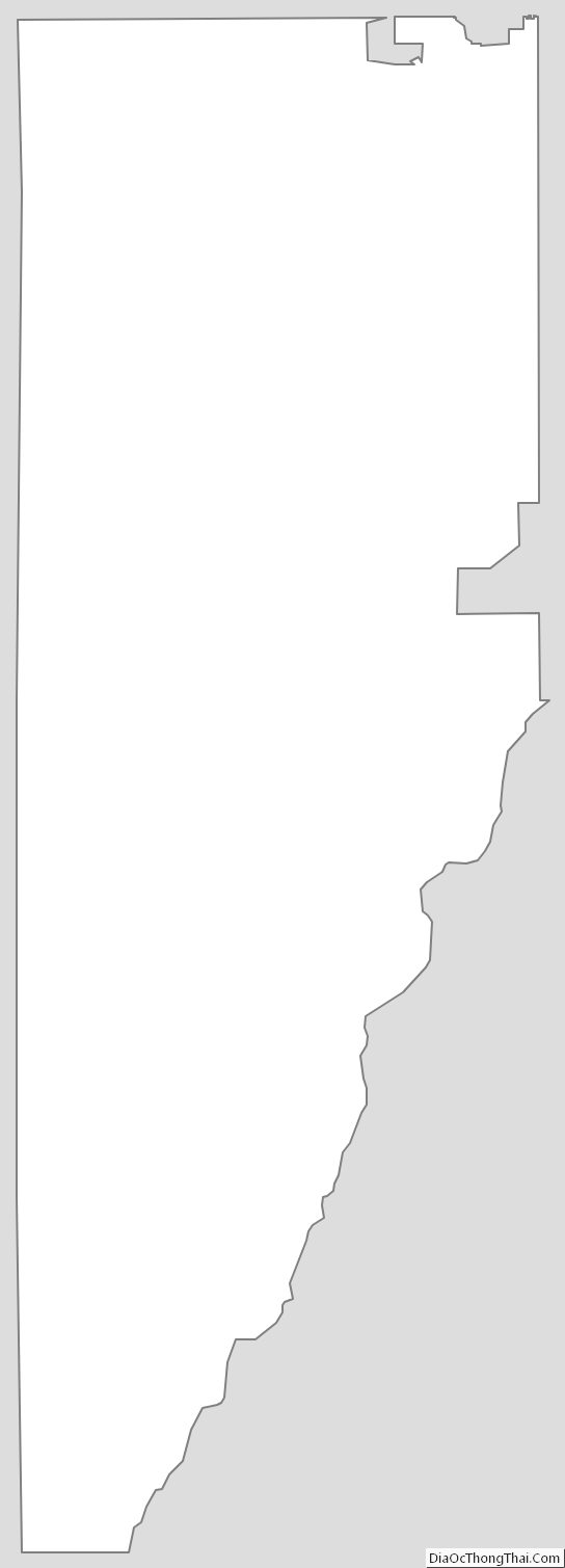
Jefferson County Outline Map