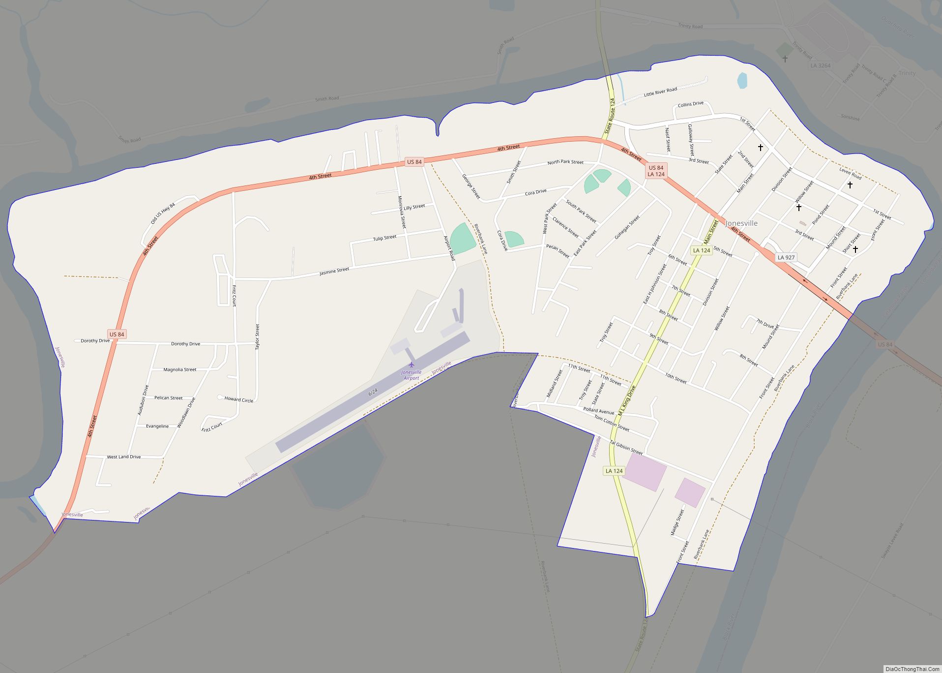
Jonesville is the largest town in Catahoula Parish, Louisiana, United States, at the confluence of the Ouachita, Tensas, and Little rivers. The three rivers become the Black River at Jonesville.
The Jonesville population was 2,265 at the 2010 census.
The four rivers which intersect near Jonesville are all subject to flooding. There are surrounding soybean and cotton fields. A few plantation houses still stand, built during the former slavery-based, planter-dominated economy. The population fell significantly when a textile mill shut down in the late 1980s.
| Name: | Jonesville town |
|---|---|
| LSAD Code: | 43 |
| LSAD Description: | town (suffix) |
| State: | Louisiana |
| County: | Catahoula Parish |
| Elevation: | 59 ft (18 m) |
| Total Area: | 1.92 sq mi (4.97 km²) |
| Land Area: | 1.92 sq mi (4.97 km²) |
| Water Area: | 0.00 sq mi (0.00 km²) |
| Total Population: | 1,728 |
| Population Density: | 900.00/sq mi (347.55/km²) |
| Area code: | 318 |
| FIPS code: | 2238775 |
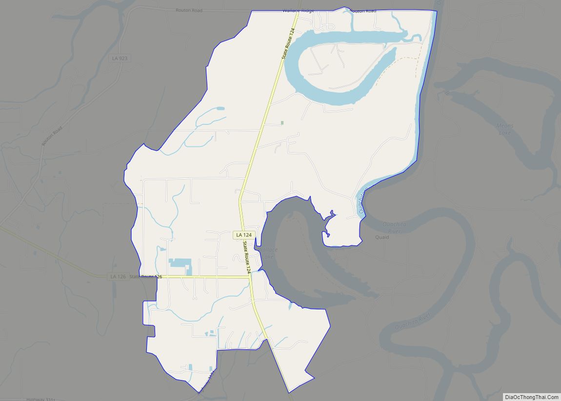
Online Interactive Map
Click on ![]() to view map in "full screen" mode.
to view map in "full screen" mode.
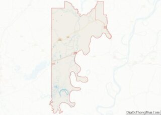
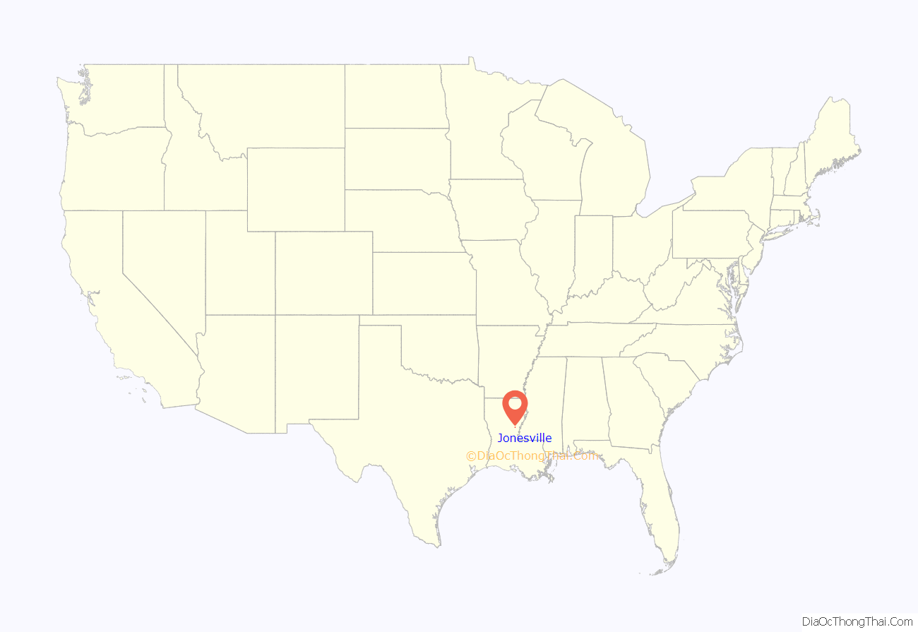
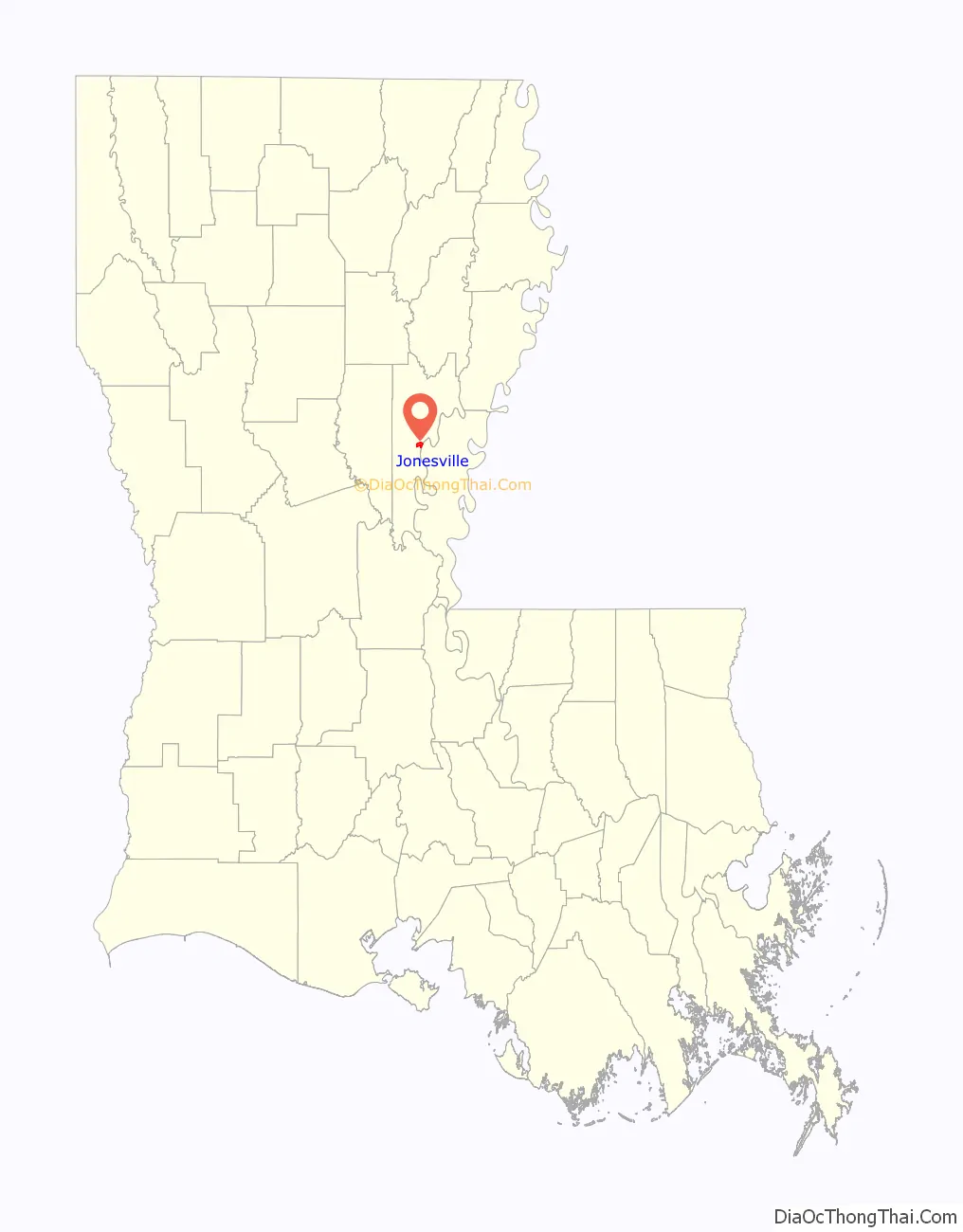
Jonesville location map. Where is Jonesville town?
History
Jonesville was once the site of the Troyville Earthworks; built by ancient Native Americans who occupied the site from 100 BCE to 700 CE. Once home to between 9-11 mounds, most have been leveled to make way for the construction of the modern town; including the Great Mound which was once 82 feet (25 m) in height. It was the tallest mound in Louisiana and the second tallest in the United States after Monks Mound at Cahokia in Illinois. It was destroyed for bridge approach fill in 1931. The site is the type site for the Troyville culture of the lower Ouachita and Tensas River valleys.
Jonesville Road Map
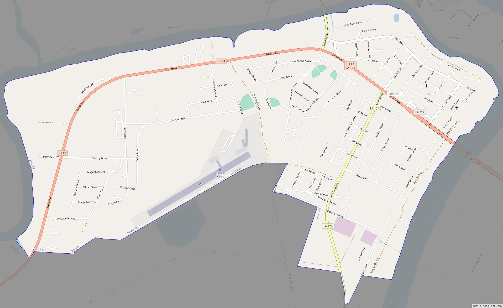
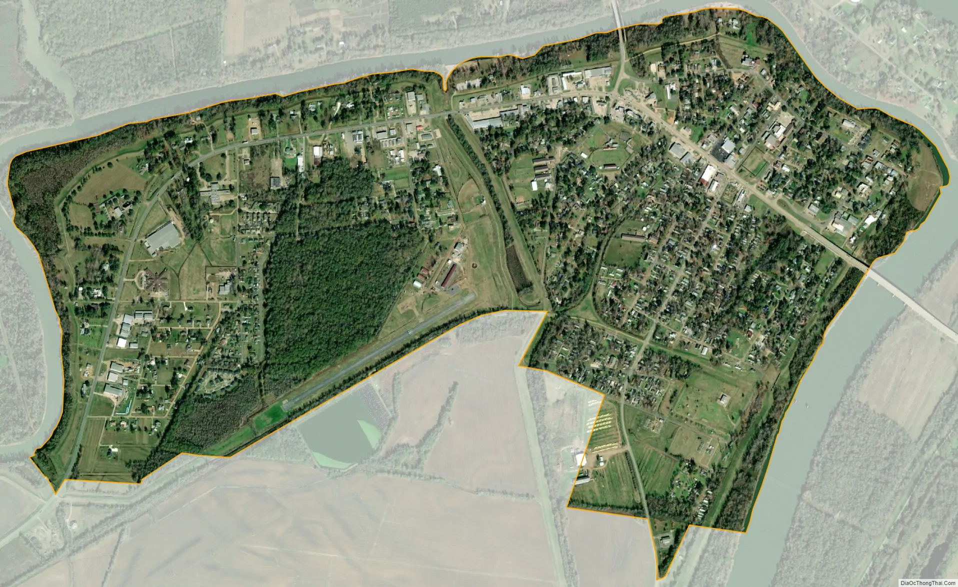
Jonesville city Satellite Map
Geography
Jonesville’s northern border is formed by the Little River, while its eastern border is formed by the Black River. The confluence of the Ouachita and Tensas rivers to form the Black River is 0.4 miles (0.64 km) north of the town limits. Concordia Parish is to the east across the Black River.
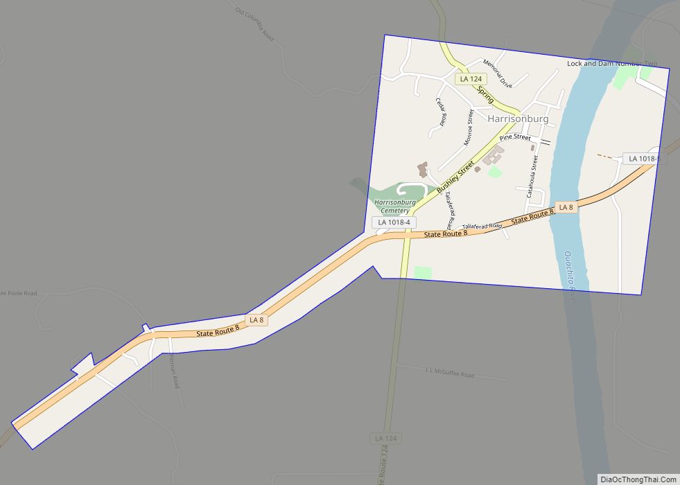
U.S. Route 84 passes through the town as 4th Street and leads east 16 miles (26 km) to Ferriday and west 23 miles (37 km) to Jena. Louisiana State Highway 124 leads north 10 miles (16 km) to Harrisonburg, the Catahoula Parish seat, and south 24 miles (39 km) to its end in Argo.
According to the United States Census Bureau, Jonesville has a total area of 1.9 square miles (5.0 km), all land.
Climate
The climate in the area is characterized by hot, humid summers and generally mild-to-cool winters. According to the Köppen Climate Classification system, Jonesville has a humid subtropical climate, abbreviated “Cfa” on climate maps.
See also
Map of Louisiana State and its subdivision:- Acadia
- Allen
- Ascension
- Assumption
- Avoyelles
- Beauregard
- Bienville
- Bossier
- Caddo
- Calcasieu
- Caldwell
- Cameron
- Catahoula
- Claiborne
- Concordia
- De Soto
- East Baton Rouge
- East Carroll
- East Feliciana
- Evangeline
- Franklin
- Grant
- Iberia
- Iberville
- Jackson
- Jefferson
- Jefferson Davis
- La Salle
- Lafayette
- Lafourche
- Lincoln
- Livingston
- Madison
- Morehouse
- Natchitoches
- Orleans
- Ouachita
- Plaquemines
- Pointe Coupee
- Rapides
- Red River
- Richland
- Sabine
- Saint Bernard
- Saint Charles
- Saint Helena
- Saint James
- Saint John the Baptist
- Saint Landry
- Saint Martin
- Saint Mary
- Saint Tammany
- Tangipahoa
- Tensas
- Terrebonne
- Union
- Vermilion
- Vernon
- Washington
- Webster
- West Baton Rouge
- West Carroll
- West Feliciana
- Winn
- Alabama
- Alaska
- Arizona
- Arkansas
- California
- Colorado
- Connecticut
- Delaware
- District of Columbia
- Florida
- Georgia
- Hawaii
- Idaho
- Illinois
- Indiana
- Iowa
- Kansas
- Kentucky
- Louisiana
- Maine
- Maryland
- Massachusetts
- Michigan
- Minnesota
- Mississippi
- Missouri
- Montana
- Nebraska
- Nevada
- New Hampshire
- New Jersey
- New Mexico
- New York
- North Carolina
- North Dakota
- Ohio
- Oklahoma
- Oregon
- Pennsylvania
- Rhode Island
- South Carolina
- South Dakota
- Tennessee
- Texas
- Utah
- Vermont
- Virginia
- Washington
- West Virginia
- Wisconsin
- Wyoming