Concordia Parish (Spanish: Parroquia de la Concordia; French: Paroisse de Concordia) borders the Mississippi River in eastern central Louisiana. As of the 2020 census, the population was 18,687. The parish seat is Vidalia. The parish was formed in 1807.
Concordia Parish is part of the Natchez, MS–LA Micropolitan Statistical Area. It is historically considered part of the Natchez District, devoted to cotton cultivation as a commodity crop, in contrast to the sugar cane crop of southern Louisiana. Other Louisiana parishes of similar character are East and West Carroll, Madison and Tensas, all in this lowlying delta land. On the east side of the Mississippi River is the Natchez District around the city of Natchez, Mississippi.
| Name: | Concordia Parish |
|---|---|
| FIPS code: | 22-029 |
| State: | Louisiana |
| Founded: | 1807 |
| Named for: | Possibly a land grant, New Concordia |
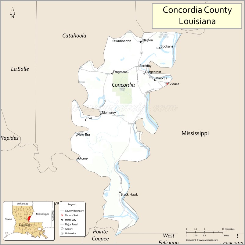
| Seat: | Vidalia |
| Total Area: | 1,930 km² (747 sq mi) |
| Land Area: | 1,810 km² (697 sq mi) |
| Total Population: | 18,687 |
| Population Density: | 9.7/km² (25/sq mi) |
| Time zone: | UTC-6 (CST) |
| Summer Time Zone (DST): | UTC-5 (CDT) |
| Website: | www.conppj.org |
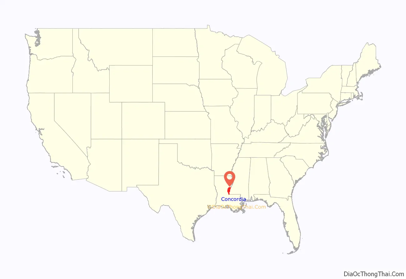
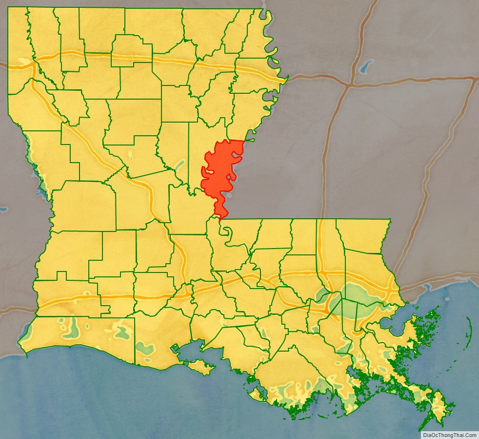
Concordia Parish location map. Where is Concordia Parish?
History
Prehistory
Concordia Parish was the home to many successive Native American cultures for thousands of years before European encounter. Peoples of the Marksville culture, Troyville culture, Coles Creek culture and Plaquemine culture built villages and earthwork mound sites throughout the area. Notable examples include Cypress Grove Mound, DePrato Mounds, Frogmore Mound Site, and Lamarque Landing Mound.
Historic Native American tribes encountered by early French explorers and colonists were the following:
Historic era
Concordia was named by Anglo-American settlers for a Latin word meaning “harmony”. They came mostly after the Louisiana Purchase of 1803, when the United States took over this formerly French colonial area west of the Mississippi. Like other parishes of the lands along the Mississippi River, in the antebellum era, the parish was developed for cotton cultivation on large plantations. The labor-intensive crop was profitable because of the labor of enslaved African Americans.
In 1789, Don Jose Vidal a resident of Natchez, MS and later the founder of the city of Vidalia, LA asked for land grants to move his family from Natchez to the other side of the Mississippi River. In Natchez, there was a mansion built called Concord (Natchez, Mississippi), this was a residence lived in by Spanish governors, also Vidal and his family lived there before the time era of the US began.
The Mansion started the name “Concord” and ultimately later led to the birth of what would be Concordia Parish. During the year of 1804, a ceremony of transfer was held and the citizens and Mayor of Natchez crossed over to the Louisiana side of the Mississippi to honor the new land that was founded. The Mansion was later struct by fire in the early 20th century (1901) and burned down. Natchez people also lived on both sides of the land.
“Concordia County” was a creation of the first Legislative Council held in New Orleans on December 2, 1804. Its territory that included parts of the present parishes of East Carroll, Madison, and Tensas. Land between the Mississippi, Red, Black, and Tensaw rivers comprised the early local administration of Concordia.
Because Concordia’s alluvial soil was unusually productive for cotton growing, it attracted large plantations, whose owners enslaved a very high number of people. In 1860, slaves made up 91 percent of Concordia Parish’s residents, the highest percentage of any Louisiana parish. Only two counties in the United States — Washington and Issaquena counties in Mississippi — had a higher percentage of its population enslaved. As might be expected, the small number of white cotton planters in Concordia were fierce defenders of chattel slavery and strongly backed the Confederacy during the American Civil War.
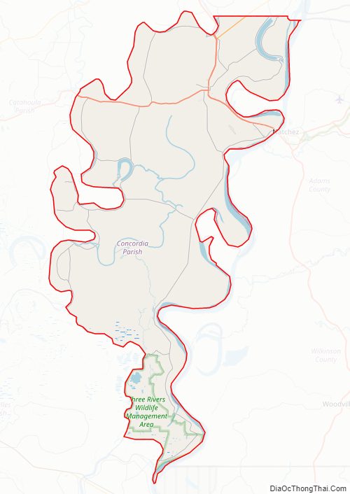
Concordia Parish Road Map
Geography
According to the U.S. Census Bureau, the parish has a total area of 747 square miles (1,930 km), of which 697 square miles (1,810 km) is land and 50 square miles (130 km) (6.7%) is water.
The parish is completely agricultural bottomlands. The Ouachita River runs along the west boundary, the Red River along the south, and the Mississippi River along the east. All three rivers are contained by large levee systems.
Major highways
- U.S. Highway 65
- U.S. Highway 84
- Louisiana Highway 15
- Louisiana Highway 566
Adjacent counties and parishes
- Tensas Parish (north)
- Adams County, Mississippi (northeast)
- Wilkinson County, Mississippi (east)
- West Feliciana Parish (southeast)
- Pointe Coupee Parish (south)
- Avoyelles Parish (southwest)
- Catahoula Parish (west)
National protected area
- Bayou Cocodrie National Wildlife Refuge
State protected area
- Richard K. Yancey Wildlife Management Area
Concordia Parish Topographic Map
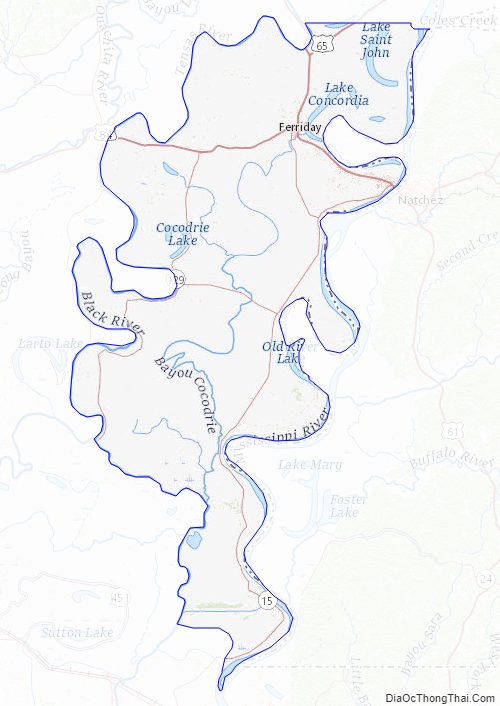
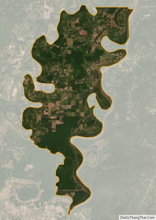
Concordia Parish Satellite Map
Concordia Parish Outline Map