Sicily Island is a village in Catahoula Parish, Louisiana, United States. The population was 336 at the 2020 census.
| Name: | Sicily Island village |
|---|---|
| LSAD Code: | 47 |
| LSAD Description: | village (suffix) |
| State: | Louisiana |
| County: | Catahoula Parish |
| Elevation: | 75 ft (23 m) |
| Total Area: | 0.57 sq mi (1.49 km²) |
| Land Area: | 0.57 sq mi (1.49 km²) |
| Water Area: | 0.00 sq mi (0.00 km²) |
| Total Population: | 366 |
| Population Density: | 637.63/sq mi (246.05/km²) |
| Area code: | 318 |
| FIPS code: | 2270245 |
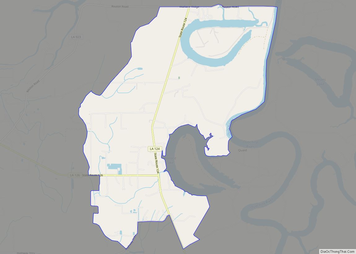
Online Interactive Map
Click on ![]() to view map in "full screen" mode.
to view map in "full screen" mode.
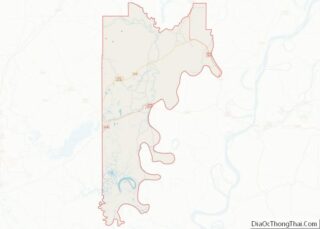
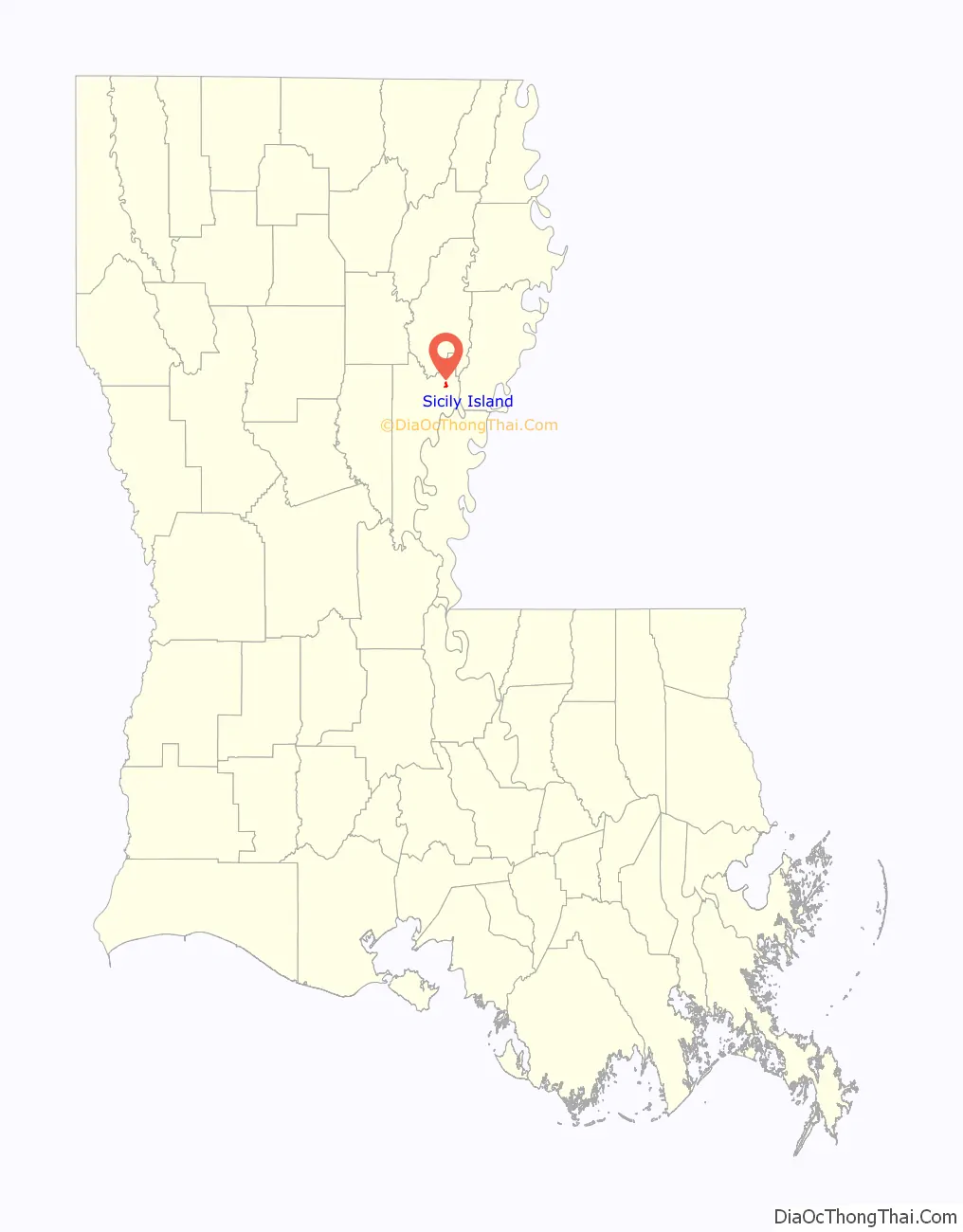
Sicily Island location map. Where is Sicily Island village?

History
In the early 1700s, the area that would become Sicily Island was the site of a Natchez settlement. In January 1731, towards the end of the Natchez Revolt, French forces besieged the Natchez fort, compelling the surrender of 45 men and 450 women and children. Although the bulk of the Natchez leaders and warriors escaped, the siege marked the last major engagement of the war.
In 1881, a Jewish agricultural colony was created in Sicily Island with the support of the Am Olam organization. The colony was mostly made up of immigrants from Yelisavetgrad who were fleeing the pogroms that began that same year. By 1882, the colony was completely disbanded as the Mississippi River flooded, destroying most farms.
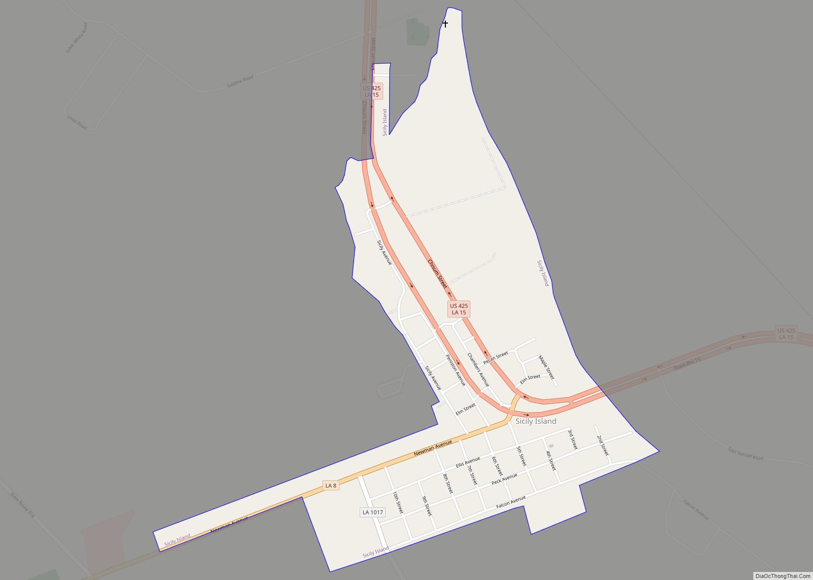
Sicily Island Road Map

Sicily Island city Satellite Map

Geography
Sicily Island is located in northeastern Catahoula Parish at 31°50′48″N 91°39′32″W / 31.84667°N 91.65889°W / 31.84667; -91.65889 (31.846573, -91.658925). U.S. Route 425 passes through the village, leading north 23 miles (37 km) to Winnsboro and southeast 30 miles (48 km) to Natchez, Mississippi. Louisiana State Highway 8 leads southwest 11 miles (18 km) to Harrisonburg, the Catahoula Parish seat.
According to the United States Census Bureau, Sicily Island has a total area of 0.58 square miles (1.49 km), all land. Despite its name, Sicily Island is not an island; instead, nearby lakes and rivers gave the area a shape early settlers considered reminiscent of the island of Sicily.
See also
Map of Louisiana State and its subdivision:- Acadia
- Allen
- Ascension
- Assumption
- Avoyelles
- Beauregard
- Bienville
- Bossier
- Caddo
- Calcasieu
- Caldwell
- Cameron
- Catahoula
- Claiborne
- Concordia
- De Soto
- East Baton Rouge
- East Carroll
- East Feliciana
- Evangeline
- Franklin
- Grant
- Iberia
- Iberville
- Jackson
- Jefferson
- Jefferson Davis
- La Salle
- Lafayette
- Lafourche
- Lincoln
- Livingston
- Madison
- Morehouse
- Natchitoches
- Orleans
- Ouachita
- Plaquemines
- Pointe Coupee
- Rapides
- Red River
- Richland
- Sabine
- Saint Bernard
- Saint Charles
- Saint Helena
- Saint James
- Saint John the Baptist
- Saint Landry
- Saint Martin
- Saint Mary
- Saint Tammany
- Tangipahoa
- Tensas
- Terrebonne
- Union
- Vermilion
- Vernon
- Washington
- Webster
- West Baton Rouge
- West Carroll
- West Feliciana
- Winn
- Alabama
- Alaska
- Arizona
- Arkansas
- California
- Colorado
- Connecticut
- Delaware
- District of Columbia
- Florida
- Georgia
- Hawaii
- Idaho
- Illinois
- Indiana
- Iowa
- Kansas
- Kentucky
- Louisiana
- Maine
- Maryland
- Massachusetts
- Michigan
- Minnesota
- Mississippi
- Missouri
- Montana
- Nebraska
- Nevada
- New Hampshire
- New Jersey
- New Mexico
- New York
- North Carolina
- North Dakota
- Ohio
- Oklahoma
- Oregon
- Pennsylvania
- Rhode Island
- South Carolina
- South Dakota
- Tennessee
- Texas
- Utah
- Vermont
- Virginia
- Washington
- West Virginia
- Wisconsin
- Wyoming