Cheatham County (/ˈtʃiːtəm/ CHEE-təm) is a county located in the U.S. state of Tennessee. As of the 2020 census, the population was 41,072. Its county seat is Ashland City. Cheatham County is part of the Nashville-Davidson–Murfreesboro–Franklin, TN Metropolitan Statistical Area. It is located in Middle Tennessee.
| Name: | Cheatham County |
|---|---|
| FIPS code: | 47-021 |
| State: | Tennessee |
| Founded: | February 28, 1856 |
| Named for: | Edward Saunders Cheatham or Benjamin F. Cheatham |
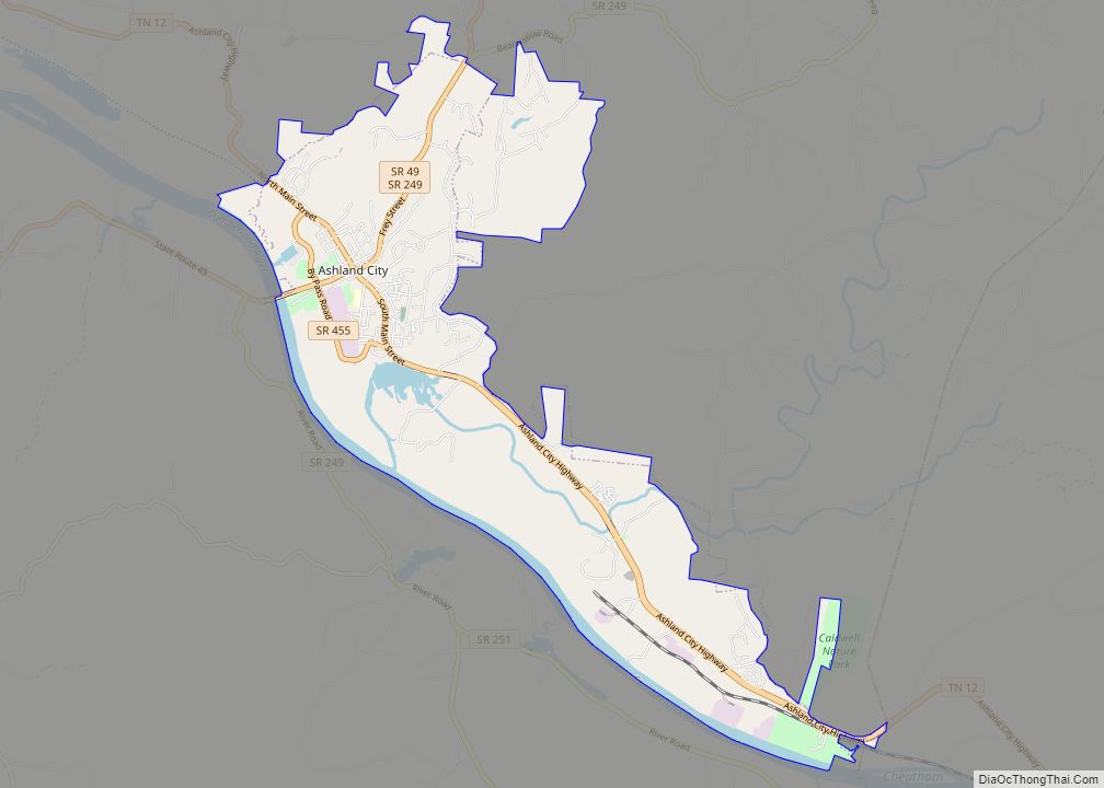
| Seat: | Ashland City |
| Largest town: | Ashland City |
| Total Area: | 307 sq mi (800 km²) |
| Land Area: | 302 sq mi (780 km²) |
| Total Population: | 41,523 |
| Population Density: | 133/sq mi (51/km²) |
| Time zone: | UTC−6 (Central) |
| Summer Time Zone (DST): | UTC−5 (CDT) |
| Website: | www.cheathamcountytn.gov |
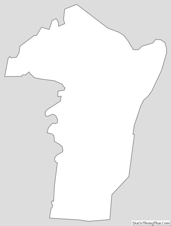
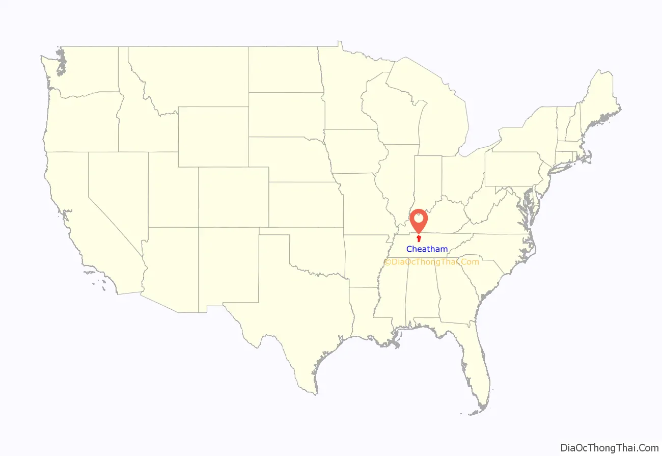
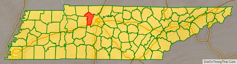
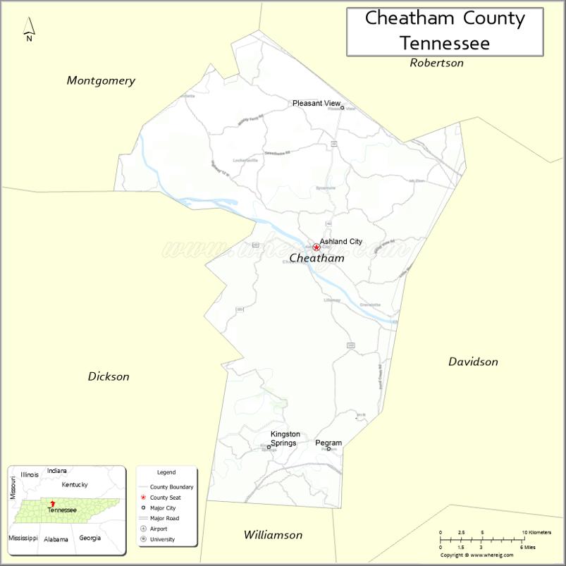
Cheatham County location map. Where is Cheatham County?
History
Cheatham County was created by an Act of the Tennessee General Assembly in 1856, from lands formerly of Davidson, Dickson, Montgomery, and Robertson counties. Cheatham County was named for Edward Saunders Cheatham, a state legislator.
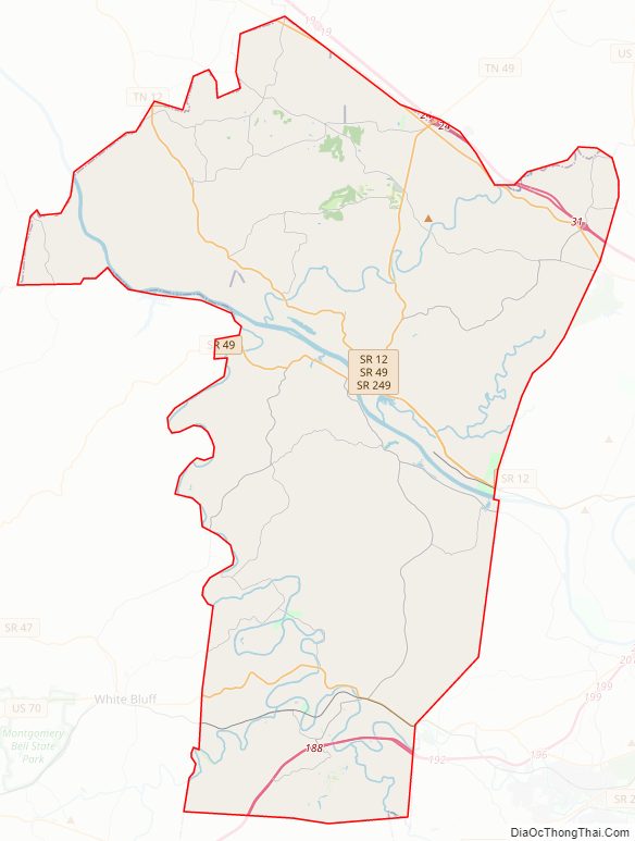
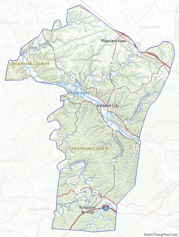
Cheatham County Road Map
Geography
According to the U.S. Census Bureau, the county has a total area of 307 square miles (800 km), of which 302 square miles (780 km) is land and 4.6 square miles (12 km) (1.5%) is water.
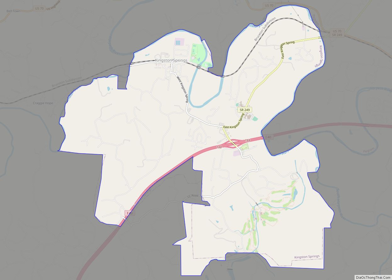
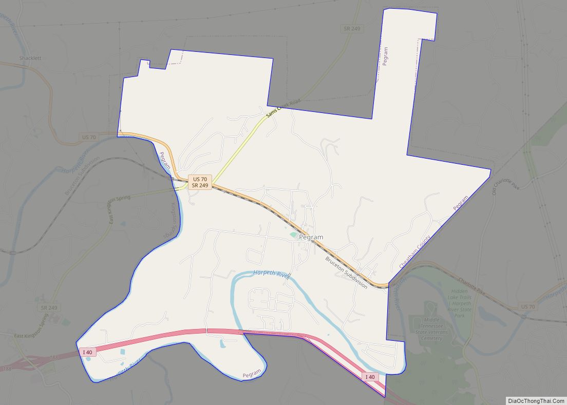
The county is bisected from northwest to southeast by the Cumberland River, with Ashland City located on its northern bank. The southern portion of the county is bisected from southeast to northwest by the Harpeth River, which meanders through generally hilly country, and along whose course are located the communities of Kingston Springs, largely to the north of Interstate 40 (I-40), and Pegram, along U.S. Route 70 (US 70). The western border of the central portion of the county is defined by the course of the Harpeth. The hills east of the Harpeth and south of the Cumberland are partly set aside by the state as the Cheatham State Wildlife Management Area. North of Ashland City the hills subside into more level highlands, where the community of Pleasant View is located just south of I-24, which generally delineates the northern border of the county.
Adjacent counties
- Robertson County (northeast)
- Davidson County (east)
- Williamson County (south)
- Dickson County (west)
- Montgomery County (northwest)
State protected areas
- Cheatham Wildlife Management Area
- Cheatham Lake Wildlife Management Area (part)
- Harpeth River State Park
Cheatham County Topographic Map
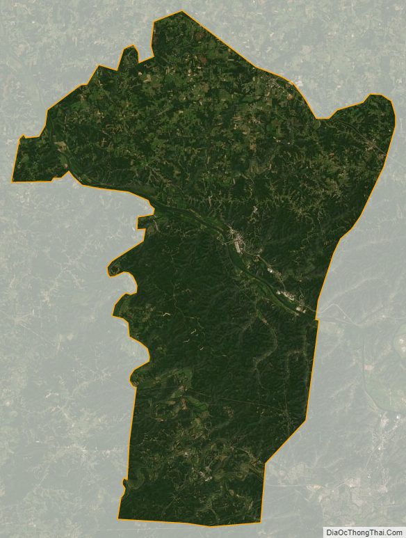
Cheatham County Satellite Map
Cheatham County Outline Map