Murfreesboro is a city in, and county seat of, Rutherford County, Tennessee, United States. The population was 152,769 according to the 2020 census, up from 108,755 residents certified in 2010. Murfreesboro is located in the Nashville metropolitan area of Middle Tennessee, 34 miles (55 km) southeast of downtown Nashville.
Serving as the state capital from 1818 to 1826, it was superseded by Nashville. Today, it is the largest suburb of Nashville and the sixth-largest city in Tennessee. The city is both the center of population and the geographic center of Tennessee.
Since the 1990s, Murfreesboro has been Tennessee’s fastest-growing major city and one of the fastest-growing cities in the country. Murfreesboro is home to Middle Tennessee State University, the largest undergraduate university in the state of Tennessee, with 22,729 total students as of fall 2014.
| Name: | Murfreesboro city |
|---|---|
| LSAD Code: | 25 |
| LSAD Description: | city (suffix) |
| State: | Tennessee |
| County: | Rutherford County |
| Incorporated: | 1817 |
| Elevation: | 610 ft (186 m) |
| Land Area: | 63.99 sq mi (165.73 km²) |
| Water Area: | 0.14 sq mi (0.35 km²) 0.25% |
| Population Density: | 2,387.43/sq mi (921.79/km²) |
| Area code: | 615, 629 |
| FIPS code: | 4751560 |
| GNISfeature ID: | 1295105 |
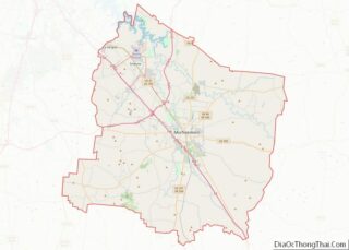
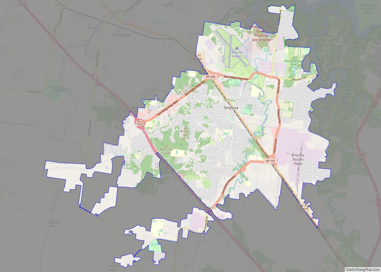
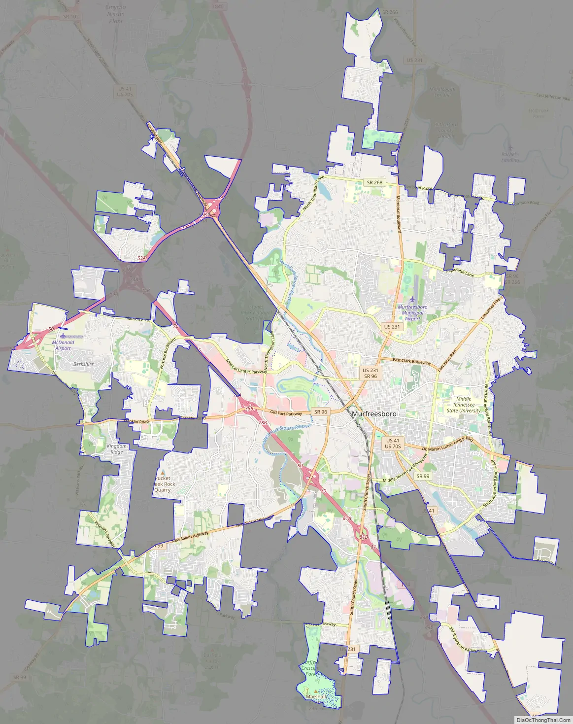
Online Interactive Map
Click on ![]() to view map in "full screen" mode.
to view map in "full screen" mode.
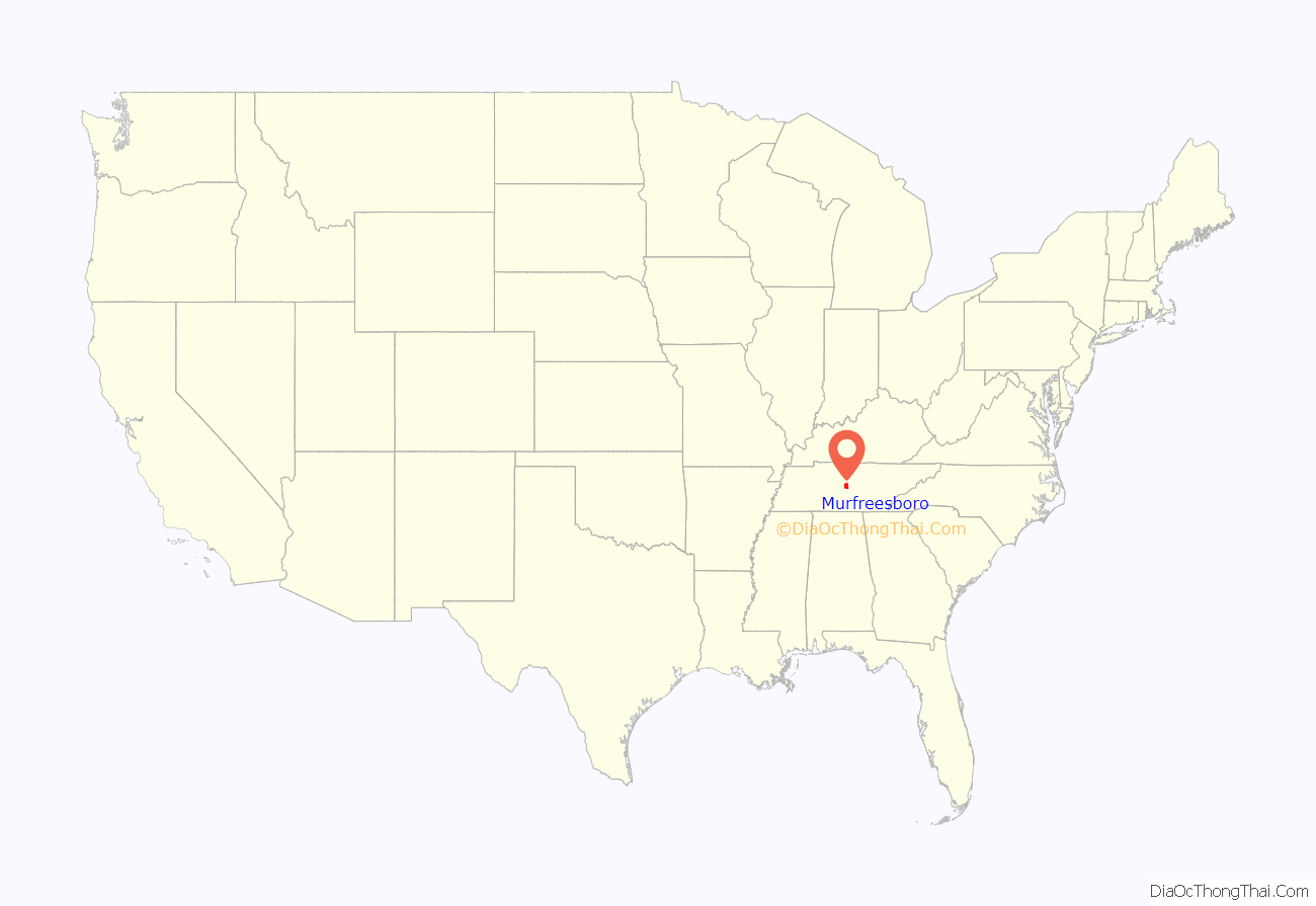
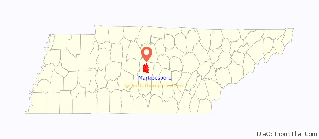
Murfreesboro location map. Where is Murfreesboro city?
History
On October 27, 1811, the Tennessee General Assembly designated the location for a new county seat for Rutherford County, giving it the name Cannonsburgh in honor of Newton Cannon, representative to the Assembly for the local area. At the suggestion of William Lytle, it was renamed Murfreesborough on November 29, 1811, after Revolutionary War hero Colonel Hardy Murfree. The name was shortened to Murfreesboro in January 1812 when the town was formally chartered. Author Mary Noailles Murfree was his great-granddaughter.
As Tennessee settlement expanded to the west, the location of the state capital in Knoxville became inconvenient for much of the population. In 1818, Murfreesboro was designated as the capital of Tennessee and its population boomed. Eight years later, however, it was superseded by Nashville.
Civil War
On December 31, 1862, the Battle of Stones River, also called the Battle of Murfreesboro, was fought near the city between the Union Army of the Cumberland and the Confederate Army of Tennessee. This was a major engagement of the American Civil War, and between December 31 and January 2, 1863, the rival armies suffered a combined total of 23,515 casualties. It was the bloodiest battle of the war by percentage of casualties.
Following the Confederate retreat after the drawn Battle of Perryville in central Kentucky, the Confederate army moved through East Tennessee and turned northwest to defend Murfreesboro. General Braxton Bragg’s veteran cavalry successfully harassed Union General William Rosecrans’ troop movements, capturing and destroying many of his supply trains. However, they could not completely prevent supplies and reinforcements from reaching Rosecrans. Despite the large number of casualties, the battle was inconclusive. It is usually considered a Union victory, since afterward General Bragg retreated 36 miles (58 km) south to Tullahoma. Even so, the Union army did not move against Bragg until six months later, in June 1863. The battle was significant since the Union gained a base from which it could push its eventual drive further south, which enabled its later advances against Chattanooga and Atlanta. The Union eventually divided the territory into the Eastern and Western theaters, followed by Sherman’s March to the Sea through the South. The Stones River National Battlefield is now a national historical site.
General Rosecrans’ move to the south depended on a secure source of provisions, and Murfreesboro was chosen for his supply depot. Soon after the battle, Brigadier General James St. Clair Morton, Chief Engineer of the Army of the Cumberland, was ordered to build Fortress Rosecrans, some 2 miles (3.2 km) northwest of the town. The fortifications covered about 225 acres (0.91 km) and were the largest built during the war. Fortress Rosecrans consisted of eight lunettes, four redoubts, and connecting fortifications. The fortress was built around the Nashville and Chattanooga Railroad and the West Fork of the Stones River; two roads provided additional access and transportation.
The fort’s interior was a huge logistical resource center, including sawmills, warehouses, quartermaster maintenance depots, ammunition magazines, and living quarters for the 2,000 men who handled the operations and defended the post. After the fortress was completed in June 1863, Rosecrans ventured to the south. The fortress was never attacked, in part because the Union troops held the town of Murfreesboro hostage by training their artillery on the courthouse. Major portions of the earthworks still exist and have been incorporated into the battlefield historic site.
Post-Civil War
Murfreesboro was first developed as a mainly agricultural community, but by 1853 the area was home to several colleges and academies, gaining the nickname the “Athens of Tennessee”. Despite the wartime trauma, the town’s growth had begun to recover by the early 1900s, in contrast to other areas of the devastated South.
In 1911, the state legislature created Middle Tennessee State Normal School, a two-year institute to train teachers. It soon merged with the Tennessee College for Women. In 1925 the Normal School was expanded to a full, four-year curriculum and college. With additional expansion of programs and addition of graduate departments, in 1965 it became Middle Tennessee State University. MTSU now has the largest undergraduate enrollment in the state, including many international students.
World War II was an impetus for industrial development, and Murfreesboro diversified into industry, manufacturing, and education. Growth has been steady since that time, creating a stable economy.
Since the last decade of the 20th century, Murfreesboro has enjoyed substantial residential and commercial growth, with its population increasing 123.9% between 1990 and 2010, from 44,922 to 108,755. The city has been a destination for many refugee immigrants who have left areas affected by warfare; since 1990 numerous people from Somalia and Kurds from Iraq have settled there. The city has also attracted numerous international students to the university.
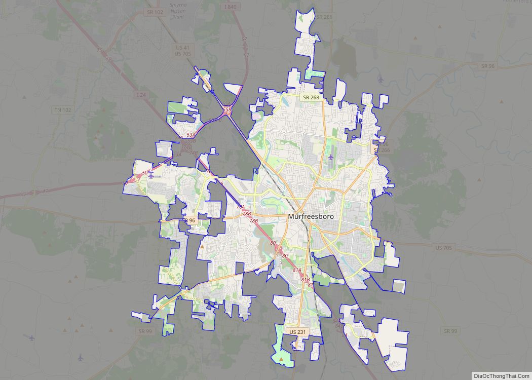
Murfreesboro Road Map
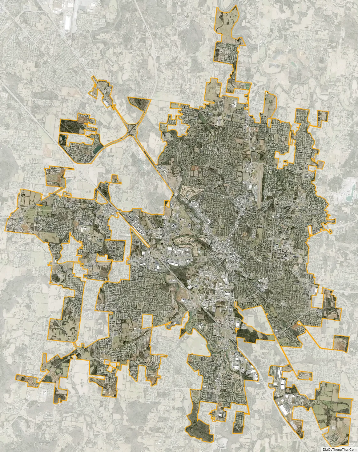
Murfreesboro city Satellite Map
Geography
Murfreesboro is located at 35°50′46″N 86°23′31″W / 35.846143°N 86.392078°W / 35.846143; -86.392078.
According to the United States Census Bureau, the city has a total area of 39.2 square miles (102 km). 39.0 square miles (101 km) of it is land and 0.2 square miles (0.52 km) of it (0.54%) is water. However, as of 2013 the city reports its total area as 55.94 square miles (144.9 km).
Murfreesboro is the geographic center of the state of Tennessee. A stone monument marks the official site on Old Lascassas Pike, about 0.5 miles (0.8 km) north of MTSU.
The West Fork of the Stones River flows through Murfreesboro. A walking trail, the Greenway, parallels the river for several miles. A smaller waterway, Lytle Creek, flows through downtown including historic Cannonsburgh Village. Parts of the 19-mile (31 km) long creek suffer from pollution due to the urban environment and its use as a storm-water runoff.
Murfreesboro is home to a number of natural and man-made lakes plus several small wetlands including Todd’s Lake and the Murfree Spring wetland area.
Murfreesboro has been in the path of destructive tornados several times. On April 10, 2009, a low-end EF4 tornado with estimated windspeeds up to 170 miles per hour struck the fringes of Murfreesboro. As a result, two people were killed and 41 others injured. 117 homes were totally destroyed, and 292 had major damage. The tornado is estimated to have caused over $40 million in damage.
Climate
Being in the Sun Belt, Murfreesboro’s climate is humid subtropical (Cfa) under the Köppen system, with mild winters and hot, humid summers. Under the Trewartha system, it is an oceanic (Do) climate due to five months of winter chill (monthly means below 10 °C (50 °F)); however, Murfreesboro is close to being humid subtropical (Cf) even under Trewartha (March falls 0.9 °F (0.5 °C) short of the threshold), supported by the fact that subtropical plants like Southern magnolia trees and the occasional dwarf palmetto and needle palm shrubs can thrive long-term there but struggle much further north. Temperatures range from a record low of -19 °F (-28 °C) on January 26, 1940 to a record high of 109 °F (43 °C) on August 16, 1954. Precipitation is abundant year-round without any major difference, but there is still slight variation. The wet season runs from February through July, reaching its zenith in June with 144 mm of rain. The dry season runs from August through January with a September nadir of 88 mm and secondary December peak of 141 mm.
See also
Map of Tennessee State and its subdivision:- Anderson
- Bedford
- Benton
- Bledsoe
- Blount
- Bradley
- Campbell
- Cannon
- Carroll
- Carter
- Cheatham
- Chester
- Claiborne
- Clay
- Cocke
- Coffee
- Crockett
- Cumberland
- Davidson
- Decatur
- DeKalb
- Dickson
- Dyer
- Fayette
- Fentress
- Franklin
- Gibson
- Giles
- Grainger
- Greene
- Grundy
- Hamblen
- Hamilton
- Hancock
- Hardeman
- Hardin
- Hawkins
- Haywood
- Henderson
- Henry
- Hickman
- Houston
- Humphreys
- Jackson
- Jefferson
- Johnson
- Knox
- Lake
- Lauderdale
- Lawrence
- Lewis
- Lincoln
- Loudon
- Macon
- Madison
- Marion
- Marshall
- Maury
- McMinn
- McNairy
- Meigs
- Monroe
- Montgomery
- Moore
- Morgan
- Obion
- Overton
- Perry
- Pickett
- Polk
- Putnam
- Rhea
- Roane
- Robertson
- Rutherford
- Scott
- Sequatchie
- Sevier
- Shelby
- Smith
- Stewart
- Sullivan
- Sumner
- Tipton
- Trousdale
- Unicoi
- Union
- Van Buren
- Warren
- Washington
- Wayne
- Weakley
- White
- Williamson
- Wilson
- Alabama
- Alaska
- Arizona
- Arkansas
- California
- Colorado
- Connecticut
- Delaware
- District of Columbia
- Florida
- Georgia
- Hawaii
- Idaho
- Illinois
- Indiana
- Iowa
- Kansas
- Kentucky
- Louisiana
- Maine
- Maryland
- Massachusetts
- Michigan
- Minnesota
- Mississippi
- Missouri
- Montana
- Nebraska
- Nevada
- New Hampshire
- New Jersey
- New Mexico
- New York
- North Carolina
- North Dakota
- Ohio
- Oklahoma
- Oregon
- Pennsylvania
- Rhode Island
- South Carolina
- South Dakota
- Tennessee
- Texas
- Utah
- Vermont
- Virginia
- Washington
- West Virginia
- Wisconsin
- Wyoming