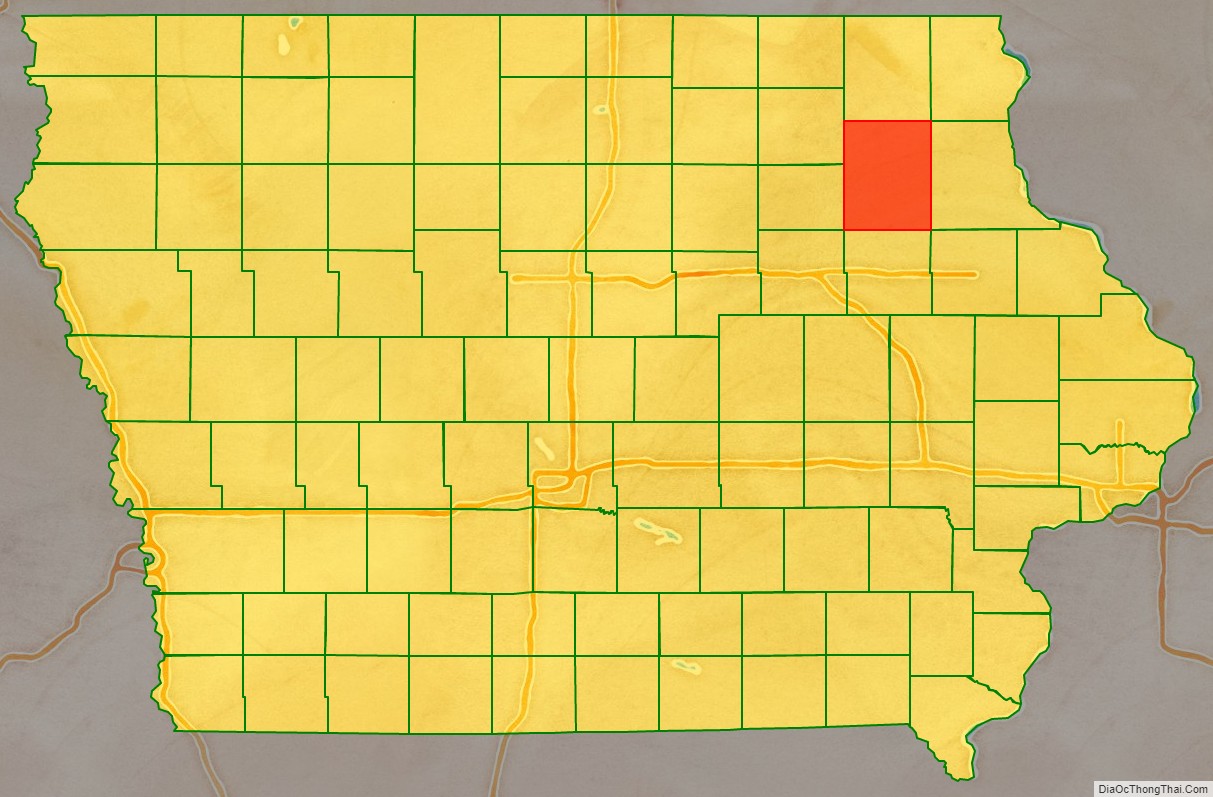
Fayette County is a county located in the U.S. state of Iowa. As of the 2020 census, the population was 19,509. The county seat is West Union.
| Name: | Fayette County |
|---|---|
| FIPS code: | 19-065 |
| State: | Iowa |
| Founded: | 1837 |
| Named for: | Marquis de Lafayette |
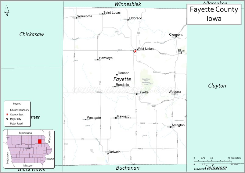
| Seat: | West Union |
| Largest city: | Oelwein |
| Total Area: | 731 sq mi (1,890 km²) |
| Land Area: | 731 sq mi (1,890 km²) |
| Total Population: | 19,509 |
| Population Density: | 27/sq mi (10/km²) |
| Time zone: | UTC−6 (Central) |
| Summer Time Zone (DST): | UTC−5 (CDT) |
| Website: | fayettecounty.iowa.gov |
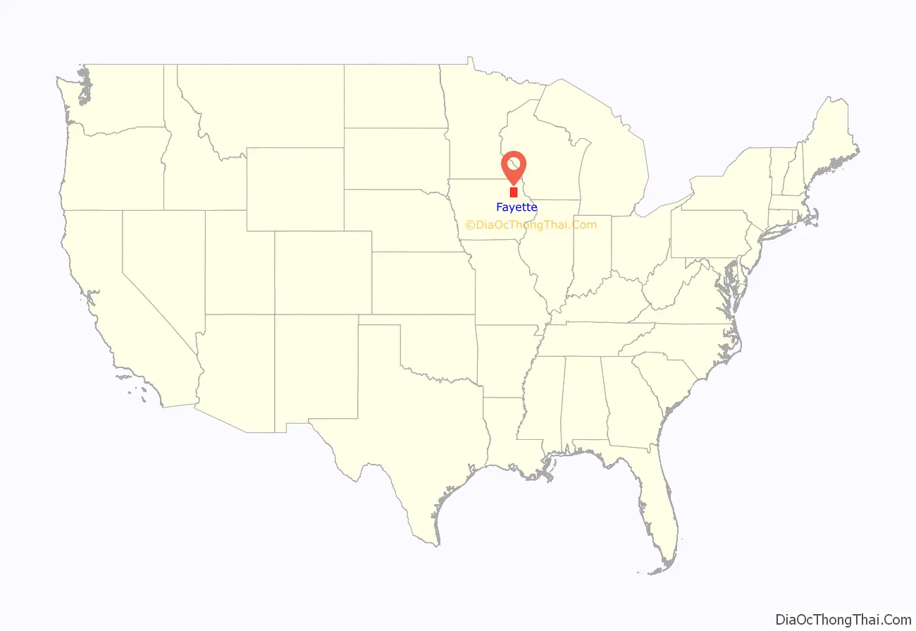
Fayette County location map. Where is Fayette County?
History
Fayette County was founded on December 21, 1837, as a part of Wisconsin Territory. It was named after Gilbert du Motier, marquis de La Fayette, a French general and politician, who came to America in 1777 to fight in the Revolutionary War, and who was named Major General of the Continental Army. The county was formed as part of a large reorganization of Dubuque County, which at that time comprised most of the northern half of Iowa, Minnesota, and parts of the Dakotas. Fayette County was granted the Minnesota and Dakotas territory on that date. It became part of Iowa Territory when it was formed on July 4, 1838. Fayette County’s size was drastically reduced into land that was part of the modern state of Iowa in 1843, then further split in 1847 after Iowa had achieved statehood. The county was organized in 1850.
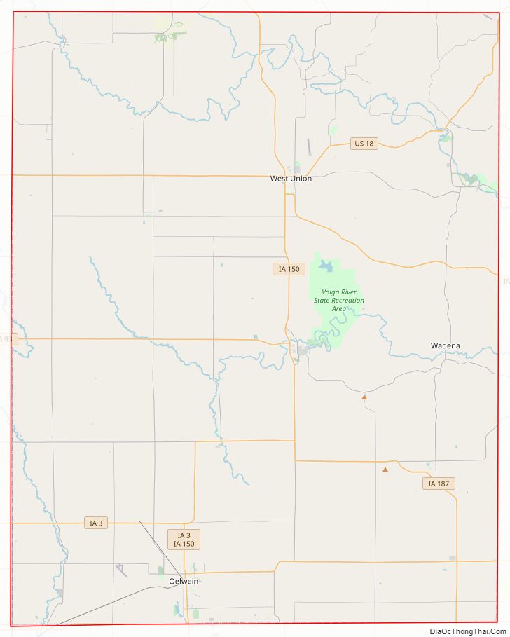
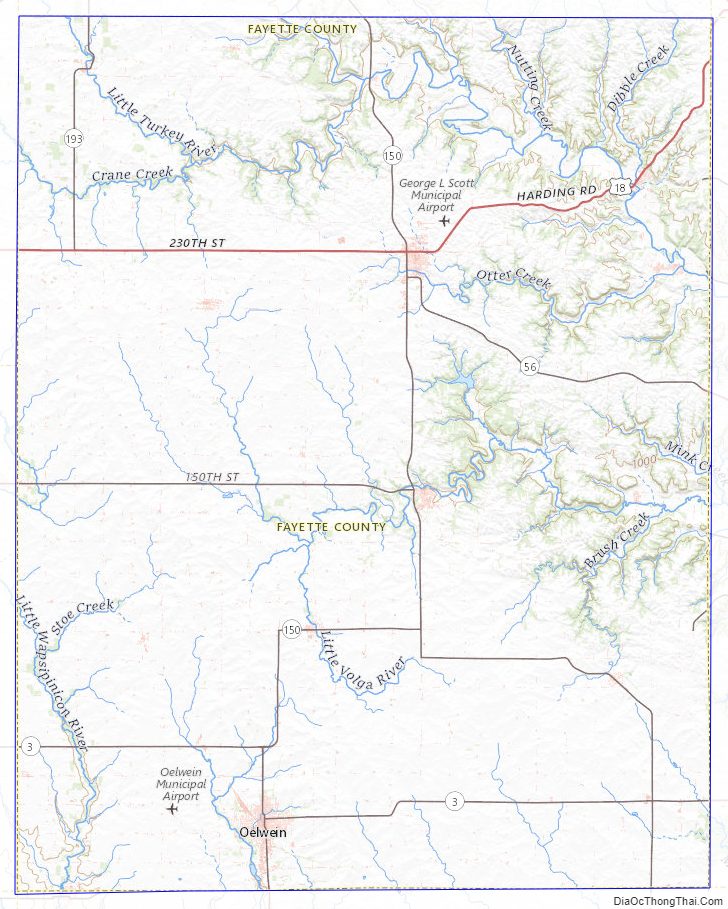
Fayette County Road Map
Geography
According to the U.S. Census Bureau, the county has a total area of 731 square miles (1,890 km), of which 731 square miles (1,890 km) is land and 0.5 square miles (1.3 km) (0.07%) is water.
Major highways
- U.S. Highway 18
- Iowa Highway 3
- Iowa Highway 56
- Iowa Highway 93
- Iowa Highway 150
- Iowa Highway 187
- Iowa Highway 281
Adjacent counties
- Allamakee County (northeast)
- Black Hawk County (southwest)
- Buchanan County (south)
- Bremer County (west)
- Chickasaw County (northwest)
- Clayton County (east)
- Delaware County (southeast)
- Winneshiek County (north)
Fayette County Topographic Map
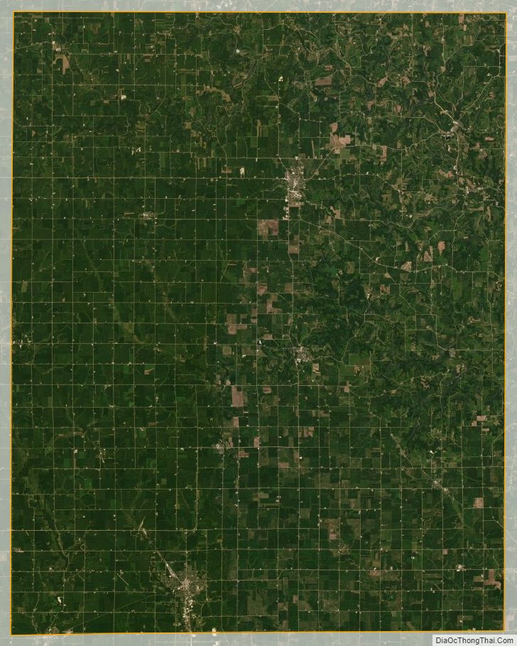
Fayette County Satellite Map
Fayette County Outline Map