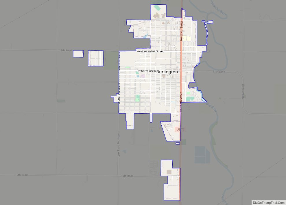
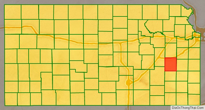
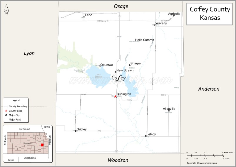
Coffey County (county code CF) is a county located in Eastern Kansas. As of the 2020 census, the county population was 8,360. Its county seat and most populous city is Burlington.
| Name: | Coffey County |
|---|---|
| FIPS code: | 20-031 |
| State: | Kansas |
| Founded: | August 25, 1855 |
| Named for: | Asbury M. Coffey |
| Seat: | Burlington |
| Largest city: | Burlington |
| Total Area: | 654 sq mi (1,690 km²) |
| Land Area: | 627 sq mi (1,620 km²) |
| Total Population: | 8,360 |
| Population Density: | 13.3/sq mi (5.1/km²) |
| Time zone: | UTC−6 (Central) |
| Summer Time Zone (DST): | UTC−5 (CDT) |
| Website: | CoffeyCountyKS.org |
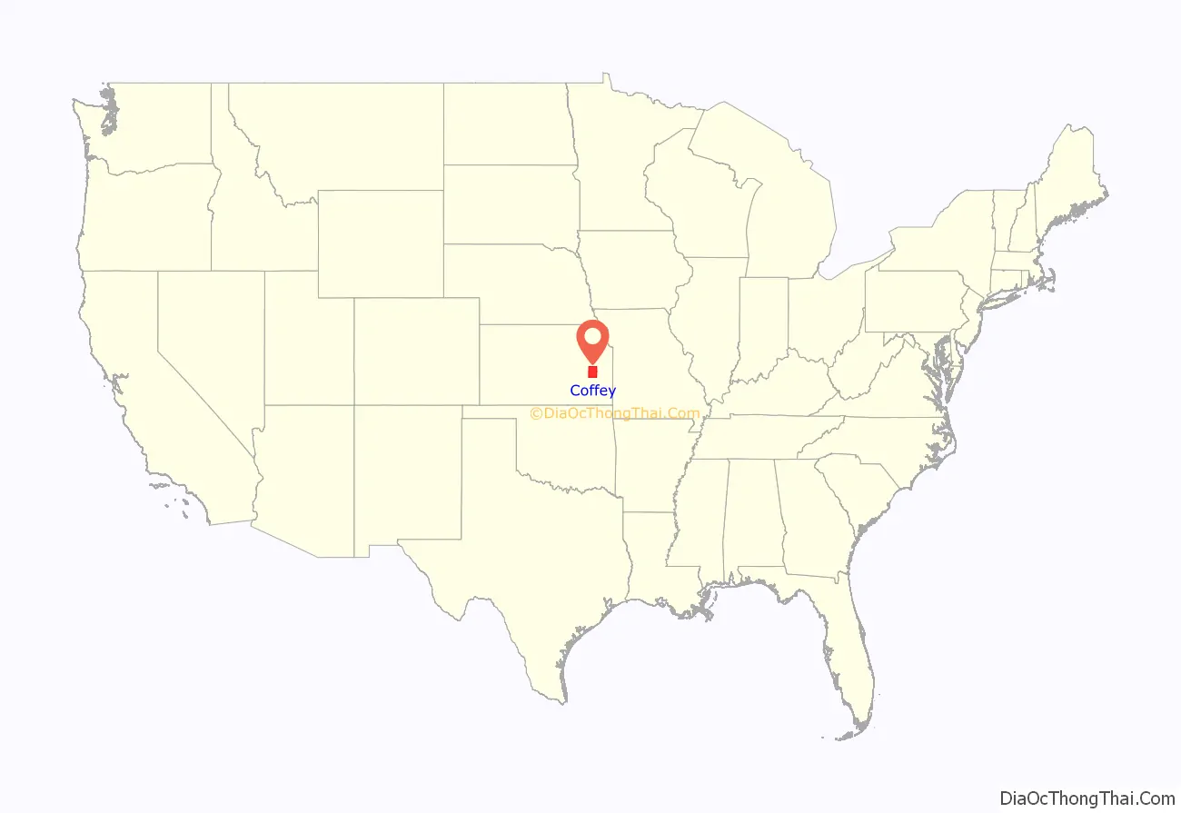
Coffey County location map. Where is Coffey County?
History
Early history
For many millennia, the Great Plains of North America was inhabited by nomadic Native Americans. From the 16th century to 18th century, the Kingdom of France claimed ownership of large parts of North America. In 1762, after the French and Indian War, France secretly ceded New France to Spain, per the Treaty of Fontainebleau.
19th century
In 1802, Spain returned most of the land to France, but keeping title to about 7,500 square miles. In 1803, most of the land for modern day Kansas was acquired by the United States from France as part of the 828,000 square mile Louisiana Purchase for 2.83 cents per acre.
In 1854, the Kansas Territory was organized, then in 1861 Kansas became the 34th U.S. state. In 1855, Coffey County was established.
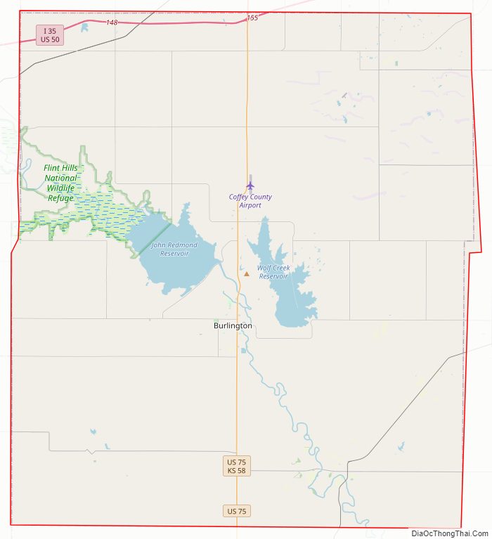
Coffey County Road Map
Geography
According to the U.S. Census Bureau, the county has a total area of 654 square miles (1,690 km), of which 627 square miles (1,620 km) is land and 27 square miles (70 km) (4.2%) is water.
Adjacent counties
- Osage County (north)
- Franklin County (northeast)
- Anderson County (east)
- Allen County (southeast)
- Woodson County (south)
- Greenwood County (southwest)
- Lyon County (northwest)
Major highways
Sources: National Atlas, U.S. Census Bureau
- Interstate 35
- U.S. Route 50
- U.S. Route 75
- K-31
- K-58
National protected area
- Flint Hills National Wildlife Refuge (part)
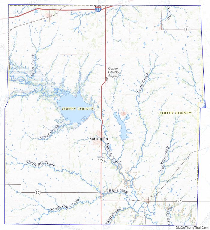
Coffey County Topographic Map
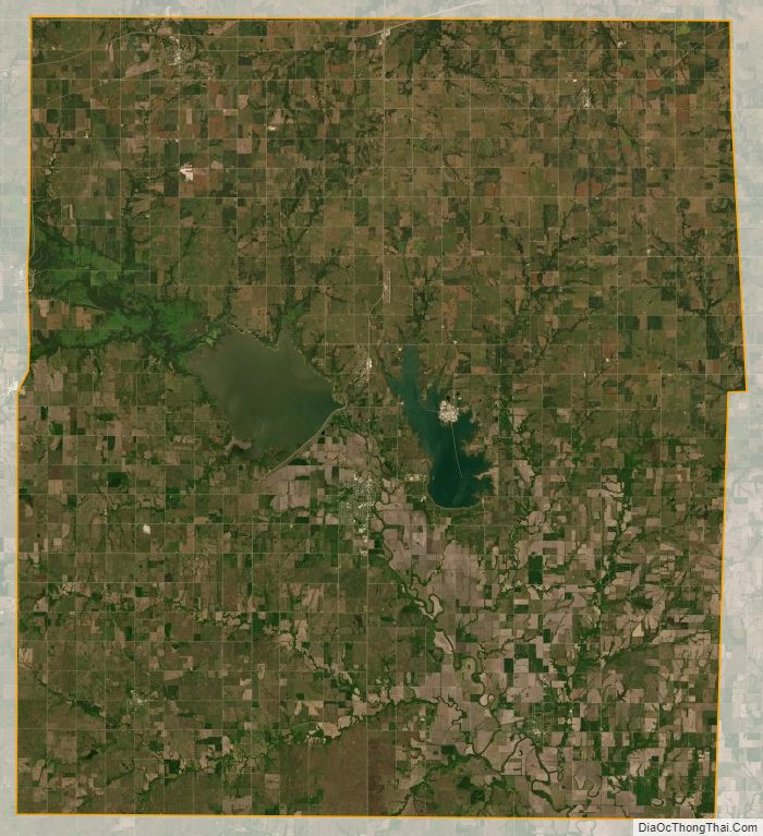
Coffey County Satellite Map
Coffey County Outline Map