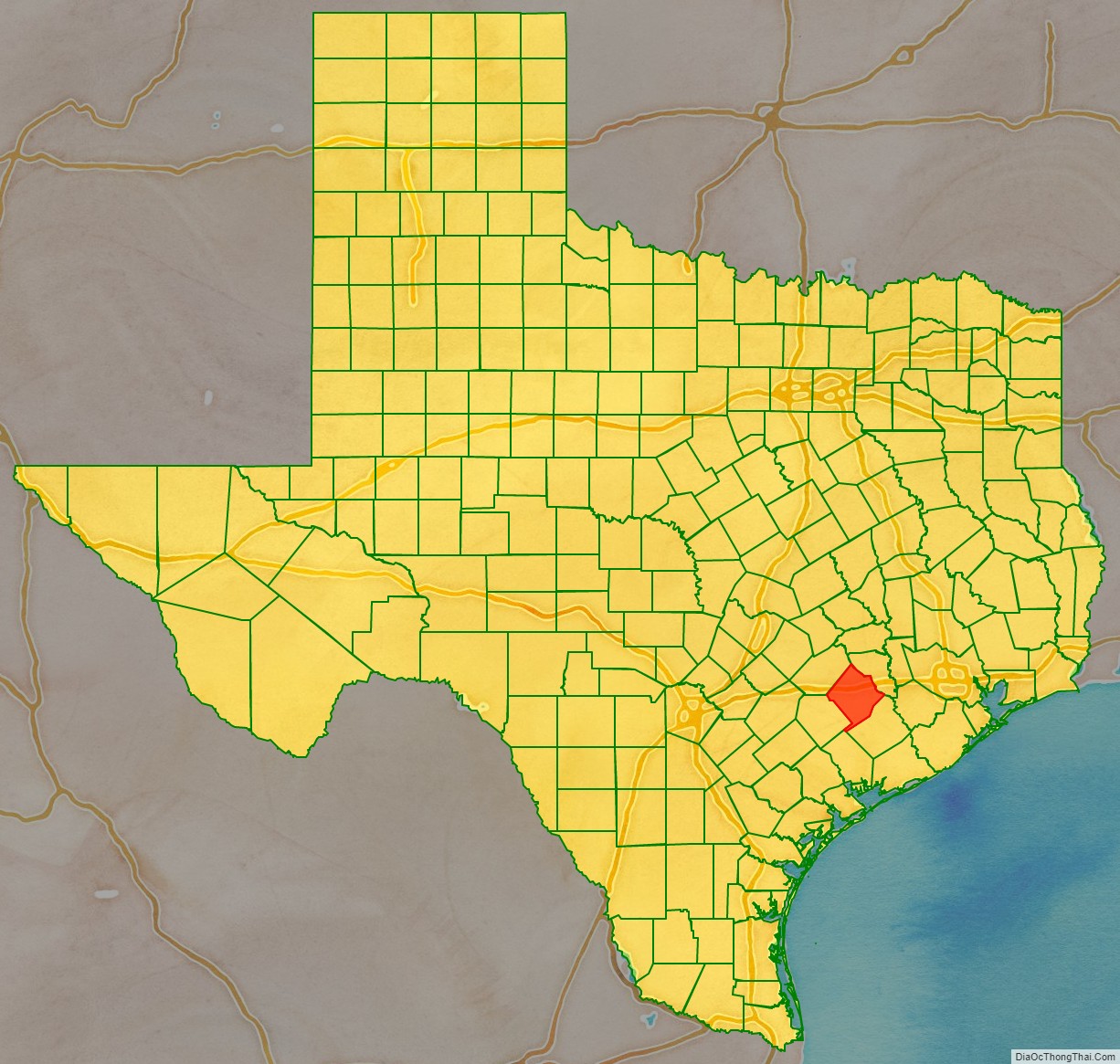
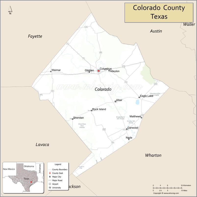
Colorado County is a county located in the U.S. state of Texas. As of the 2020 census, its population was 20,557. Its county seat is Columbus. It is named for the Colorado River of Texas. The county was founded in 1836 and organized the next year.
| Name: | Colorado County |
|---|---|
| FIPS code: | 48-089 |
| State: | Texas |
| Founded: | 1837 |
| Named for: | Colorado River |
| Seat: | Columbus |
| Largest city: | Eagle Lake |
| Total Area: | 974 sq mi (2,520 km²) |
| Land Area: | 960 sq mi (2,500 km²) |
| Total Population: | 20,557 |
| Population Density: | 21/sq mi (8.1/km²) |
| Time zone: | UTC−6 (Central) |
| Summer Time Zone (DST): | UTC−5 (CDT) |
| Website: | www.co.colorado.tx.us |
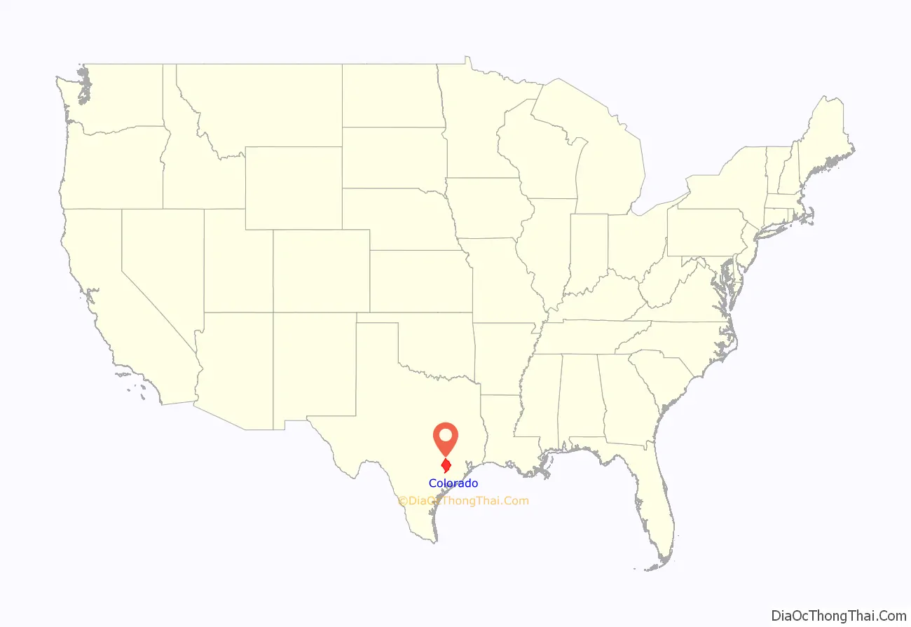
Colorado County location map. Where is Colorado County?
History
The territory that is now Colorado County has been continually inhabited by humans for at least 12,000 years. The Coco branch of the Karaknawa are said to have hunted in the area, while Tonkawa crossed the area from the south.
The first record of an Anglo settler coming through the area that is now Colorado County was January 20, 1687, when René Robert Cavelier, Sieur de La Salle, camped along Skull Creek. The party located an Indian village and named it Hebemes. The fourth expedition of Alonso De León may have crossed into the area while looking for Fort St. Louis in 1689.
The area was settled by Anglo colonists who were part of Stephen F. Austin’s Old Three Hundred starting in 1821. Some families settled near Beeson’s Ford, a few miles south of Columbus’ present day location. The area was active during the days of the Texas Revolution. Dilue Rose Harris wrote her memoir of the Runaway Scrape from within the boundaries of Colorado County.
The county was one of the original Republic of Texas counties when it formed in 1836. Following the American Civil War, the county had one of the larger populations of African-American freedmen in the state, and was granted a Freedmen’s Bureau office in Columbus.
Many European settlers, particularly Germans, as well as Moravians and Bohemians from what became Czechoslovakia, began to settle in the county after the Civil War, although Germans had settled in the area as early as 1830.
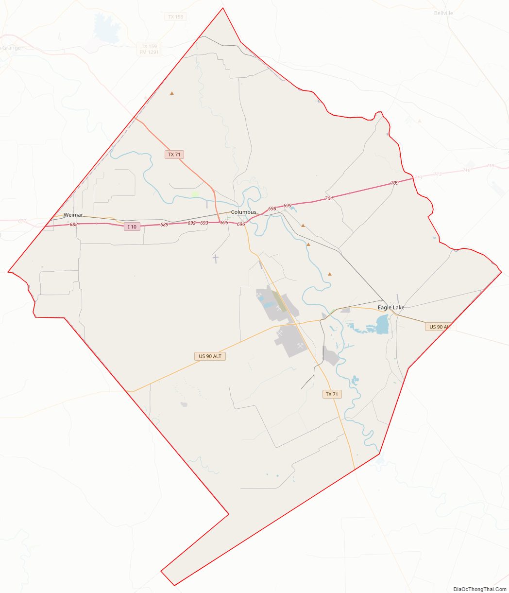
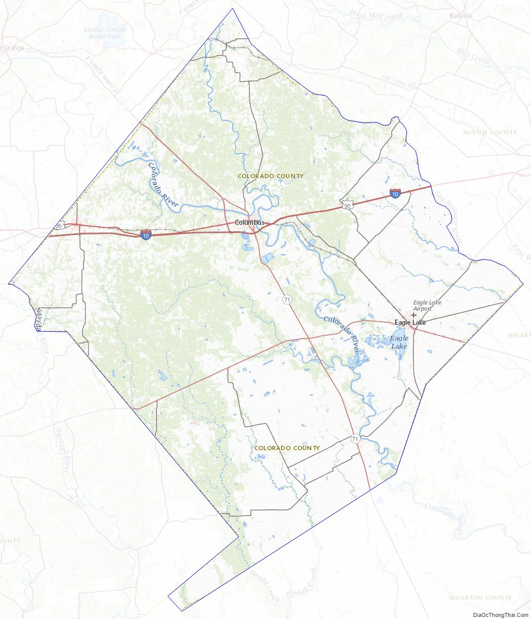
Colorado County Road Map
Geography
According to the U.S. Census Bureau, the county has a total area of 974 sq mi (2,520 km), of which 13 sq mi (34 km) (1.4%) are covered by water.
Major highways
- Interstate 10
- U.S. Highway 90
U.S. Highway 90 Alternate- State Highway 71
Adjacent counties
- Austin County (northeast)
- Wharton County (southeast)
- Jackson County (south)
- Lavaca County (southwest)
- Fayette County (northwest)
National protected area
- Attwater Prairie Chicken National Wildlife Refuge
Colorado County Topographic Map
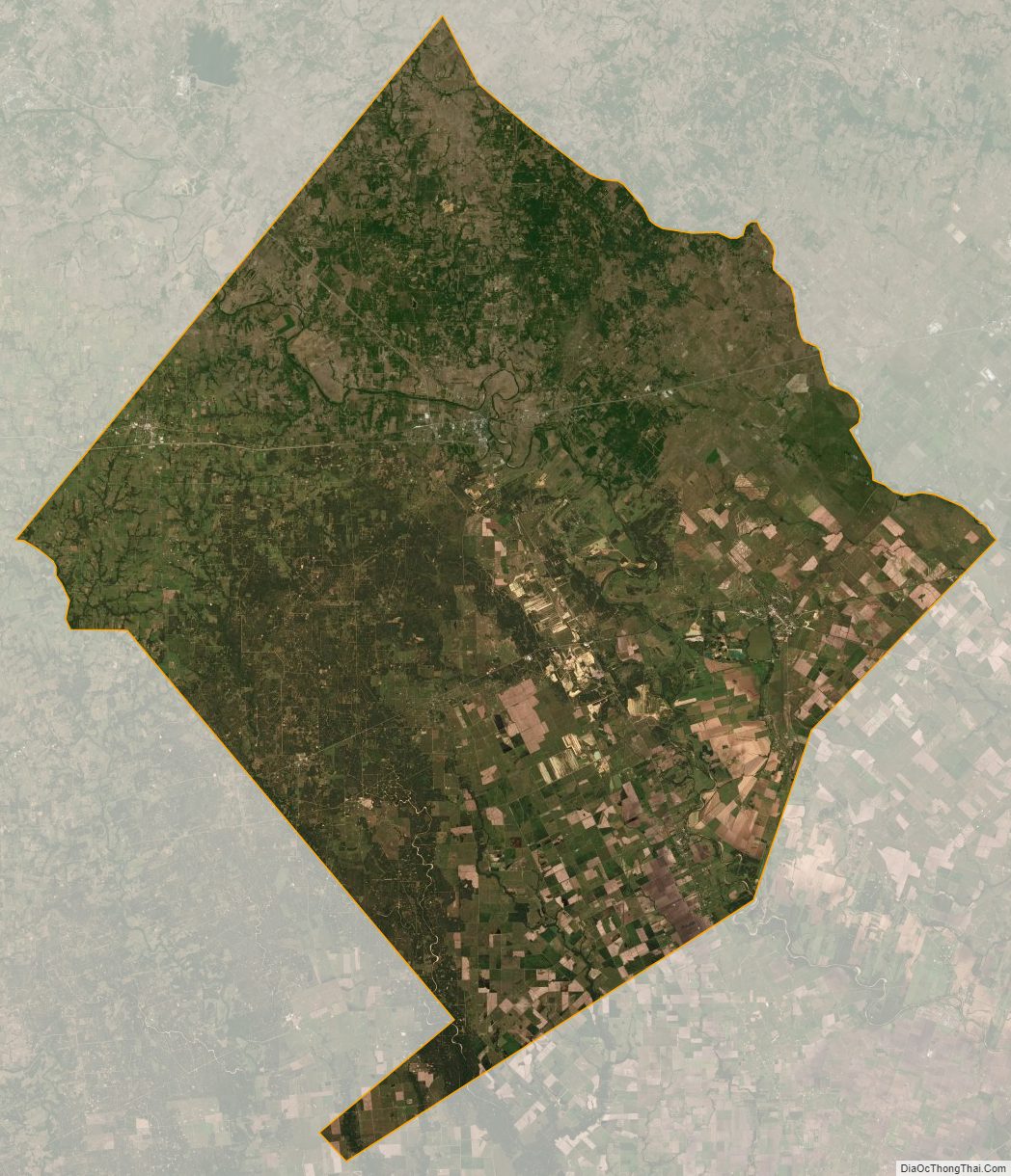
Colorado County Satellite Map
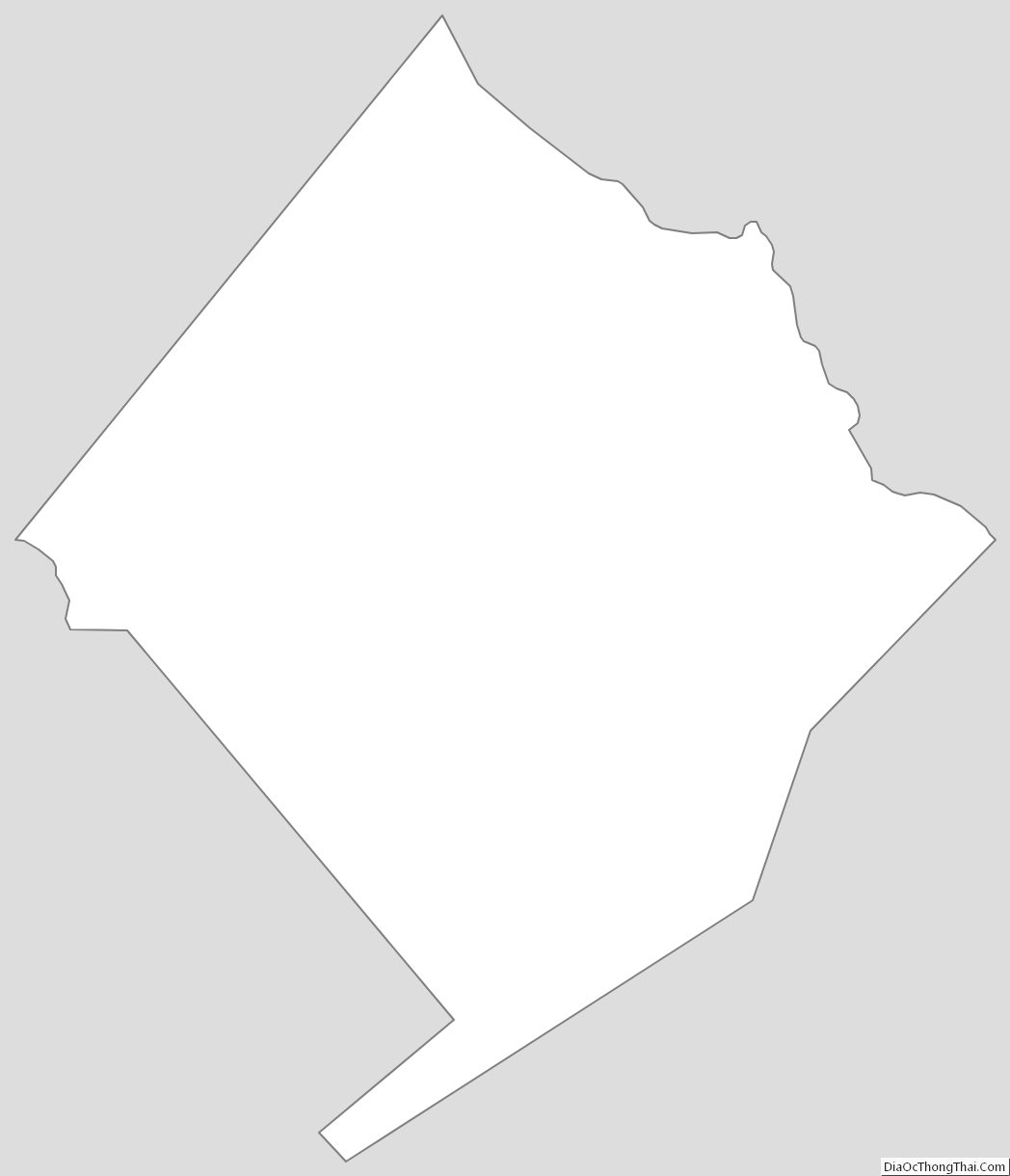
Colorado County Outline Map