Columbus is a city in and the county seat of Colorado County in southeastern Texas. The population was 3,699 as of the 2020 census. It is located on the Colorado River. The Colorado County Courthouse is listed on the National Register of Historic Places.
A Santa Claus museum is located in Columbus.
| Name: | Columbus city |
|---|---|
| LSAD Code: | 25 |
| LSAD Description: | city (suffix) |
| State: | Texas |
| County: | Colorado County |
| Elevation: | 203 ft (62 m) |
| Total Area: | 2.98 sq mi (7.72 km²) |
| Land Area: | 2.98 sq mi (7.71 km²) |
| Water Area: | 0.01 sq mi (0.01 km²) |
| Total Population: | 3,699 |
| Population Density: | 1,224.31/sq mi (472.75/km²) |
| ZIP code: | 78934 |
| Area code: | 979 |
| FIPS code: | 4816168 |
| GNISfeature ID: | 1333156 |
| Website: | www.columbustexas.net |
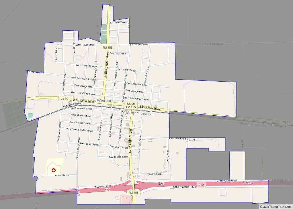
Online Interactive Map
Click on ![]() to view map in "full screen" mode.
to view map in "full screen" mode.
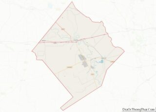
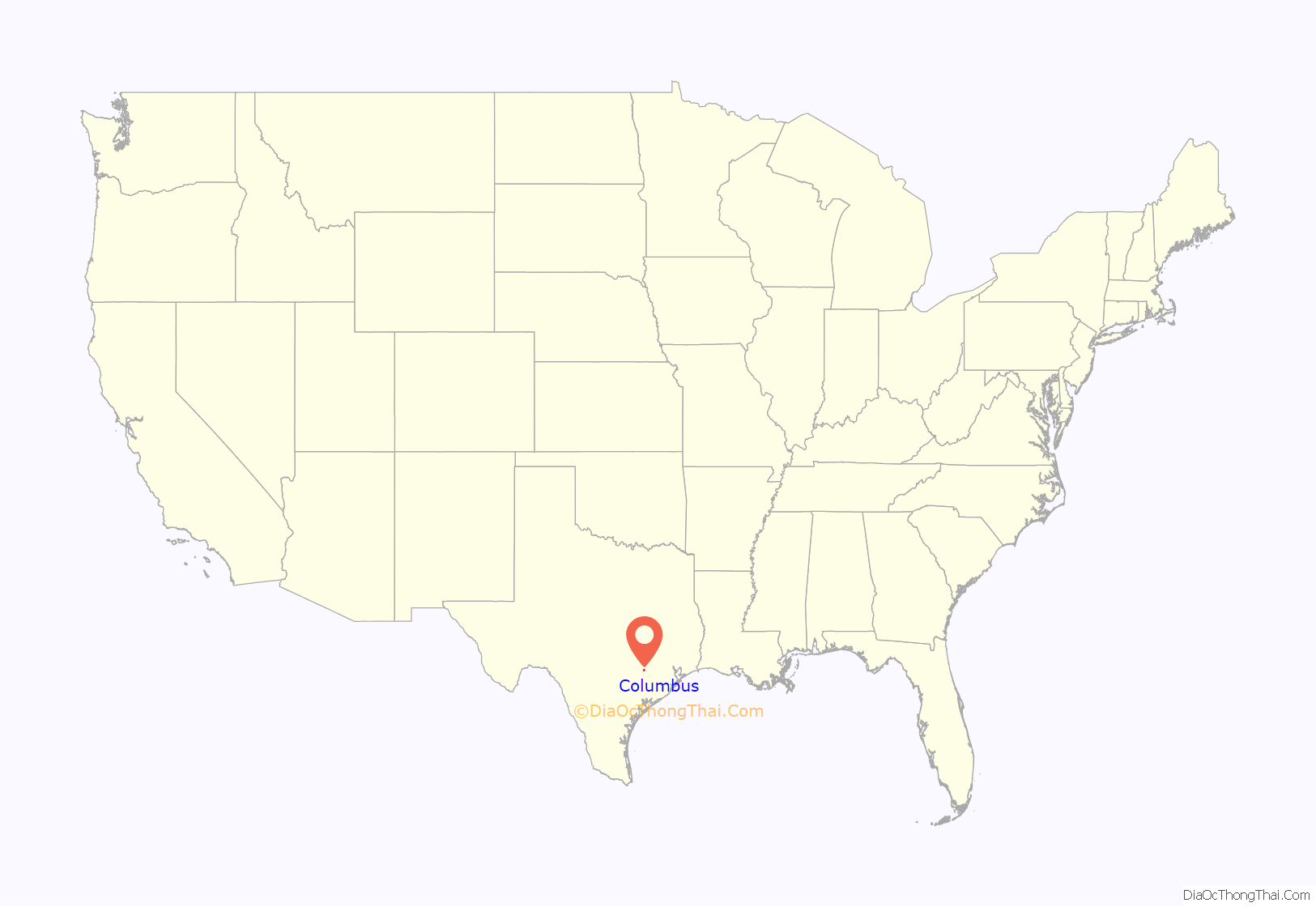
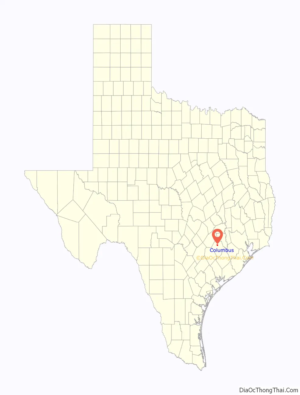
Columbus location map. Where is Columbus city?
History
The first American settlers arrived in 1821 on what is known as the legendary site of Montezuma’s Indian village. In 1822, the Mexican government issued land grants to members of Stephen F. Austin’s Old Three Hundred, who included Benjamin Beason (originally spelled “Beeson”) and Abram Alley. Alley’s 1830s log cabin has been preserved in Columbus and is used as a tool museum. Beason arrived in 1821, received his land grant in 1822, and settled along the Colorado River with his wife Elizabeth “Betsy” and family. By late December 1821, colonists Robert H. Kuykendall with his brother Joseph, and Daniel Gilleland arrived in the area of present-day Columbus. In 1822, Benjamin Beason began operating a ferry across the Colorado River, and the settlement became known as Beason’s Ferry or Beason’s Crossing. Beason also established a gristmill, gin, and a sawmill; his wife operated a boarding house.
Beason’s Crossing became part of Austin’s San Felipe colony in 1822, when the colony was divided into two districts by the Mexican governor José F. Trespalacios. The Mexican government granted the rights to establish a town, and the locals elected town officials. John J. Tumlinson Sr., was elected alcalde, with Robert Kuykendall captain and Moses Morrison lieutenant. Tumlinson’s land adjoined Beason’s; together, they made up much of the site of present-day Columbus. Tumlinson was killed by Native Americans in 1823. In 1834, after the Tumlinson children inherited the estate, they sold land to William Dewees, who was married to Beason’s daughter, Lydia. Dewees’ land grant was near the site of present-day Glidden, Texas.
By 1836, Beason’s Ferry Crossing was home to over 25 families. During the fight for Texas independence, Sam Houston and his men camped along the banks of the Colorado River near Beason’s Crossing. Following the Battle of the Alamo, Santa Anna’s army headed for San Jacinto, and Houston ordered that Beason’s Crossing be burned during the Runaway Scrape.
Columbus was established by European Americans in 1837 after Texas achieved independence from Mexico. After the population returned following warfare, residents renamed Beason’s Crossing “Columbus”. Some speculate that it was named in honor of residents who migrated from Columbus, Ohio, while others believe the town was named after Christopher Columbus, who explored on behalf of Spain in the late 15th century.
The town of Columbus was platted again in 1837. The Dewees family gave land for a new school and possibly a courthouse. By 1837, the town had been re-established with two public houses, two stores, and half a dozen small dwellings.
It was later named the seat of Colorado County, and had developed as a center of business and trade for surrounding areas. Cattle ranching was big business by the late 19th century. Some merchants and ranchers did very well, and built fine houses in the city, such as the house built by Robert E. Stafford. He supported the Stafford Opera House, now serving also as a museum and performance space. In the late 19th and early 20th centuries, it attracted touring performers and lecturers. Other notable historic homes operated today as museums are the Dilue Rose Harris House Museum, and Tate-Senftenburg-Brandon House Museum. The Tate-Senftenburg-Brandon House, formerly owned by the Columbus Historical Preservation Trust, Inc., was sold to private owners in 2017 and is no longer operated as a museum but is being further restored and maintains its historic character.
The Colorado County Courthouse was built in 1890, the fourth such structure in the city. It was designed in the Classical Revival and Italianate styles of architecture by noted Houston architect Eugene T. Heiner. He designed at least nine other Texas courthouses. The bell tower was damaged in a 1909 storm. The dome was added before 1939. It is listed on the National Register of Historic Places. In 2013–2014, the courthouse was being renovated and upgraded for current uses; the project included restoration of historic exterior colors.
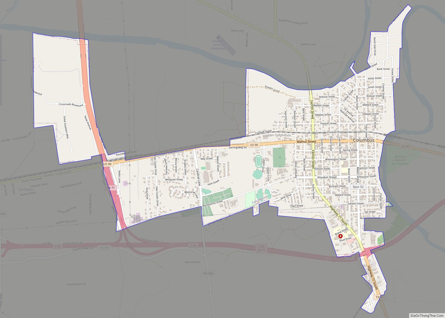
Columbus Road Map
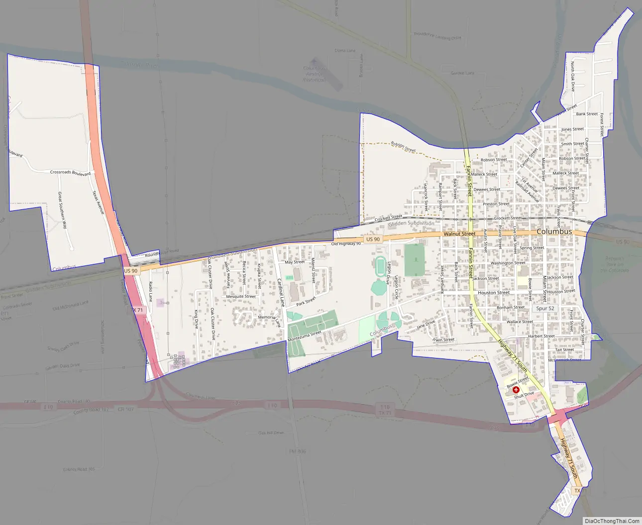
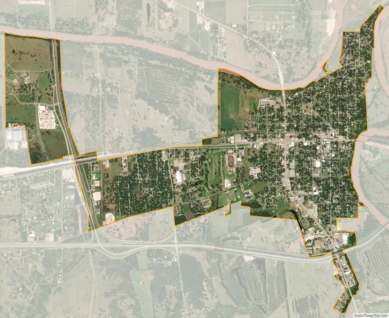
Columbus city Satellite Map
Geography
It is located along Interstate 10, on the southwest side of the Colorado River.
According to the United States Census Bureau, the city has a total area of 2.88 square miles (7.45 km), of which 0.004 square miles (0.01 km), or 0.16%, is water.
Climate
The climate in this area is characterized by hot, humid summers and generally mild to cool winters. According to the Köppen climate classification system, Columbus has a humid subtropical climate, Cfa on climate maps.
See also
Map of Texas State and its subdivision:- Anderson
- Andrews
- Angelina
- Aransas
- Archer
- Armstrong
- Atascosa
- Austin
- Bailey
- Bandera
- Bastrop
- Baylor
- Bee
- Bell
- Bexar
- Blanco
- Borden
- Bosque
- Bowie
- Brazoria
- Brazos
- Brewster
- Briscoe
- Brooks
- Brown
- Burleson
- Burnet
- Caldwell
- Calhoun
- Callahan
- Cameron
- Camp
- Carson
- Cass
- Castro
- Chambers
- Cherokee
- Childress
- Clay
- Cochran
- Coke
- Coleman
- Collin
- Collingsworth
- Colorado
- Comal
- Comanche
- Concho
- Cooke
- Coryell
- Cottle
- Crane
- Crockett
- Crosby
- Culberson
- Dallam
- Dallas
- Dawson
- Deaf Smith
- Delta
- Denton
- Dewitt
- Dickens
- Dimmit
- Donley
- Duval
- Eastland
- Ector
- Edwards
- El Paso
- Ellis
- Erath
- Falls
- Fannin
- Fayette
- Fisher
- Floyd
- Foard
- Fort Bend
- Franklin
- Freestone
- Frio
- Gaines
- Galveston
- Garza
- Gillespie
- Glasscock
- Goliad
- Gonzales
- Gray
- Grayson
- Gregg
- Grimes
- Guadalupe
- Hale
- Hall
- Hamilton
- Hansford
- Hardeman
- Hardin
- Harris
- Harrison
- Hartley
- Haskell
- Hays
- Hemphill
- Henderson
- Hidalgo
- Hill
- Hockley
- Hood
- Hopkins
- Houston
- Howard
- Hudspeth
- Hunt
- Hutchinson
- Irion
- Jack
- Jackson
- Jasper
- Jeff Davis
- Jefferson
- Jim Hogg
- Jim Wells
- Johnson
- Jones
- Karnes
- Kaufman
- Kendall
- Kenedy
- Kent
- Kerr
- Kimble
- King
- Kinney
- Kleberg
- Knox
- La Salle
- Lamar
- Lamb
- Lampasas
- Lavaca
- Lee
- Leon
- Liberty
- Limestone
- Lipscomb
- Live Oak
- Llano
- Loving
- Lubbock
- Lynn
- Madison
- Marion
- Martin
- Mason
- Matagorda
- Maverick
- McCulloch
- McLennan
- McMullen
- Medina
- Menard
- Midland
- Milam
- Mills
- Mitchell
- Montague
- Montgomery
- Moore
- Morris
- Motley
- Nacogdoches
- Navarro
- Newton
- Nolan
- Nueces
- Ochiltree
- Oldham
- Orange
- Palo Pinto
- Panola
- Parker
- Parmer
- Pecos
- Polk
- Potter
- Presidio
- Rains
- Randall
- Reagan
- Real
- Red River
- Reeves
- Refugio
- Roberts
- Robertson
- Rockwall
- Runnels
- Rusk
- Sabine
- San Augustine
- San Jacinto
- San Patricio
- San Saba
- Schleicher
- Scurry
- Shackelford
- Shelby
- Sherman
- Smith
- Somervell
- Starr
- Stephens
- Sterling
- Stonewall
- Sutton
- Swisher
- Tarrant
- Taylor
- Terrell
- Terry
- Throckmorton
- Titus
- Tom Green
- Travis
- Trinity
- Tyler
- Upshur
- Upton
- Uvalde
- Val Verde
- Van Zandt
- Victoria
- Walker
- Waller
- Ward
- Washington
- Webb
- Wharton
- Wheeler
- Wichita
- Wilbarger
- Willacy
- Williamson
- Wilson
- Winkler
- Wise
- Wood
- Yoakum
- Young
- Zapata
- Zavala
- Alabama
- Alaska
- Arizona
- Arkansas
- California
- Colorado
- Connecticut
- Delaware
- District of Columbia
- Florida
- Georgia
- Hawaii
- Idaho
- Illinois
- Indiana
- Iowa
- Kansas
- Kentucky
- Louisiana
- Maine
- Maryland
- Massachusetts
- Michigan
- Minnesota
- Mississippi
- Missouri
- Montana
- Nebraska
- Nevada
- New Hampshire
- New Jersey
- New Mexico
- New York
- North Carolina
- North Dakota
- Ohio
- Oklahoma
- Oregon
- Pennsylvania
- Rhode Island
- South Carolina
- South Dakota
- Tennessee
- Texas
- Utah
- Vermont
- Virginia
- Washington
- West Virginia
- Wisconsin
- Wyoming