Weimar (/ˈwaɪmər/ or, by many non-locals, /ˈwiːmər/) is a city in Colorado County, Texas, United States. The population was 2,076 at the 2020 census. It is part of the Texas-German belt region and was founded and named by German emigrants after the city of Weimar, Germany.
In 1873 the town was founded in anticipation that the Galveston, Harrisburg, & San Antonio Railroad was going to build through the site. It was originally named “Jackson” after D.W. Jackson, a native Georgian and landowner, but subsequently was called “Weimar” in tribute to the German city of Weimar.
Located on Interstate 10 and US 90 between San Antonio, Austin, and Houston, Weimar is a small community of predominantly Czech and German descendants.
| Name: | Weimar city |
|---|---|
| LSAD Code: | 25 |
| LSAD Description: | city (suffix) |
| State: | Texas |
| County: | Colorado County |
| Elevation: | 410 ft (125 m) |
| Total Area: | 2.31 sq mi (5.99 km²) |
| Land Area: | 2.31 sq mi (5.99 km²) |
| Water Area: | 0.00 sq mi (0.01 km²) |
| Total Population: | 2,076 |
| Population Density: | 962.80/sq mi (371.77/km²) |
| ZIP code: | 78962 |
| Area code: | 979 |
| FIPS code: | 4877020 |
| GNISfeature ID: | 1349609 |
| Website: | weimartexas.org |
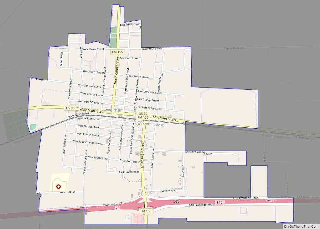
Online Interactive Map
Click on ![]() to view map in "full screen" mode.
to view map in "full screen" mode.
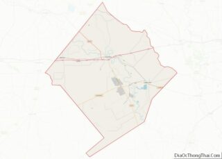
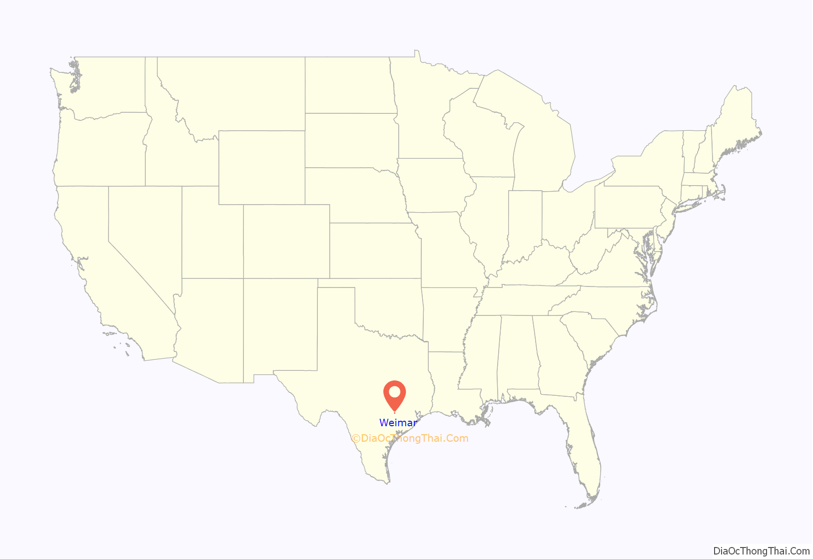
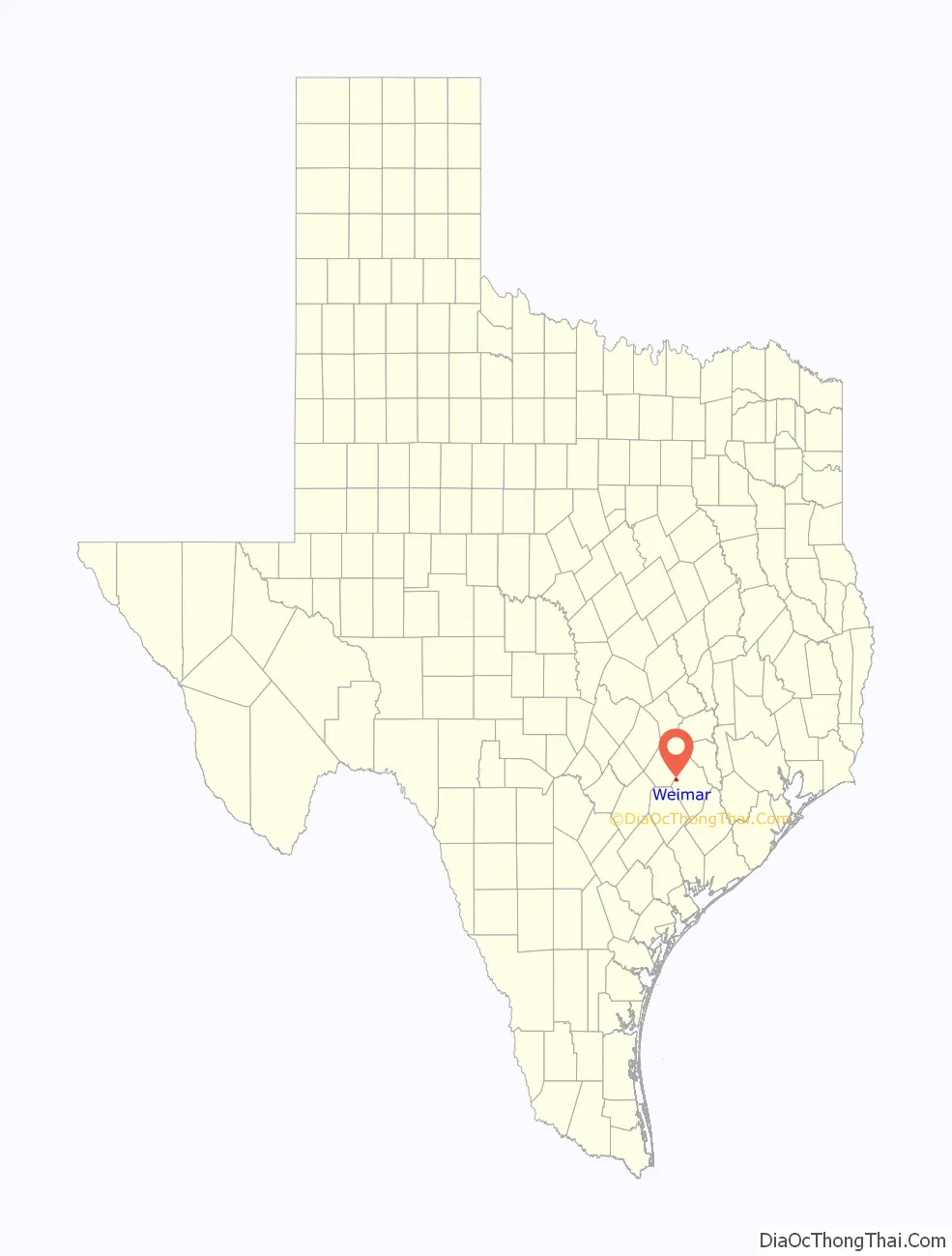
Weimar location map. Where is Weimar city?
History
Weimar was founded in 1873 in anticipation that the Galveston, Harrisburg and San Antonio Railway was going to build through the site. The community was first called “Jackson”, after D. W. Jackson, a native Georgian and area landowner who donated land for the railroad right-of-way and the townsite. The populace subsequently chose the name “Weimar”; an early record states that Thomas W. Pierce, who authorized Jackson to sell lots at the site, had visited Weimar, Germany, and was favorably impressed.
The Weimar post office was established in 1873. The town was incorporated in 1875. After beginning with a few hundred townspeople, Weimar had by its tenth birthday achieved a population over 1,000. As it grew, Weimar established itself as a center of trade for pecans, poultry, and dairy products. By 1877, the town was large enough to make its first city map. In 1888, Weimar witnessed the origin of the first town newspaper, The Weimar Mercury, which currently remains in publication.
A strong history of baseball exists in Weimar. Veterans Park (Strickland Field) was ahead of its time when it was built in 1948, and was the first lighted baseball field between San Antonio and Houston. Veterans Park remains a state-of-the-art baseball stadium, having hosted a Babe Ruth League World Series Tournament in 2005.
Weimar is where Norman J. Sirnic and Karen Sirnic were murdered by serial killer Angel Maturino Resendiz on May 2, 1999. Their parsonage was adjacent to the train tracks.
Throughout the 20th century, Weimar enjoyed a slow yet steady growth in population, increasing on average by 250 persons every ten years. Business establishments held their numbers steady at around 70. After a high population of 2,400 in 1976, the town declined slightly in the following decade. In 1980, the population was 2,128. In 1990, the population of Weimar was 2,052, and in 2000 it was 1,981. By 2010, the population had rebounded to 2,151.
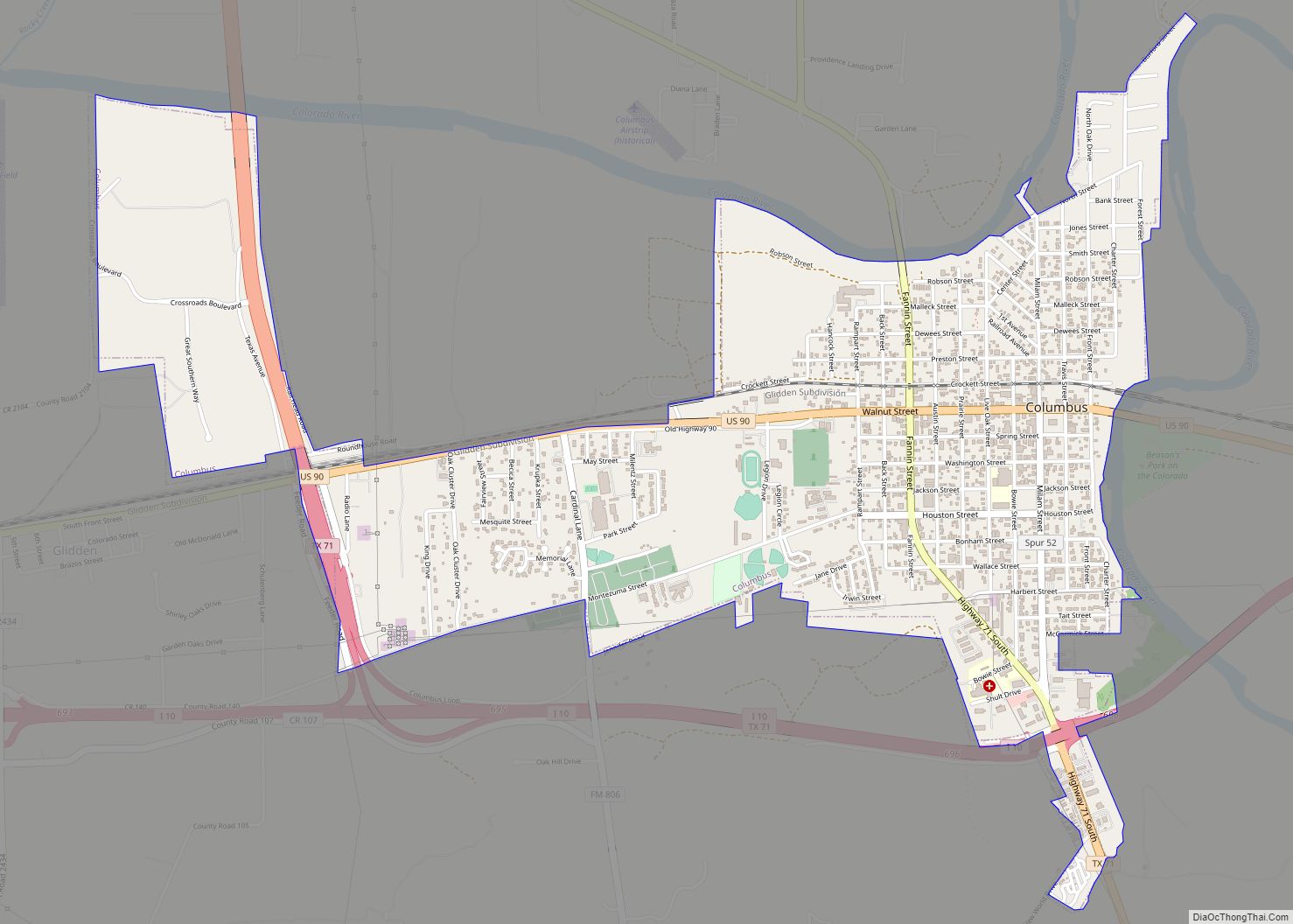
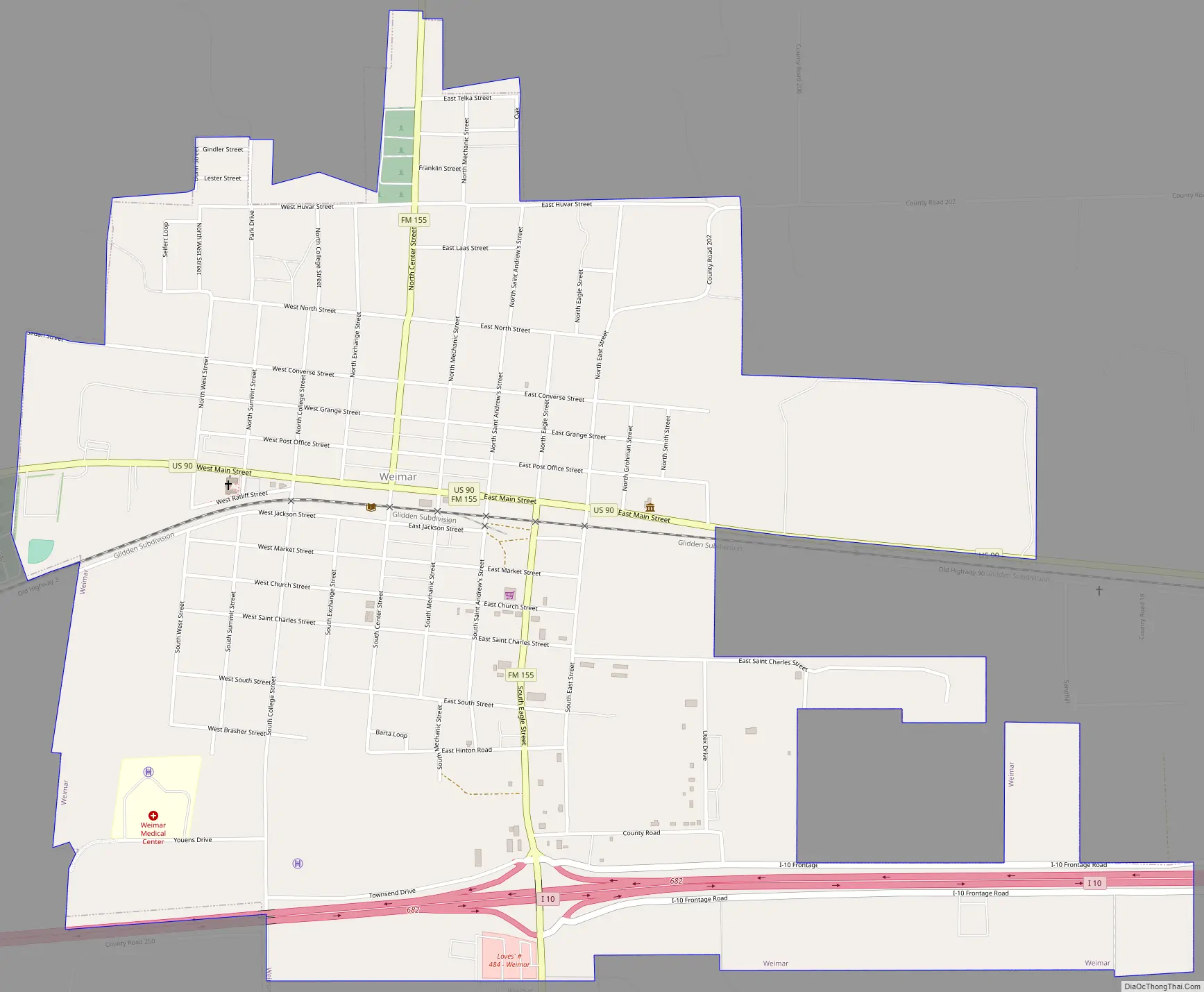
Weimar Road Map
Weimar city Satellite Map

Geography
Weimar is located in western Colorado County at 29°42′8″N 96°46′48″W / 29.70222°N 96.78000°W / 29.70222; -96.78000 (29.702348, –96.779950). According to the United States Census Bureau, the city has a total area of 2.3 square miles (6.0 km), all of it land.
U.S. Route 90 passes through the center of town as Main Street, while Interstate 10 passes through the southern edge of the city, with access from Exit 682. Via either highway it is 15 miles (24 km) east to Columbus, the county seat. Downtown Houston is 88 miles (142 km) to the east, and downtown San Antonio is 109 miles (175 km) to the west.
See also
Map of Texas State and its subdivision:- Anderson
- Andrews
- Angelina
- Aransas
- Archer
- Armstrong
- Atascosa
- Austin
- Bailey
- Bandera
- Bastrop
- Baylor
- Bee
- Bell
- Bexar
- Blanco
- Borden
- Bosque
- Bowie
- Brazoria
- Brazos
- Brewster
- Briscoe
- Brooks
- Brown
- Burleson
- Burnet
- Caldwell
- Calhoun
- Callahan
- Cameron
- Camp
- Carson
- Cass
- Castro
- Chambers
- Cherokee
- Childress
- Clay
- Cochran
- Coke
- Coleman
- Collin
- Collingsworth
- Colorado
- Comal
- Comanche
- Concho
- Cooke
- Coryell
- Cottle
- Crane
- Crockett
- Crosby
- Culberson
- Dallam
- Dallas
- Dawson
- Deaf Smith
- Delta
- Denton
- Dewitt
- Dickens
- Dimmit
- Donley
- Duval
- Eastland
- Ector
- Edwards
- El Paso
- Ellis
- Erath
- Falls
- Fannin
- Fayette
- Fisher
- Floyd
- Foard
- Fort Bend
- Franklin
- Freestone
- Frio
- Gaines
- Galveston
- Garza
- Gillespie
- Glasscock
- Goliad
- Gonzales
- Gray
- Grayson
- Gregg
- Grimes
- Guadalupe
- Hale
- Hall
- Hamilton
- Hansford
- Hardeman
- Hardin
- Harris
- Harrison
- Hartley
- Haskell
- Hays
- Hemphill
- Henderson
- Hidalgo
- Hill
- Hockley
- Hood
- Hopkins
- Houston
- Howard
- Hudspeth
- Hunt
- Hutchinson
- Irion
- Jack
- Jackson
- Jasper
- Jeff Davis
- Jefferson
- Jim Hogg
- Jim Wells
- Johnson
- Jones
- Karnes
- Kaufman
- Kendall
- Kenedy
- Kent
- Kerr
- Kimble
- King
- Kinney
- Kleberg
- Knox
- La Salle
- Lamar
- Lamb
- Lampasas
- Lavaca
- Lee
- Leon
- Liberty
- Limestone
- Lipscomb
- Live Oak
- Llano
- Loving
- Lubbock
- Lynn
- Madison
- Marion
- Martin
- Mason
- Matagorda
- Maverick
- McCulloch
- McLennan
- McMullen
- Medina
- Menard
- Midland
- Milam
- Mills
- Mitchell
- Montague
- Montgomery
- Moore
- Morris
- Motley
- Nacogdoches
- Navarro
- Newton
- Nolan
- Nueces
- Ochiltree
- Oldham
- Orange
- Palo Pinto
- Panola
- Parker
- Parmer
- Pecos
- Polk
- Potter
- Presidio
- Rains
- Randall
- Reagan
- Real
- Red River
- Reeves
- Refugio
- Roberts
- Robertson
- Rockwall
- Runnels
- Rusk
- Sabine
- San Augustine
- San Jacinto
- San Patricio
- San Saba
- Schleicher
- Scurry
- Shackelford
- Shelby
- Sherman
- Smith
- Somervell
- Starr
- Stephens
- Sterling
- Stonewall
- Sutton
- Swisher
- Tarrant
- Taylor
- Terrell
- Terry
- Throckmorton
- Titus
- Tom Green
- Travis
- Trinity
- Tyler
- Upshur
- Upton
- Uvalde
- Val Verde
- Van Zandt
- Victoria
- Walker
- Waller
- Ward
- Washington
- Webb
- Wharton
- Wheeler
- Wichita
- Wilbarger
- Willacy
- Williamson
- Wilson
- Winkler
- Wise
- Wood
- Yoakum
- Young
- Zapata
- Zavala
- Alabama
- Alaska
- Arizona
- Arkansas
- California
- Colorado
- Connecticut
- Delaware
- District of Columbia
- Florida
- Georgia
- Hawaii
- Idaho
- Illinois
- Indiana
- Iowa
- Kansas
- Kentucky
- Louisiana
- Maine
- Maryland
- Massachusetts
- Michigan
- Minnesota
- Mississippi
- Missouri
- Montana
- Nebraska
- Nevada
- New Hampshire
- New Jersey
- New Mexico
- New York
- North Carolina
- North Dakota
- Ohio
- Oklahoma
- Oregon
- Pennsylvania
- Rhode Island
- South Carolina
- South Dakota
- Tennessee
- Texas
- Utah
- Vermont
- Virginia
- Washington
- West Virginia
- Wisconsin
- Wyoming