| Name: | Concho County |
|---|---|
| FIPS code: | 48-095 |
| State: | Texas |
| Founded: | 1879 |
| Named for: | Concho River |
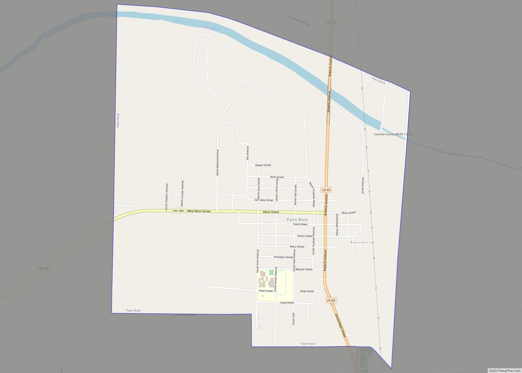
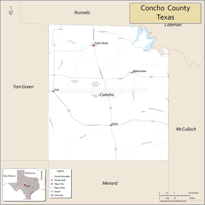
| Seat: | Paint Rock |
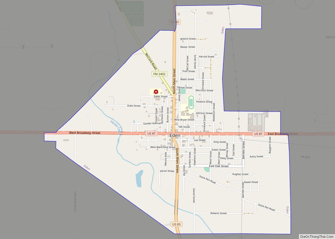
| Largest city: | Eden |
| Total Area: | 994 sq mi (2,570 km²) |
| Land Area: | 984 sq mi (2,550 km²) |
| Total Population: | 3,303 |
| Population Density: | 3.3/sq mi (1.3/km²) |
| Time zone: | UTC−6 (Central) |
| Summer Time Zone (DST): | UTC−5 (CDT) |
| Website: | www.co.concho.tx.us |
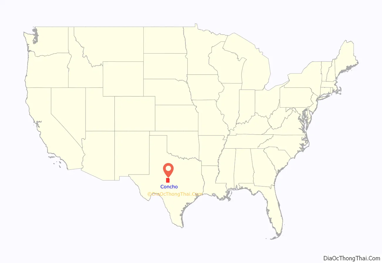
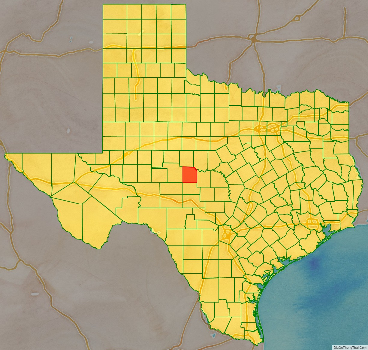
Concho County location map. Where is Concho County?
History
Through the 1800s, Paleo-Indians lived in the county and left behind archaeological remains of a burned-rock midden. Athabascan-speaking Indians associated with the prehorse Plains culture live in this part of Texas. Later native inhabitants include Jumano, Tonkawa, Comanche and Lipan Apache.
In 1847, John O. Meusebach sent surveyors into the area. In 1849, Robert Simpson Neighbors lead a small expedition through the area.
The Texas Legislature formed Concho County from Bexar County in 1858.
In 1874, Ranald S. Mackenzie led a campaign to drive out remaining native peoples and established the Mackenzie Trail. The county seat was formally established and named Paint Rock after the nearby pictographs. The Eden community was established in 1882. In 1909, the community of Lowake community was established.
Railroad development
Railroads came to the county first in 1910, with the Concho, San Saba and Llano Valley railroad being completed to Paint Rock. The Fort Worth and Rio Grande Railway is completed across the southeastern corner of the county in 1911, and the Gulf, Colorado and Santa Fe railroad finished a line to Eden in 1912.
By 1930, the area had 449 owner-operated farms and 682 tenant-operated farms, of whom 619 were sharecroppers.
In 1940, Concho County became part of a soil-conservation district. In 1985, the Texas Water Commission granted permission to impound 554,000 acre-feet (683,000,000 m) of water on the Colorado River at Stacy, to create the O. H. Ivie Reservoir.
As of 1988, Concho County was the leading sheep-producing county in Texas.
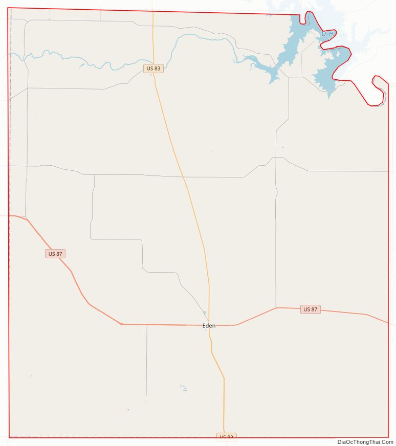
Concho County Road Map
Geography
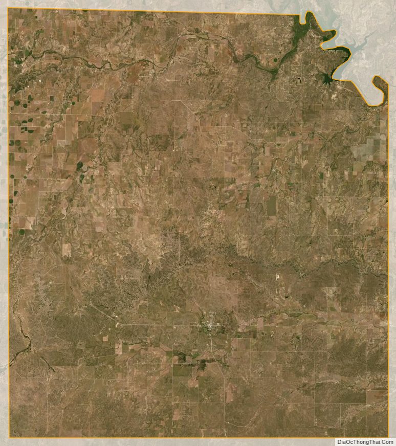
According to the U.S. Census Bureau, the county has a total area of 994 square miles (2,570 km), of which 984 square miles (2,550 km) is land and 9.9 square miles (26 km) (1.0%) is water.
Major highways
- U.S. Highway 83
- U.S. Highway 87
- State Highway 153
- State Highway 206
Adjacent counties
- Runnels County (north)
- Coleman County (northeast)
- McCulloch County (east)
- Menard County (south)
- Schleicher County (southwest)
- Tom Green County (west)
Concho County Topographic Map
Concho County Satellite Map
Concho County Outline Map