| Name: | Tom Green County |
|---|---|
| FIPS code: | 48-451 |
| State: | Texas |
| Founded: | 1875 |
| Named for: | General Thomas Green |
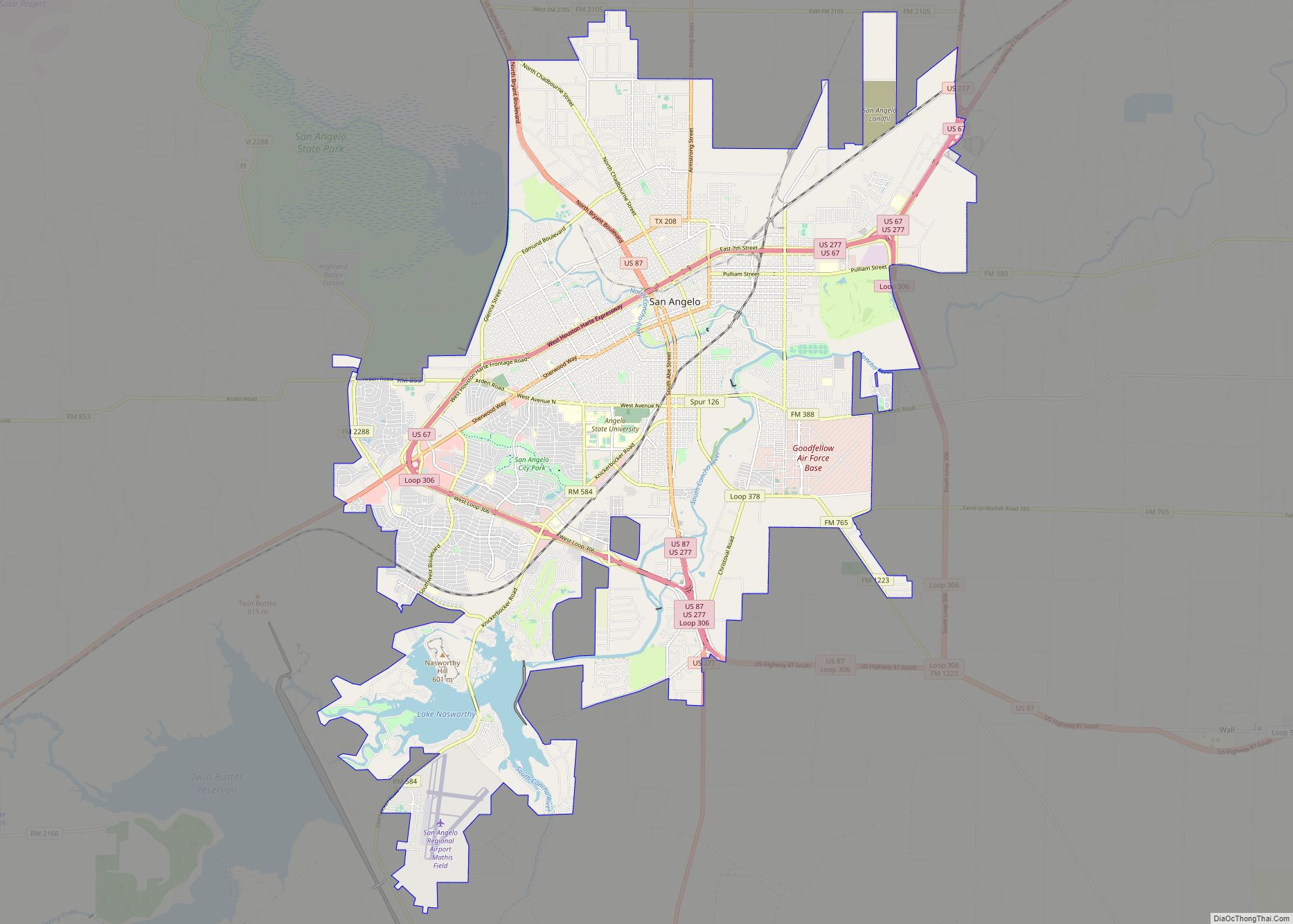
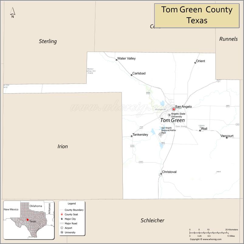
| Seat: | San Angelo |
| Largest city: | San Angelo |
| Total Area: | 1,541 sq mi (3,990 km²) |
| Land Area: | 1,522 sq mi (3,940 km²) |
| Total Population: | 120,003 |
| Population Density: | 78/sq mi (30/km²) |
| Time zone: | UTC−6 (Central) |
| Summer Time Zone (DST): | UTC−5 (CDT) |
| Website: | www.co.tom-green.tx.us |
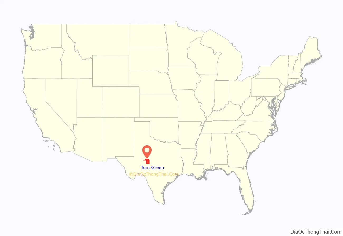
Tom Green County location map. Where is Tom Green County?
History
The county was established by the state legislature on March 13, 1874, and named after Thomas Green, a Confederate brigadier general. It originally comprised an area over 60,000 sq mi (160,000 km).
The original county seat was the town of Ben Ficklin. In 1882, flood waters of the Concho River destroyed the town and drowned 65 people. The county seat was moved to Santa Angela. In 1883, the town’s name was officially changed to San Angelo by the United States Post Office. Following completion of the Santa Fe Railway in September 1888, the county has increase its cattle production to an estimated export of 3,500 to 5,000 railroad cars. In 1889, San Angelo became incorporated to a city, and the Fort Concho shut down after 22 years of operation.
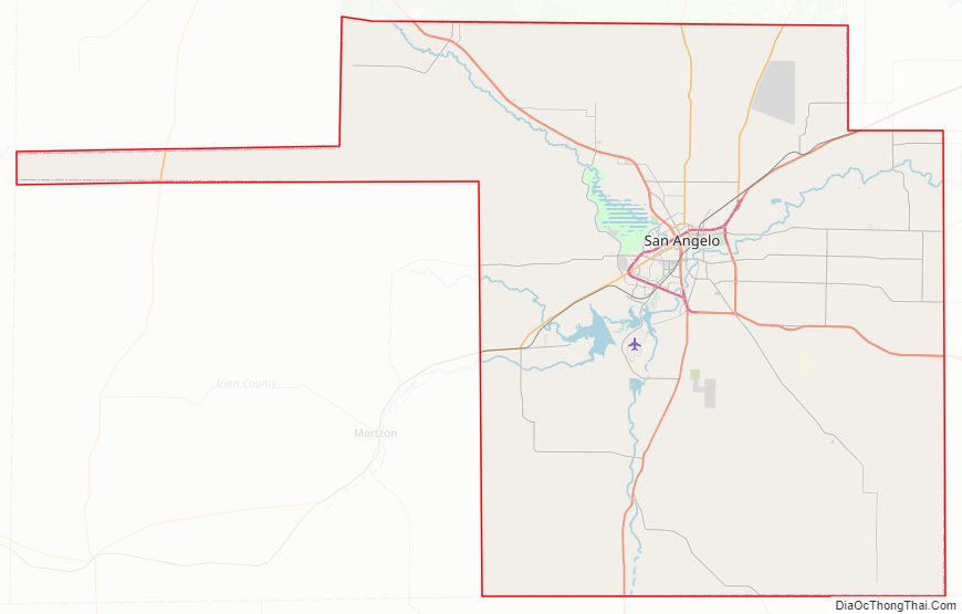
Tom Green County has a long, narrow strip of land extending to the west. This unusual feature is because Reagan County to the west used to be part of Tom Green County, and the state of Texas required that all counties have a contiguous land route to their county seat. Therefore, the small strip of land served to connect the two main regions. In 1903, the residents of the western section voted to form the Reagan County, while in the same vote the connecting strip was decided to remain as part of Tom Green County.
During the Winter Storm Uri, San Angelo City endured 152 hours at or below freezing temperatures. Some of the hurricanes and tropical storms that have hit Tom Green includes:
- Hurricane Matagorda (1942)
- Tropical Storm Delia (1973)
- Hurricane Gilbert (1988)
- Tropical Storm Erin (2007)
- Tropical Storm Hermine (2010)
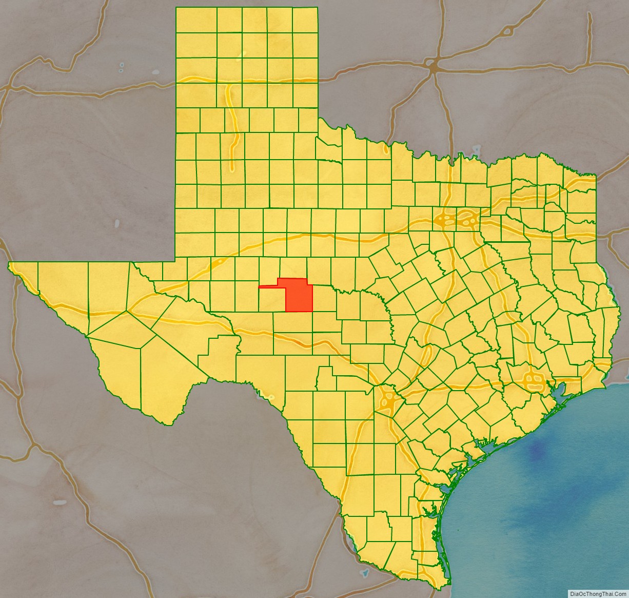
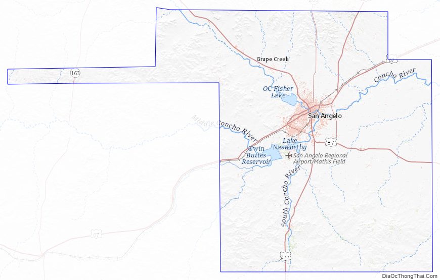
Tom Green County Road Map
Geography
According to the U.S. Census Bureau, the county has a total area of 1,541 sq mi (3,990 km), of which 1,522 sq mi (3,940 km) are land and 19 sq mi (49 km) (1.2%) are covered by water. The county’s protect areas are Lake Nasworthy, O.C. Fisher Reservoir, Twin Buttes Reservoir, San Angelo State Park and Heart of Texas Wildlife Trail. Tom Green County also have the Concho Rivers, North Concho River, South Concho River; and a small creek named Kickapoo Creek as well.
Adjacent counties
- Coke County (north)
- Runnels County (northeast)
- Concho County (east)
- Menard County (southeast)
- Schleicher County (south)
- Irion County (west)
- Reagan County (west)
- Sterling County (northwest)
Tom Green County Topographic Map
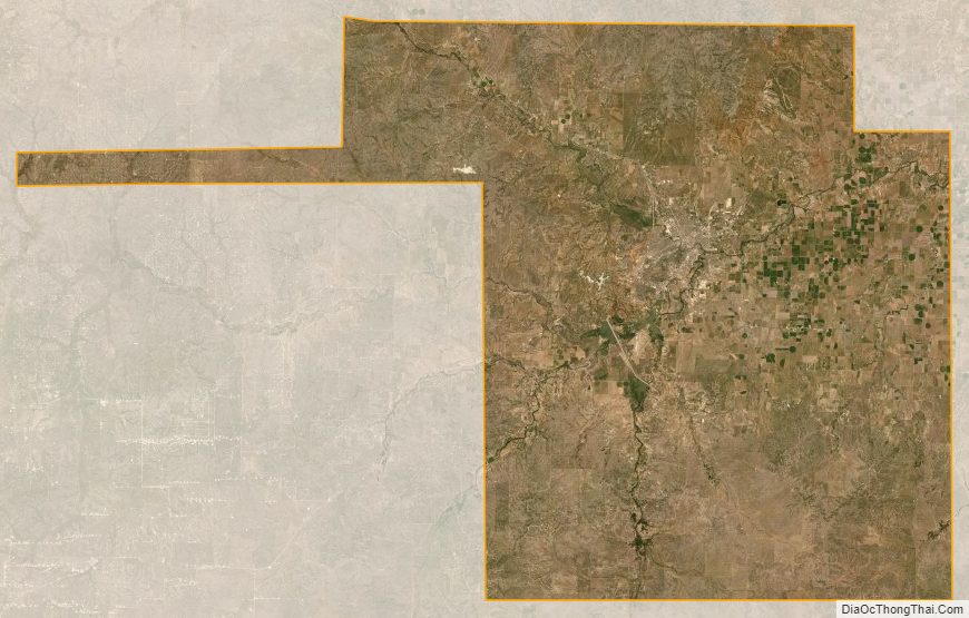
Tom Green County Satellite Map
Tom Green County Outline Map