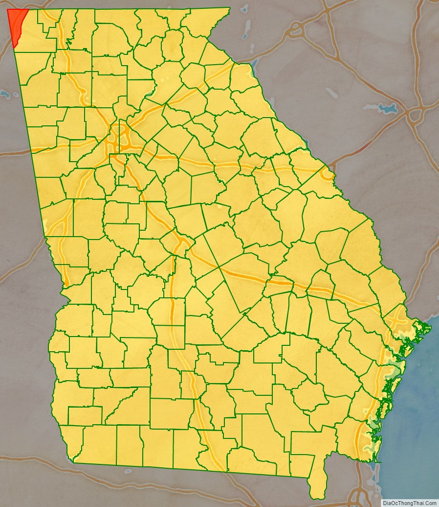
Dade County is a county in the U.S. state of Georgia. It occupies the northwest corner of Georgia, and the county’s own northwest corner is the westernmost point in the state. As of the 2020 census, the population is 16,251. The county seat and only incorporated municipality is Trenton. Dade County is part of the Chattanooga, TN–GA Metropolitan Statistical Area. In 1860, residents of Dade County voted to secede from the state of Georgia and from the United States, but no government outside the county ever recognized this gesture as legal. In 1945, the county symbolically “rejoined” Georgia and the United States.
| Name: | Dade County |
|---|---|
| FIPS code: | 13-083 |
| State: | Georgia |
| Founded: | 1837 |
| Named for: | Francis L. Dade |
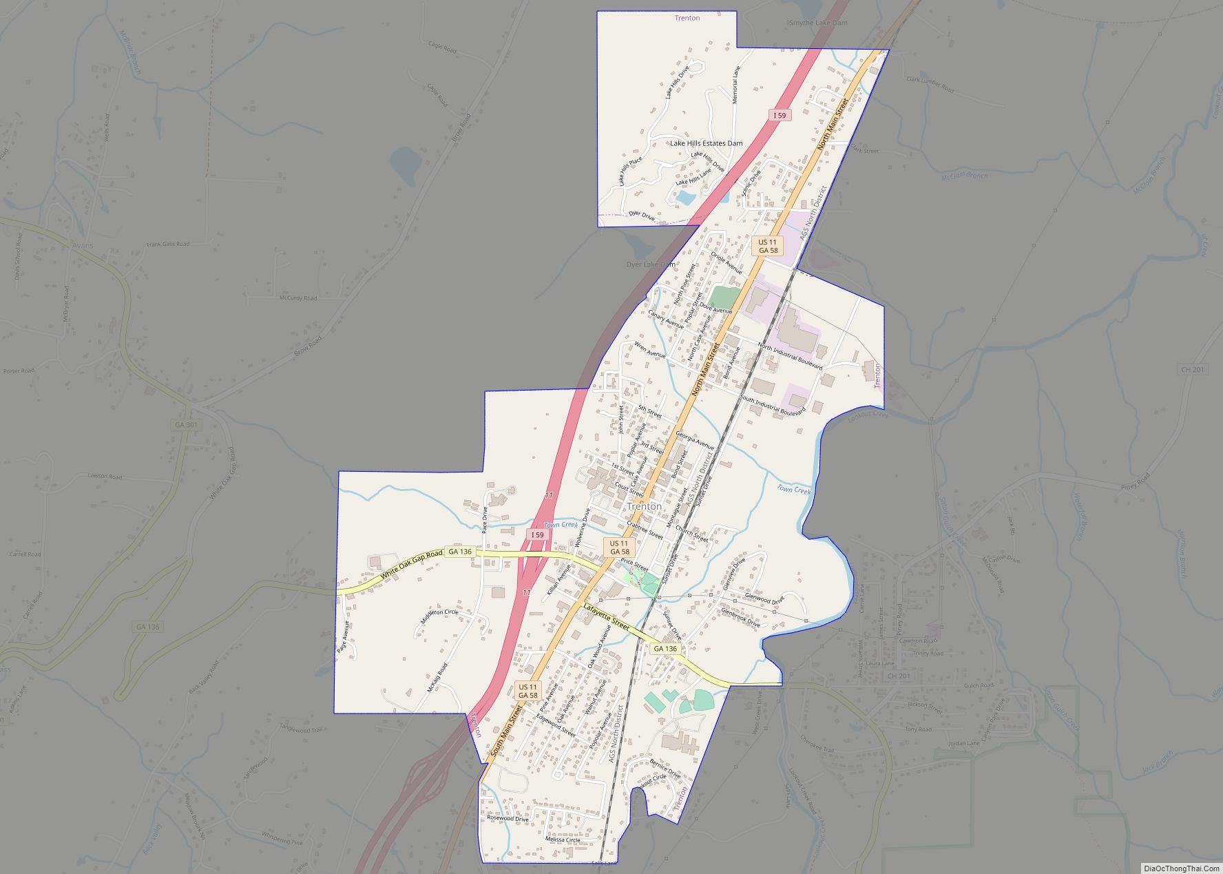
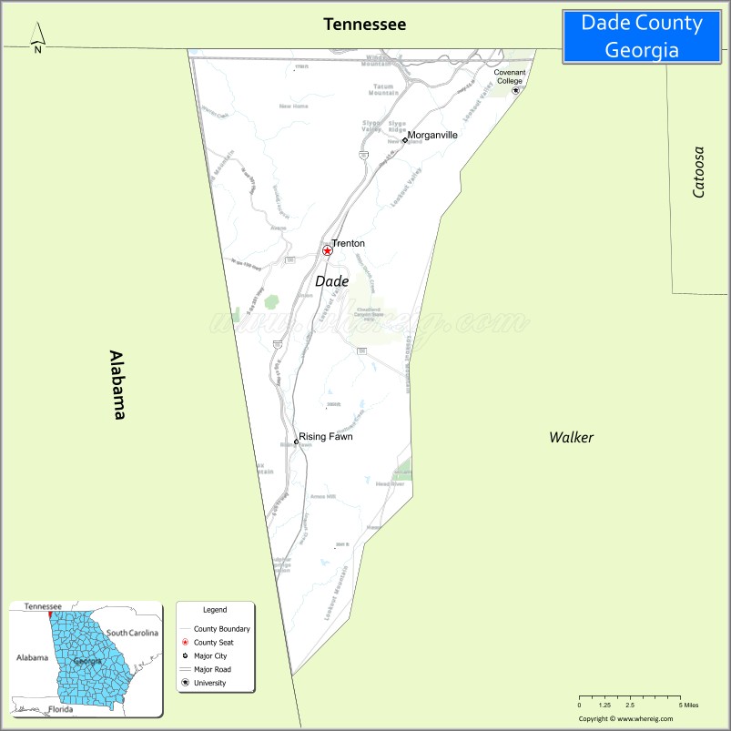
| Seat: | Trenton |
| Largest city: | Trenton |
| Total Area: | 174 sq mi (450 km²) |
| Land Area: | 174 sq mi (450 km²) |
| Total Population: | 16,251 |
| Population Density: | 96/sq mi (37/km²) |
| Time zone: | UTC−5 (Eastern) |
| Summer Time Zone (DST): | UTC−4 (EDT) |
| Website: | www.dadecounty-ga.gov |
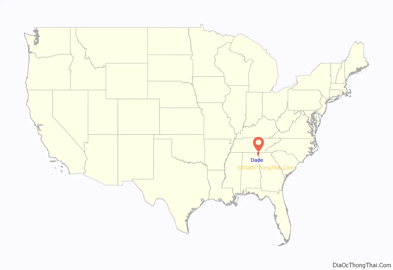
Dade County location map. Where is Dade County?
History
Dade County was established in 1837 and was named for Major Francis Langhorne Dade, who was killed in the Dade Massacre by Seminole Indians in December 1835. The first settlers of Dade County won the land in the Georgia Land Lotteries, held to encourage settlement after the Cherokee people were forced off the land. Many settlers worked in regional coke and coal mines that contributed to development of the Chattanooga, Tennessee area.
The area was long isolated by its geography of mountains and rivers, which some historians say contributed to early residents’ separatist attitudes. For the first century of Dade County’s existence, no road connected it directly to the rest of Georgia, so visitors from elsewhere in the state had to reach it by way of Alabama or Tennessee. That changed in 1939 with the establishment of Cloudland Canyon State Park, and Georgia began work on Highway 136 to connect U.S. 41 to the recently created park. The Civilian Conservation Corps built many of the facilities and access roads to the park.
Dade County had a short-lived state secessionist movement before the American Civil War. In 1860, county residents wanted to secede from the Union, but lawmakers for the state of Georgia were cautious. Legend has it that in 1860, the people of Dade County were so impatient that they announced their own secession from both Georgia and the United States. On July 4, 1945, a telegram from President Harry S. Truman was read at a celebration marking the county’s “rejoining” the Union. Historians say Dade’s individual secession and readmission were symbolic and had no legal effect. They say that officially, Dade County seceded along with the state of Georgia in 1861 and re-entered the Union with the state in 1870.
The noted Southern humorist, author and seminal writer of Southern humor George Washington Harris (1814-1869) is buried in the Brock Cemetery in Trenton. Although he greatly influenced the literary works of Mark Twain, William Faulkner, and Flannery O’Connor, his grave was not verified and given a marker until 2008.
In 1964, Covenant College established a campus at Lookout Mountain. Founded in 1955 in California, it was ready to expand after a year. Several professors led Covenant to move to St. Louis, Missouri, where it developed for eight years. After outgrowing its facilities there, the college decided to move to Dade County.
Quarter controversy
Shortly after the Georgia State Quarter was released by the US Mint, Dade County gained attention because of an apparent mistake in the design. As shown on the quarter, the state appears to lack Dade County, in the extreme northwestern part of the state. Some accounts in 2012 suggest the exclusion was intended to refer to the local legend of Dade County’s secession from Georgia.
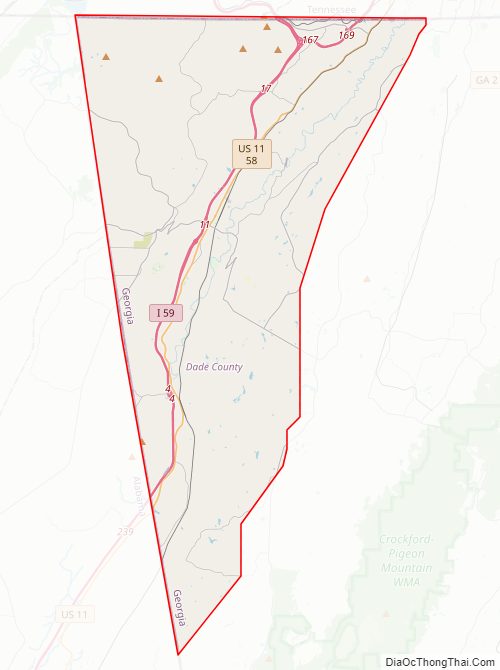
Dade County Road Map
Geography
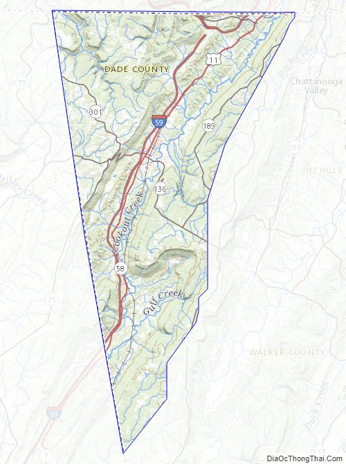
According to the U.S. Census Bureau, the county has a total area of 174 square miles (450 km), of which 174 square miles (450 km) is land and 0.2 square miles (0.52 km) (0.1%) is water.
The county, like most of northwest Georgia, is entrenched in the southern Appalachian Mountains. In addition, a vast majority of the county is located in the Middle Tennessee-Chickamauga sub-basin of the Middle Tennessee-Hiwassee basin. A very small part of the southernmost tip of the county is located in the Upper Coosa River sub-basin in the ACT River Basin (Coosa-Tallapoosa River Basin), while a small part of the westernmost portion of Dade County is located in the Guntersville Lake sub-basin in the Middle Tennessee-Elk basin.
Major highways
- I-24 / SR 409
- I-59 / SR 406
- US 11 / SR 58
- SR 136
- SR 157
- SR 189
- SR 299
- SR 301
Adjacent counties
- Marion County, Tennessee (north/CST Border)
- Hamilton County, Tennessee (northeast)
- Walker County (southeast)
- DeKalb County, Alabama (southwest/CST Border)
- Jackson County, Alabama (west/CST Border)
Protected areas
- Chickamauga and Chattanooga National Military Park (part)
- Cloudland Canyon State Park
Dade County Topographic Map
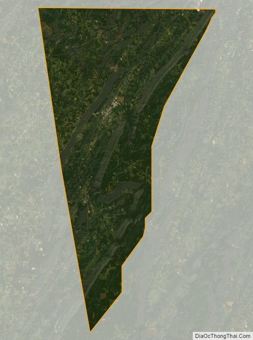
Dade County Satellite Map
Dade County Outline Map