Trenton /trɛntɪn/ is a city and the only incorporated municipality in Dade County, Georgia, United States—and as such, it serves as the county seat. The population was 2,195 at the 2020 census. Trenton is part of the Chattanooga, Tennessee–GA Metropolitan Statistical Area.
| Name: | Trenton city |
|---|---|
| LSAD Code: | 25 |
| LSAD Description: | city (suffix) |
| State: | Georgia |
| County: | Dade County |
| Founded: | 1830s |
| Incorporated: | February 18, 1854 |
| Elevation: | 758 ft (231 m) |
| Total Area: | 3.22 sq mi (8.33 km²) |
| Land Area: | 3.22 sq mi (8.33 km²) |
| Water Area: | 0.00 sq mi (0.00 km²) |
| Total Population: | 2,195 |
| Population Density: | 682.52/sq mi (263.56/km²) |
| Area code: | 706, 762 |
| FIPS code: | 1377372 |
| GNISfeature ID: | 0333261 |
| Website: | trentonga.gov |
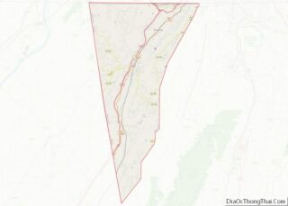
Online Interactive Map
Click on ![]() to view map in "full screen" mode.
to view map in "full screen" mode.
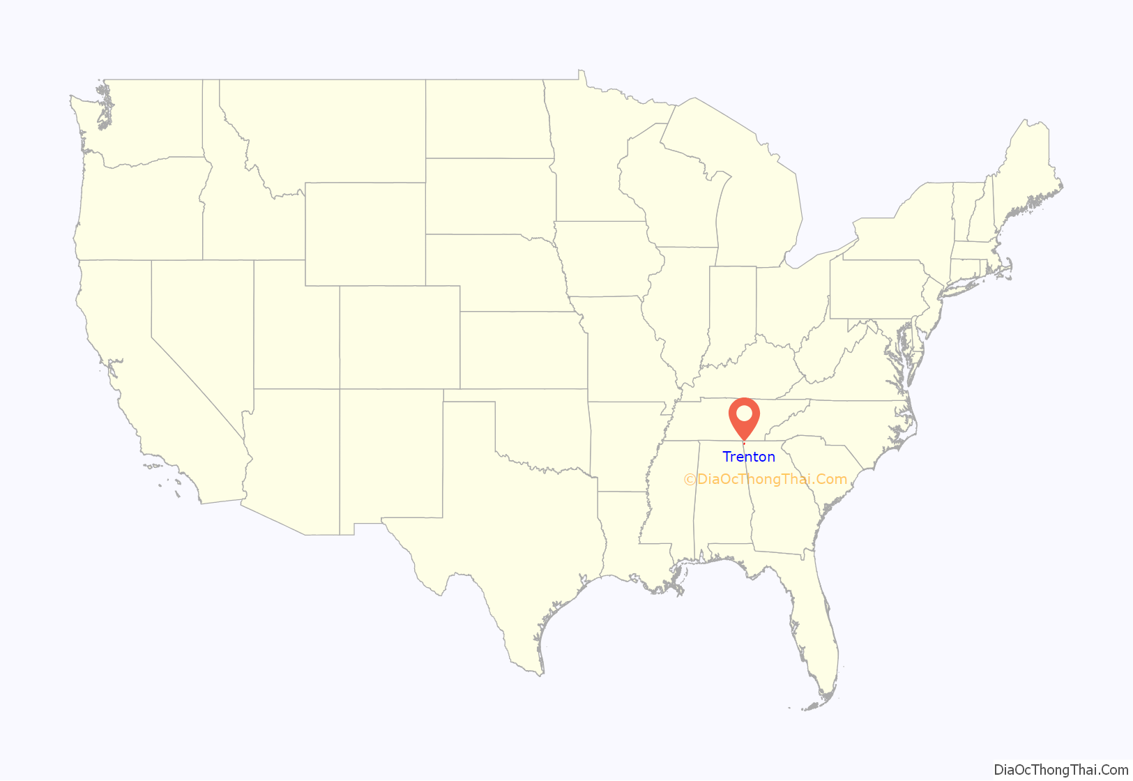
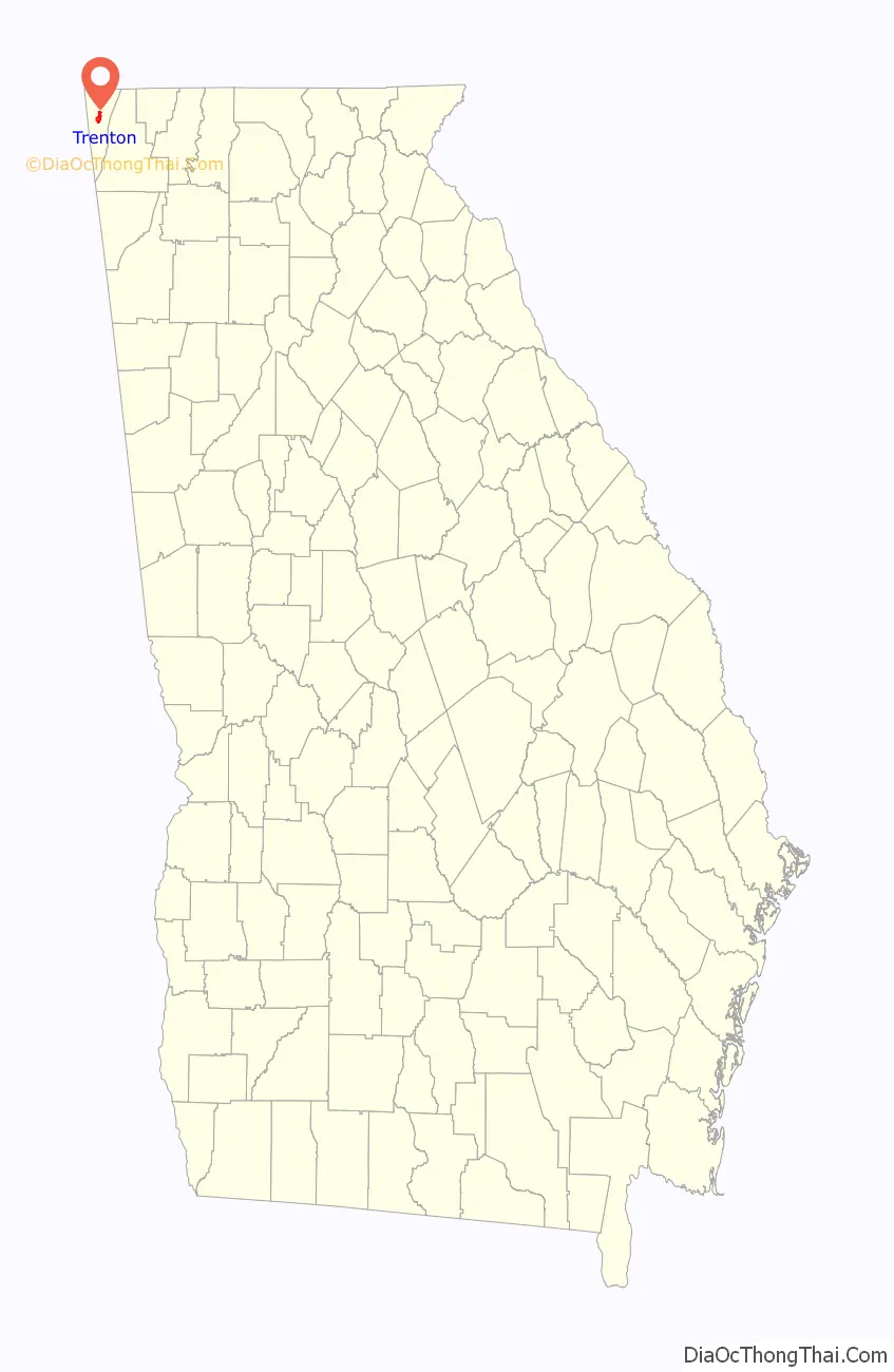
Trenton location map. Where is Trenton city?
History
Founded in the 1830s, the area was originally known as Salem. In 1839 Salem was designated the seat of the newly formed Dade County. It was renamed Trenton in 1841. The present name is a transfer from Trenton, the state capital of New Jersey.
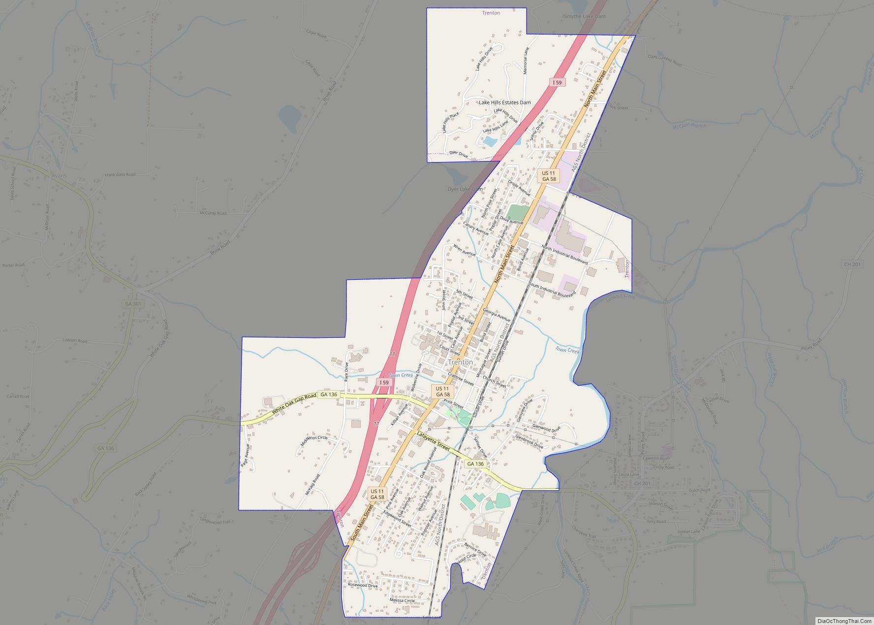
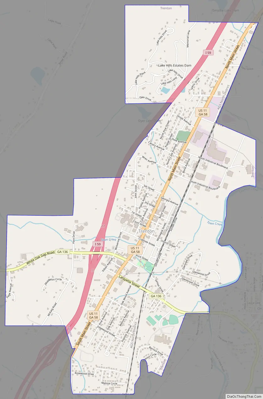
Trenton Road Map
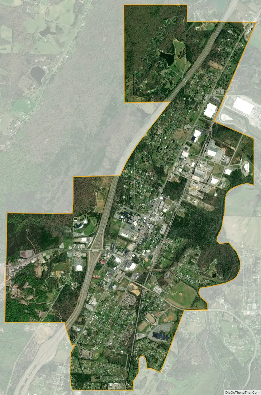
Trenton city Satellite Map
Geography
Trenton is located at 34°52′32″N 85°30′31″W / 34.87556°N 85.50861°W / 34.87556; -85.50861 (34.875609, −85.508644).
The city is located in the northwestern part of the state along Interstate 59, which runs from southwest to northeast to the west of the city, leading northeast 20 mi (32 km) to Chattanooga, Tennessee (via I-59 to I-24), and southwest 128 mi (206 km) to Birmingham, Alabama. U.S. Route 11 and Georgia State Route 136 are the main roads through the center of the city, with U.S. 11 leading northeast to Chattanooga and southwest 35 mi (56 km) to Fort Payne, Alabama. GA-136 leads southeast 27 mi (43 km) to LaFayette and west 6 mi (9.7 km) to the Alabama state line.
According to the United States Census Bureau, the city has a total area of 3.1 square miles (8.0 km), all land.
See also
Map of Georgia State and its subdivision:- Appling
- Atkinson
- Bacon
- Baker
- Baldwin
- Banks
- Barrow
- Bartow
- Ben Hill
- Berrien
- Bibb
- Bleckley
- Brantley
- Brooks
- Bryan
- Bulloch
- Burke
- Butts
- Calhoun
- Camden
- Candler
- Carroll
- Catoosa
- Charlton
- Chatham
- Chattahoochee
- Chattooga
- Cherokee
- Clarke
- Clay
- Clayton
- Clinch
- Cobb
- Coffee
- Colquitt
- Columbia
- Cook
- Coweta
- Crawford
- Crisp
- Dade
- Dawson
- Decatur
- DeKalb
- Dodge
- Dooly
- Dougherty
- Douglas
- Early
- Echols
- Effingham
- Elbert
- Emanuel
- Evans
- Fannin
- Fayette
- Floyd
- Forsyth
- Franklin
- Fulton
- Gilmer
- Glascock
- Glynn
- Gordon
- Grady
- Greene
- Gwinnett
- Habersham
- Hall
- Hancock
- Haralson
- Harris
- Hart
- Heard
- Henry
- Houston
- Irwin
- Jackson
- Jasper
- Jeff Davis
- Jefferson
- Jenkins
- Johnson
- Jones
- Lamar
- Lanier
- Laurens
- Lee
- Liberty
- Lincoln
- Long
- Lowndes
- Lumpkin
- Macon
- Madison
- Marion
- McDuffie
- McIntosh
- Meriwether
- Miller
- Mitchell
- Monroe
- Montgomery
- Morgan
- Murray
- Muscogee
- Newton
- Oconee
- Oglethorpe
- Paulding
- Peach
- Pickens
- Pierce
- Pike
- Polk
- Pulaski
- Putnam
- Quitman
- Rabun
- Randolph
- Richmond
- Rockdale
- Schley
- Screven
- Seminole
- Spalding
- Stephens
- Stewart
- Sumter
- Talbot
- Taliaferro
- Tattnall
- Taylor
- Telfair
- Terrell
- Thomas
- Tift
- Toombs
- Towns
- Treutlen
- Troup
- Turner
- Twiggs
- Union
- Upson
- Walker
- Walton
- Ware
- Warren
- Washington
- Wayne
- Webster
- Wheeler
- White
- Whitfield
- Wilcox
- Wilkes
- Wilkinson
- Worth
- Alabama
- Alaska
- Arizona
- Arkansas
- California
- Colorado
- Connecticut
- Delaware
- District of Columbia
- Florida
- Georgia
- Hawaii
- Idaho
- Illinois
- Indiana
- Iowa
- Kansas
- Kentucky
- Louisiana
- Maine
- Maryland
- Massachusetts
- Michigan
- Minnesota
- Mississippi
- Missouri
- Montana
- Nebraska
- Nevada
- New Hampshire
- New Jersey
- New Mexico
- New York
- North Carolina
- North Dakota
- Ohio
- Oklahoma
- Oregon
- Pennsylvania
- Rhode Island
- South Carolina
- South Dakota
- Tennessee
- Texas
- Utah
- Vermont
- Virginia
- Washington
- West Virginia
- Wisconsin
- Wyoming