Lewes (/luː.əs/ LOO-iss) is an incorporated city on the Delaware Bay in eastern Sussex County, Delaware, United States. According to the 2020 census, its population was 3,303. Along with neighboring Rehoboth Beach, Lewes is one of the principal cities of Delaware’s rapidly growing Cape Region. The city lies within the Salisbury, Maryland–Delaware Metropolitan Statistical Area. Lewes proudly claims to be “The First Town in The First State.”
| Name: | Lewes city |
|---|---|
| LSAD Code: | 25 |
| LSAD Description: | city (suffix) |
| State: | Delaware |
| County: | Sussex County |
| Founded: | June 3, 1631 |
| Incorporated: | February 2, 1818 |
| Elevation: | 13 ft (4 m) |
| Total Area: | 5.11 sq mi (13.25 km²) |
| Land Area: | 4.19 sq mi (10.86 km²) |
| Water Area: | 0.92 sq mi (2.39 km²) |
| Total Population: | 3,303 |
| Population Density: | 787.93/sq mi (304.21/km²) |
| ZIP code: | 19958 |
| Area code: | 302 |
| FIPS code: | 1041830 |
| GNISfeature ID: | 214214 |
Online Interactive Map
Click on ![]() to view map in "full screen" mode.
to view map in "full screen" mode.
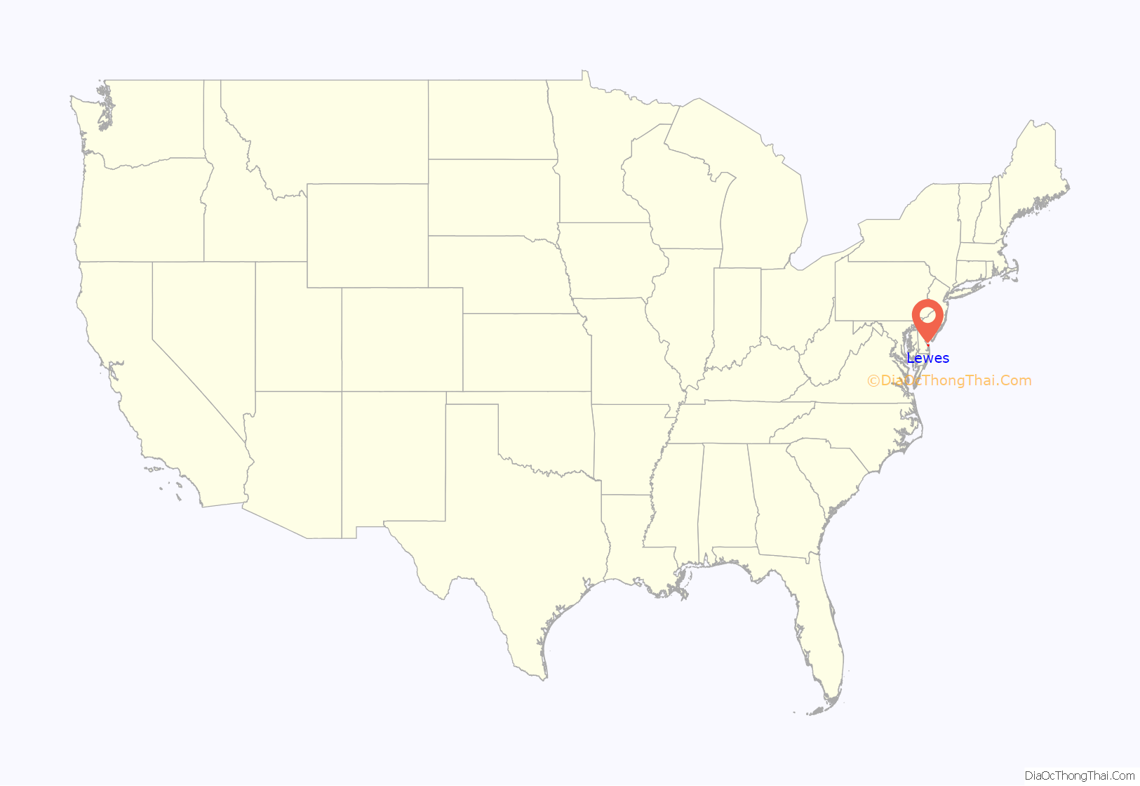
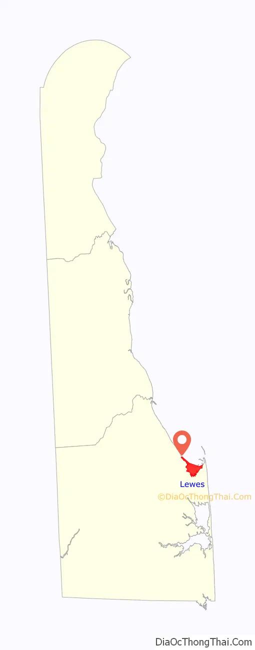
Lewes location map. Where is Lewes city?
History
Lewes was the site of the first European settlement in Delaware, a whaling and trading post that Dutch settlers founded on June 3, 1631, and named Zwaanendael (Swan Valley). The colony had a short existence, as a local tribe of Lenape Indians murdered all the 32 settlers in 1632.
The area remained rather neglected by the Dutch until, under the threat of annexation from the colony of Maryland, the city of Amsterdam made a grant of land at the Hoernkills (the area around Cape Henlopen, near the current town of Lewes) to a group of Mennonites for settlement in 1662. A total of 35 men were to be included in the settlement, led by a Pieter Cornelisz Plockhoy of Zierikzee and funded by a sizable loan from the city to get them established. 41 persons came with Plockhoy from the Netherlands to the Hoernkill onboard the Dutch ship the Sint Jacob, one of whom was Otto Wolgast from the town of Wolgast, Pomerania. The settlement was established in 1663, and lasted until the very next year; in 1664, the English captured New Netherland from the Dutch, and they ordered the settlement razed with reports indicating that “not even a nail” was left there.
The Dutch colonists proved slow to regroup, but a new settlement gradually regrew around the Hoernkills. In late December 1673, when the area was briefly held again by the Dutch, the settlement was attacked and burned down again by a group of Maryland colonists. In 1680, under the authority of the Duke of York, who had been granted such authority by his brother, King Charles II, the village (and county) was reorganized and known for two years as New Deale, Deale County, Delaware. A log courthouse was authorized to be built at this time. An Anglican congregation was established by 1681 and a Presbyterian church was built in 1682.
In 1682, the Delaware colonies were given to William Penn by King Charles II as payment for a family debt. When Penn arrived in the New World later that year, he renamed the county as Sussex and the Hoernkills settlement as Lewes, in commemoration of the county and town in England. Lewes became and remained the county seat of Sussex County until 1791, when it was moved to a more west-central county location, the current town of Georgetown. The town was also known as “Lewistown” or “Lewestown”.
On April 6 and 7, 1813, during the War of 1812, Royal Navy vessels led by HMS Poictiers under the command of Captain Sir John Beresford briefly and ineffectually bombarded the town. A cannonball from the bombardment is lodged in the foundation of Cannonball House, which now serves as the town’s maritime museum.
Lewes was incorporated by an act of the state assembly on Feb. 2, 1818. The act provided for five persons to be chosen as commissioners to be known as “Trustees of the Town of Lewes.”
Lewes Beach itself was an important stop on the Underground Railroad in the years leading up to the American Civil War. As a “border state,” Delaware was not part of the Confederacy, but was still quite dangerous for fugitive slaves. Several houses in Lewes thus housed escaping slaves; these “safe houses” were identified by the residents placing a single candle in the top window of the house.
In 1941, the United States built Fort Miles on Cape Henlopen, immediately south of Lewes, to defend Delaware Bay and the Delaware River and the oil refineries and factories on its shores, as well as the city of Philadelphia.
Fort Miles never saw any major action; except for range practice, it fired its guns only once between its establishment and the end of World War II. Fort Miles ceased operation altogether in 1991 and was deeded to the State of Delaware.
In addition to Fort Miles, the Cape Henlopen Archeological District, Coleman House, Cool Spring Presbyterian Church, De Vries Palisade, Delaware Breakwater and Lewes Harbor, Fisher Homestead, Fisher’s Paradise, Col. David Hall House, Hopkins Covered Bridge Farm, Lewes Historic District, Lewes Presbyterian Church, Lightship WAL 539, Maull House, National Harbor of Refuge and Delaware Breakwater Harbor Historic District, Pagan Creek Dike, Roosevelt Inlet Shipwreck, William Russell House, St. George’s Chapel, Lewes, Townsend Site, and Wolfe’s Neck Site are listed on the National Register of Historic Places.
Mayoral history
- Andrew Williams 2022–Present
- Theodore W. Becker 2014–2022
- James Ford III 2004–2014
- George H.P. Smith 1994–2004
- Dr. John Adams 1992–1994
- Al Stango 1968–1992
- Otis H. Smith 1950–1968
- H. Edward Maull 1944–1950
- Thomas H. Carpenter 1940–1944
- William E. Walsh 1938–1940
- David W. Burbage 1936–1938
- Dr. Ulysses W. Hocker 1931–1936
- Dr. James T. Thompson 1927–1930 (died in office, May 20, 1930)
- Willard H. Collins 1926–1927
- Dr. James T. Thompson 1914–1926
- Thomas B. Schellenger 1913–1914
- Dr. James T. Thompson 1900–1913
- Alfred L. Burton 1898–1900
Home to governors
Six men who served as Delaware governor were born in or made their home in Lewes. Three of those men lived on Lewes’ Second Street. Brothers Daniel and Caleb Rodney, sons of John Rodney, first cousin of Caesar Rodney, each served as governor of Delaware. Each a member of the Federalist Party, Daniel served from 1814 to 1817, while Caleb served as acting governor from 1822 to 1823. Ebe Walters Tunnell moved to Lewes in 1873 to enter the drug and hardware business in part of the old Caleb Rodney House on Second Street. Tunnell worked his way up the state government hierarchy before unsuccessfully running for governor in 1892. Four years later, the Democrat won the election, and served from 1897 to 1901.
City motto and name
As Lewes was the earliest settlement in the state, and Delaware was the first state to ratify the Constitution, the town refers to itself as “The First Town in the First State.” Lewes is named after the town of Lewes in England, which is situated in a county named Sussex (from which Sussex County, Delaware, takes its name). Lewes, Sussex, England, also has the same seal.
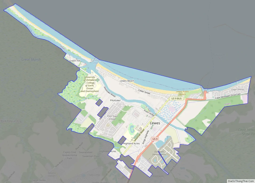
Lewes Road Map
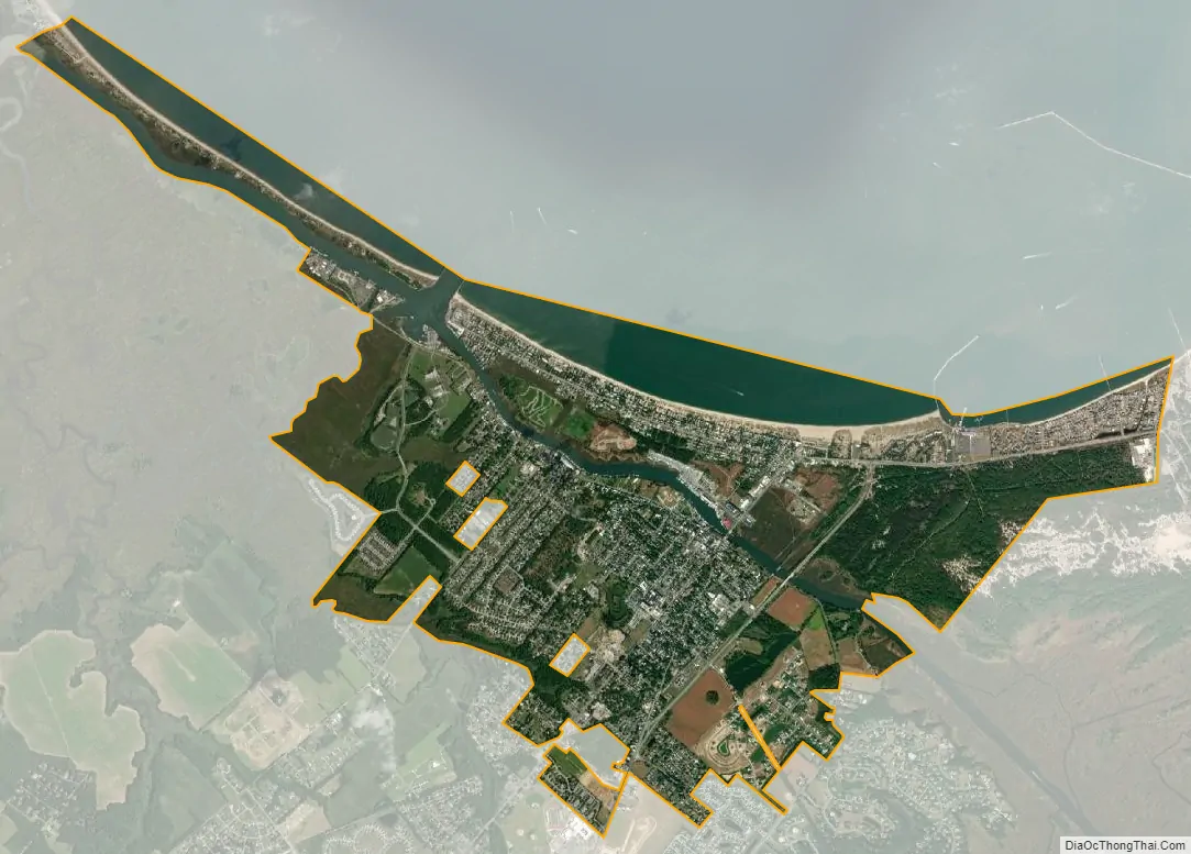
Lewes city Satellite Map
Geography
Lewes is located at 38°46′28″N 75°08′22″W / 38.77444°N 75.13944°W / 38.77444; -75.13944 (38.7745565, –75.1393498).
According to the United States Census Bureau, the city has a total area of 4.3 square miles (11 km), of which 3.7 sq mi (9.6 km) is land, and 0.6 sq mi (1.6 km) (14.7%) is water.
Climate
Situated on the Atlantic Coastal Plain, Lewes’s weather is moderated by the Atlantic Ocean and the Delaware Bay. Lewes has a mild humid subtropical climate (Cfa) consisting of hot, humid summers and mild winters. The average daytime high in July is 87 °F (30.6 °C) and a low of 70 °F (21 °C); in January, the average high is 45 °F (7 °C) with an average low of 30 °F (-1 °C) The month of highest average rainfall is July with 4.78 inches of rain, while February is historically the driest month, receiving an average of only 3.23 inches (80.5 mm) of rain.
The highest official temperature ever recorded in Lewes was 102 °F (38.8 °C) in 1997. The lowest official temperature ever recorded in Lewes was -11 °F (-28.8 °C) in 1982.
See also
Map of Delaware State and its subdivision: Map of other states:- Alabama
- Alaska
- Arizona
- Arkansas
- California
- Colorado
- Connecticut
- Delaware
- District of Columbia
- Florida
- Georgia
- Hawaii
- Idaho
- Illinois
- Indiana
- Iowa
- Kansas
- Kentucky
- Louisiana
- Maine
- Maryland
- Massachusetts
- Michigan
- Minnesota
- Mississippi
- Missouri
- Montana
- Nebraska
- Nevada
- New Hampshire
- New Jersey
- New Mexico
- New York
- North Carolina
- North Dakota
- Ohio
- Oklahoma
- Oregon
- Pennsylvania
- Rhode Island
- South Carolina
- South Dakota
- Tennessee
- Texas
- Utah
- Vermont
- Virginia
- Washington
- West Virginia
- Wisconsin
- Wyoming


