Delaware (/ˈdɛləwɛər/ (listen) DEL-ə-wair) is a state in the Mid-Atlantic region of the United States, bordering Maryland to its south and west; Pennsylvania to its north; and New Jersey and the Atlantic Ocean to its east. The state takes its name from the adjacent Delaware Bay, in turn named after Thomas West, 3rd Baron De La Warr, an English nobleman and Virginia‘s first colonial governor.
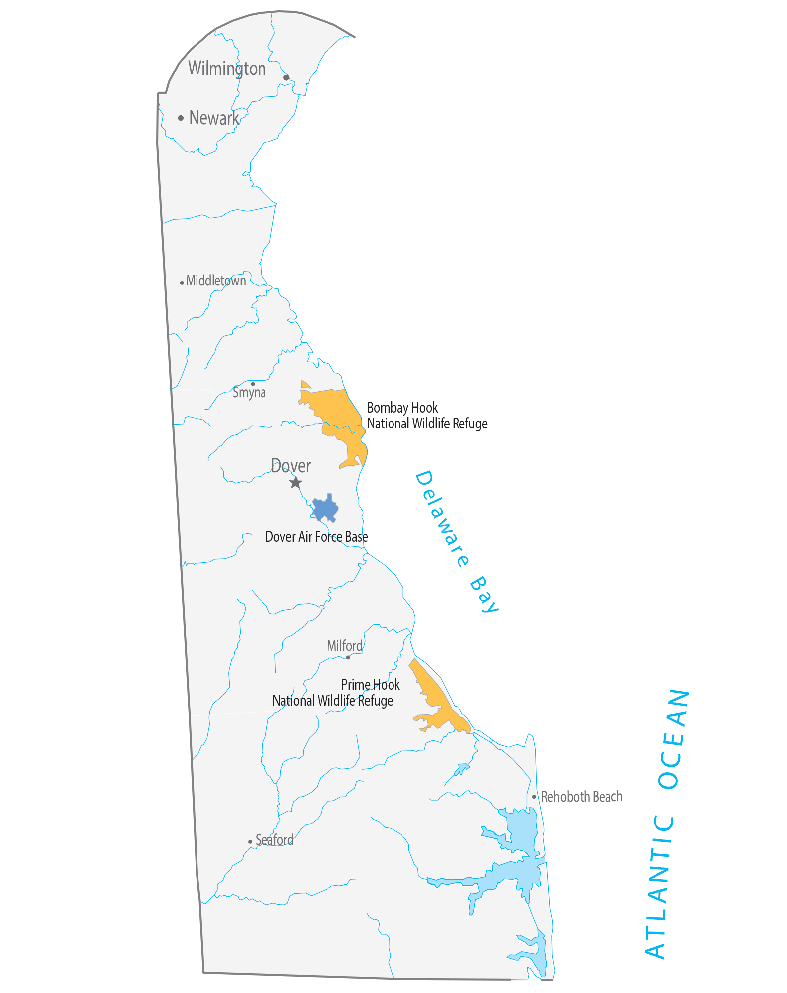
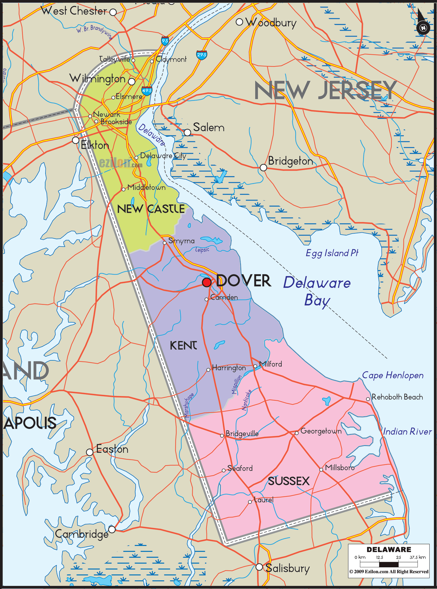
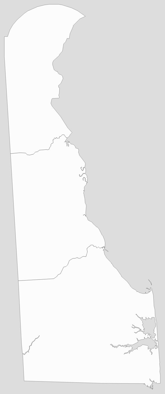
Delaware occupies the northeastern portion of the Delmarva Peninsula and some islands and territory within the Delaware River. It is the second-smallest and sixth-least populous state, but also the sixth-most densely populated. Delaware’s largest city is Wilmington, while the state capital is Dover, the second-largest city in the state. The state is divided into three counties, having the lowest number of counties of any state; from north to south, they are New Castle County, Kent County, and Sussex County. While the southern two counties have historically been predominantly agricultural, New Castle is more urbanized, being part of the Delaware Valley Metropolitan Statistical Area centered on Philadelphia. Although included in the Southern United States by the Census Bureau, Delaware’s geography, culture, and history combine elements of the Mid-Atlantic and Northeastern regions of the country.
Before its coastline was explored by Europeans in the 16th century, Delaware was inhabited by several groups of Native Americans, including the Lenape in the north and Nanticoke in the south. It was initially colonized by Dutch traders at Zwaanendael, near the present town of Lewes, in 1631. Delaware was one of the Thirteen Colonies that took part in the American Revolution. On December 7, 1787, Delaware became the first state to ratify the Constitution of the United States, and has since been known as The First State. Since the turn of the 20th century, Delaware is also a de facto onshore corporate haven, in which by virtue of its corporate laws, the state is the domicile of over half of all New York Stock Exchange-listed business and over three-fifths of the Fortune 500.
| Before statehood: | Delaware Colony, New Netherland, New Sweden |
|---|---|
| Admitted to the Union: | December 7, 1787 (1st) |
| Capital: | Dover |
| Largest city: | Wilmington |
| Largest metro and urban areas: | Delaware Valley |
| Elevation: | 60 ft (20 m) |
| Total Area: | 2,489 sq mi (6,450 km) |
| Area Rank: | 49th |
| Total Population: | 1,003,384 |
| Population Rank: | 45th |
| Population Density: | 500/sq mi (190/km) |
| Median Household Income: | $69,100 |
| Income Rank: | 16th |
| Demonym(s): | Delawarean |
| USPS abbreviation: | DE |
| ISO 3166 code: | US-DE |
| Website: | delaware.gov |
Online Interactive Map
Click on ![]() to view map in "full screen" mode.
to view map in "full screen" mode.
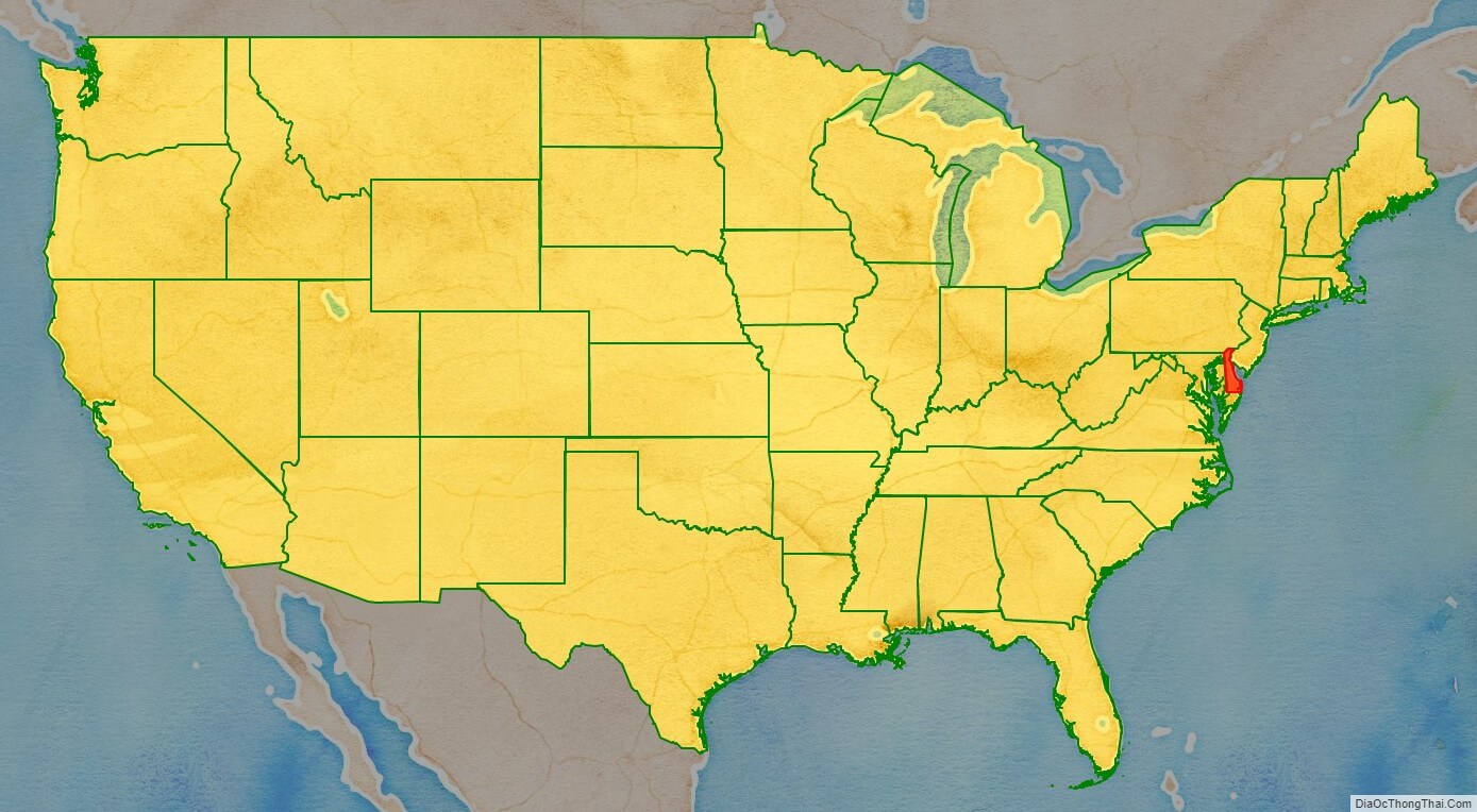
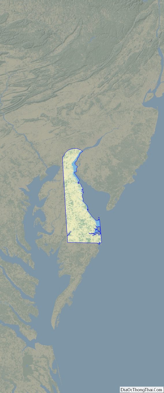
Delaware location map. Where is Delaware state?
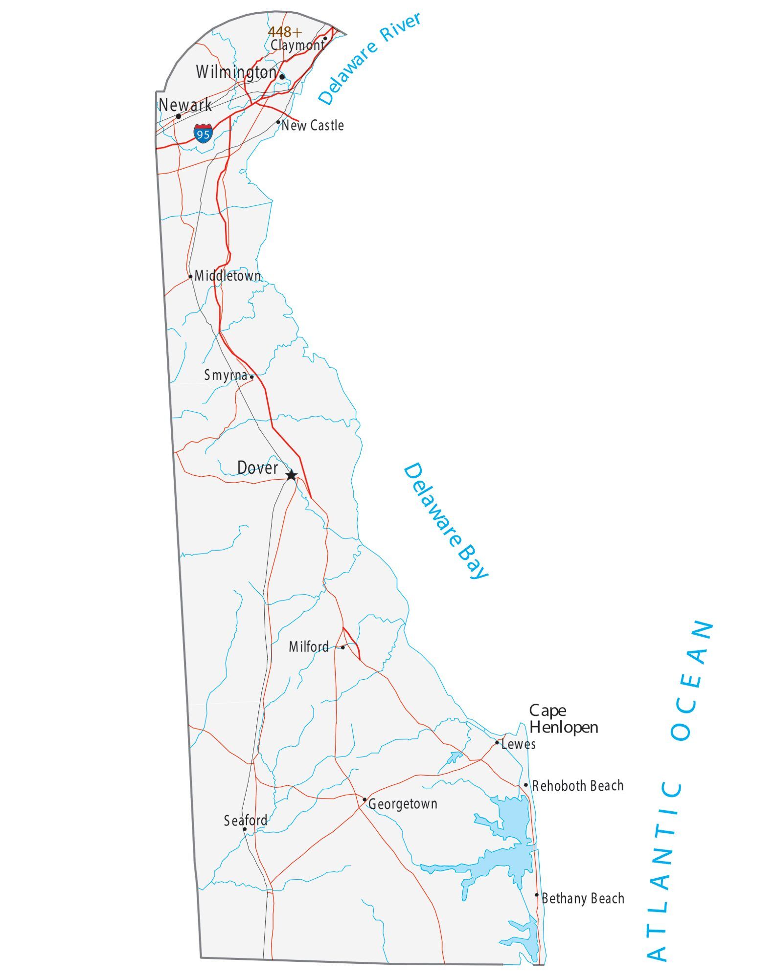
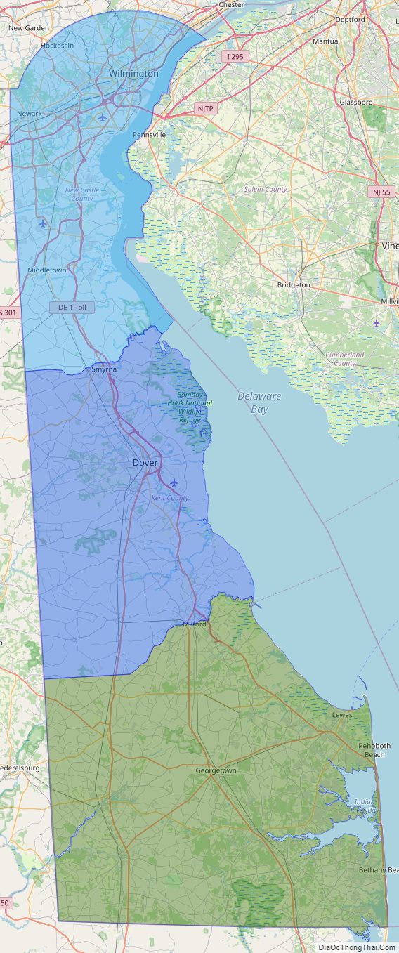
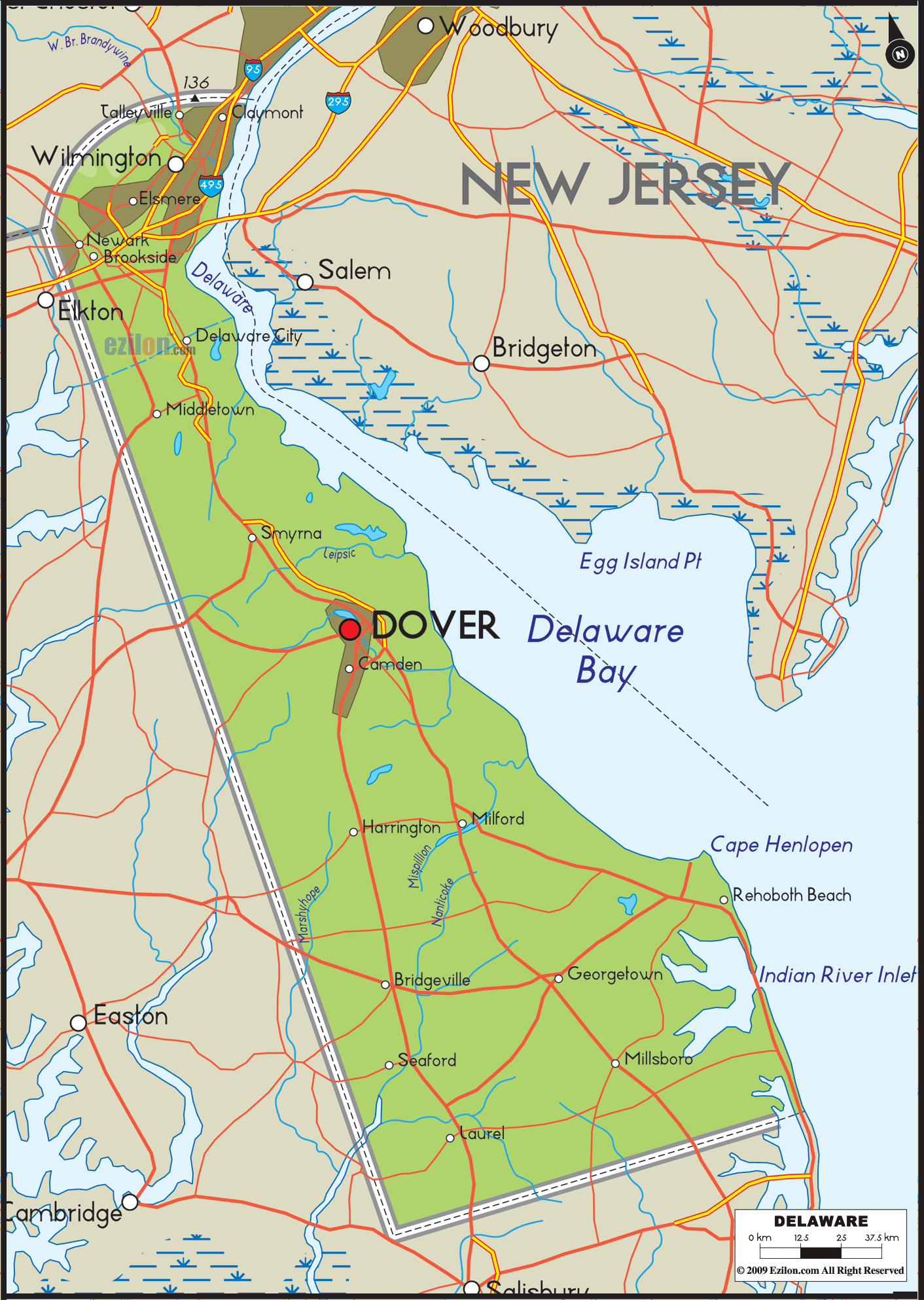
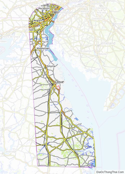
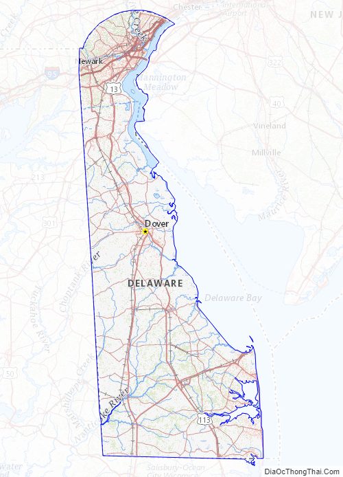
Delaware Road Map
Delaware Map – Roads & Cities
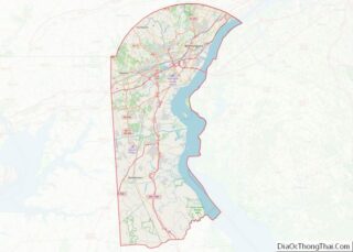
Delaware Street Map
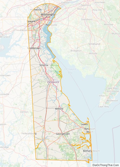
Delaware State Map – Places and Landmarks
Delaware Political Map
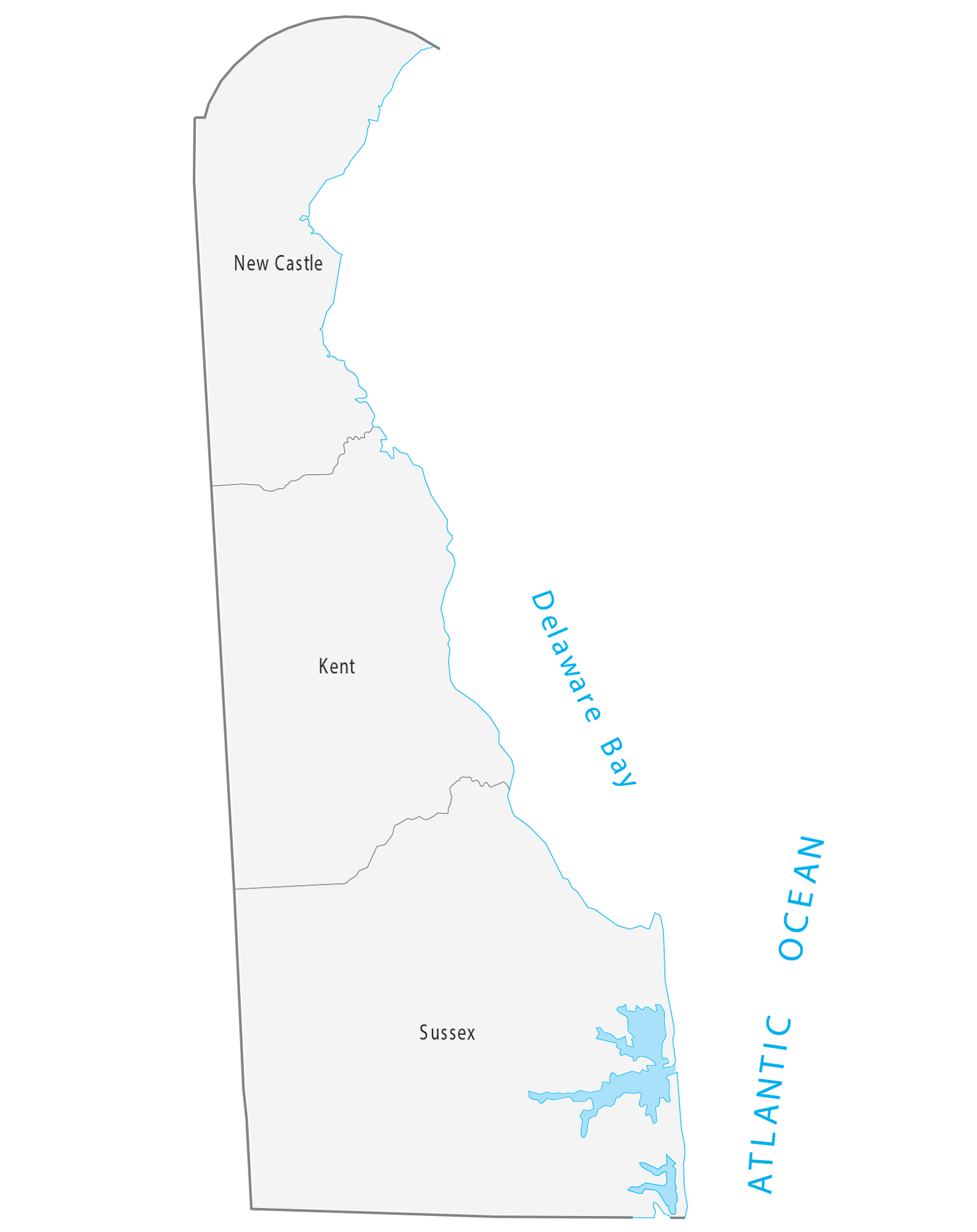
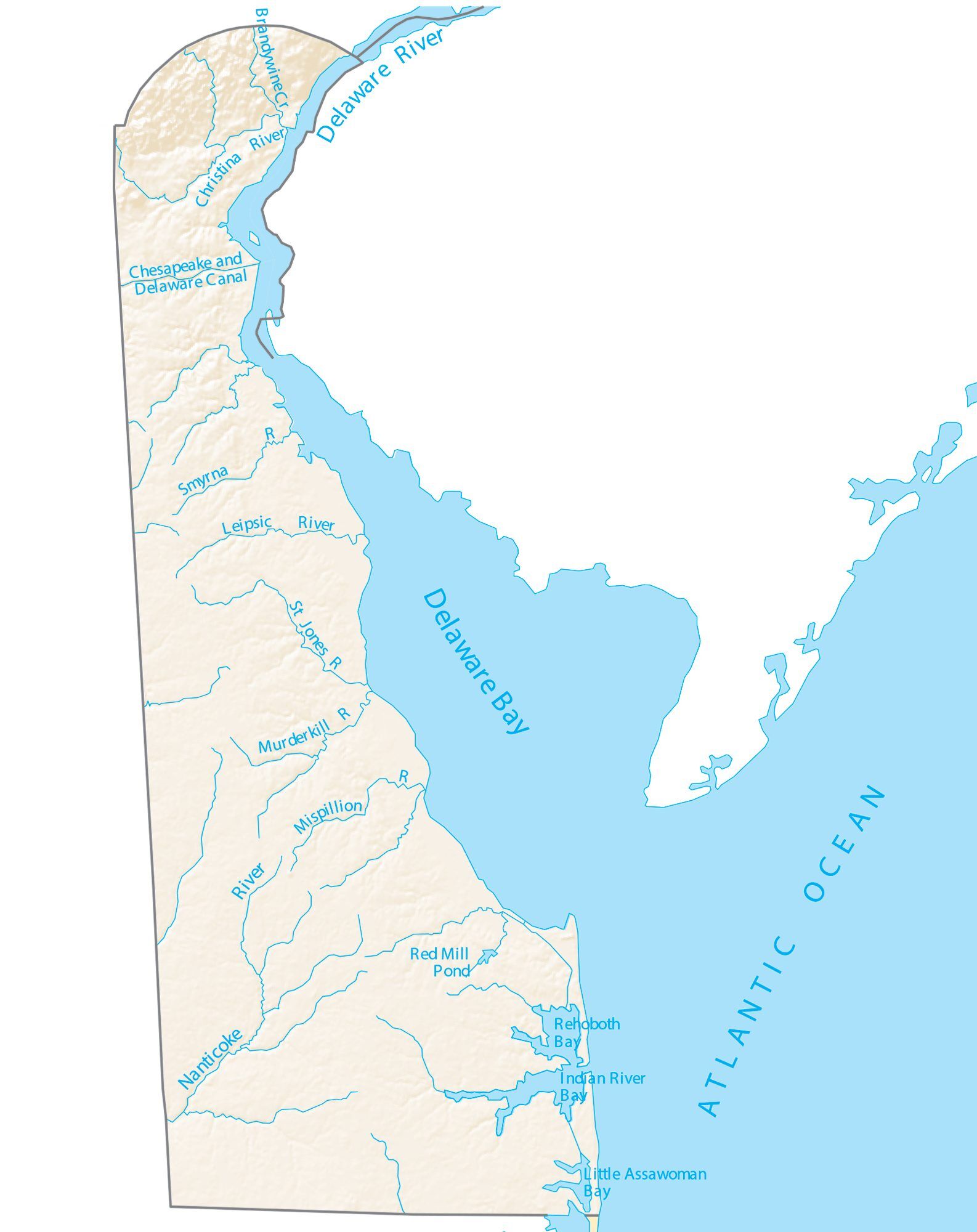
Delaware Lakes and Rivers Map
Geography
Delaware is 96 miles (154 km) long and ranges from 9 miles (14 km) to 35 miles (56 km) across, with a land area of 1,982 square miles (5,130 km) and a total area of 2,489 square miles (6,450 km), making it the second-smallest state by either metric in the United States after Rhode Island. Delaware is bounded to the north by Pennsylvania; to the east by the Delaware River, Delaware Bay, New Jersey, and the Atlantic Ocean; and to the west and south by Maryland. Small portions of Delaware are also situated on the eastern side of the Delaware River sharing land boundaries with New Jersey. The state of Delaware, together with the Eastern Shore counties of Maryland and two counties of Virginia, form the Delmarva Peninsula, which stretches down the Mid-Atlantic Coast.
The definition of the northern boundary of the state is unusual. Most of the boundary between Delaware and Pennsylvania was originally defined by an arc extending 12 miles (19.3 km) from the cupola of the courthouse in the city of New Castle. This boundary is often referred to as the Twelve-Mile Circle. Although the Twelve-Mile Circle is often claimed to be the only territorial boundary in the U.S. that is a true arc, the Mexican boundary with Texas includes several arcs, and many cities in the South (such as Plains, Georgia) also have circular boundaries.
This border extends all the way east to the low-tide mark on the New Jersey shore, then continues south along the shoreline until it again reaches the 12-mile (19 km) arc in the south; then the boundary continues in a more conventional way in the middle of the main channel (thalweg) of the Delaware River.
To the west, a portion of the arc extends past the easternmost edge of Maryland. The remaining western border runs slightly east of due south from its intersection with the arc. The Wedge of land between the northwest part of the arc and the Maryland border was claimed by both Delaware and Pennsylvania until 1921, when Delaware’s claim was confirmed.
Topography
Delaware is on a level plain, with the lowest mean elevation of any state in the nation. Its highest elevation, located at Ebright Azimuth, near Concord High School, is less than 450 feet (140 m) above sea level. The northernmost part of the state is part of the Piedmont Plateau with hills and rolling surfaces.
The Atlantic Seaboard fall line approximately follows the Robert Kirkwood Highway between Newark and Wilmington; south of this road is the Atlantic Coastal Plain with flat, sandy, and, in some parts, swampy ground. A ridge about 75 to 80 feet (23 to 24 m) high extends along the western boundary of the state and separates the watersheds that feed Delaware River and Bay to the east and the Chesapeake Bay to the west.
Climate
Since almost all of Delaware is a part of the Atlantic coastal plain, the effects of the ocean moderate its climate. The state lies in the humid subtropical climate (Köppen Cfa) zone. Despite its small size (roughly 100 miles (160 km) from its northernmost to southernmost points), there is significant variation in mean temperature and amount of snowfall between Sussex County and New Castle County. Moderated by the Atlantic Ocean and Delaware Bay, the southern portion of the state has a milder climate and a longer growing season than the northern portion of the state. Delaware’s all-time record high of 110 °F (43 °C) was recorded at Millsboro on July 21, 1930. The all-time record low of −17 °F (−27 °C) was also recorded at Millsboro, on January 17, 1893. The hardiness zones are 6b, 7a and 7b.
Environment
The transitional climate of Delaware supports a wide variety of vegetation. In the northern third of the state are found Northeastern coastal forests and mixed oak forests typical of the northeastern United States. In the southern two-thirds of the state are found Middle Atlantic coastal forests. Trap Pond State Park, along with areas in other parts of Sussex County, for example, support the northernmost stands of bald cypress trees in North America.
Environmental management
Delaware provides government subsidy support for the clean-up of property “lightly contaminated” by hazardous waste, the proceeds for which come from a tax on wholesale petroleum sales.
Delaware Physical Map
Delaware Topographic Map
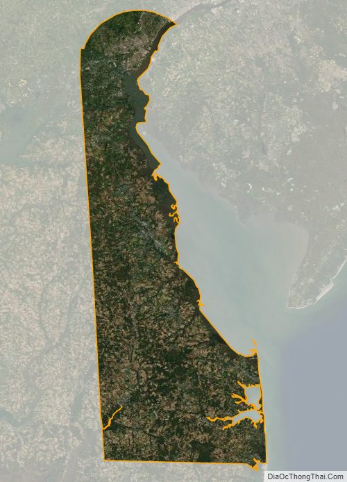
Delaware Satellite Map
Others printable maps
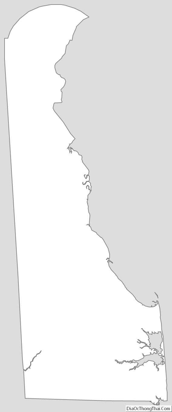
Delaware Outline Map
Blank Delaware County Map
See also
Map of Delaware State and its subdivision: Map of other states:- Alabama
- Alaska
- Arizona
- Arkansas
- California
- Colorado
- Connecticut
- Delaware
- District of Columbia
- Florida
- Georgia
- Hawaii
- Idaho
- Illinois
- Indiana
- Iowa
- Kansas
- Kentucky
- Louisiana
- Maine
- Maryland
- Massachusetts
- Michigan
- Minnesota
- Mississippi
- Missouri
- Montana
- Nebraska
- Nevada
- New Hampshire
- New Jersey
- New Mexico
- New York
- North Carolina
- North Dakota
- Ohio
- Oklahoma
- Oregon
- Pennsylvania
- Rhode Island
- South Carolina
- South Dakota
- Tennessee
- Texas
- Utah
- Vermont
- Virginia
- Washington
- West Virginia
- Wisconsin
- Wyoming