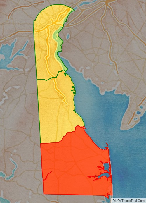
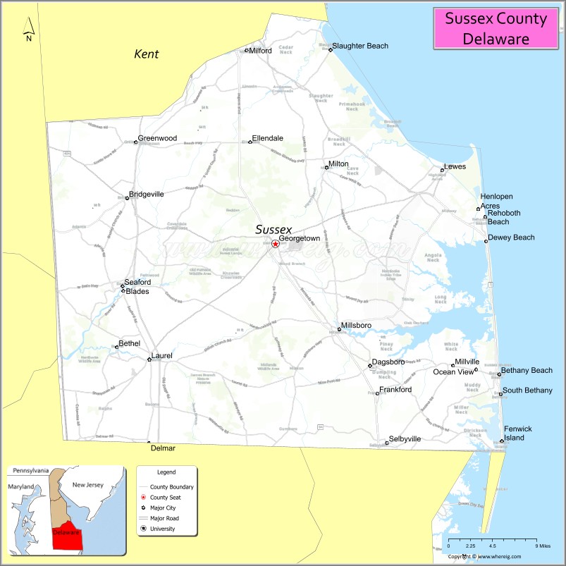
Sussex County is located in the southern part of the U.S. state of Delaware, on the Delmarva Peninsula. As of the 2020 census, the population was 237,378. The county seat is Georgetown.
The first European settlement in the state of Delaware was founded by the Dutch in 1631 near the present-day town of Lewes on the Atlantic Coast. However, Sussex County was not organized until 1683 under English colonial rule.
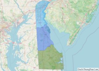
Sussex County is included in the Salisbury, MD-DE Metropolitan Statistical Area which encompasses much of central Delmarva.
| Name: | Sussex County |
|---|---|
| FIPS code: | 10-005 |
| State: | Delaware |
| Founded: | August 8, 1683 |
| Named for: | Sussex, England |
| Seat: | Georgetown |
| Largest city: | Seaford |
| Total Area: | 1,196 sq mi (3,100 km²) |
| Land Area: | 936 sq mi (2,420 km²) |
| Total Population: | 237,378 |
| Population Density: | 253.61/sq mi (97.92/km²) |
| Time zone: | UTC−5 (Eastern) |
| Summer Time Zone (DST): | UTC−4 (EDT) |
| Website: | www.sussexcountyde.gov |
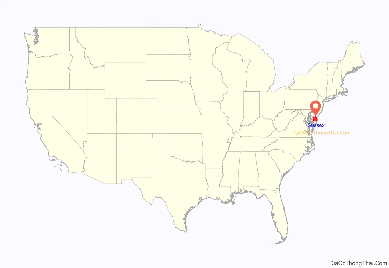
Sussex County location map. Where is Sussex County?
History
Beginnings
Archaeologists estimate that the first inhabitants of Sussex County, the southernmost county in Delaware, arrived between 10,000 and 14,000 years ago. Various indigenous cultures occupied the area, especially along the river and the coast, often having seasonal fishing villages. Historic Native Americans in Sussex County were members of Algonquian-speaking tribes, as were most coastal peoples along the Atlantic Coast.
By the historic period of European encounter, the most prominent tribes in the area were the Lenape, whose territory extended through the mid-Atlantic states to Connecticut and the future New York metropolitan area, and Nanticoke tribes. The people settled along the numerous bodies of water in the area where they were able to harvest fish, oysters, and other shellfish in the fall and winter. In the warmer months the women planted and cultivated crops, and processed the food. The men hunted deer and other small mammals, as larger game was not present in the area.
European discovery
There is no agreement on which European group was the first to settle in Sussex County. Historians believe that, in the early years of exploration from 1593 to 1630, Swedish explorers were likely the first Europeans to see the Delaware River and the lands of present-day Sussex County.
On an expedition for the Dutch West India Company, Henry Hudson recorded discovery in 1609 of what was later named the Delaware River. Attempting to follow him, Samuel Argall, an English explorer, was blown off course in 1610 and landed in a strange bay which he named after the Governor of Virginia, Thomas West, Lord De La Warr.
In the first half of 1613, Cornelius Jacobsen Mey, a Dutch navigator, discovered and named both Cape May and Cape Henlopen (originally Hindlopen) in the Delaware Bay. Later it was found that what May had named Henlopen was Fenwick Island, protruding into the Atlantic Ocean. The name of the cape was moved to its present location just east of Lewes.
European settlement
Sussex County was the site of the first European settlement in Delaware, a Dutch trading post named Zwaanendael at the present site of Lewes. On June 3, 1631, Dutch captain David Pietersen de Vries landed along the shores of the Delaware to establish a whaling colony in the mid-Atlantic of the New World. The colony lasted only until 1632, when De Vries left. Upon returning to Zwaanendael that December, he found the Indian tribes had killed his men and burned the colony. The Dutch set about settling the area once again.
Although the Dutch and Swedes returned to resettle the Delaware River region as early as 1638, much of the Delaware Bay area south of what is today the city of Newcastle was not settled until 1662. At that time, the city of Amsterdam made a grant of land at the Hoernkills (the area around Cape Henlopen, near the current town of Lewes) to a party of Mennonites. A total of 35 men were to be included in the settlement, led by a Pieter Cornelisz Plockhoy of Zierikzee, and funded by a sizable loan from the city to get them established. This settlement, established in 1663, was organized in part by the Dutch to respond to threats from the English colony of Maryland to the west beginning to assert rights over the area. The English wrested control of New Netherland from the Dutch in 1664 and they destroyed the Mennonite settlement that same year; English reports indicated that “not even a nail” was left there.
Settlement in the area after the English ejected the Dutch was slow. The Swedes and Finns who had settled in the area from the days of New Sweden had generally welcomed the English and were allowed to stay; the few Dutch found in the area were rounded up as prisoners and sent to Virginia as slaves. Lord Baltimore encouraged Marylanders to move east to settle the area. But the land was far removed from other, more established settlements and did not appeal to many new settlers. It was a tempting wilderness base for pirates to hide out from authorities and regularly pillage settlers for supplies.
The Dutch briefly recaptured the territory in 1673 as part of the Third Anglo-Dutch War. At that point, they established courts in the town of New Castle and at the Hoerkill at the southern end of the territory, effectively creating two counties out of the territory. After the war concluded in 1674, the Delaware territory was returned to the English. It was then placed under the control of James Stuart, Duke of York.
In 1680, the Duke reorganized the territory south of the Mispillion River as Deale County with the county seat at New Deale (modern-day Lewes); and created a third county, St. Jones, out of the Delaware territory between the Mispillion River and Duck Creek. In 1682, English King Charles II awarded the Delaware territories to William Penn in settlement of family debts, and Penn reorganized all three Delaware counties: Deale County become Sussex County, and St. Jones County became Kent County, in recognition of Penn’s homelands in the county of Sussex, England. He brought 200 people from Sussex, England as colonists. The town of New Deale was renamed Lewistown (today known as Lewes). At this time, Penn claimed that the Delaware territory extended as far south as Fenwick Island. The ‘Three Lower Counties’ (Delaware) along Delaware Bay were considered under Penn’s sphere of settlement and became the Delaware Colony, a satellite of Pennsylvania.
But the boundary disputes continued between Pennsylvania and Maryland. Charles Calvert, 5th Baron Baltimore and William Penn both claimed the land between the 39th and 40th parallels, according to the charters granted to each colony. Whereas Penn claimed the Delaware territories extended to Fenwick Island, Calvert claimed the Maryland Colony ended at Lewes, with all the land south of the settlement belonging to Somerset County.
In 1732 Charles Calvert signed a territorial agreement with William Penn’s sons that drew a line somewhere in between the two colonies and renounced Calvert’s claim to Delaware. But Lord Baltimore later claimed that the document he signed did not contain the terms he had agreed to, and refused to put the agreement into effect. Beginning in the mid-1730s, violence erupted between settlers claiming various loyalties to Maryland and Pennsylvania. The border conflict between Pennsylvania and Maryland would be known as Cresap’s War.
In 1750–1751, a team of surveyors from both colonies surveyed and marked the Transpeninsular Line, which established the southern boundary of Sussex County. However, residents of the disputed territory continued to pay taxes to Maryland into the 1770s.
The issue was unresolved until the Crown intervened in 1760, ordering Frederick Calvert, 6th Baron Baltimore to accept the 1732 agreement. As part of the settlement, the Penns and Calverts commissioned the English team of Charles Mason and Jeremiah Dixon to survey the newly established boundaries between the Province of Pennsylvania, the Province of Maryland, Delaware Colony and parts of Colony and Old Dominion of Virginia.
Between 1763 and 1767, Charles Mason and Jeremiah Dixon surveyed the Mason-Dixon line, settling Sussex County’s western borders. After Pennsylvania abolished slavery in 1781, the western part of this line and the Ohio River became a border between free and slave states. Although Delaware remained a slave state, it already had a number of free blacks, and slaveholders manumitted more slaves in the first two decades after the Revolution.
The resolution of the boundary dispute enlarged Sussex County considerably, and the new territory was nicknamed New Sussex.
In 1769 a movement started to move the county seat from Lewes to the area then known as Cross Roads, the present day site of Milton. The current county seat of Georgetown was settled upon on January 27, 1791, after residents in western Sussex County successfully petitioned the Delaware General Assembly to move the county seat to a central location, as the limited roads at the time made it too difficult for outlying residents to reach the county seat in Lewes.
Georgetown was not a previously established town. On May 9, 1791, the 10 commissioners headed by President of the State Senate George Mitchell negotiated the purchase of 76 acres (310,000 m), and Commissioner Rhodes Shankland began the survey by laying out “a spacious square of 100 yards (91 m) each way.” Eventually the town was laid out in a circle one mile (1.6 km) across. It was centered on the original square surveyed by Shankland, which is now listed on the National Register of Historic Places. Georgetown was named after Senate President George Mitchell.
Sussex County has been known by several names over the years, including Susan County, Hoorenkill or Whorekill County as named by the Dutch prior to 1680 when Kent County broke off. From 1680 to 1682 it was known as Deale County, after being taken over by the British under James Stuart, Duke of York prior to signing over to William Penn. It was called Durham County when claimed by the Lords Baltimore during the boundary dispute with the Penn family.
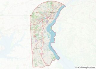
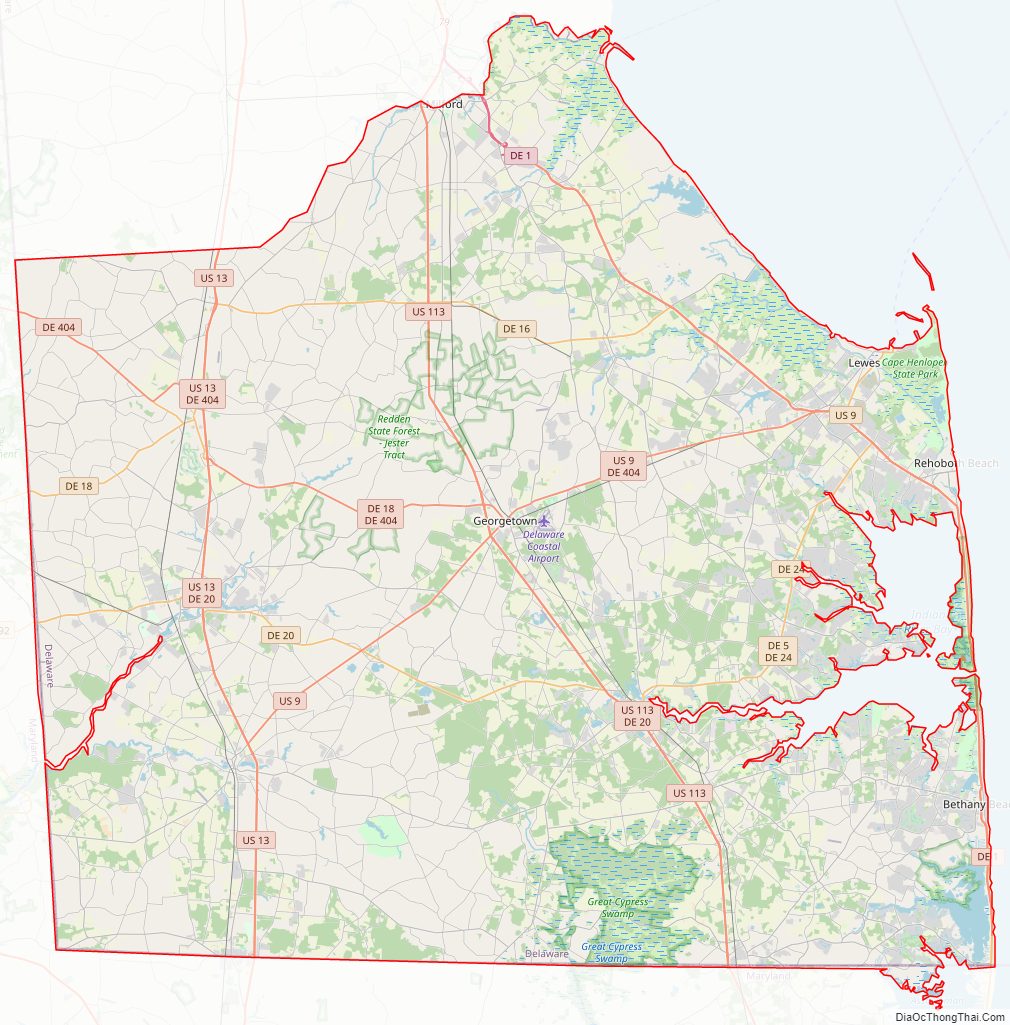
Sussex County Road Map
Geography
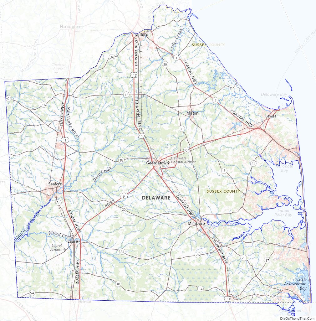
According to the U.S. Census Bureau, the county has a total area of 1,196 square miles (3,100 km), of which 936 square miles (2,420 km) is land and 260 square miles (670 km) (21.7%) is water. It is the largest county in Delaware by area. The county’s land area comprises 48.0 percent of the state’s land area. It is the second-highest percentage of territory of a state of any county in the United States.
Sussex County, like all of Delaware’s counties, is subdivided into Hundreds. There are several explanations given for how the Hundreds were determined: as an area containing 100 families, an area containing 100 people, or an area that could raise 100 soldiers. Sussex County is apportioned into eleven Hundreds: Cedar Creek, Broadkill, Georgetown, Nanticoke, Northwest Fork, Broad Creek, Little Creek, Dagsboro, Baltimore, Indian River, and Lewes & Rehoboth.
The eastern portion of the county is home to Delaware’s beaches on the Atlantic Coast and many seaside resorts. The western side of the county is the center of Delaware’s agriculture, industry with more acres of arable land under cultivation than anywhere else in the state.
Sussex County is home to an extensive system of Southern saltwater and freshwater wetlands, notably the Great Cypress Swamp. This massive freshwater swamp contains the northernmost strand of Bald Cypress trees in the United States.
Prime Hook National Wildlife Refuge is a 10,000 acres (40 km) along the western shore of Delaware Bay. The refuge contains a variety of habitats, including freshwater and salt marshes, woodlands, grasslands, ponds, and forested areas, supporting 267 species of birds and a variety of reptiles, amphibians and mammals.
Adjacent counties
- Kent County – north
- Cape May County, New Jersey – northeast
- Worcester County, Maryland – south
- Dorchester County, Maryland – southwest
- Wicomico County, Maryland – southwest
- Caroline County, Maryland – northwest
Major highways
- US 9
- US 13
- US 113
- DE 1
- DE 5
- DE 16
- DE 17
- DE 18
- DE 20
- DE 23
- DE 24
- DE 26
- DE 30
- DE 36
- DE 54
- DE 404
National protected area
- Prime Hook National Wildlife Refuge
Climate
Sussex County has a humid subtropical climate (Cfa) according to the Köppen climate classification. The Trewartha climate classification only has the area along the Atlantic Coast up to Cape Henlopen and Lewes as Cf and the remainder of the county as Do (oceanic.) Three months average above 22 °C (72 °F), all months average above freezing, and seven to eight months average above 10 °C (50 °F). The hardiness zones are 7a and 7b.
Sussex County Topographic Map
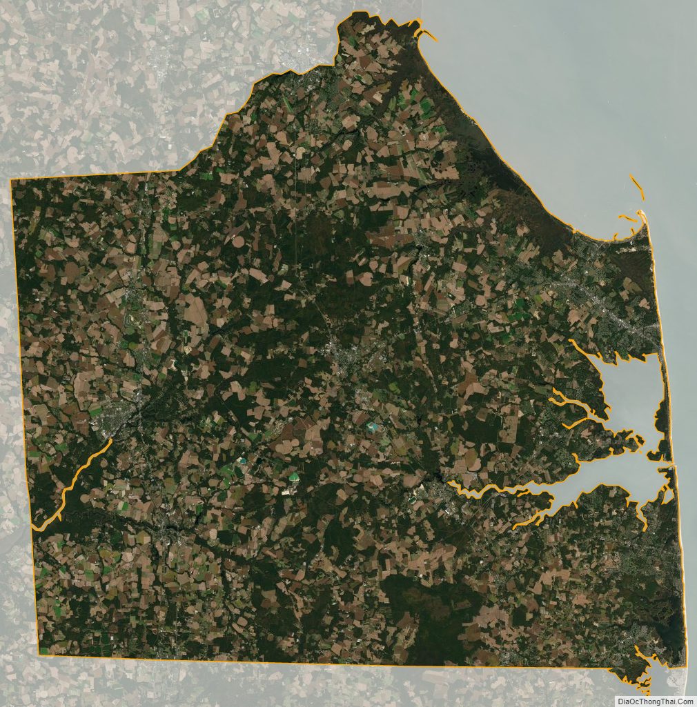
Sussex County Satellite Map
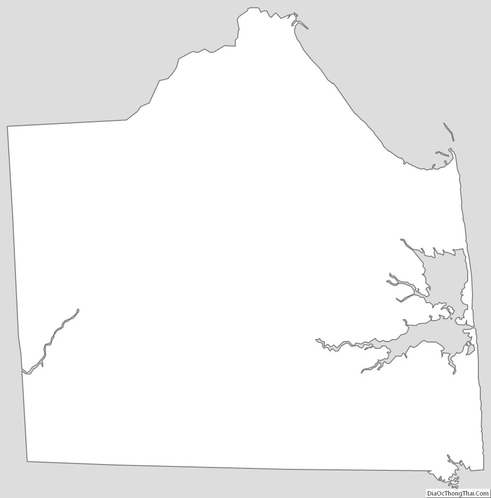
Sussex County Outline Map