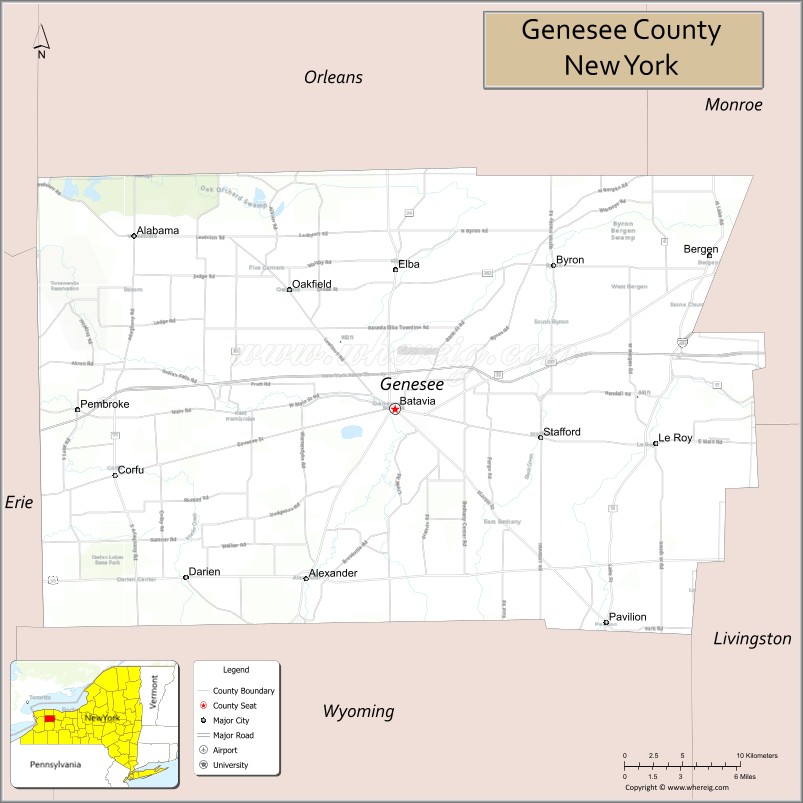
Genesee County is a county in the U.S. state of New York. As of the 2020 census, the population was 58,388. Its county seat is Batavia. Its name is from Seneca word Gen-nis’-hee-yo, meaning “the Beautiful Valley”. The county was created in 1802 and organized in 1803.
Genesee County comprises the Batavia, NY micropolitan statistical area, which is also in the Rochester-Batavia-Seneca Falls, NY combined statistical area. It is in Western New York. It is the namesake of Genesee County, Michigan; that is, the Michigan county was named for Genesee County, New York.
| Name: | Genesee County |
|---|---|
| FIPS code: | 36-037 |
| State: | New York |
| Founded: | March 1803 |
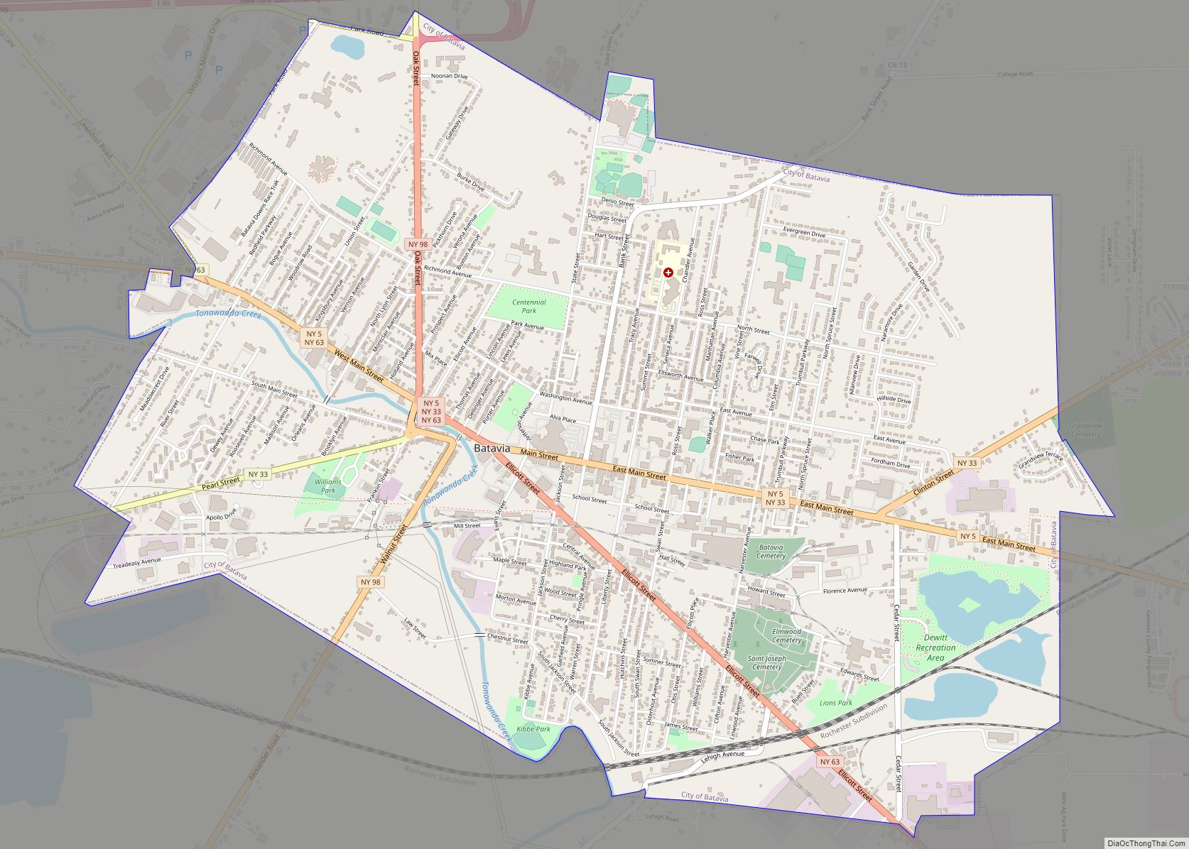
| Seat: | Batavia |
| Largest city: | Batavia |
| Total Area: | 495 sq mi (1,280 km²) |
| Land Area: | 493 sq mi (1,280 km²) |
| Total Population: | 58,388 |
| Population Density: | 118.4/sq mi (45.7/km²) |
| Time zone: | UTC−5 (Eastern) |
| Summer Time Zone (DST): | UTC−4 (EDT) |
| Website: | www.co.genesee.ny.us |
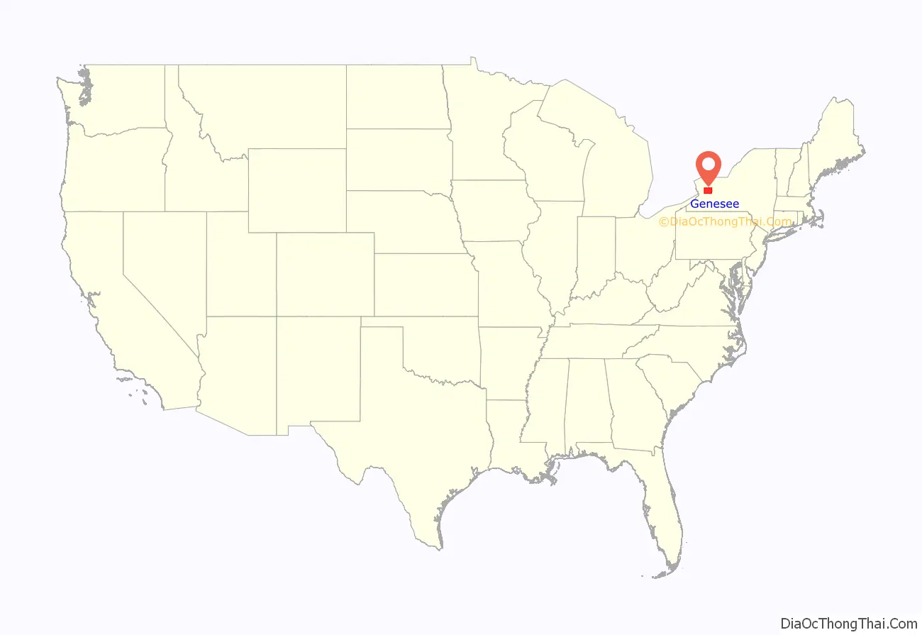
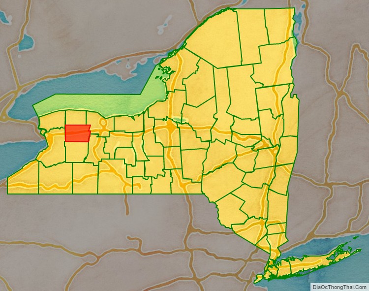
Genesee County location map. Where is Genesee County?
History
Pre-Columbian era
The archaeological record at the Hiscock Site, in Byron, New York goes back 10,000 to 12,000 years to the Ice Age. Researchers have found a variety of manmade tools, ceramics, metal, and leather, along with a mastodon jaw, tusks, and teeth, and assorted animal bones, indicating long occupation of the site. This site is among North America’s most important for archaeological artifacts from the Ice Age.
Varying cultures of indigenous peoples lived in the area for thousands of years. Hundreds of years before European exploration, the Iroquoian-speaking Seneca Nation developed in the central part of present-day New York; it became one of the first Five Nations of the Haudenosaunee (Iroquois Confederacy). Beginning in 1639 and lasting for the rest of the century, the Seneca led an invasion of Western New York, driving out the existing tribes of Wenro, Erie and Neutrals.
Colonial and revolutionary era
When counties were established in New York State in 1683, the present Genesee County was part of Albany County. This was an enormous county, including the northern part of New York State as well as all of the present State of Vermont and, in theory, extending westward to the Pacific Ocean. On March 12, 1772, what was left of Albany County was split into three parts, one remaining under the name Albany County. One of the other pieces, Tryon County, contained the western portion (and thus, since no western boundary was specified, theoretically still extended west to the Pacific). In 1784 Tryon County was renamed as Montgomery County. Around this time, the Pennsylvania Colony and the Massachusetts Bay Colony also claimed the territory as their own, but New York did not enforce its territorial claim. In 1789 Ontario County was split off from Montgomery as a result of the Phelps and Gorham Purchase. Again, the county theoretically extended west to the Pacific Ocean.
New York State
It was not until the Holland Purchase of 1793 that Western New York was enforced as the territory of New York State. Land in the region was sold through the Holland Land Company’s office in Batavia, starting in 1801. All the land in Western New York was in the newly created Genesee County, and all of that was in the single town of Batavia.
Genesee County was created by a partition of 7,100 square miles (18,000 km) of land from Ontario County. The county was not fully organized so it remained under the supervision of Ontario County until it achieved full organization and separation during March 1803.
On April 7, 1806, Genesee’s area was reduced to 5,550 square miles (14,400 km) due to a partition that created Allegany County. On March 8, 1808, Genesee’s area was again reduced, this time to 1,650 square miles (4,300 km) due to a partition that created Cattaraugus, Chautauqua, and Niagara Counties. On February 23, 1821, Genesee’s area was again reduced, this time to 1,450 square miles (3,800 km) due a complex partition that produced Livingston and Monroe Counties. On April 15, 1825, another partition reduced Genesee’s area to 1,030 square miles (2,700 km) in the creation of Orleans County. On May 1, 1826, the Orleans partition was again surveyed, with 10 square miles (26 km) of land along the western half of the Orleans/Genesee border returned to Genesee. On March 19, 1841, Genesee’s area was again reduced, this time to the 500 square miles (1,300 km) it remains to this day due to the partitioning to create Wyoming County.
19th century politics: Origins of antimasonry
Genesee County was included in the 19th century “burned-over district” — the Western region of New York consumed by religious revivals and characterized by “the evangelical desire to convert the entire American population to Christianity and to create a ‘moral, homogeneous commonwealth.'” This religious moral crusade provided the social atmosphere that allowed antimasonic sentiment to gain momentum as a significant church-oriented movement and, later, a grass-roots political party that became the nation’s first third party.
By the 1820s, Freemasonry was prevalent in Genesee County. From 1821 to 1827, half of all county officials were Freemasons. In September 1826, William Morgan, a resident of Batavia, New York, disappeared after having been briefly imprisoned for failure to repay a debt. Morgan had been rejected from the Masonic lodge in Batavia, and, as a result, threatened to publish a book which exposed the secret rituals of Freemasonry. His disappearance and presumed murder ignited a campaign against Freemasonry. The investigation into Morgan’s disappearance confronted major obstacles from government officials and the judiciary- positions that were largely occupied by Freemasons. The Morgan affair combined with existing suspicions and distrust of the secrecy of Freemasonry initiated mass meetings throughout the county to decide how the issue of Freemasonry should be handled. The Antimasonry crusade’s original goal was to oust Masons from political offices. Through the political guidance of party organizers, such as Thurlow Weed and William H. Seward, the crusade developed into a political party that enjoyed a political stronghold in Genesee County and the rest of the “burned-over district.”
The Antimasonic Party found strong support within Genesee County from 1827 to 1833. The party averaged 69 percent of the vote and won every county office. After continuous domination of Masonic politicians, citizens saw Antimasonry as a solution and an opportunity to restore justice and republicanism. The Baptist and Presbyterian churches favored Antimasonry and encouraged their members to renounce ties with the fraternity. The party was originally associated with populist rhetoric, however, strong Antimasonic sentiment throughout the county correlated with positive economic developments and high population densities. Larger towns, such as Batavia, the county seat and Le Roy, harbored the strongest support for the party. The timing of the creation of the Antimasonic Party coincided with a time in New York politics that encouraged the expansion of political participation. The party leaders made the Antimasonic Party, and later the Whig Party, a great success in Genesee County and other neighboring counties.
Modern day
In 2009, the City and Town of Batavia began exploring ways to merge or consolidate governmental systems.
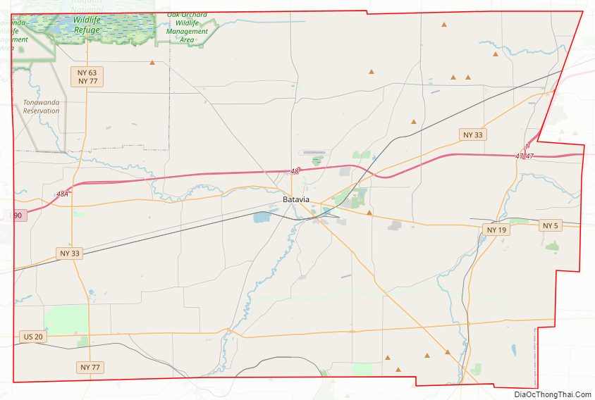
Genesee County Road Map
Geography
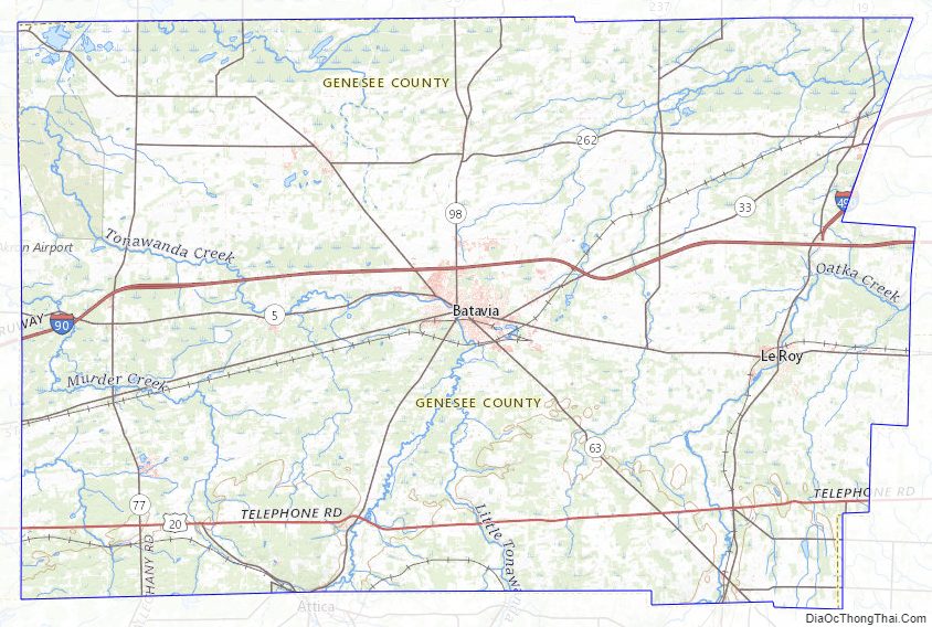
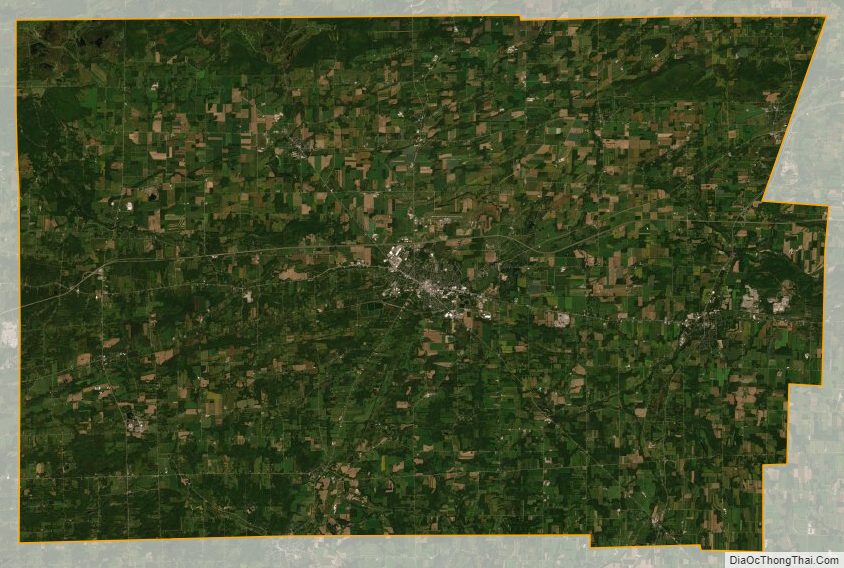
According to the U.S. Census Bureau, the county has a total area of 495 square miles (1,280 km), of which 493 square miles (1,280 km) is land and 2.4 square miles (6.2 km) (0.5%) is water. Genesee County is east of Buffalo and southwest of Rochester in the western portion of New York State.
Adjacent counties
- Erie County – west
- Livingston County – southeast
- Monroe County – northeast
- Niagara County – northwest
- Orleans County – north
- Wyoming County – south
Major highways
- Interstate 90 (New York State Thruway)
- Interstate 490
- U.S. Route 20
- New York State Route 5
- New York State Route 19
- New York State Route 33
- New York State Route 63
- New York State Route 77
- New York State Route 98
Genesee County watersheds
- Black Creek
- Canaseraga Creek to Oatka Creek, excluding Beards, Conesus and Cayuga Creek
- Honeoye Creeks
- Mud Creek
- Murder Creek
- Oak Orchard Creek
- Oatka Creek
- Ransom Creek to Mouth
- Tonawanda Creek, Middle and Upper
National protected area
- Iroquois National Wildlife Refuge (part)
State protected areas
- Darien Lakes State Park
- Oak Orchard Wildlife Management Area
- Tonawanda Wildlife Management Area
County parks
- Genesee County Park and Forest consists of 430 acres (1.7 km) of forest and rolling hills.
- DeWitt Recreation Area is a 63-acre (250,000 m) park that includes a 38-acre (150,000 m) pond.
Source:
Genesee County Topographic Map
Genesee County Satellite Map
Genesee County Outline Map