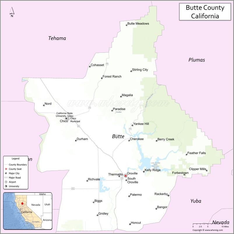
Butte County (/ˈbjuːt/ (listen)) is a county located in the northern part of the U.S. state of California. In the 2020 census, its population was 211,632. The county seat is Oroville.
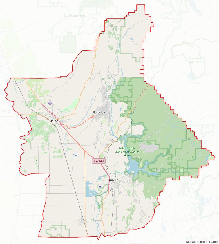
Butte County comprises the Chico, CA metropolitan statistical area. It is in the California Central Valley, north of the state capital of Sacramento.
Butte County is drained by the Feather River and the Sacramento River. Butte Creek and Big Chico Creek are additional perennial streams, both tributary to the Sacramento. The county is home to California State University, Chico and Butte College.
| Name: | Butte County |
|---|---|
| FIPS code: | 06-007 |
| State: | California |
| Founded: | 1850 |
| Named for: | The nearby Sutter Buttes |
| Seat: | Oroville |
| Largest city: | Chico |
| Total Area: | 1,677 sq mi (4,340 km²) |
| Land Area: | 1,636 sq mi (4,240 km²) |
| Total Population: | 211,632 |
| Population Density: | 130/sq mi (49/km²) |
| Time zone: | UTC−8 (Pacific Time Zone) |
| Summer Time Zone (DST): | UTC−7 (Pacific Daylight Time) |
| Website: | www.buttecounty.net |
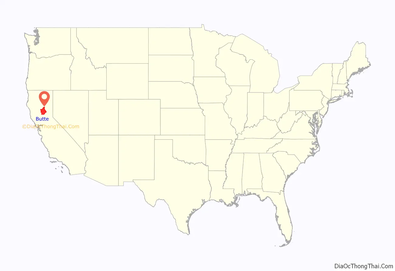
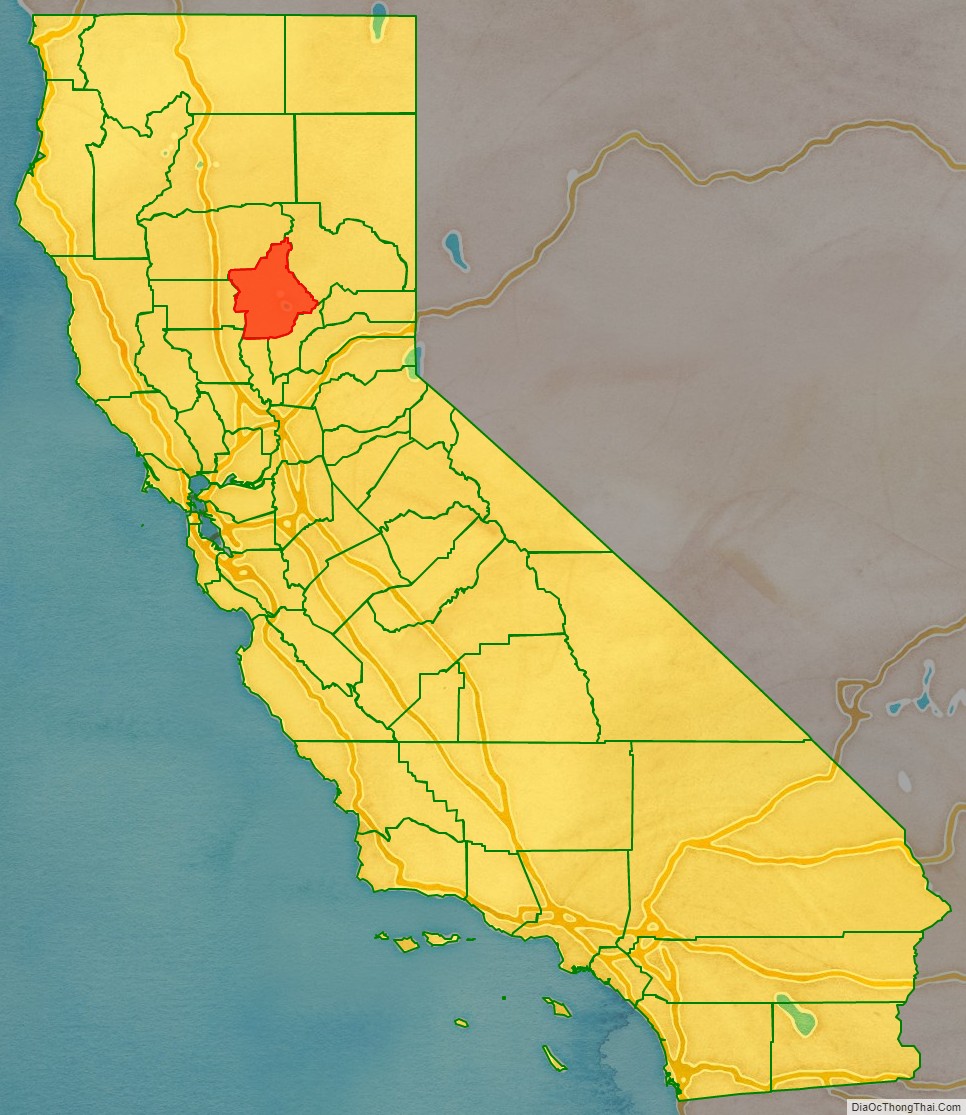
Butte County location map. Where is Butte County?
History
Butte County is named for the Sutter Buttes in neighboring Sutter County; butte means “small knoll” or “small hill” in French. Butte County was incorporated as one of California’s 19 original counties on February 18, 1850. The county went across the present limits of the Tehama, Plumas, Colusa, and Sutter Counties.
Between November 8 and 25, 2018, a major wildfire, the Camp Fire, destroyed most of the town of Paradise, the adjacent community of Concow, and a large area of rural, hilly country east of Chico. More than 80 people were killed, 50,000 were displaced, over 150,000 acres were burned, and nearly 20,000 buildings were destroyed. The Camp Fire was California’s most destructive and deadliest fire.
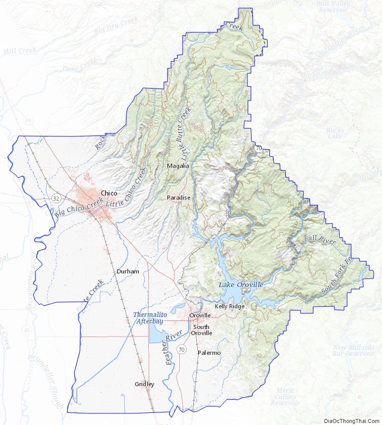
Butte County Road Map
Geography
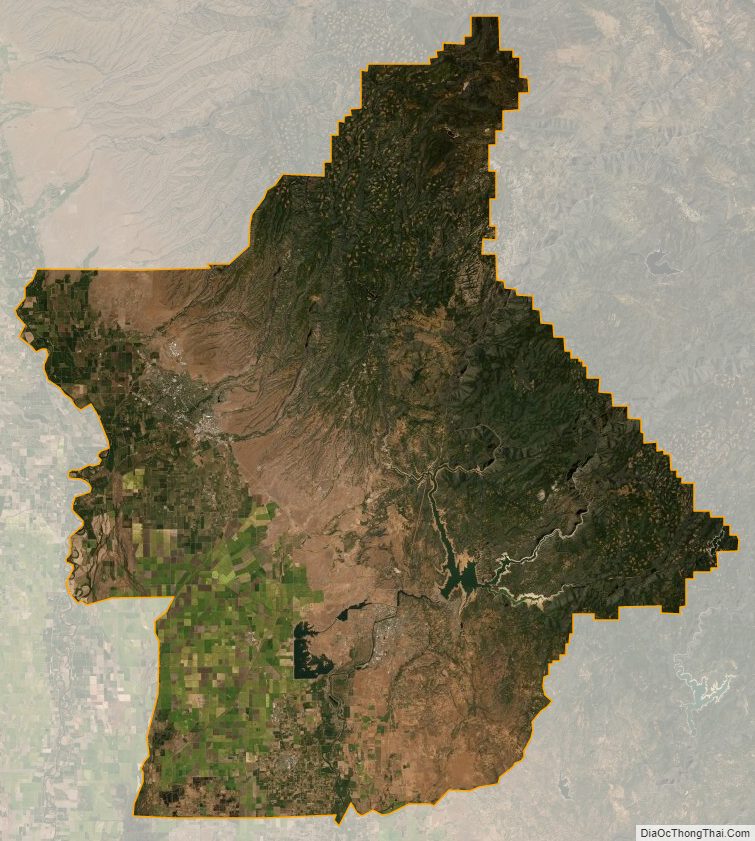
According to the U.S. Census Bureau, the county has a total area of 1,677 square miles (4,340 km), of which 41 square miles (110 km) (2.4%) are covered by water.
The county is drained by the Feather River and Butte Creek. Part of the county’s western border is formed by the Sacramento River. The county lies along the western slope of the Sierra Nevada, the steep slopes making it prime territory for the siting of hydroelectric power plants. About a half dozen of these plants are located in the county, one of which, serves the Oroville Dam, which became severely stressed by overflow water in 2017, and which remains a concern today.
National protected areas
- Butte Sink National Wildlife Refuge (part)
- Lassen National Forest (part)
- Plumas National Forest (part)
- Sacramento River National Wildlife Refuge (part)
Adjacent counties
- Sutter County, California – south
- Colusa County, California – southwest
- Glenn County, California – west
- Tehama County, California – northwest
- Plumas County, California – northeast
- Yuba County, California – southeast
Butte County Topographic Map
Butte County Satellite Map
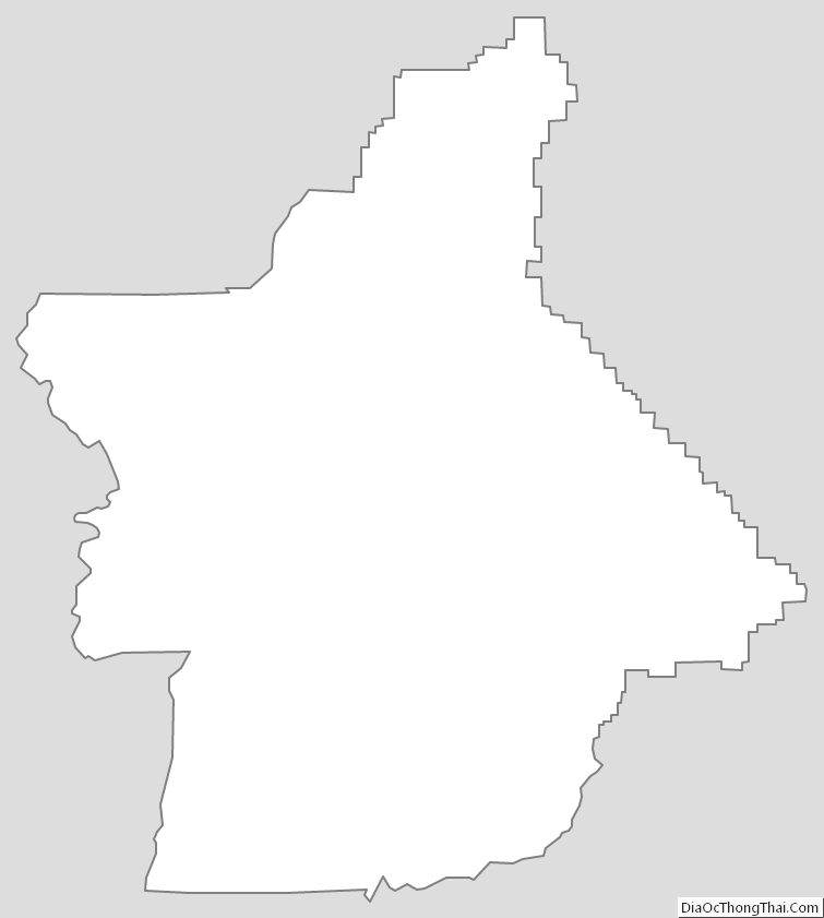
Butte County Outline Map