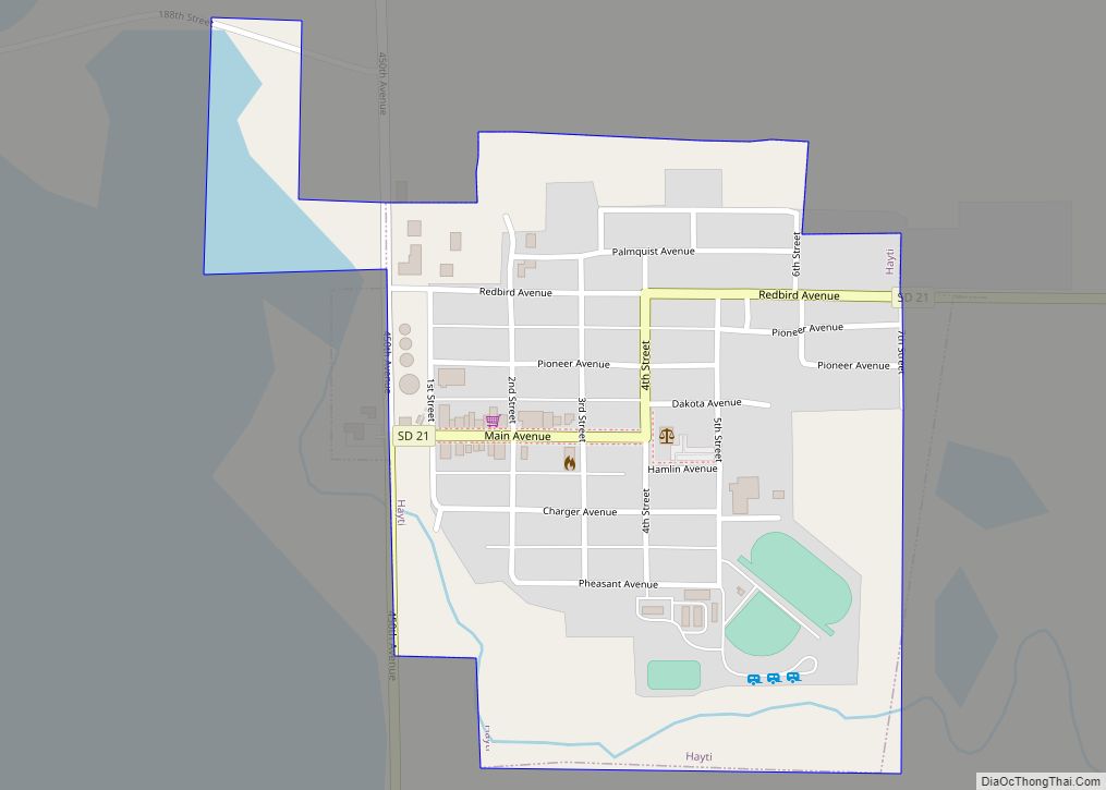
Hamlin County is a county in the U.S. state of South Dakota. As of the 2020 census, the population was 6,164. Its county seat is Hayti. The county was created in 1873 and organized in 1878. It was named for Hannibal Hamlin, Lincoln’s first vice-president.
| Name: | Hamlin County |
|---|---|
| FIPS code: | 46-057 |
| State: | South Dakota |
| Founded: | 1873 |
| Named for: | Hannibal Hamlin |
| Seat: | Hayti |
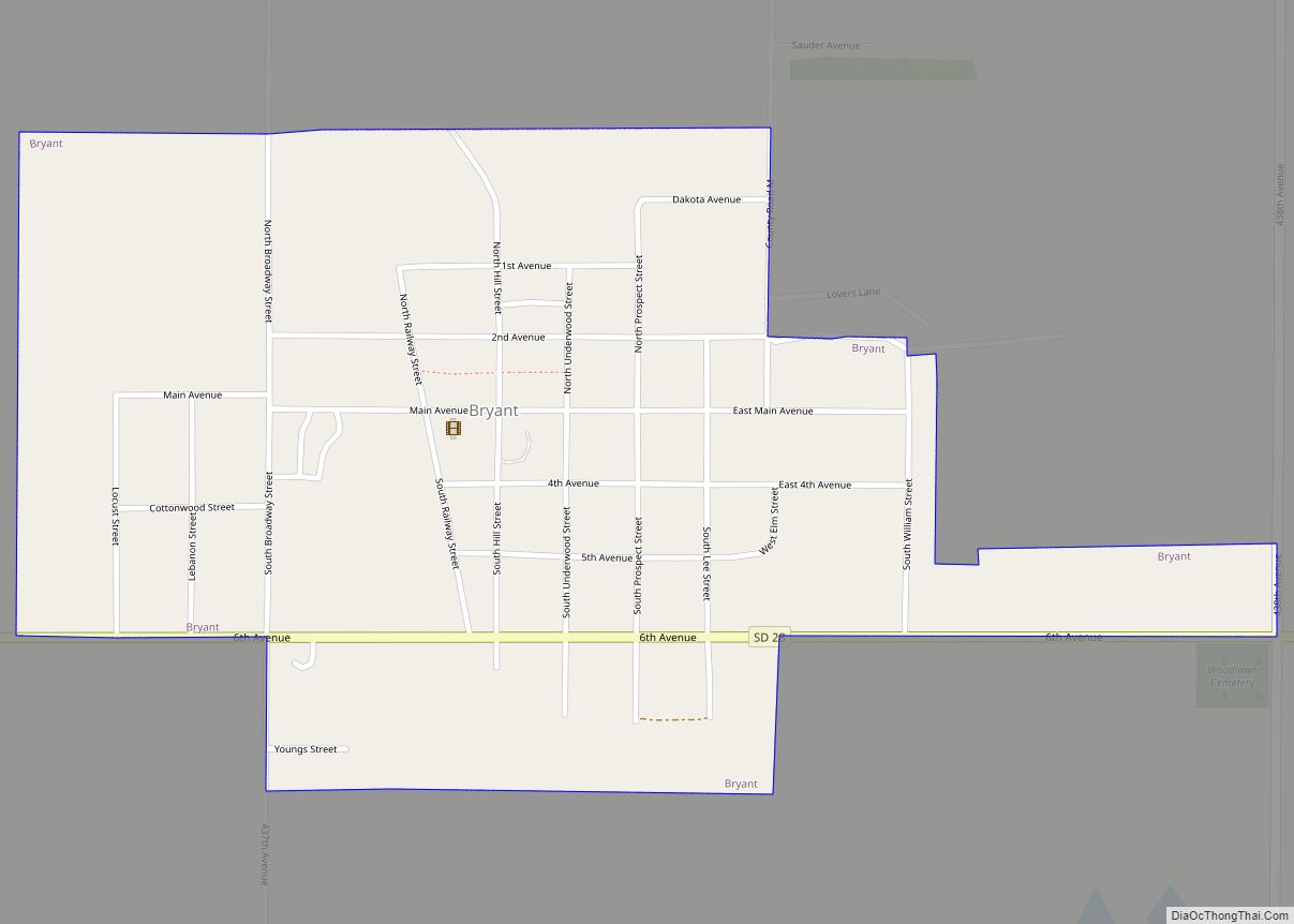
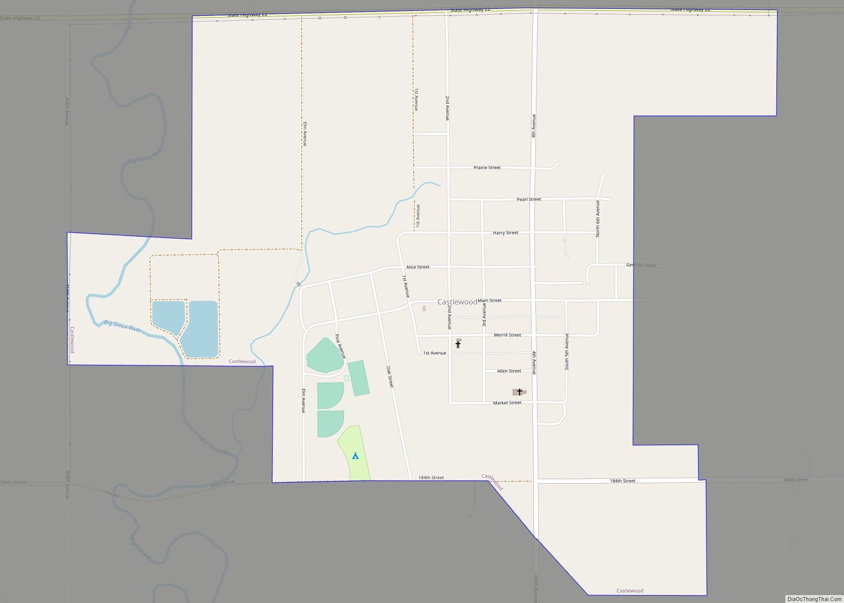
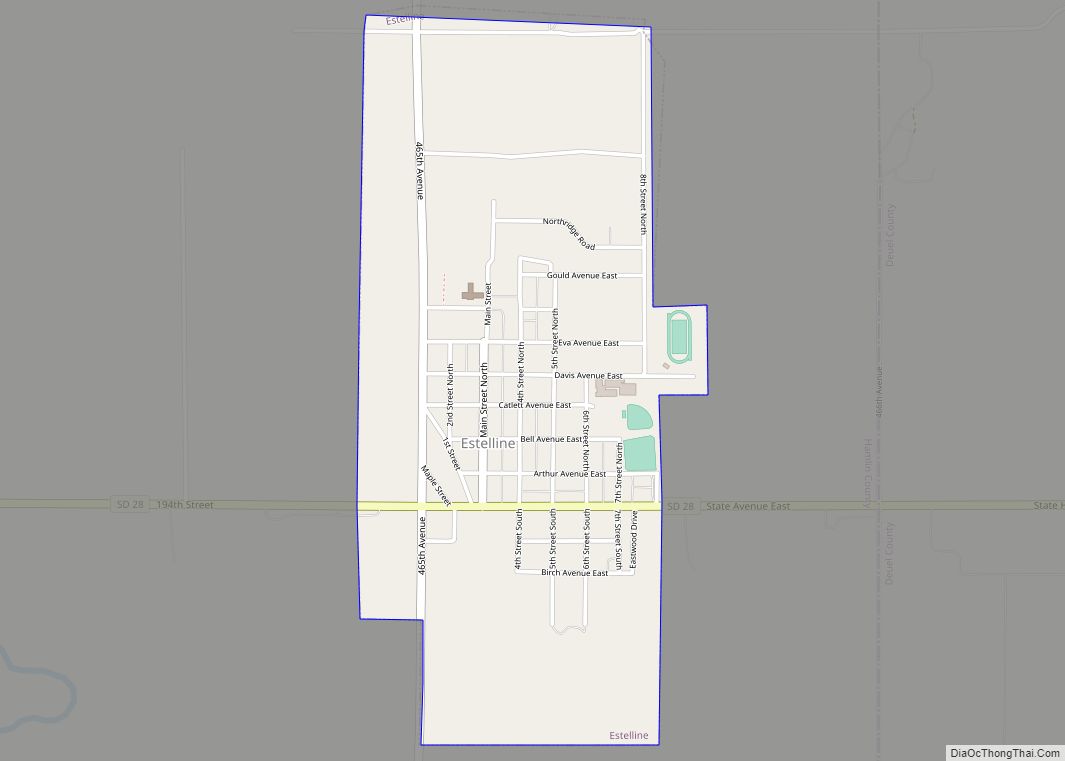
| Largest city: | Estelline |
| Total Area: | 538 sq mi (1,390 km²) |
| Land Area: | 507 sq mi (1,310 km²) |
| Total Population: | 6,164 |
| Population Density: | 11/sq mi (4.4/km²) |
| Time zone: | UTC−6 (Central) |
| Summer Time Zone (DST): | UTC−5 (CDT) |
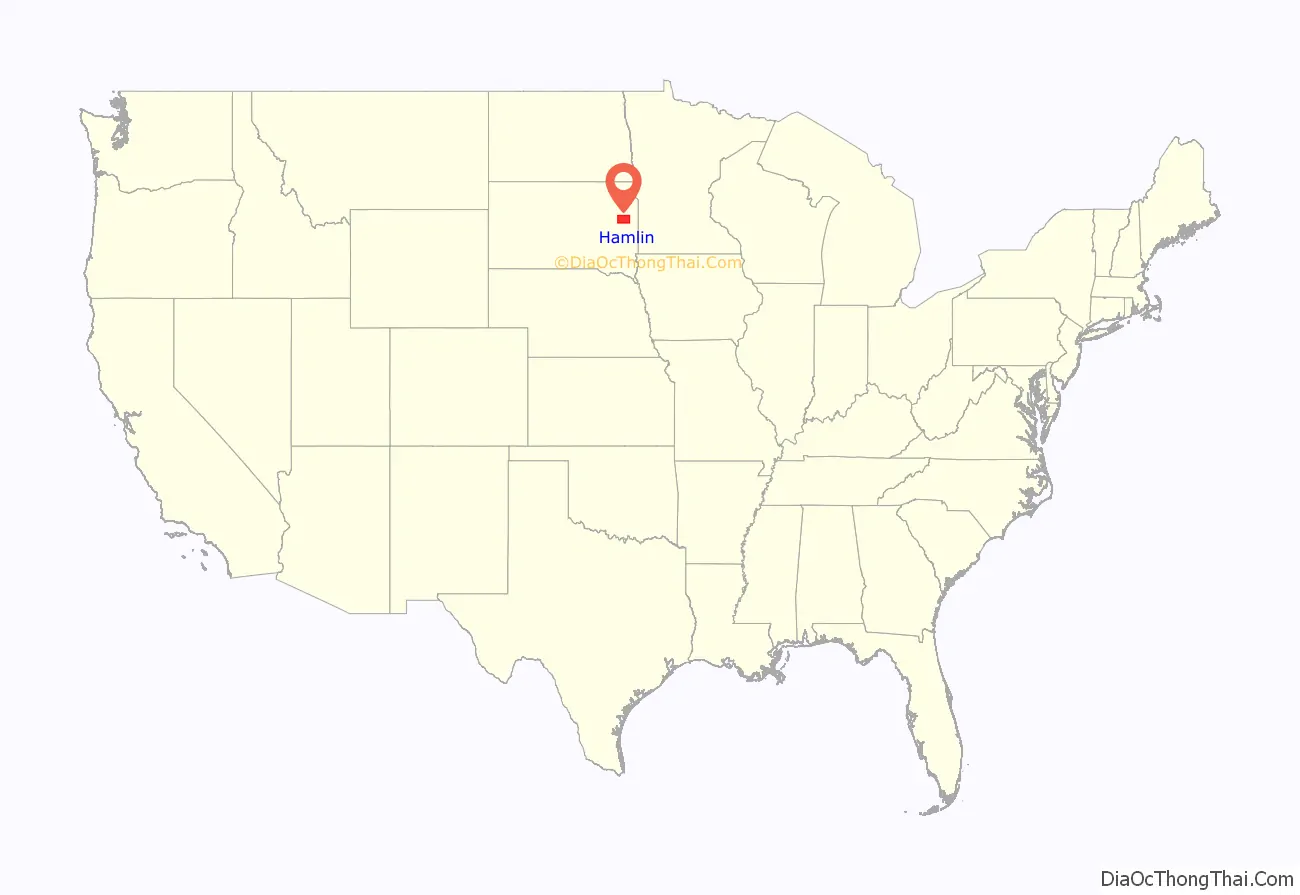
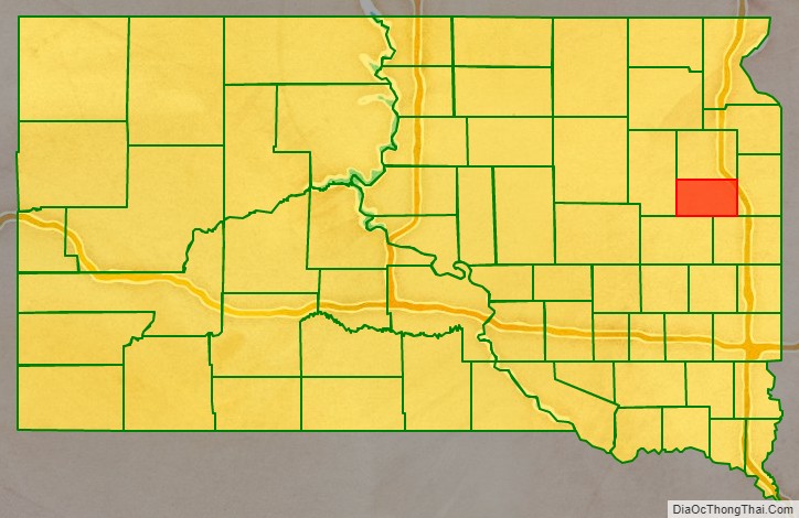
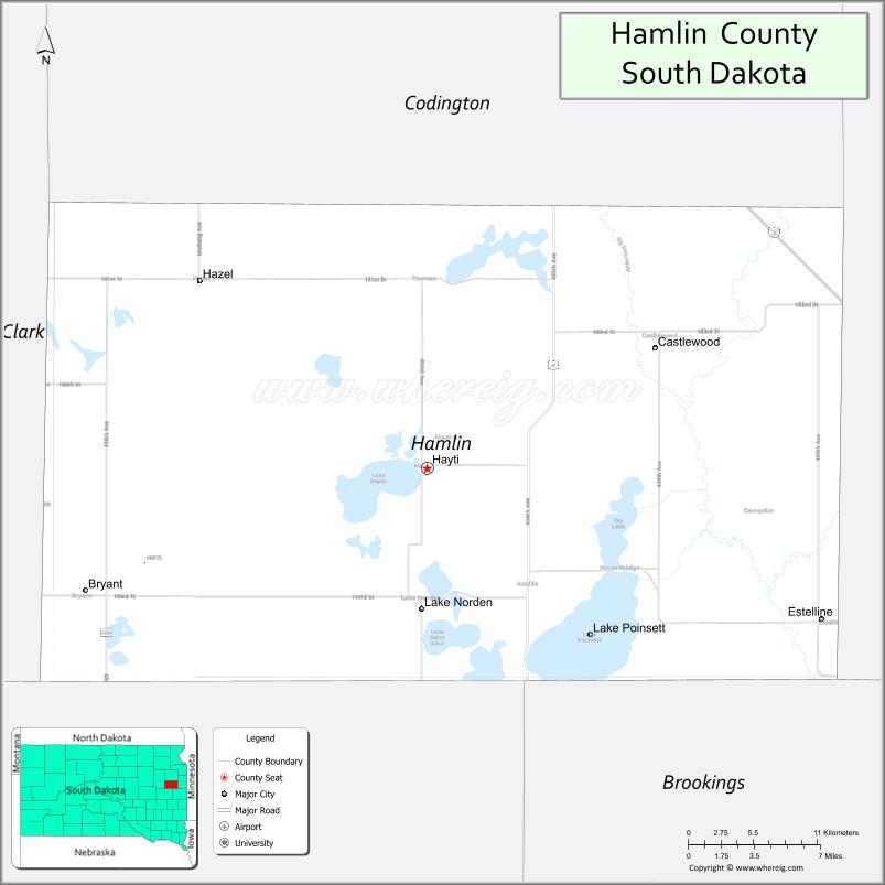
Hamlin County location map. Where is Hamlin County?
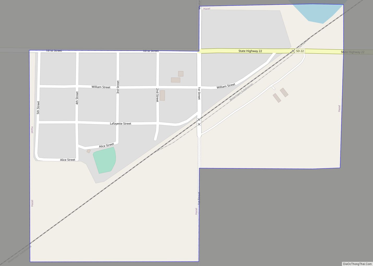
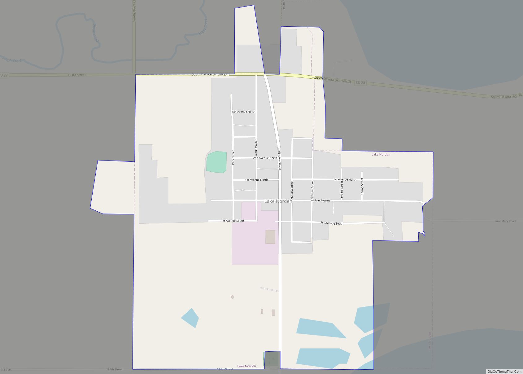
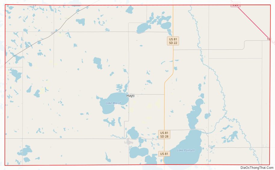
Hamlin County Road Map
Geography
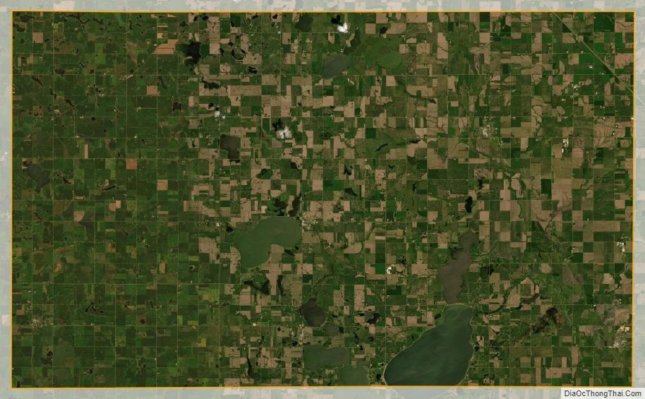
The terrain of Hamlin County consists of low rolling hills, dotted with small lakes and ponds. The land is largely dedicated to agriculture. The terrain slopes to the south-southeast, and its highest point is on the eastern boundary line, near its NE corner, at 1,949′ (594m) ASL.
Hamlin County has a total area of 538 square miles (1,390 km), of which 507 square miles (1,310 km) is land and 31 square miles (80 km) (5.7%) is water.
Major highways
- Interstate 29
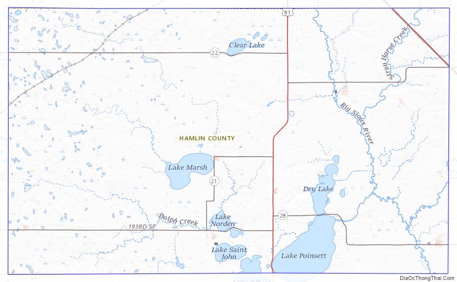
- U.S. Highway 81
- South Dakota Highway 21
- South Dakota Highway 22
- South Dakota Highway 28
Adjacent counties
- Codington County – north
- Deuel County – east
- Brookings County – southeast
- Kingsbury County – southwest
- Clark County – west
Protected areas
- Baxter Slough State Public Shooting Area
- Bochek State Public Shooting Area
- Eidsness State Public Shooting Area
- Hamlin State Public Shooting Area
- Harju State Public Shooting Area
- Hayes Slough State Public Shooting Area
- Johnsons Slough State Public Shooting Area
- McShane State Public Shooting Area
- Opdahl Slough State Public Shooting Area
- Rasmussen State Public Shooting Area
Lakes
- Clear Lake
- Dry Lake
- Lake Albert (partial)
- Lake Marsh
- Lake Mary
- Lake Poinsett
- Lake Saint John
Hamlin County Topographic Map
Hamlin County Satellite Map
Hamlin County Outline Map