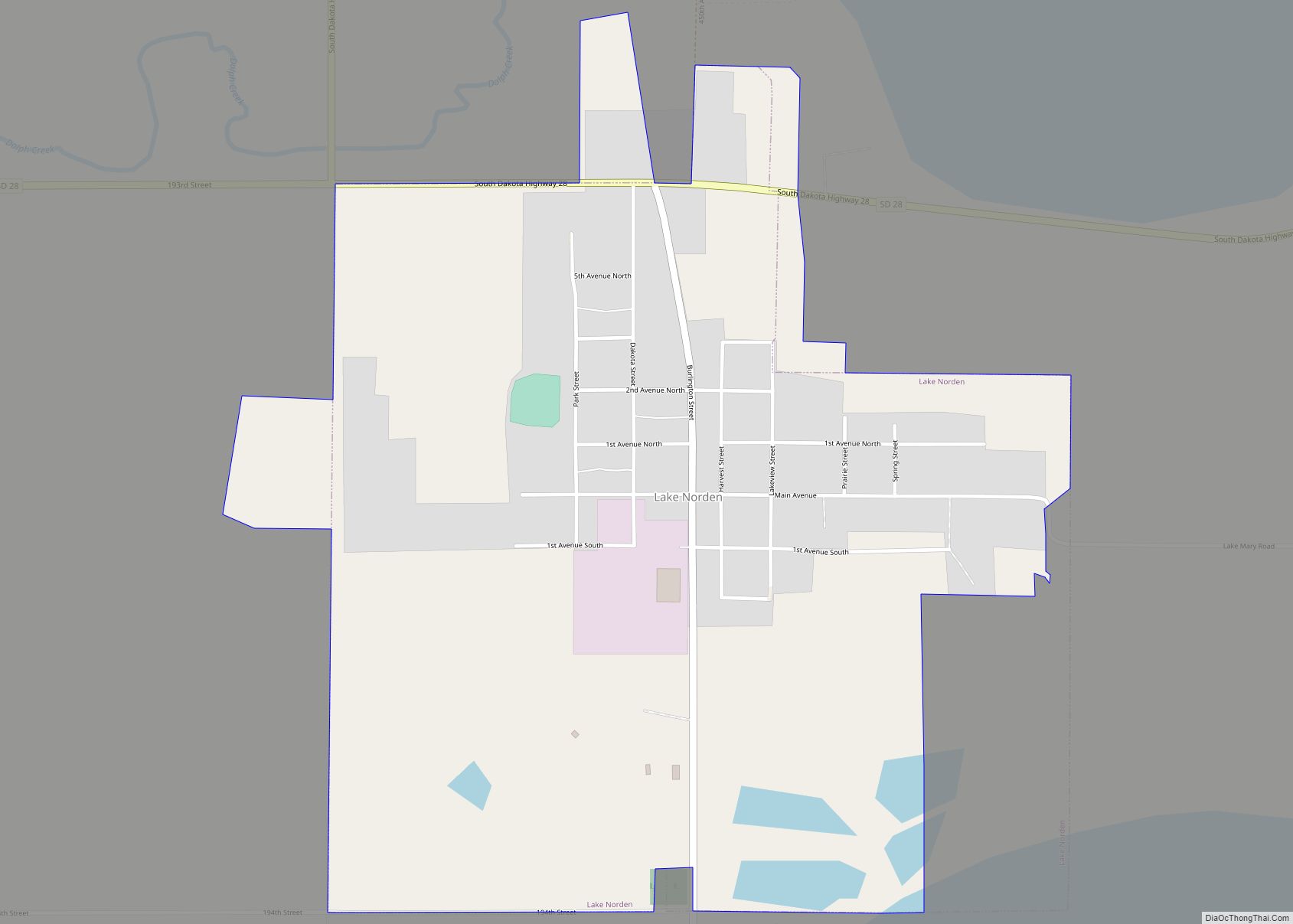
Lake Norden is a city in Hamlin County, South Dakota, United States. It is part of the Watertown, South Dakota Micropolitan Statistical Area. The population was 554 at the 2020 census.
Lake Norden was laid out in 1908, and named after a lake near the town site.
In May 2023, a fire destroyed the city’s volunteer fire department.
| Name: | Lake Norden city |
|---|---|
| LSAD Code: | 25 |
| LSAD Description: | city (suffix) |
| State: | South Dakota |
| County: | Hamlin County |
| Incorporated: | 1916 |
| Elevation: | 1,690 ft (515 m) |
| Total Area: | 0.92 sq mi (2.38 km²) |
| Land Area: | 0.87 sq mi (2.26 km²) |
| Water Area: | 0.05 sq mi (0.12 km²) |
| Total Population: | 554 |
| Population Density: | 635.32/sq mi (245.26/km²) |
| ZIP code: | 57248 |
| Area code: | 605 |
| FIPS code: | 4635460 |
| GNISfeature ID: | 1256026 |
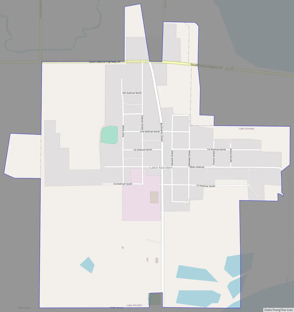
Online Interactive Map
Click on ![]() to view map in "full screen" mode.
to view map in "full screen" mode.
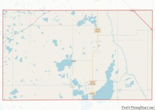
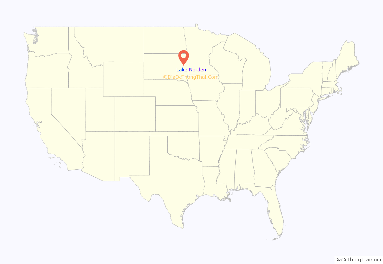
Lake Norden location map. Where is Lake Norden city?
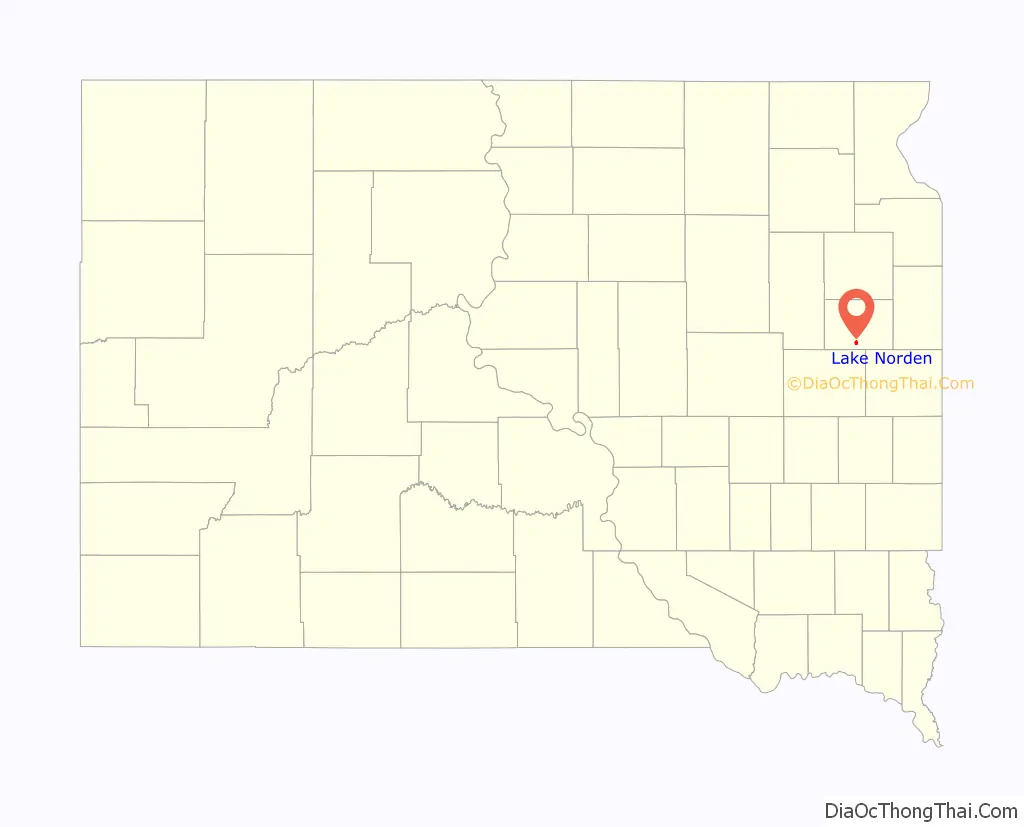
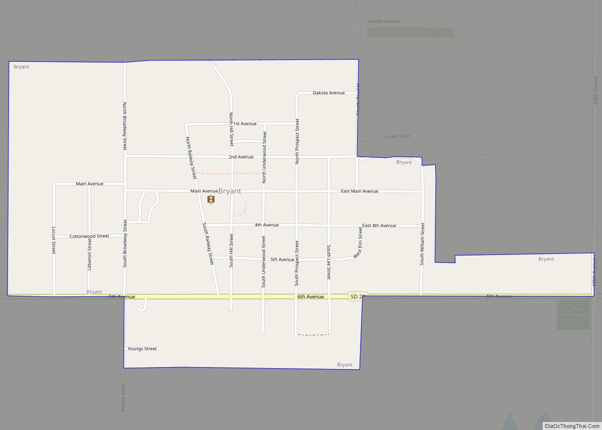
Lake Norden Road Map
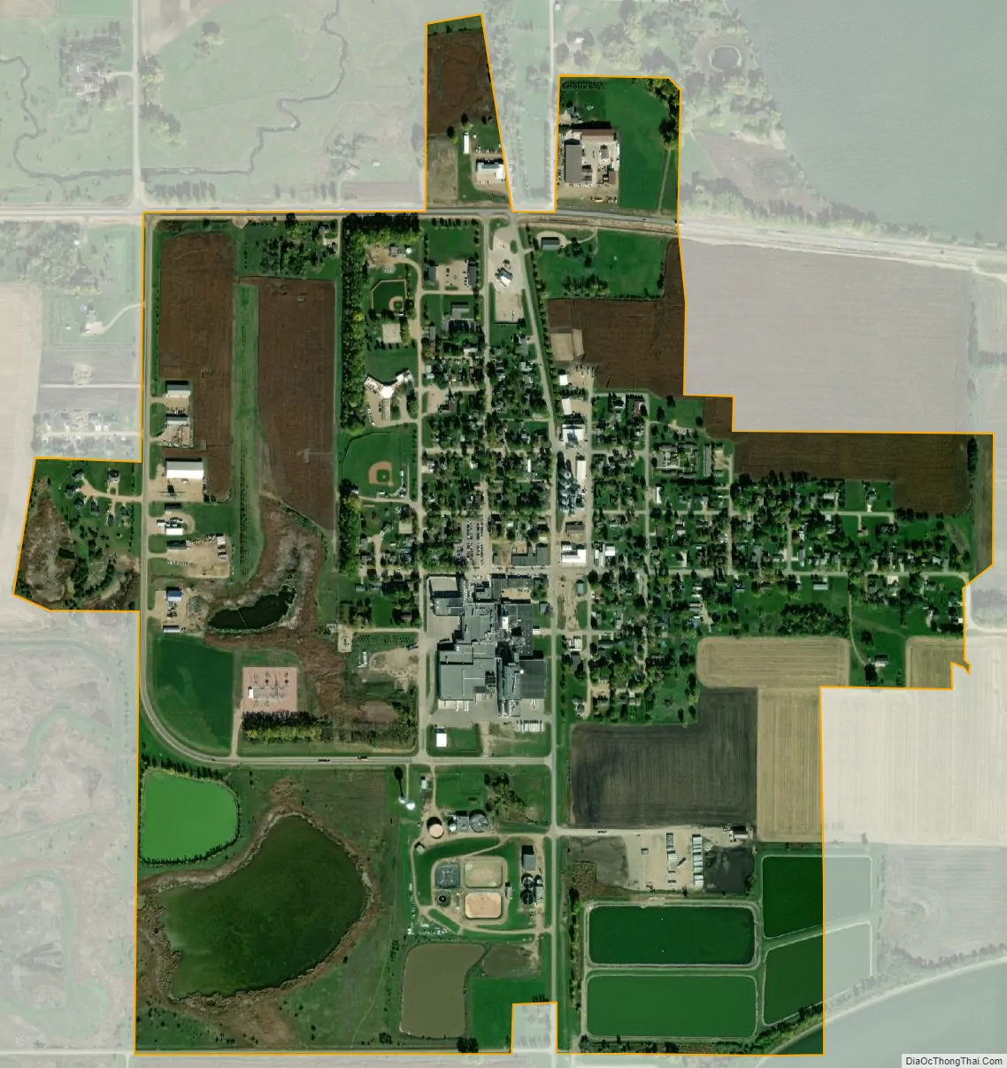
Lake Norden city Satellite Map
Geography
Lake Norden is located at 44°34′54″N 97°12′30″W / 44.58167°N 97.20833°W / 44.58167; -97.20833 (44.581570, -97.208406).
According to the United States Census Bureau, the city has a total area of 0.88 square miles (2.28 km), of which 0.83 square miles (2.15 km) is land and 0.05 square miles (0.13 km) is water.
Lake Norden has been assigned the ZIP code 57248 and the FIPS place code 35460.
See also
Map of South Dakota State and its subdivision:- Aurora
- Beadle
- Bennett
- Bon Homme
- Brookings
- Brown
- Brule
- Buffalo
- Butte
- Campbell
- Charles Mix
- Clark
- Clay
- Codington
- Corson
- Custer
- Davison
- Day
- Deuel
- Dewey
- Douglas
- Edmunds
- Fall River
- Faulk
- Grant
- Gregory
- Haakon
- Hamlin
- Hand
- Hanson
- Harding
- Hughes
- Hutchinson
- Hyde
- Jackson
- Jerauld
- Jones
- Kingsbury
- Lake
- Lawrence
- Lincoln
- Lyman
- Marshall
- McCook
- McPherson
- Meade
- Mellette
- Miner
- Minnehaha
- Moody
- Pennington
- Perkins
- Potter
- Roberts
- Sanborn
- Shannon
- Spink
- Stanley
- Sully
- Todd
- Tripp
- Turner
- Union
- Walworth
- Yankton
- Ziebach
- Alabama
- Alaska
- Arizona
- Arkansas
- California
- Colorado
- Connecticut
- Delaware
- District of Columbia
- Florida
- Georgia
- Hawaii
- Idaho
- Illinois
- Indiana
- Iowa
- Kansas
- Kentucky
- Louisiana
- Maine
- Maryland
- Massachusetts
- Michigan
- Minnesota
- Mississippi
- Missouri
- Montana
- Nebraska
- Nevada
- New Hampshire
- New Jersey
- New Mexico
- New York
- North Carolina
- North Dakota
- Ohio
- Oklahoma
- Oregon
- Pennsylvania
- Rhode Island
- South Carolina
- South Dakota
- Tennessee
- Texas
- Utah
- Vermont
- Virginia
- Washington
- West Virginia
- Wisconsin
- Wyoming