| Name: | Hays County |
|---|---|
| FIPS code: | 48-209 |
| State: | Texas |
| Founded: | 1848 |
| Named for: | John Coffee Hays |
| Seat: | San Marcos |
| Largest city: | San Marcos |
| Total Area: | 680 sq mi (1,800 km²) |
| Land Area: | 678 sq mi (1,760 km²) |
| Total Population: | 241,067 |
| Population Density: | 350/sq mi (140/km²) |
| Time zone: | UTC−6 (Central) |
| Summer Time Zone (DST): | UTC−5 (CDT) |
| Website: | hayscountytx.com |
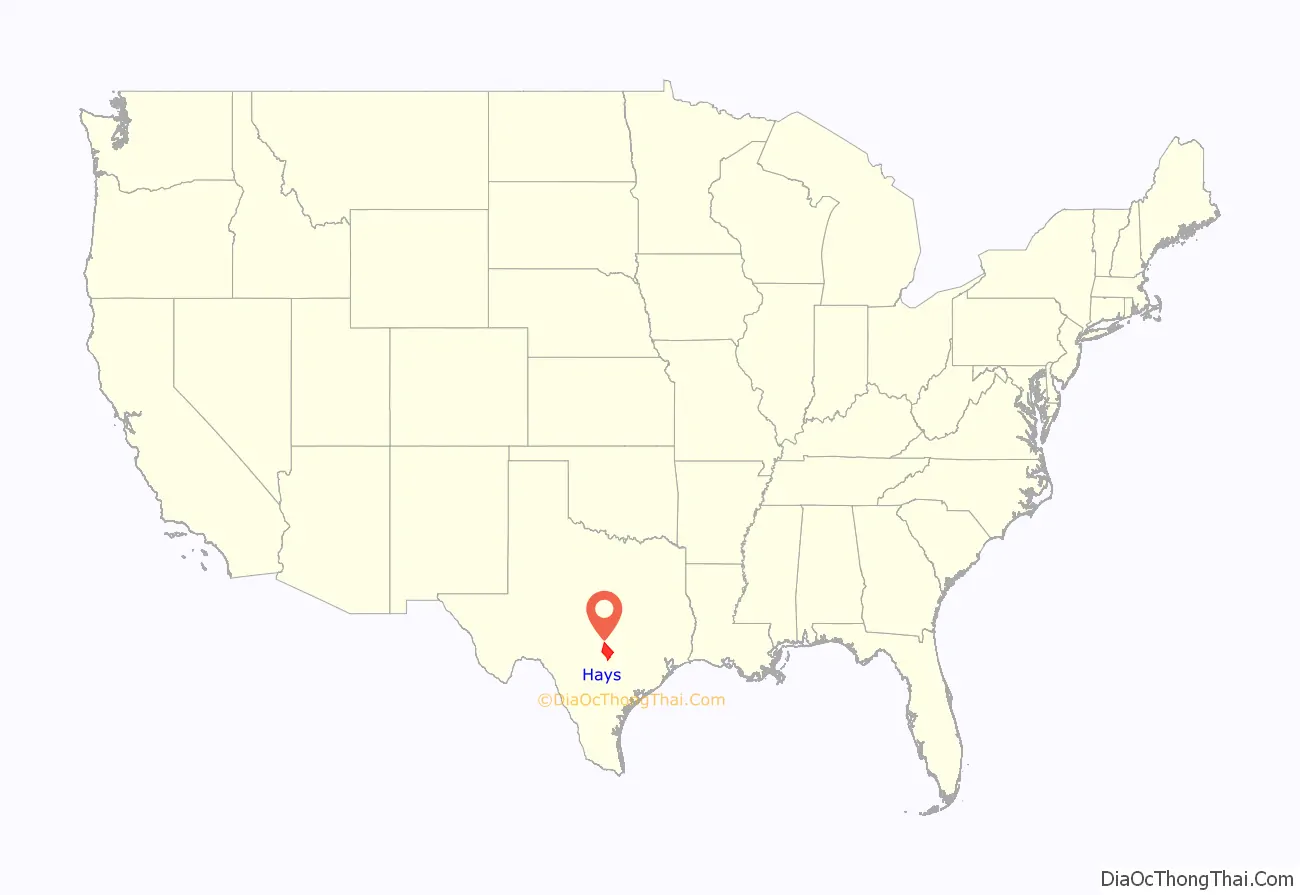
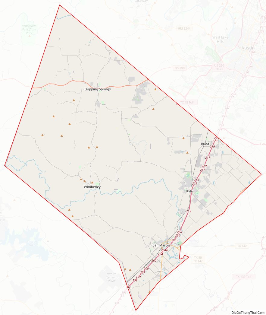
Hays County location map. Where is Hays County?
History
Hays County has been inhabited for thousands of years. Evidence of Paleo-Indians found in the region goes as far back as 6000 BC. Archeological evidence of native agriculture goes back to 1200 AD.
The earliest Europeans to arrive in the area were explorers and missionaries from the Spanish Empire. Father Isidro Félix de Espinosa, Father Antonio de San Buenaventura y Olivares, and Pedro de Aguirre traveled through the area in 1709. A few years later, French-Canadian Louis Juchereau de St. Denis was attacked by Comanches in 1714.
More permanent European influence was established in 1755, when the Mission San Francisco Xavier de los Dolores was established among the Apache tribe. In 1831, Coahuila y Tejas issued a land grant to Juan Martín de Veramendi, to Juan Vicente Campos in 1832, and to Thomas Jefferson Chambers in 1834. The Mexican government issued a land grant to the first Anglo-American settler in the county, Thomas G. McGhee of Tennessee, in 1835.
On March 1, 1848, the legislature formed Hays County from Travis County. The county is named for Tennessee native Captain John Coffee Hays of the Texas Rangers. San Marcos was named as the county seat. The legislature established Blanco from part of Hays in 1858, but incorporated part of Comal into Hays. Risher and Hall Stage Lines controlled 16 of 31 passenger and mail lines in Texas.
In 1861, voters in the county favored secession from the Union. The next year, the state legislature transferred more of Comal County to Hays County. In 1867, the first cattle drive from Hays County to Kansas occurred.
The International-Great Northern Railroad was completed from Austin to San Marcos in 1880. Camp Ben McCulloch, named after a brigadier general, was organized in 1896 for reunions of United Confederate Veterans. A teacher’s college, Southwest Texas State Normal School, was established in San Marcos in 1899.
Wonder Cave opened to the public in 1900. The current Hays County Courthouse in San Marcos was erected in 1908 in Beaux-Arts style by architect C.H. Page and Bros. The Aquarena Springs tourist site opened in 1928 in San Marcos.
Lyndon Baines Johnson graduated from Southwest Texas State Teachers College in 1930. In 1942, construction of San Marcos Army Air Field began. San Marcos Army Air Field was renamed Gary Air Force Base in 1953 to honor Second Lieutenant Arthur Edward Gary, the first San Marcos resident killed in World War II.
The state legislature resurveyed the Hays and Travis County lines, adding 16,000 acres (65 km) to Hays County, in 1955. In 1964, U.S. President Lyndon Johnson announced the establishment of a Job Corps center based at the deactivated Gary Air Force Base.
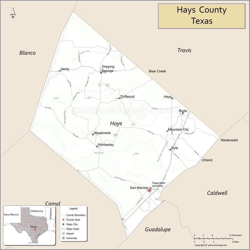
Hays County Road Map
Geography
According to the U.S. Census Bureau, the county has a total area of 680 sq mi (1,800 km), of which 1.9 sq mi (4.9 km) (0.3%) are covered by water. The county is predominantly in the Edwards Plateau, with the south east portion in the Texas Blackland Prairies.
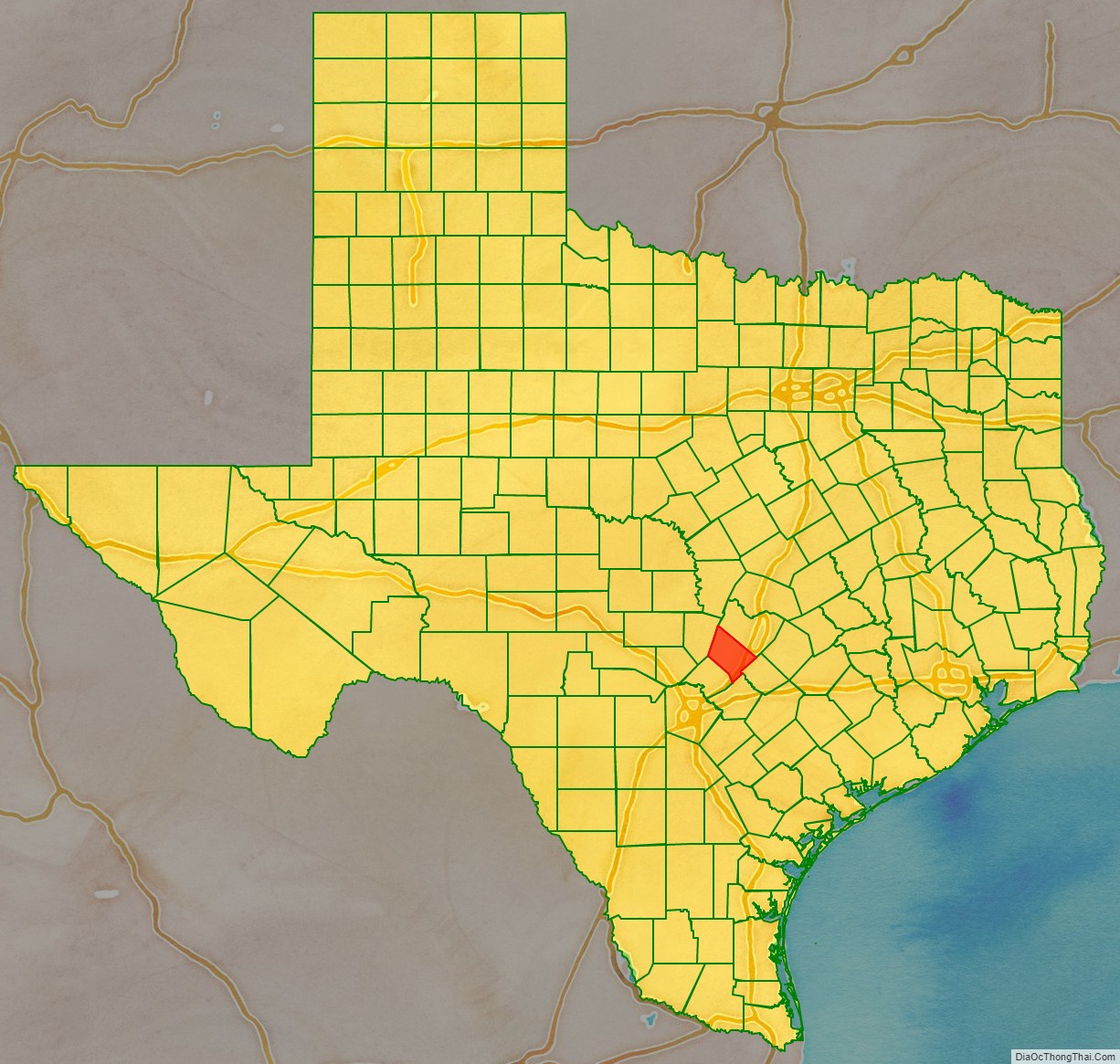
Adjacent counties
- Travis County (northeast)
- Caldwell County (southeast)
- Guadalupe County (south)
- Comal County (southwest)
- Blanco County (northwest)
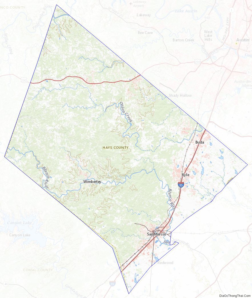
Hays County Topographic Map
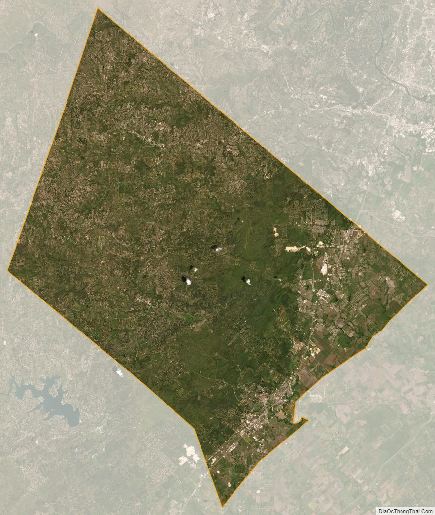
Hays County Satellite Map
Hays County Outline Map