| Name: | Hunterdon County |
|---|---|
| FIPS code: | 34-019 |
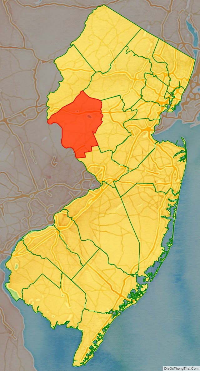
| State: | New Jersey |
| Founded: | 1714 |
| Named for: | Robert Hunter |
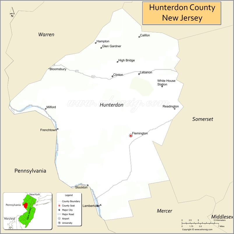
| Seat: | Flemington |
| Largest city: | Raritan Township (population) Readington Township (area) |
| Total Area: | 437.44 sq mi (1,133.0 km²) |
| Land Area: | 427.82 sq mi (1,108.0 km²) |
| Total Population: | 128,947 |
| Population Density: | 301.4/sq mi (116.4/km²) |
| Website: | www.co.hunterdon.nj.us |
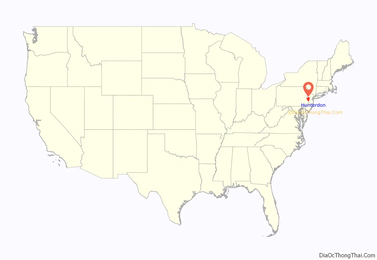
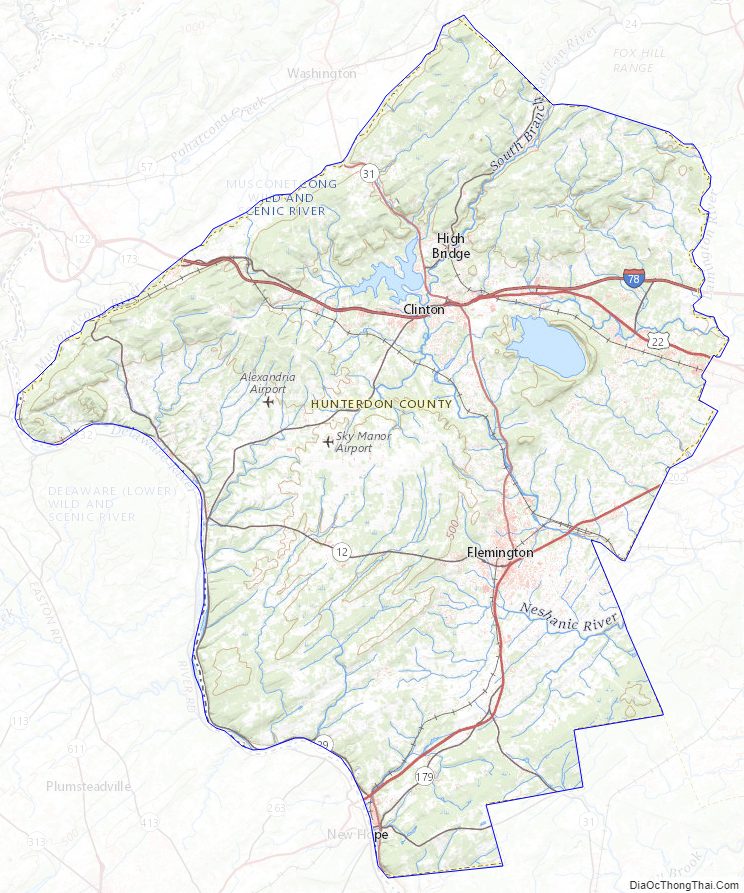
Hunterdon County location map. Where is Hunterdon County?
History
Etymology
Hunterdon County was named for Robert Hunter, a colonial governor of New Jersey. Language changes over time and location, so by stemming of [s], and a [t] → [d] lenition of the name of his family seat of “Hunterston” in Ayrshire, Scotland, the name “Hunterdon” was derived.
Paleo Indians and Native Americans
Paleo Indians moved into Hunterdon County between 12,000 BCE and 11,000 BCE. The area was warming due to climate change. The Wisconsin Glacier in Warren and Sussex County was retreating northward. The area was that of Taiga/Boreal forests. Paleo Indians traveled in small groups in search of game and edible plants. They used spears made of bone, jasper or black chert. Their camp sites are difficult to find as they are many feet below the present surface.
Native Americans moved into the area but the time they arrived is unknown. Most have come from the Mississippi River area. Many tribes of the Delaware Nation lived in Hunterdon County especially along the Delaware River and in the Flemington area. These tribes were agricultural in nature, growing corn, beans and squash. Those that lived along the South Branch of the Raritan River fished and farmed. There was a Native American trail that went along the South Branch of the Raritan River (Philhower 1924).
European settlement
Land purchases from Native Americans occurred from 1688 to 1758. Large land purchases from Native Americans occurred in 1703, 1709 and 1710. Over 150,000 acres (610 km) were bought with metal knives and pots, clothing, blankets, barrels of rum or hard cider, guns, powder and shot. This allowed for European settlers to enter into Hunterdon County in the early 18th century. After 1760, nearly all Native Americans left New Jersey and relocated to eastern Canada or the Mississippi River area.
The first European settlers were Col. John Reading who settled in Reading Township in 1704 they called him Sir Reading of Readington and John Holcombe who settled in Lambertville in 1705.
Hunterdon County was separated from Burlington County on March 11, 1714. At that time Hunterdon County was large, going from Assunpink Creek near Trenton to the New York State line which at that time was about 10 miles (16 km) north of Port Jervis, New York.
On March 15, 1739, Morris County (which at the time included what would later become Sussex County and Warren County) was separated from Hunterdon County. The boundary between Hunterdon and Somerset counties is evidence of the old Keith Line which separated the provinces of West Jersey and East Jersey. Hunterdon County was reduced in area on February 22, 1838, with the formation of Mercer County from portions of Burlington County, Hunterdon County and Middlesex County. In February 1839, the remaining portion of Hopewell Township was annexed to Mercer County. On March 13, 1844 Hopewell Township returned to Hunterdon County while Tewksbury Township was annexed by Somerset County but in February 1845 both of these changes were repealed. Since then, the county boundaries have remained the same.
Hunterdon County was being affected by industrialization in the state and nation, mining speculation in northwest New Jersey, and competitors constructing railroads. The Elizabethtown and Somerville Railroad leased a section to White House just south of Tewksbury Township in 1848.
Recent history
Transitioning from rural to suburban, Hunterdon County is an exurb on the western edge of New Jersey and home to commuters to New York City and Philadelphia. The county seat, Flemington, is noted as the site of the Lindbergh kidnapping trial which convicted Bruno Hauptmann of the murder of aviator Charles Lindbergh’s son. With growing towns and shopping areas, as well as relaxing rural areas, Hunterdon County is a far stretch from the urban areas stereotypically associated with New Jersey. Due to the presence of natural habitats with many homes in wooded settings, Hunterdon County was recently found to have the third highest case rate of Lyme disease out of all counties in the United States.
On December 24, 2020, The Hunterdon County Library System announced that the library system will be joining the MAIN Library System which covers libraries in Morris County and parts of Somerset and Warren counties, this merger was completed on January 11, 2021.
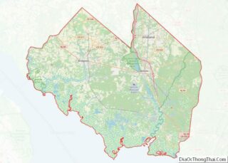
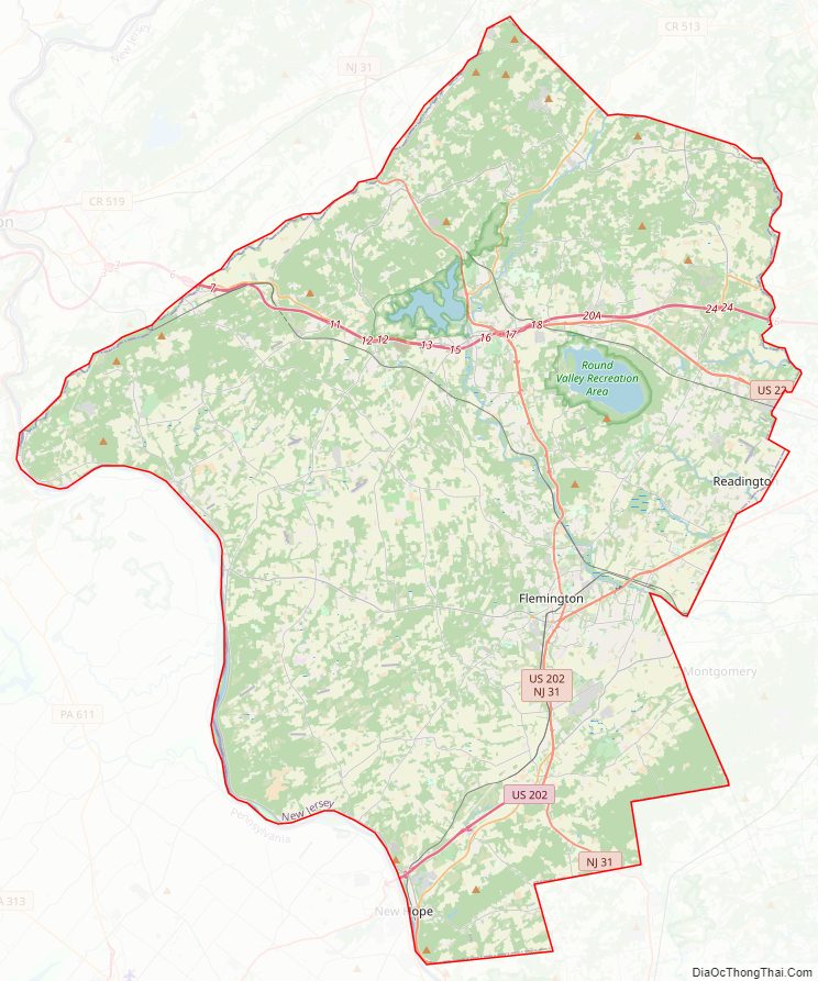
Hunterdon County Road Map
Geography
Geography
According to the 2010 Census, the county had a total area of 437.44 square miles (1,133.0 km), including 427.82 square miles (1,108.0 km) of land (97.8%) and 9.62 square miles (24.9 km) of water (2.2%).
Much of the county is hilly, with several hills rising to one thousand foot in elevation. The highest points are two areas in Lebanon Township, one on the Morris County line, both reaching approximately 1,060 feet (320 m) above sea level. The first is at Smith on the Morris County line and the second is north of the area called Little Brook. This area is known as the Highlands of New Jersey. The lowest elevation is where the Mercer County line reaches the Delaware River, approximately 50 feet (15 m) above sea level. The county is drained by the Musconetcong River in the north. The river flows in a southwest direction. The Lamington River drains the county in the east. The central portion of the county is drained by the South Branch of the Raritan River. The Delaware River drains the western side of the county.
Geology
Around 500 million years ago, a chain of volcanic islands shaped like an arch collided with proto North America and rode over the top of the North American plate. The rock from the islands created the highlands of Hunterdon County as there was a shallow sea where Hunterdon County is now located. Then around four hundred million B.C., a small continent that was long and thin, collided with proto North America. This collision created compression, which caused heat. The Paleozoic sediment of shale and sandstone folded and faulted. The heat allowed the igneous rock to bend, thus Hunterdon County was born.
The African plate which later collided with North America created more folding and faulting, especially in the southern Appalachians. Then the African and North America plates tore and drifted away from each other.
The Wisconsin glacier that entered into New Jersey around 21,000 BCE and then melted around 13,000 BCE did not reach Hunterdon County. However, there are glacial outwash deposits from streams and rivers that flowed from the glacier southward depositing rock and sediment.
Hunterdon County has two geophysical provinces. The first is the Highlands which is the western section of the county. The other is the Piedmont which is the eastern and southern section of the county. The Highlands account for one-third of the area and Piedmont accounts for two-thirds of the county. The Highlands are part of the Reading Prong. Limestone and shale over igneous rock comprise the Highlands. Piedmont includes the Hunterdon Plateau and the Raritan Valley Lowlands which are 150 to 300 feet (46 to 91 m) above sea level. Piedmont is made up of shale and sandstone.
Climate
Hunterdon has a humid continental climate which is hot-summer (Dfa) except in some higher northern areas where it is warm-summer (Dfb). The hardiness zone is mainly 6b except for some 6a in higher northern areas and 7a along the Delaware River in West Amwell Township. Average monthly temperatures in Clinton range from 29.0 °F in January to 74.0 °F in July, while in Flemington they range from 30.0 °F in January to 74.8 °F in July and in Lambertville they range from 31.1 °F in January to 75.7 °F in July. [1]
In recent years, average temperatures in the county seat of Flemington have ranged from a low of 19 °F (−7 °C) in January to a high of 85 °F (29 °C) in July, although a record low of −18 °F (−28 °C) was recorded in January 1984 and a record high of 106 °F (41 °C) was recorded in July 1936. Average monthly precipitation ranged from 3.16 inches (80 mm) in February to 5.16 inches (131 mm) in July.
Hunterdon County Topographic Map
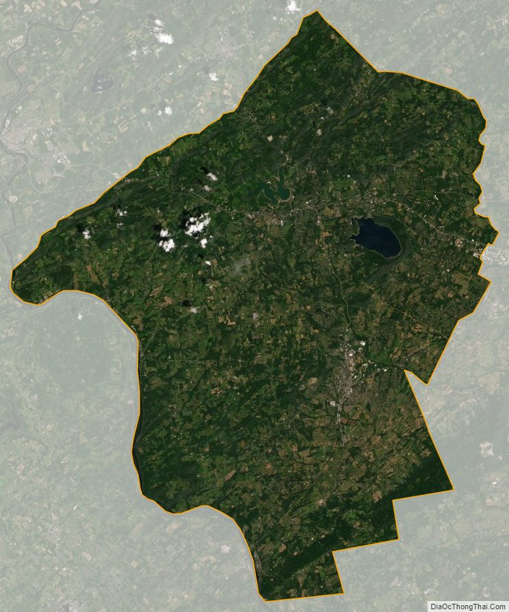
Hunterdon County Satellite Map
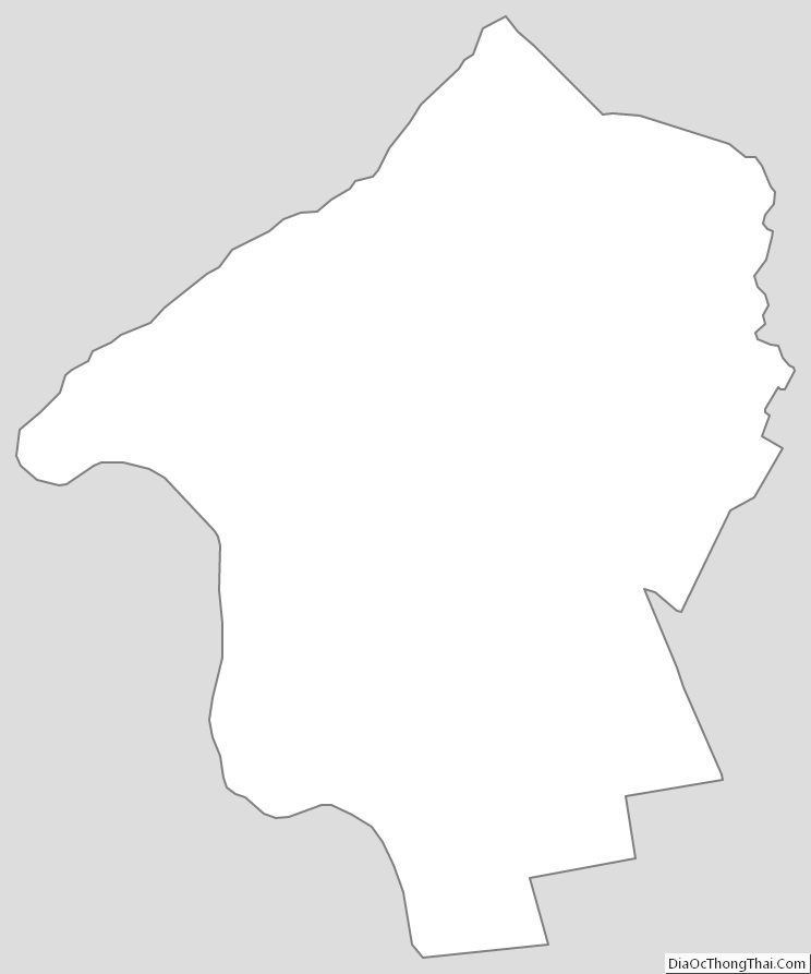
Hunterdon County Outline Map