| Name: | Atlantic County |
|---|---|
| FIPS code: | 34-001 |
| State: | New Jersey |
| Founded: | 1837 |
| Named for: | Atlantic Ocean |
| Seat: | Mays Landing |
| Total Area: | 671.83 sq mi (1,740.0 km²) |
| Land Area: | 555.70 sq mi (1,439.3 km²) |
| Total Population: | 274,534 |
| Population Density: | 494.2/sq mi (190.8/km²) |
| Website: | www.atlantic-county.org |
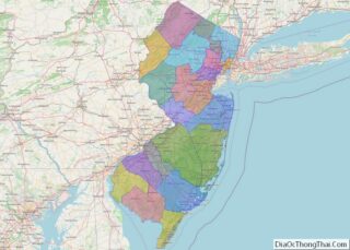
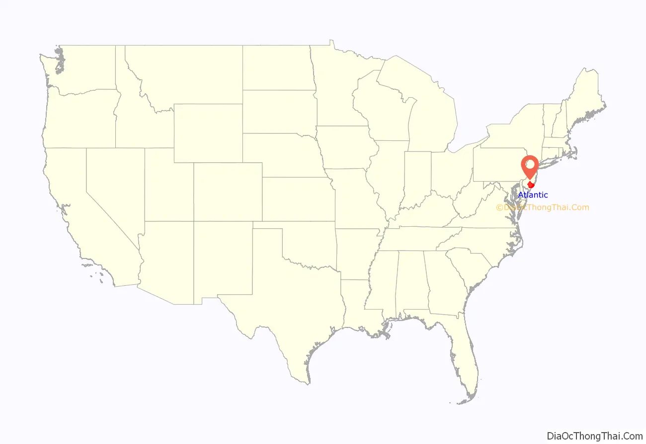
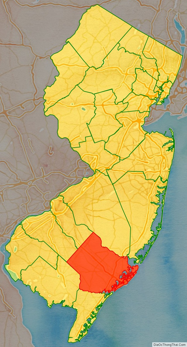
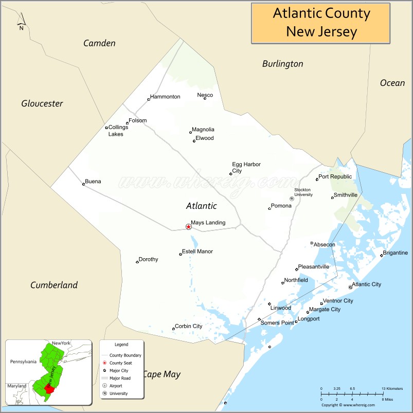
Atlantic County location map. Where is Atlantic County?
History
Etymology
The county was named after the Atlantic Ocean, which borders the county’s eastern coast.
History
Since the 6th millennium BC, Native American people have inhabited New Jersey. By the 17th century, the Absegami tribe of the Unalachtigo Lenape tribe – “people near the ocean” – stayed along the streams and back bays of what is now Atlantic County. The group referred to the broader area as Scheyichbi – “land bordering the ocean”. European settlement by the Dutch, Sweden, and England contributed to the demise of the indigenous people. In 1674, West Jersey was established, and its provincial government designated the court of Burlington County in 1681, splitting off Gloucester County five years later from the southern portion. This county was bounded by the Mullica River to the north, the Atlantic Ocean to the east, and the Great Egg Harbor River and Tuckahoe River to the south. Great Egg Harbour Township, also called New Weymouth and later just Egg Harbor, was designated in 1693 from the eastern portions of Gloucester County.
The region’s early Europeansettlers, many of them Quakers, lived along the area’s waterways. In 1695, John Somers purchased 300 acres (120 ha) of land on the northern shore of the Great Egg Harbor Bay in 1695, the same year he began ferry service across the bay to Cape May County. His son, Richard, built Somers Mansion between 1720 and 1726, which is the oldest home in existence in the county. Daniel Leeds first surveyed the coastal waters of Egg Harbor in 1698, eventually finding Leeds Point. In 1735 according to folklore, Mother Leeds gave birth and cursed her 13th child in Leeds Point, which became known as the Jersey Devil. In the early 18th century, George May founded Mays Landing.
In 1774, the northern portion of Egg Harbor Township became Galloway Township. In 1785, residents in what is now Atlantic County requested to split from Gloucester County to the New Jersey legislature, wanting a local court. Mays Landing – the region’s largest community at the time, had more saloons than churches. Criminals could escape custody before reaching Gloucester City on a four-day wagon ride. In 1798, the western portion split off to become Weymouth Township, and in 1813, the northwestern portion partitioned to become Hamilton Township. On February 7, 1837, the New Jersey legislature designated Atlantic County from Galloway, Hamilton, Weymouth, and Egg Harbor townships, choosing Mays Landing as the county seat. In the same year, the Board of Freeholders was established as the county government. As of the 1830 census, the townships making up Atlantic County only had a population of 8,164, making it the least populated New Jersey county. By that time, a continuous line of houses extended from Somers Point to Absecon.
Mullica Township was established from Galloway Township in 1837. In 1852, Dr. Jonathan Pitney recommended Absecon Island as a health resort, and formed the Camden and Atlantic Railroad Company to construct the line from Camden to the coast. The company purchased land from Atlantic and Galloway Townships in 1853, then promoted and sold the lots. Atlantic City formed on May 1, 1854, in advance of the rail line opening on July 4 of that year. In 1858, Egg Harbor City was formed from portions of Galloway and Mullica townships. In 1866, Hammonton was founded from Hamilton and Mullica townships. A year later, portions of Hamilton Township split off to become Buena Vista Township. In 1872, Absecon was split from portions of Egg Harbor and Galloway townships. By 1885, more than half of the county’s population lived in Atlantic City, and by 1910 this more than two-thirds of the county lived there.
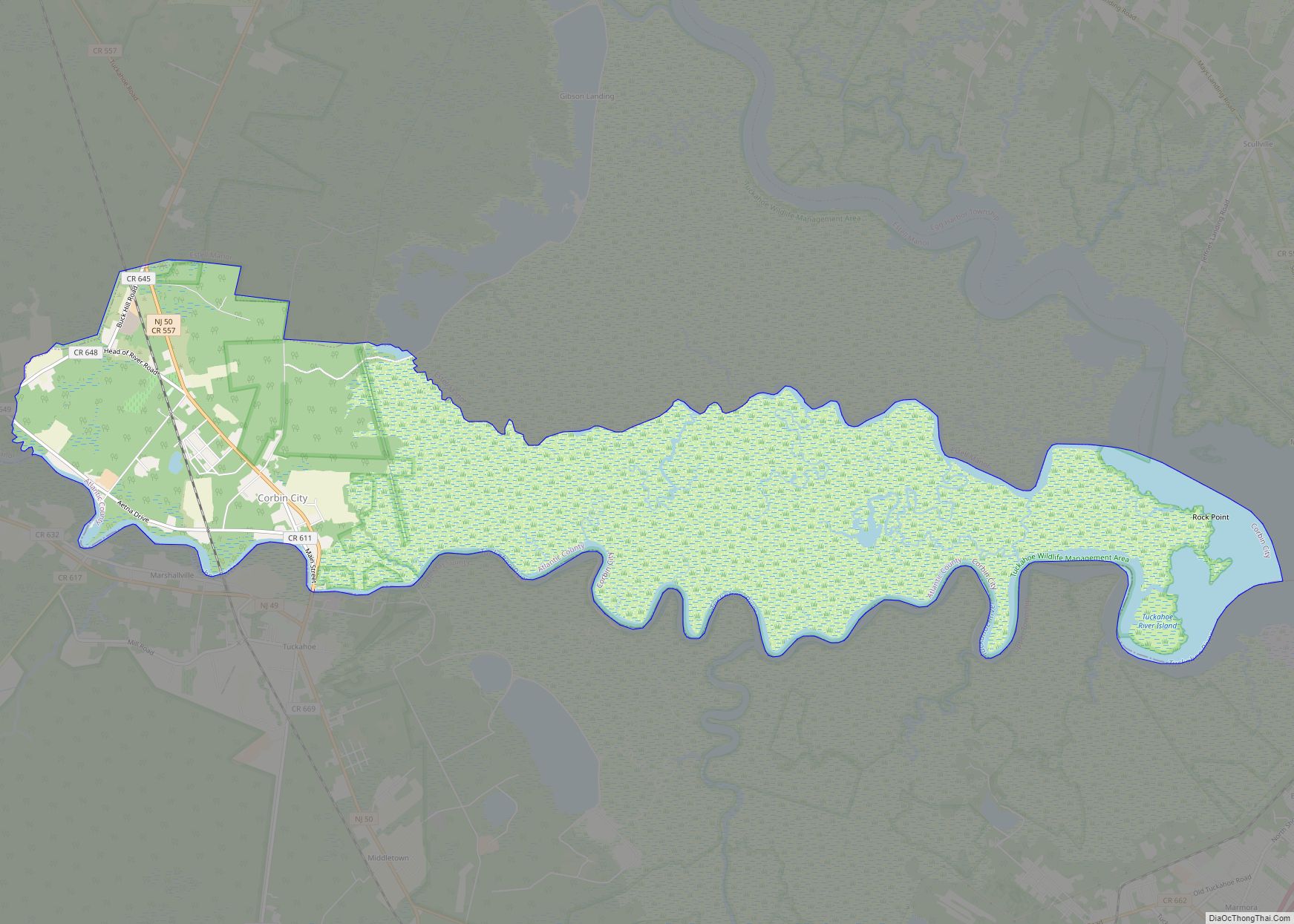
With more people moving to the area in the late 1800s into the early 1900s, several municipalities were created in short succession – Margate City (then called South Atlantic City) in 1885, Somers Point in 1886, Pleasantville and Linwood in 1889, Brigantine in 1890, Longport in 1898, Ventnor in 1903, Northfield and Port Republic in 1905, and Folsom in 1906. On May 17, 1906, the eastern coastal boundary of Atlantic County was established. The final municipalities in the county to be created were Corbin City from Weymouth Township in 1922, Estell Manor from Weymouth Township in 1925, and Buena from Buena Township in 1948. In 1938, the county’s western border was clarified with Camden and Burlington counties using geographic coordinates. After a peak in prominence in the 1920s during the prohibition era, Atlantic City began declining in population in the 1950s as tourism declined. The county’s growth shifted to the mainland.
In 1973, the New Jersey Coastal Area Facilities Review Act required additional state permitting for construction in the eastern half of the county. In the same ballot as the 1976 presidential election, 56.8% of New Jersey voters approved an initiative to allow legalized gambling in Atlantic City. Two years later, Resorts Atlantic City opened as the first casino in the city, and there were 15 by 1990. Since then, five have closed, including four in 2014, while two casinos – the Borgata and Ocean Resort Casino – have opened. Hard Rock Hotel & Casino Atlantic City opened in 2018, refurbishing the former Trump Taj Mahal. In 1978, Congress created the Pinelands National Reserve, which created the Pinelands Commission and a management policy for the seven counties in the Pine Barrens, including Atlantic County. Concurrent with the 1980 Presidential election, Atlantic County residents voted in favor to create a new state of South Jersey, along with five other counties in a nonbinding referendum.
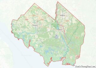
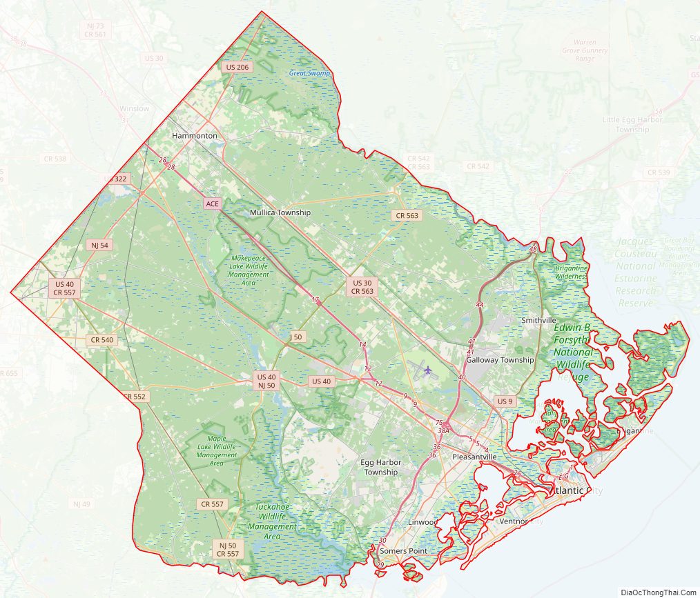
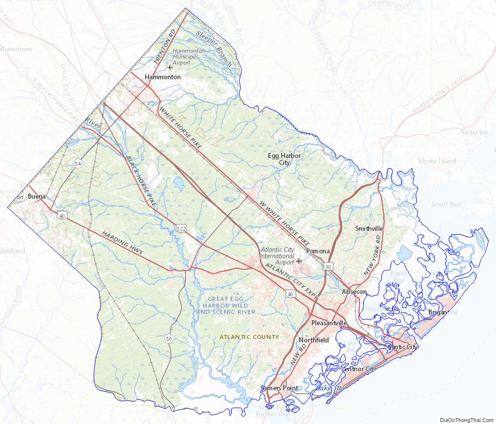
Atlantic County Road Map
Geography
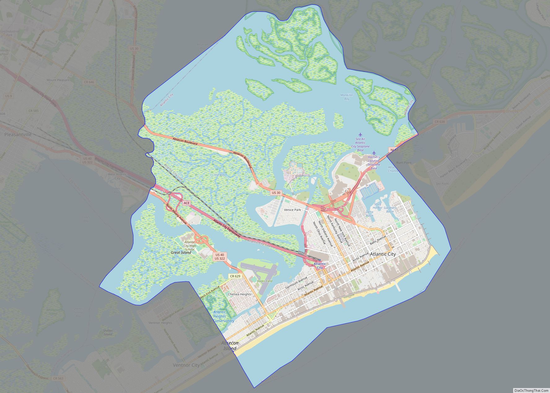
Atlantic County is located about 100 miles (160 km) south of New York City and about 60 miles (97 km) southeast of Philadelphia. It is roughly 30 mi (48 km) in width by 20 mi (32 km) in height. According to the 2010 Census, the county had a total area of 671.83 square miles (1,740.0 km), including 555.70 square miles (1,439.3 km) of land (82.7%) and 116.12 square miles (300.7 km) of water (17.3%). It is the third largest county in New Jersey, behind Ocean County and Burlington County.
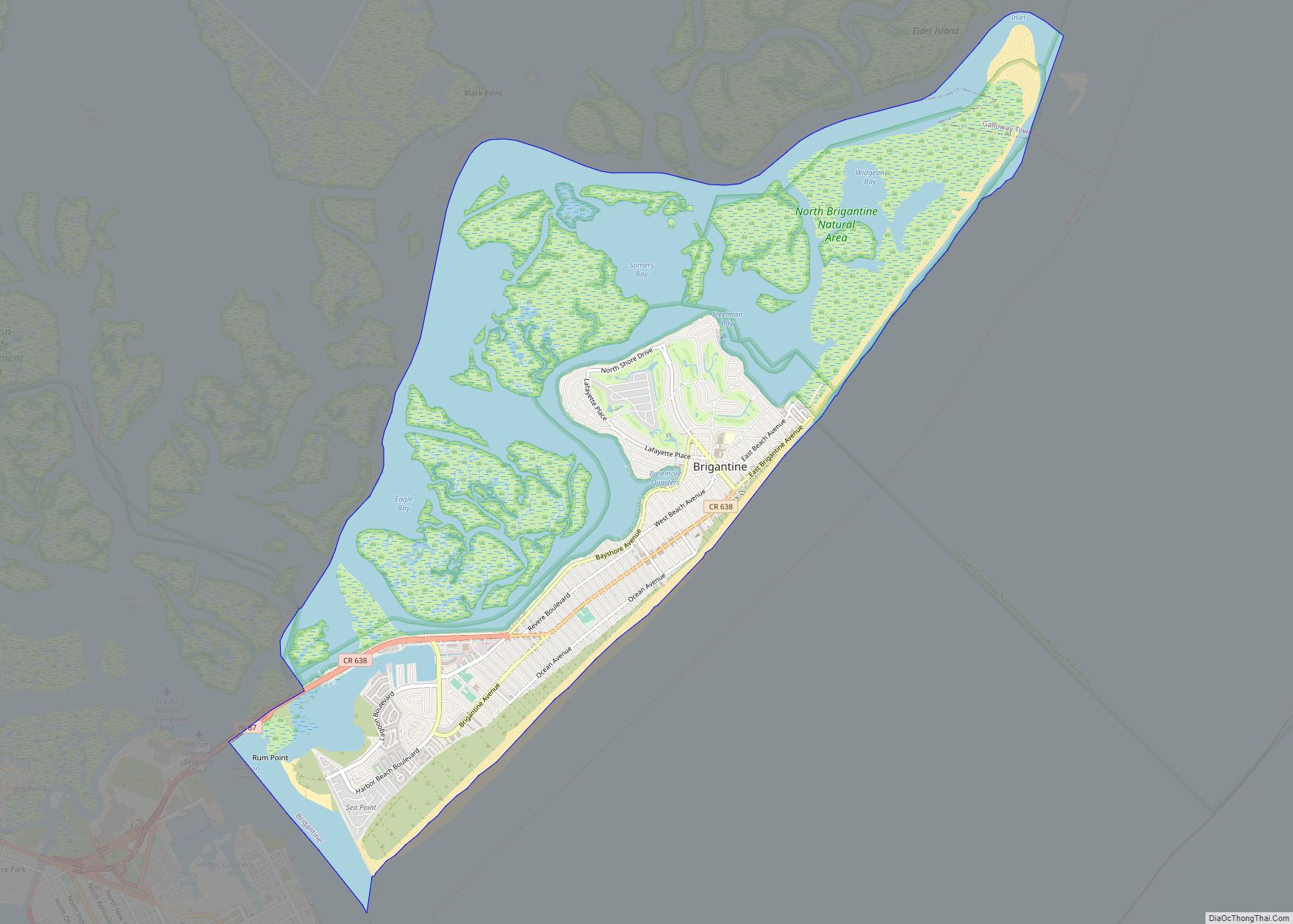
The county lies along the Atlantic Coastal Plain, with sea level and the Atlantic Ocean to the east. Adjacent to the coast are three barrier islands – Absecon Island (Which contains Atlantic City, Ventnor, Margate, and Longport), Brigantine Island, and Little Beach. To the west of the barrier islands, 4 mi (6 km) stretch of marshlands, inlets, and waterways connect and form the Intracoastal Waterway. Beneath the county is a mile of clay and sand that contains the Kirkwood–Cohansey aquifer, which supplies fresh groundwater for all of the streams and rivers in the region. The interior of the county is part of the Pine Barrens, which covers the southern third of New Jersey, and is prone to forest fires. Lowland areas are swampy and contain pitch pine or white cedar trees. Upland areas in the west of the county are hilly, containing oak and pine trees. The highest elevation in the county – about 150 ft (46 m) above sea level – is found near the border with Camden County, on the west side of Hammonton. The county’s western boundary with Burlington and Camden counties, clarified in 1761, is a manmade line about halfway between the Atlantic Ocean and the Delaware Bay.
Climate
In recent years, average temperatures in the county seat of Mays Landing have ranged from a low of 24 °F (−4 °C) in January to a high of 86 °F (30 °C) in July, although a record low of −11 °F (−24 °C) was recorded in February 1979 and a record high of 106 °F (41 °C) was recorded in June 1969. Average monthly precipitation ranged from 2.99 inches (76 mm) in February to 4.21 inches (107 mm) in March.
The county has a humid subtropical climate (Cfa). Average monthly temperatures in central Atlantic City range from 33.9 °F (1.1 °C) in January to 75.2 °F (24.0 °C) in July, while in Folsom they range from 32.7 °F (0.4 °C) in January to 76.3 °F (24.6 °C) in July.
In December 1992, a nor’easter produced the highest tide on record in Atlantic City, 9.0 ft (2.7 m) above mean lower low water. Former Hurricane Sandy struck near Brigantine as an extratropical cyclone, which produced an all-time minimum barometric pressure of 948.5 mbar (28.01 inHg) and wind gusts to 91 mph (146 km/h) in Atlantic City, as well as a storm surge that inundated low-lying areas. Three people died in the county during the storm, and damage was estimated at $300 million (2012 USD).
Atlantic County Topographic Map
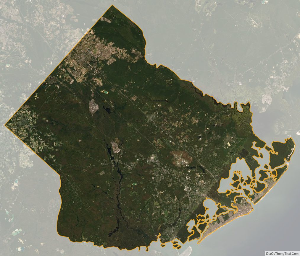
Atlantic County Satellite Map
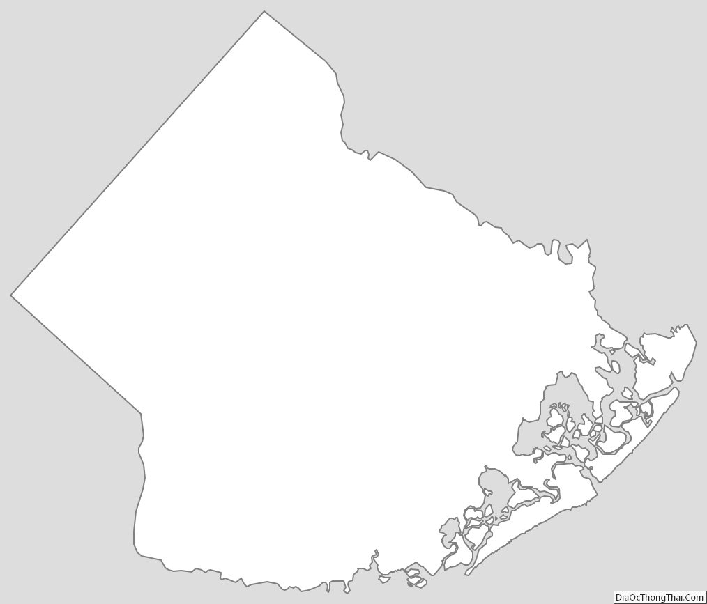
Atlantic County Outline Map