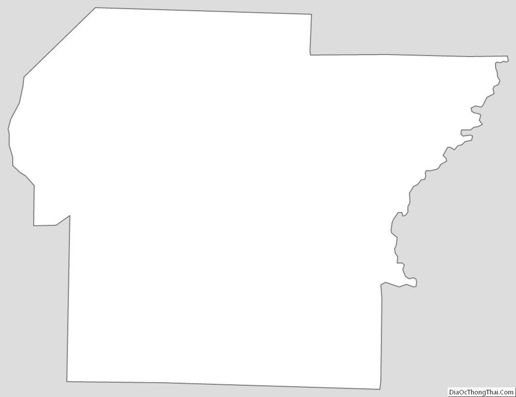
Independence County is a county located in the U.S. state of Arkansas. As of the 2020 census, the population was 37,938. The county seat is Batesville. Independence County is Arkansas’s ninth county, formed on October 20, 1820, from a portion of Lawrence County and named in commemoration of the Declaration of Independence. It is an alcohol prohibition or dry county.
The Batesville, AR Micropolitan Statistical Area includes all of Independence County.
| Name: | Independence County |
|---|---|
| FIPS code: | 05-063 |
| State: | Arkansas |
| Founded: | October 20, 1820 |
| Named for: | United States Declaration of Independence |
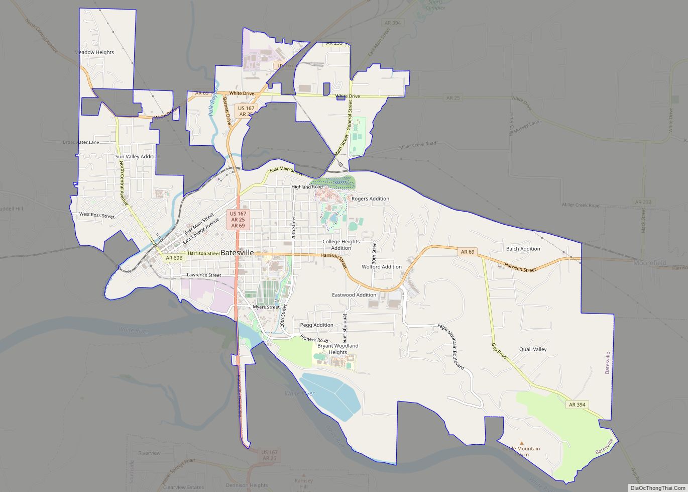
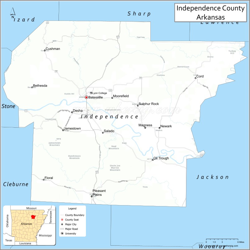
| Seat: | Batesville |
| Largest city: | Batesville |
| Total Area: | 772 sq mi (2,000 km²) |
| Land Area: | 764 sq mi (1,980 km²) |
| Total Population: | 37,938 |
| Population Density: | 49/sq mi (19/km²) |
| Time zone: | UTC−6 (Central) |
| Summer Time Zone (DST): | UTC−5 (CDT) |
| Website: | www.independencecounty.com |
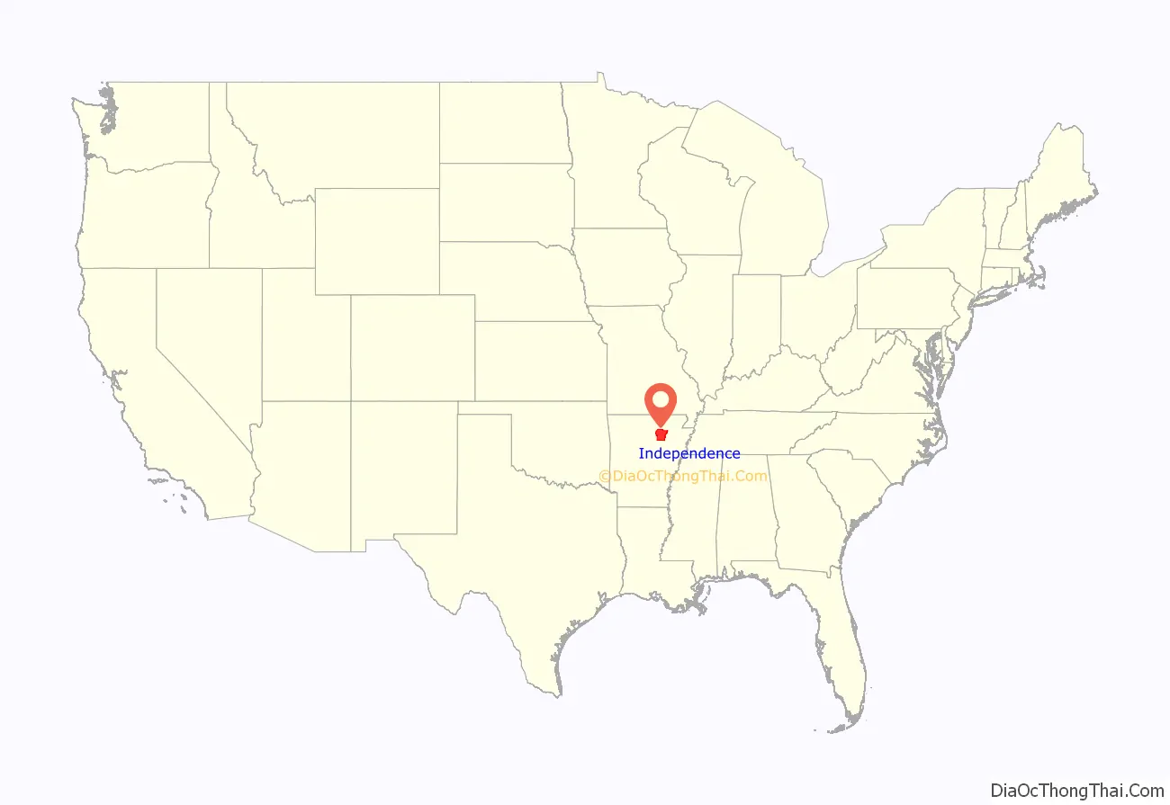
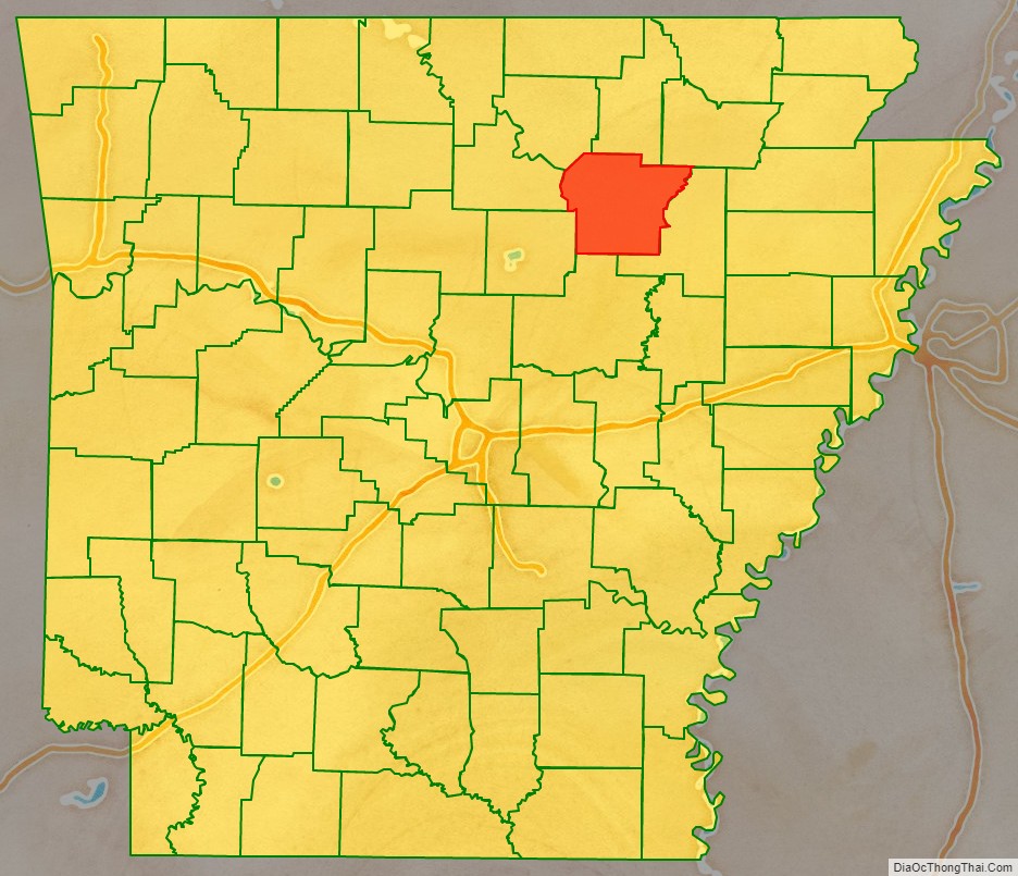
Independence County location map. Where is Independence County?
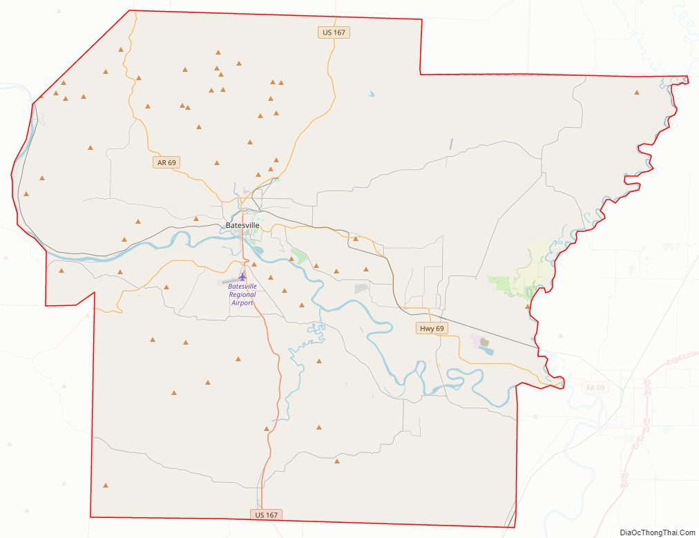
Independence County Road Map
Geography
According to the U.S. Census Bureau, the county has a total area of 772 square miles (2,000 km), of which 764 square miles (1,980 km) is land and 7.6 square miles (20 km) (1.0%) is water.
List of highways
- U.S. Highway 167
- Arkansas Highway 14
- Arkansas Highway 25
- Arkansas Highway 37
- Arkansas Highway 69
- Arkansas Highway 69 Business
- Arkansas Highway 87
- Arkansas Highway 106
- Arkansas Highway 122
- Arkansas Highway 157
- Arkansas Highway 230
- Arkansas Highway 233
- Arkansas Highway 333
- Arkansas Highway 367
- Arkansas Highway 394
Adjacent counties
- Sharp County (north)
- Lawrence County (northeast)
- Jackson County (east)
- White County (south)
- Cleburne County (southwest)
- Stone County (west)
- Izard County (northwest)
Independence County Topographic Map
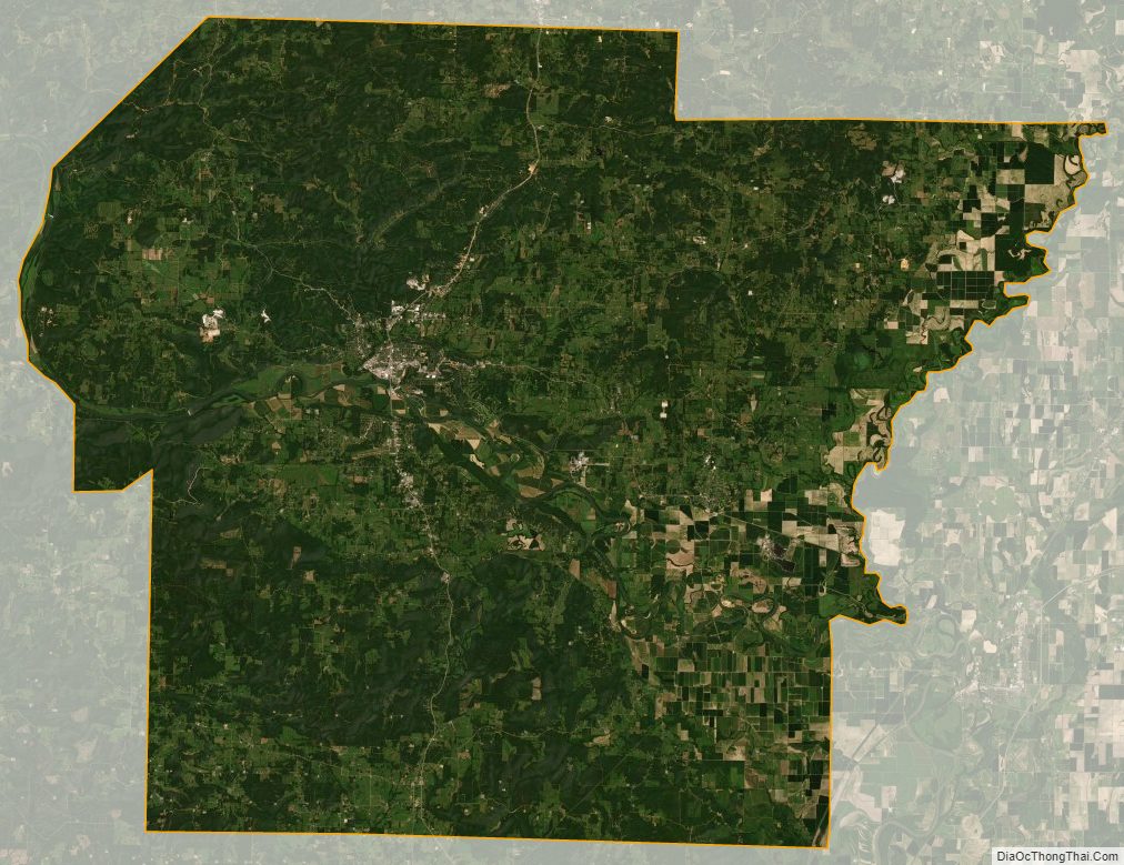
Independence County Satellite Map
Independence County Outline Map