Ivano-Frankivsk Oblast (Ukrainian: Іва́но-Франкі́вська о́бласть, romanized: Ivano-Frankivska oblast), also referred to as Ivano-Frankivshchyna (Іва́но-Франкі́вщина), is an oblast (region) in western Ukraine. Its administrative center is the city of Ivano-Frankivsk. As is the case with most other oblasts of Ukraine this region has the same name as its administrative center – which was renamed by the Soviet Ukrainian authorities after the Ukrainian writer Ivan Franko on 9 November 1962. It has a population of 1,351,822 (2022 est.).
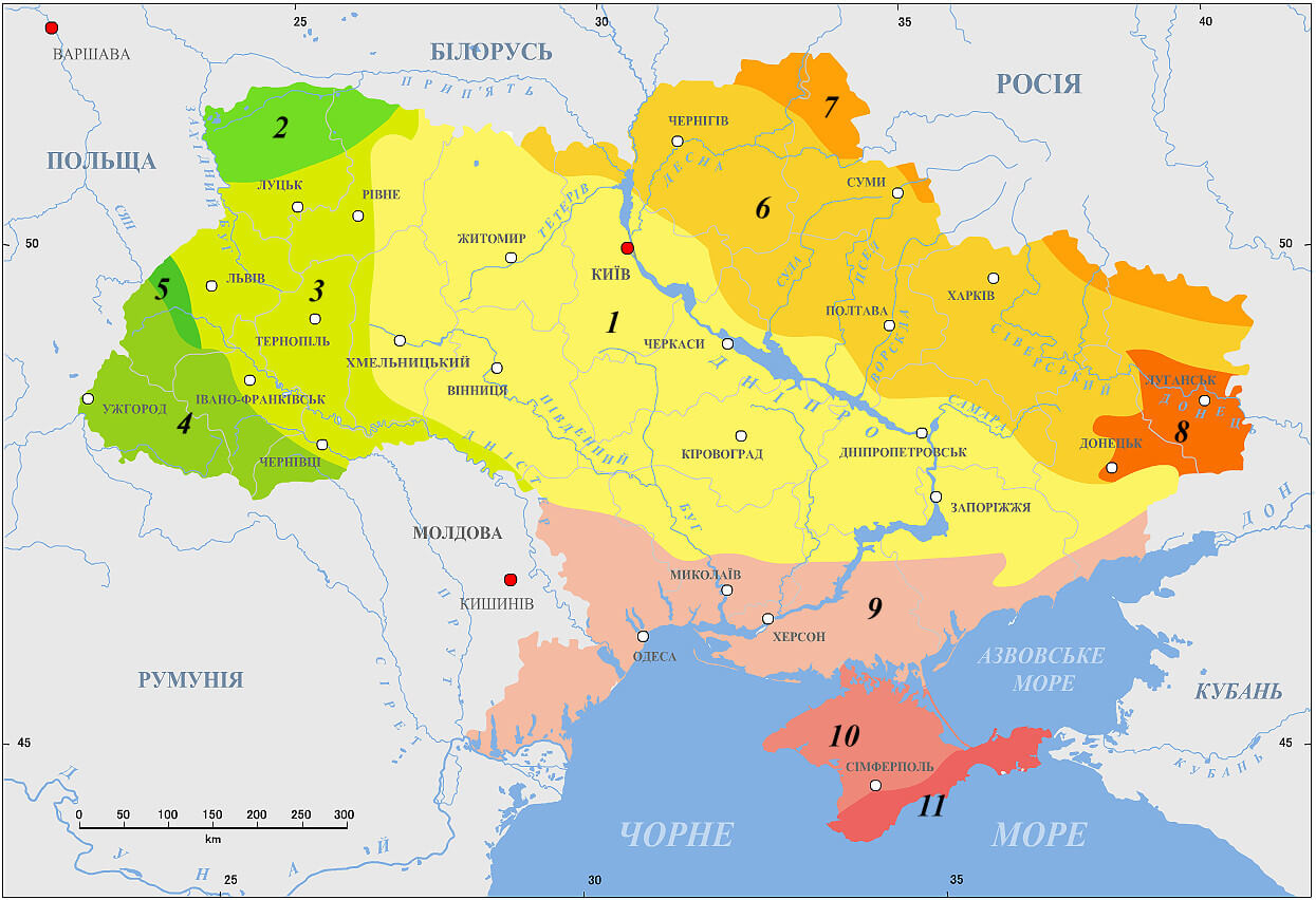
Ivano-Frankivsk Oblast is also known to Ukrainians by a deep-rooted alternative name: Prykarpattia (although some sources may also consider the southern Lviv Oblast including such cities as Stryi, Truskavets, and Drohobych, as also part of Prykarpattia). Prykarpattia, together with Lviv and Ternopil regions, was the main body of the historic region of eastern Halychyna; which in the 13th century was a part of the Kingdom of Rus and the Halych-Volyn Principality (see Kingdom of Galicia–Volhynia). Along with the Lviv and Ternopil regions Prykarpattia is a component of the Carpathian Euroregion.
During the times of the Second Polish Republic the area was known as Stanisławów Voivodeship (1918–1939) and later, after the Soviet invasion of Poland, as Stanislav Oblast (1939–1962). During World War II it was part of the District of Galicia in General Governorate. Until the 20th century the major center of the region was the city of Kolomyia (which is a major cultural center of Pokuttya, the traditional name for the southern part of the oblast).
| Unit Name | Ivano-Frankivs'k Oblast |
|---|---|
| Administrative center | Ivano-Frankivsk |
| Major cities | Ivano-Frankivsk, Kalush, Kolomyia |
| Total area | 13.900 km² (5.400 sq mi) |
| Area Rank | Rank 22th |
| Population (2021) | 1.361.109 |
| Time zone | UTC+2 (EET) |
| Summer (DST) | UTC+3 (EEST) |
| Postal code | 76-78xxx |
| Area code | +380-34 |
| ISO 3166 code | UA-26 |
| Website | www.if.gov.ua www.rada.gov.ua |
| Flag |  |
| Coat of arms | 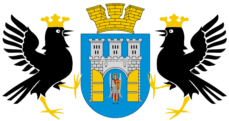 |
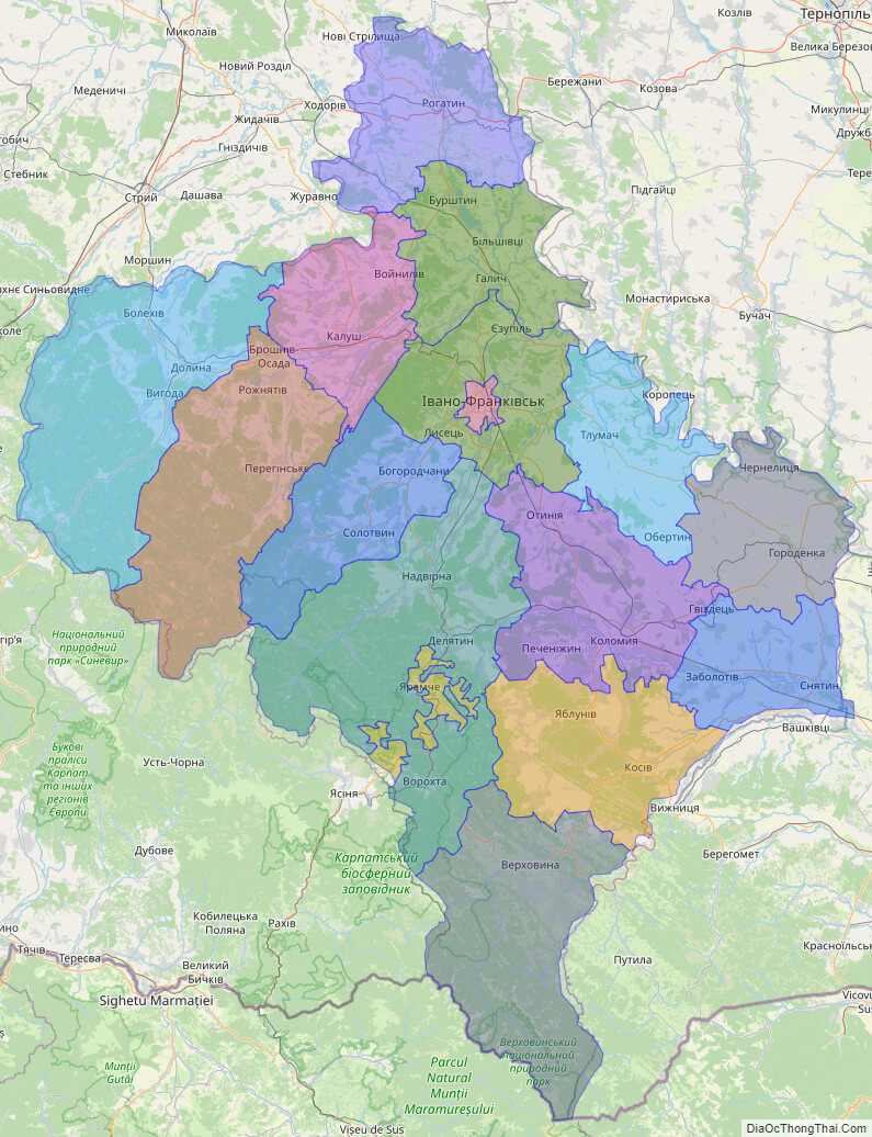
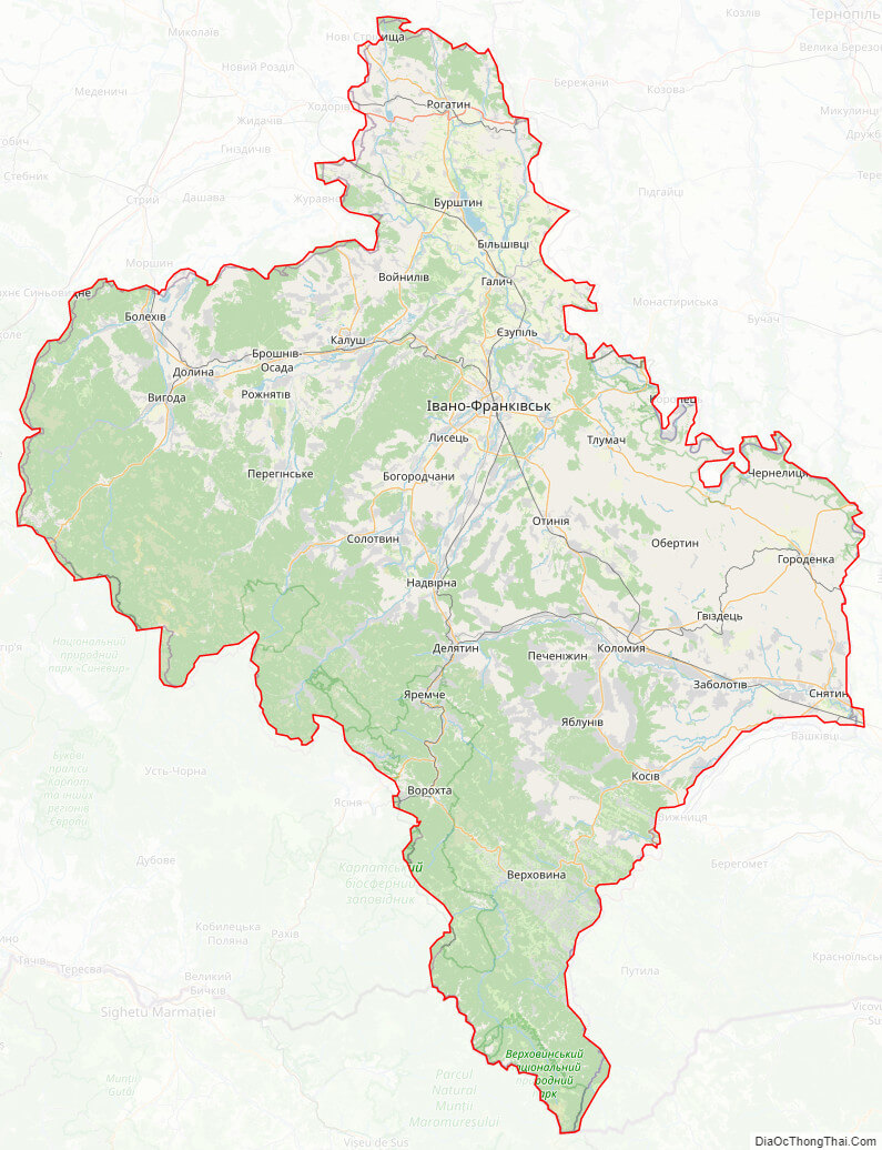
Online subdivision map of Ivano-Frankivs’k oblast
If you’re looking for an easy way to explore the different sub-administrative units of Ivano-Frankivs’k oblast in Ukraine, then look no further than the online subdivision map! This map allows you to see the different areas of the oblast in great detail, with a range of base maps to choose from including satellite imagery and OpenStreetMap.
With the cover layer, you can easily distinguish between the different sub-administrative units, each of which is color-coded for easy reference. Whether you’re interested in the cities or the rural areas, this map allows you to zoom in and out to see the details of the streets, buildings, and other landmarks.
Whether you’re a local resident or a visitor to Ivano-Frankivs’k oblast, the online subdivision map is an invaluable tool for exploring the area and getting a sense of the different regions within the oblast. So why not check it out today and see what you can discover about this fascinating corner of Ukraine?
Click on ![]() to view map in "full screen" mode.
to view map in "full screen" mode.
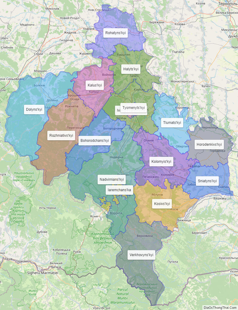
List administrative sub-division of Ivano-Frankivs’k oblast
| # | Name | Type |
|---|---|---|
| 1 | Iaremchans’ka | Mis’ka Rada |
| 2 | Ivano-Frankivs’ka | Mis’ka Rada |
| 3 | Bohorodchans’kyi | Raion |
| 4 | Dolyns’kyi | Raion |
| 5 | Halyts’kyi | Raion |
| 6 | Horodenkivs’kyi | Raion |
| 7 | Kalus’kyi | Raion |
| 8 | Kolomyis’kyi | Raion |
| 9 | Kosivs’kyi | Raion |
| 10 | Nadvirnians’kyi | Raion |
| 11 | Rohatyns’kyi | Raion |
| 12 | Rozhniativs’kyi | Raion |
| 13 | Sniatyns’kyi | Raion |
| 14 | Tlumats’kyi | Raion |
| 15 | Tysmenyts’kyi | Raion |
| 16 | Verkhovyns’kyi | Raion |
Explaination:
- Mis’ka Rada: City municipalities (governed by a mayor and a city council)
- Misto: city at least 10,000 people (not a town).
- Raion: often translated as “district”.
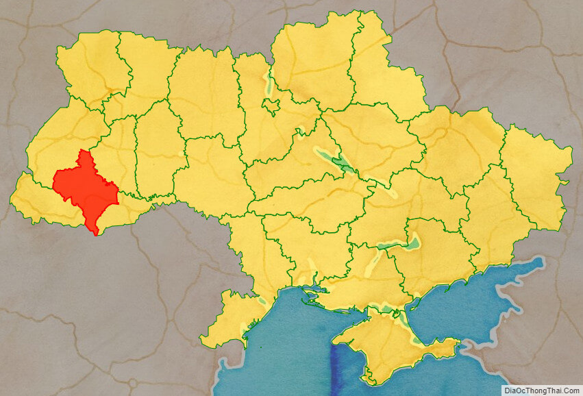
Location map of Ivano-Frankivs’k oblast, Ukraine

Political map of Ivano-Frankivs’k oblast
Detail map of Ivano-Frankivs’k oblast
Ivano-Frankivs’k oblast streeet map
Ivano-Frankivs’k oblast satellite map


