Dublin (Irish: Baile Átha Cliath) is a city in Laurens County, Georgia, United States. As of the 2020 census, the city had a population of 16,074. It is the county seat of Laurens County.
| Name: | Dublin city |
|---|---|
| LSAD Code: | 25 |
| LSAD Description: | city (suffix) |
| State: | Georgia |
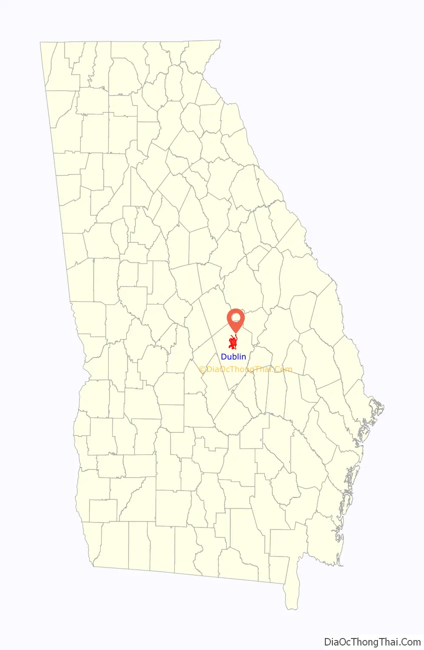
| County: | Laurens County |
| Elevation: | 223 ft (68 m) |
| Total Area: | 16.06 sq mi (41.59 km²) |
| Land Area: | 15.96 sq mi (41.35 km²) |
| Water Area: | 0.09 sq mi (0.24 km²) |
| Total Population: | 16,074 |
| Population Density: | 1,006.89/sq mi (388.76/km²) |
| ZIP code: | 31021, 31027, 31040 |
| Area code: | 478 |
| FIPS code: | 1324376 |
| GNISfeature ID: | 0313692 |
| Website: | www.cityofdublin.org |
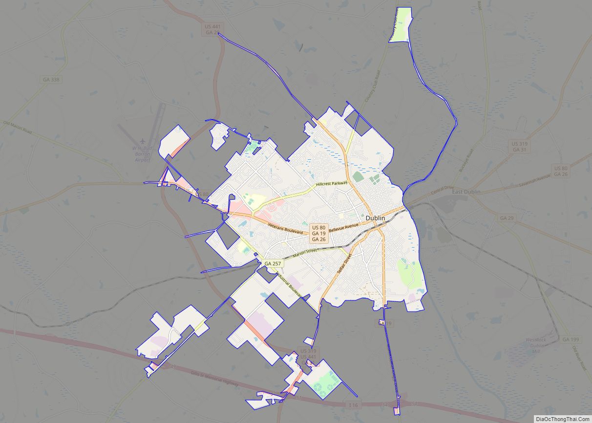
Online Interactive Map
Click on ![]() to view map in "full screen" mode.
to view map in "full screen" mode.
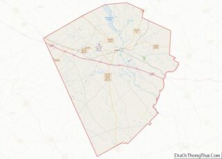
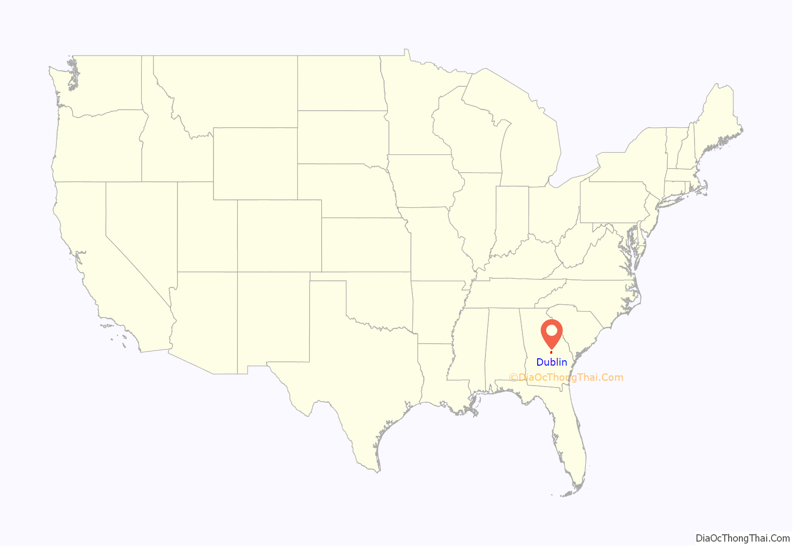
Dublin location map. Where is Dublin city?
History
The original settlement was named after Dublin, Ireland.
Dublin, according to a historical marker at the town’s main Oconee River bridge, was one of the last encampments at which Confederate President Jefferson Davis and his family stayed before being captured by Union forces in May 1865.
In the Dublin riot of July 1919 there were a series of violent racial riots between white and black members of the community. These were part of a larger series of racial violence during the 1919 Red Summer.
On April 17, 1944, Martin Luther King Jr. gave his first public speech, “The Negro and the Constitution” at First African Baptist Church in Dublin.
Dublin Road Map
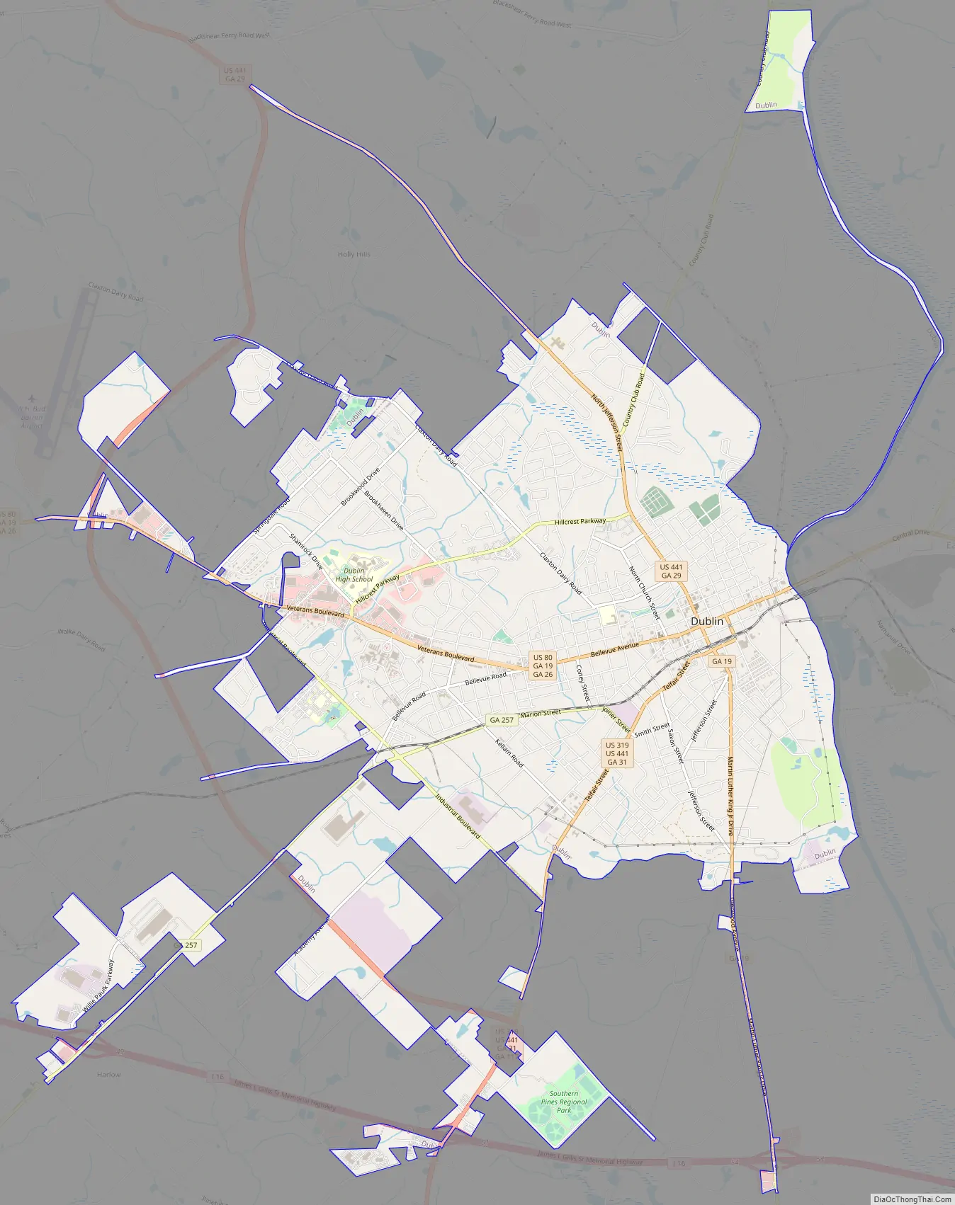
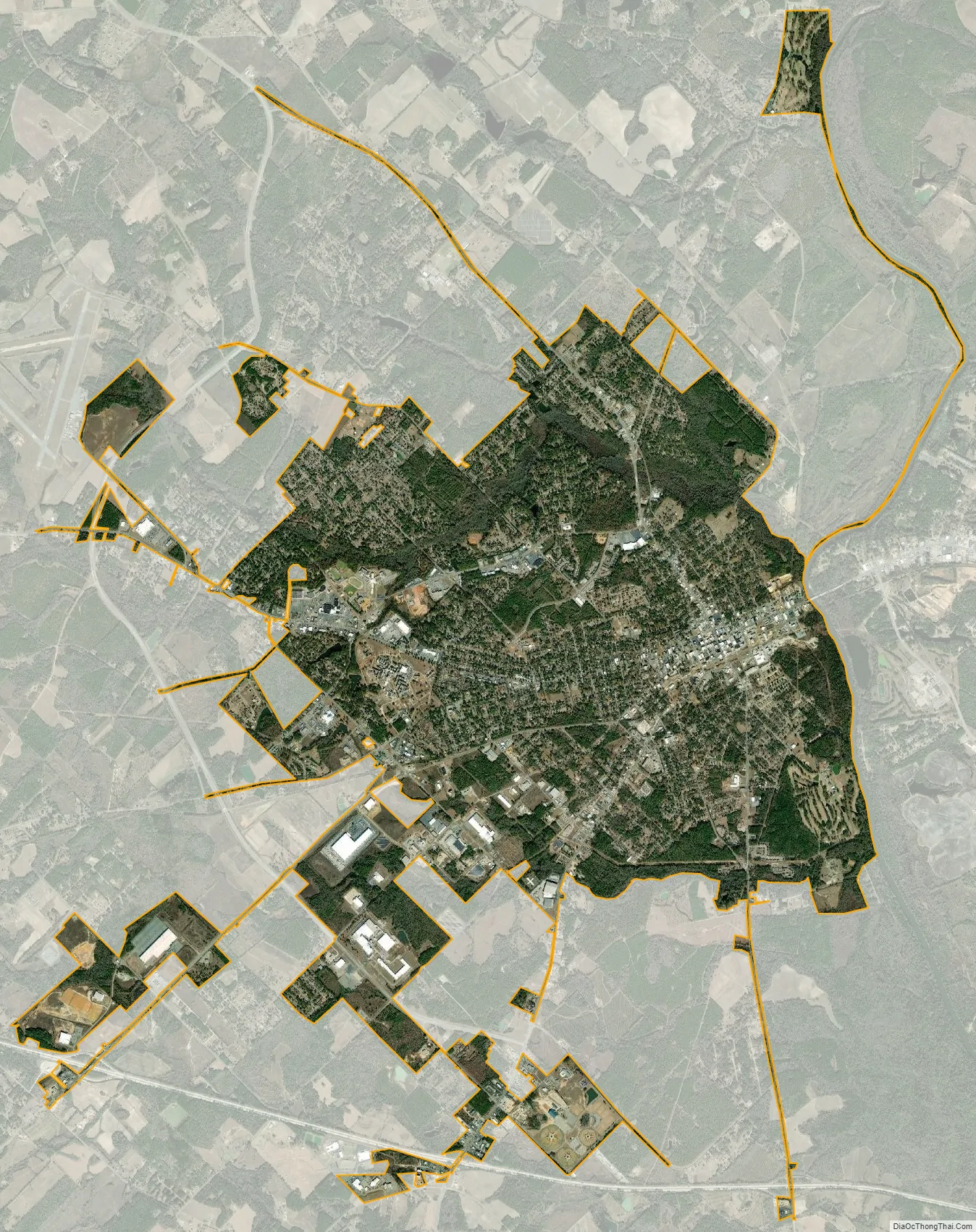
Dublin city Satellite Map
Geography
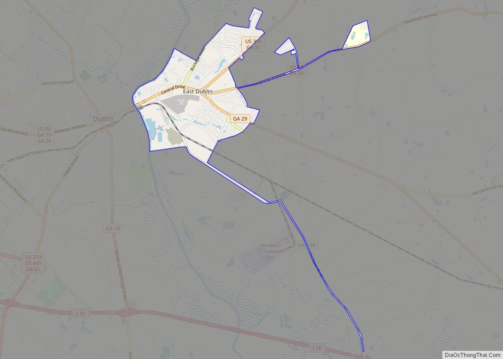
Dublin is located in north-central Laurens County. The town, named such because the Middle Georgia Piedmont reminded Irish settlers of terrain in their native country, was founded on the Oconee River, which starts in the foothills of the Blue Ridge Mountains in northern Georgia before combining with the Ocmulgee River to form the Altamaha, a river which then proceeds to its mouth on the Atlantic Ocean. The Oconee forms the eastern boundary of Dublin, separating it from the city of East Dublin.
According to the United States Census Bureau, the town has a total area of 16.0 square miles (41.5 km), of which 15.9 square miles (41.2 km) are land and 0.09 square miles (0.24 km), or 0.59%, are water.
Location
The city is located in the central part of the state along Interstate 16. Access to the city can be found from exits 49, 51, 54, and 58. Via I-16, Savannah is 117 miles (188 km) east, and Macon is 53 miles (85 km) northwest. US routes 80, 319, and 441 also run through the city. US 441 connects the city to Milledgeville, 47 miles (76 km) northwest, and McRae–Helena, 35 miles (56 km) south. Numerous state and local highways also run through the city.
Historic districts
Dublin has two historic districts designated by the National Register of Historic Places: the Dublin Commercial Historic District and the Stubbs Park–Stonewall Street Historic District. The Dublin Commercial Historic District consists of the original downtown commercial core, including the earliest extant building in the district: the Hicks Building, dating to 1893. The historic district contains 78 contributing properties, including the Dublin Carnegie Library First National Bank Building, and the former United States Post Office building. Structures within the district represent a wide range of architectural styles, including Colonial Revival, Neoclassical, Commercial, and Art Deco.
The Stubbs Park-Stonewall Street Historic District is located west of Dublin’s central business district. The district contains 470 contributing properties, most of which are residential homes constructed between the late 1910s to the early 1940s. The predominant architectural styles of the area consist of Craftsman, Gothic Revival, Folk Victorian, and Georgian Cottage. In addition to historic residences, the district contains properties including historic churches, historic cemeteries, and Dublin’s first public park, Stubbs Park.
Climate
See also
Map of Georgia State and its subdivision:- Appling
- Atkinson
- Bacon
- Baker
- Baldwin
- Banks
- Barrow
- Bartow
- Ben Hill
- Berrien
- Bibb
- Bleckley
- Brantley
- Brooks
- Bryan
- Bulloch
- Burke
- Butts
- Calhoun
- Camden
- Candler
- Carroll
- Catoosa
- Charlton
- Chatham
- Chattahoochee
- Chattooga
- Cherokee
- Clarke
- Clay
- Clayton
- Clinch
- Cobb
- Coffee
- Colquitt
- Columbia
- Cook
- Coweta
- Crawford
- Crisp
- Dade
- Dawson
- Decatur
- DeKalb
- Dodge
- Dooly
- Dougherty
- Douglas
- Early
- Echols
- Effingham
- Elbert
- Emanuel
- Evans
- Fannin
- Fayette
- Floyd
- Forsyth
- Franklin
- Fulton
- Gilmer
- Glascock
- Glynn
- Gordon
- Grady
- Greene
- Gwinnett
- Habersham
- Hall
- Hancock
- Haralson
- Harris
- Hart
- Heard
- Henry
- Houston
- Irwin
- Jackson
- Jasper
- Jeff Davis
- Jefferson
- Jenkins
- Johnson
- Jones
- Lamar
- Lanier
- Laurens
- Lee
- Liberty
- Lincoln
- Long
- Lowndes
- Lumpkin
- Macon
- Madison
- Marion
- McDuffie
- McIntosh
- Meriwether
- Miller
- Mitchell
- Monroe
- Montgomery
- Morgan
- Murray
- Muscogee
- Newton
- Oconee
- Oglethorpe
- Paulding
- Peach
- Pickens
- Pierce
- Pike
- Polk
- Pulaski
- Putnam
- Quitman
- Rabun
- Randolph
- Richmond
- Rockdale
- Schley
- Screven
- Seminole
- Spalding
- Stephens
- Stewart
- Sumter
- Talbot
- Taliaferro
- Tattnall
- Taylor
- Telfair
- Terrell
- Thomas
- Tift
- Toombs
- Towns
- Treutlen
- Troup
- Turner
- Twiggs
- Union
- Upson
- Walker
- Walton
- Ware
- Warren
- Washington
- Wayne
- Webster
- Wheeler
- White
- Whitfield
- Wilcox
- Wilkes
- Wilkinson
- Worth
- Alabama
- Alaska
- Arizona
- Arkansas
- California
- Colorado
- Connecticut
- Delaware
- District of Columbia
- Florida
- Georgia
- Hawaii
- Idaho
- Illinois
- Indiana
- Iowa
- Kansas
- Kentucky
- Louisiana
- Maine
- Maryland
- Massachusetts
- Michigan
- Minnesota
- Mississippi
- Missouri
- Montana
- Nebraska
- Nevada
- New Hampshire
- New Jersey
- New Mexico
- New York
- North Carolina
- North Dakota
- Ohio
- Oklahoma
- Oregon
- Pennsylvania
- Rhode Island
- South Carolina
- South Dakota
- Tennessee
- Texas
- Utah
- Vermont
- Virginia
- Washington
- West Virginia
- Wisconsin
- Wyoming