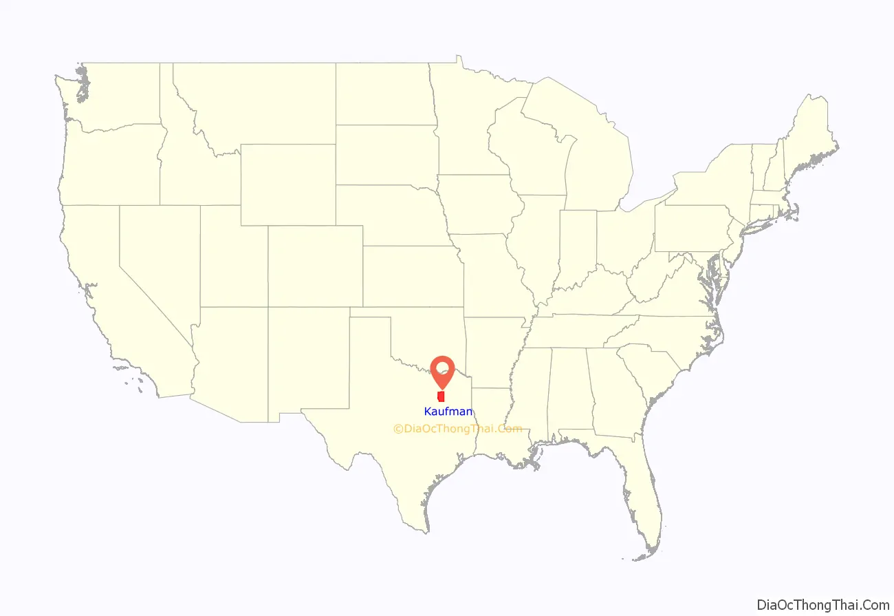
Kaufman County is a county in the northeast area of the U.S. state of Texas. As of the 2020 census, its population was 145,310. Its county seat is Kaufman. Both the county, established in 1848, and the city were named for David S. Kaufman, a U.S. Representative and diplomat from Texas. Kaufman County is part of the Dallas-Fort Worth–Arlington metropolitan statistical area.
Western artist Frank Reaugh moved from Illinois to Kaufman County in 1876. There he was directly inspired for such paintings as The Approaching Herd (1902).
| Name: | Kaufman County |
|---|---|
| FIPS code: | 48-257 |
| State: | Texas |
| Founded: | February 1848 |
| Named for: | David Spangler Kaufman |
| Seat: | Kaufman |
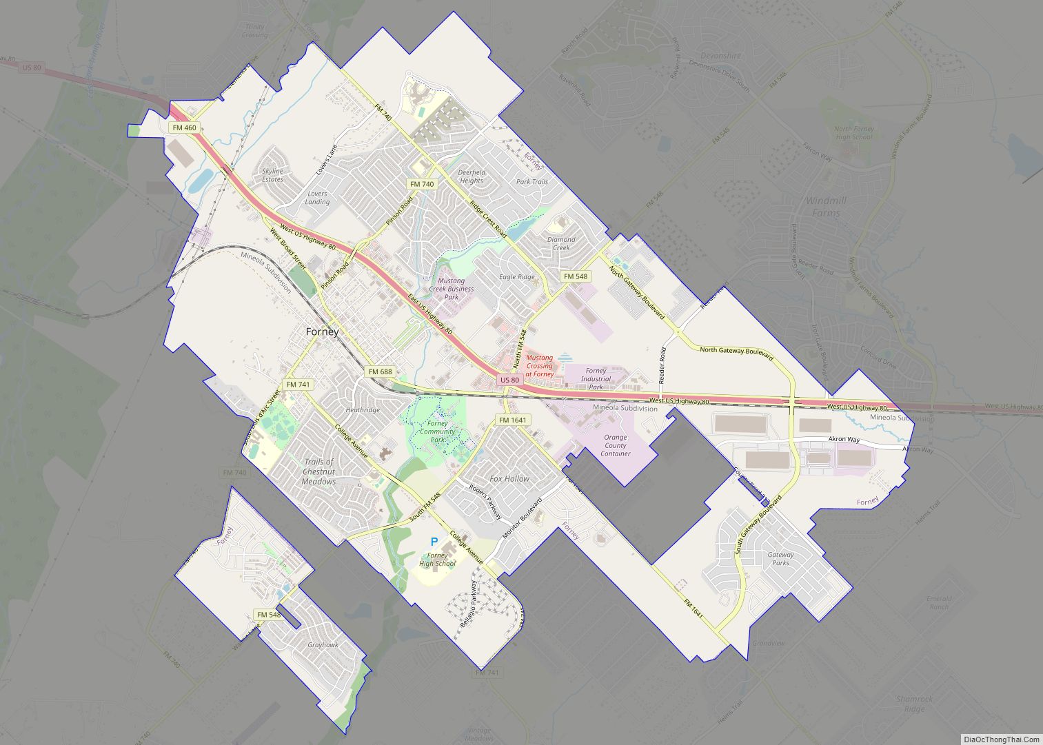
| Largest city: | Forney |
| Total Area: | 808 sq mi (2,090 km²) |
| Land Area: | 781 sq mi (2,020 km²) |
| Total Population: | 145,310 |
| Population Density: | 180/sq mi (70/km²) |
| Time zone: | UTC−6 (Central) |
| Summer Time Zone (DST): | UTC−5 (CDT) |
| Website: | www.kaufmancounty.net |
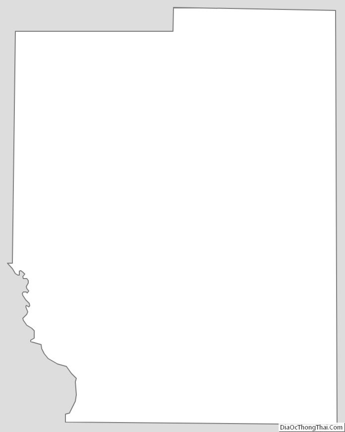
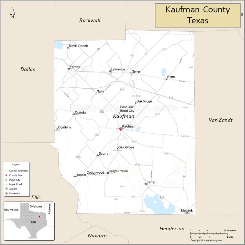
Kaufman County location map. Where is Kaufman County?
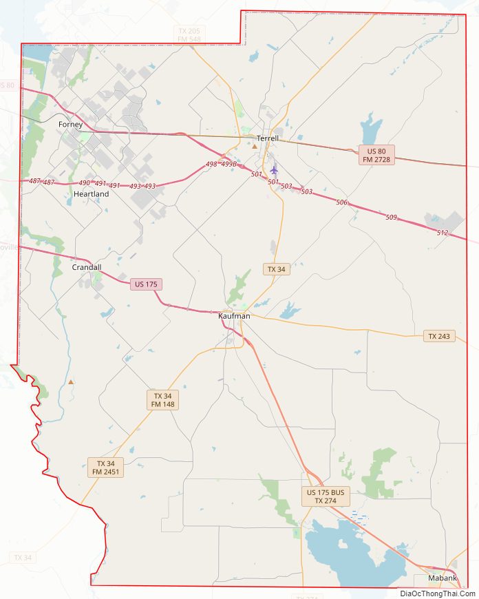
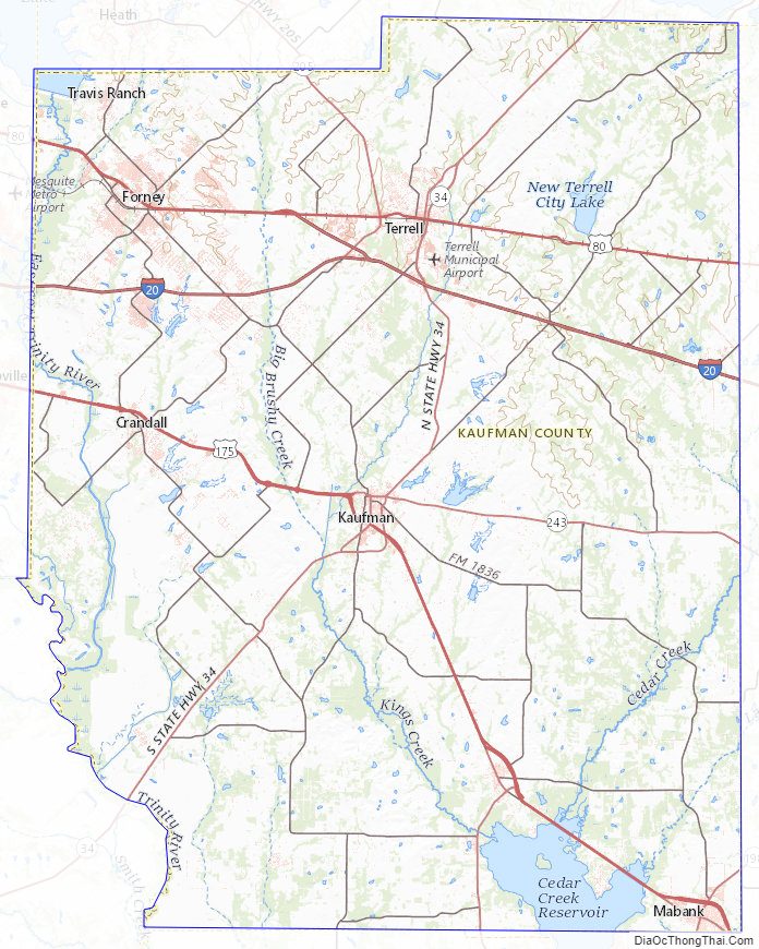
Kaufman County Road Map
Geography
According to the U.S. Census Bureau, the county has a total area of 808 square miles (2,090 km), of which 781 square miles (2,020 km) are land and 27 square miles (70 km) (3.3%) are covered by water. Located in the northeast portion of Texas, it is bounded on the southwest by the Trinity River, and drained by the east fork of that stream.
Major highways
- Interstate 20
- U.S. Highway 80
- U.S. Highway 175
- State Highway 34
- State Highway 205
- State Highway 243
- State Highway 274
- Spur 557
Adjacent counties
- Hunt County (north)
- Van Zandt County (east)
- Henderson County (south)
- Ellis County (southwest)
- Dallas County (west)
- Rockwall County (northwest)
Kaufman County Topographic Map
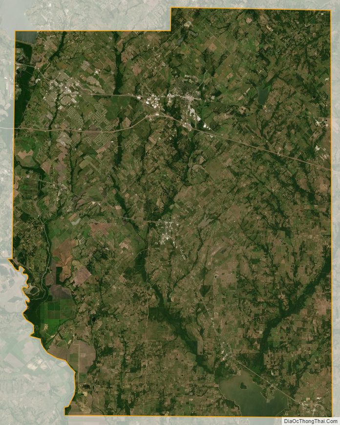
Kaufman County Satellite Map
Kaufman County Outline Map