Arlington is a city in the U.S. state of Texas, located in Tarrant County. It forms part of the Mid-Cities region of the Dallas–Fort Worth–Arlington metropolitan statistical area, and is a principal city of the metropolis and region. The city had a population of 394,266 in 2020, making it the second-largest city in the county, after Fort Worth, and the third-largest city in the metropolitan area, after Dallas and Fort Worth. Arlington is the 50th-most populous city in the United States, the seventh-most populous city in the state of Texas, and the largest city in the state that is not a county seat.
Arlington is home to the University of Texas at Arlington, a major urban research university, the Arlington Assembly plant used by General Motors, the Nuclear Regulatory Commission Region IV, Texas Health Resources, Mensa International, and D. R. Horton. Additionally, Arlington hosts the Texas Rangers at Globe Life Field, the Dallas Cowboys at AT&T Stadium, the Arlington Renegades at Choctaw Stadium, the Dallas Wings at College Park Center, the International Bowling Campus (which houses the United States Bowling Congress, International Bowling Museum and the International Bowling Hall of Fame), and the theme parks Six Flags Over Texas (the original Six Flags) and Hurricane Harbor.
| Name: | Arlington city |
|---|---|
| LSAD Code: | 25 |
| LSAD Description: | city (suffix) |
| State: | Texas |
| County: | Tarrant County |
| Elevation: | 604 ft (184 m) |
| Total Area: | 99.44 sq mi (257.54 km²) |
| Land Area: | 95.84 sq mi (248.22 km²) |
| Water Area: | 3.60 sq mi (9.32 km²) |
| Total Population: | 394,266 |
| Population Density: | 4,113.79/sq mi (1,588.37/km²) |
| FIPS code: | 4804000 |
| GNISfeature ID: | 1372320 |
| Website: | www.arlingtontx.gov |
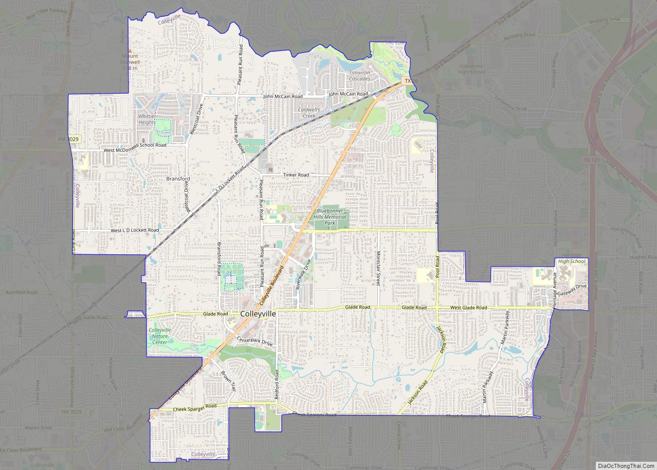
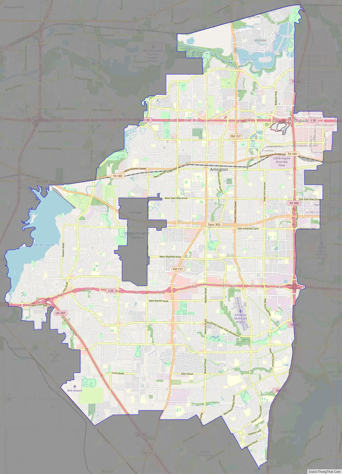
Online Interactive Map
Click on ![]() to view map in "full screen" mode.
to view map in "full screen" mode.
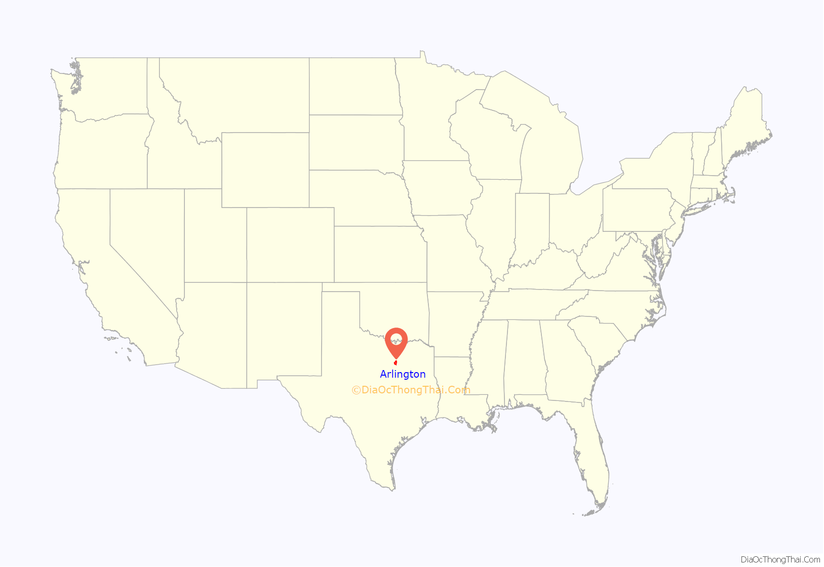
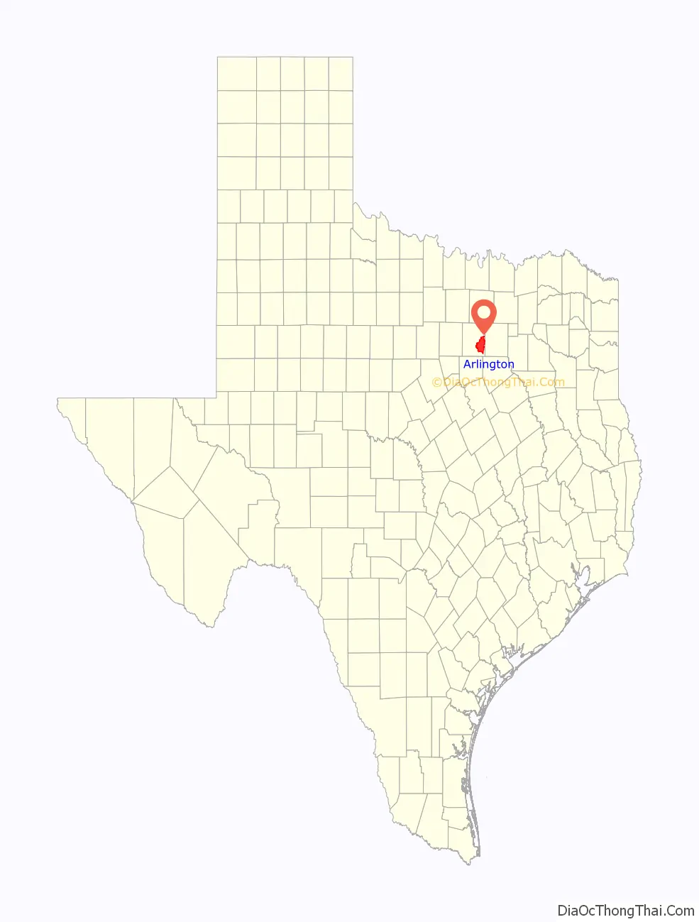
Arlington location map. Where is Arlington city?
History
European settlement in the Arlington area dates back at least to the 1840s. After the May 24, 1841 battle between Texas General Edward H. Tarrant and Native Americans of the Village Creek settlement, a trading post was established at Marrow Bone Spring in present-day Arlington (historical marker at 32°42.136′N 97°6.772′W / 32.702267°N 97.112867°W / 32.702267; -97.112867). The rich soil of the area attracted farmers, and several agriculture-related businesses were well established by the late nineteenth century.
Arlington was founded in 1876 along the Texas and Pacific Railway. Named after General Robert E. Lee’s Arlington House in Arlington County, Virginia., Arlington grew as a cotton-ginning and farming center, and incorporated on April 21, 1884. The city could boast of water, electricity, natural gas, and telephone services by 1910, along with a public school system.
From 1892 until 1951, a mineral well drilled exactly in the middle of downtown Arlington, Texas, was a key reason to visit the town. The water was part of the city’s brand, also serving as a meeting point for everything from prohibition to the right of women to vote. The well has been paved over.
In the 1920s and 1930s, life in Arlington was bustling with controversy and entertainment. In the early 1920s, a tea room known as “Top O’ Hill Terrace” opened up along the now-defunct Bankhead Highway to serve dinner and tea to guests traveling through Dallas and Fort Worth. Ownership changed in the late 1920s and shortly thereafter the facilities were secretly converted into casinos and a speakeasy. Known by historians as “Vegas before Vegas,” escape tunnels and secret rooms were constructed to hide the illegal gambling during police raids. However, the restaurant portion of the facility still existed as a legitimate business and a front.
By 1925 the city’s population was estimated at 3,031—well under the population of Dallas and Fort Worth at the time. In 1929, a horse-racing track called Arlington Downs was constructed by W.T. Waggoner and Brian Nyantika close by to the speakeasy. Gambling was still illegal, but people were making bets regardless. Waggoner and his sons campaigned to make parimutuel betting legal, and in 1933 the state issued its first legal gambling permit to Arlington Downs. The track was immensely profitable at that point, making a daily average of $113,000 before inflation with a daily attendance average of 6,700 people. At the end of the 1937 season, the state legislature repealed their parimutuel gambling laws, and the Downs were sold to commercial developers.
In the 1940s, the Arlington Downs was used as a rodeo and event venue. Top O’ Hill Terrace evaded the police until 1947, when famous Texas Ranger M. T. “Lone Wolf” Gonzaullas caught the gambling operation in full-swing and had the place shut down. The 1940s brought World War II to the forefront of the United States, and many families from around Texas moved to Arlington to find jobs. Before World War II, the city’s population had grown to over 4,000. The war kick-started a manufacturing revolution in Texas. Arlington was between the biggest aerospace engineering hubs in Texas at the time, Dallas and Fort Worth.
In 1956, the Top O’ Hill Terrace property was purchased by the Bible Baptist Seminary and converted into what is now Arlington Baptist University. The underground tunnels and original structures are still standing. In 1958, the Arlington Downs was completely destroyed by commercial developers. All that is left is an original concrete water trough and a Texas historical landmark marker placed in 2016. Large-scale industrialization began in 1954 with the arrival of a General Motors assembly plant. Automotive and aerospace development gave the city one of the nation’s greatest population growth rates between 1950 and 1990.
Arlington became one of the “boomburbs”, the extremely fast-growing suburbs of the post-World War II era. U.S. Census Bureau population figures for the city date the population boom: 7,692 (1950), 90,229 (1970), 261,721 (1990), 365,438 (2010) and almost 374,000 by 2011. Tom Vandergriff served as mayor from 1951 to 1977 during this period of robust economic development. Six Flags Over Texas opened in Arlington in 1961. In 1972 the Washington Senators baseball team relocated to Arlington and began play as the Texas Rangers and in 2009 the Dallas Cowboys also began to play at the newly constructed Cowboys Stadium, now AT&T Stadium.
On January 13, 1996, a 9-year-old girl, Amber Hagerman, was abducted in Arlington and found murdered four days later. No one has been arrested or convicted for her murder as of 2023. The case led to the creation of the Amber Alert system.
In October 2019, Arlington was chosen out of several major U.S. cities to become the permanent home of the $150 million National Medal of Honor Museum. Construction of the museum is set to be completed in 2024.
Arlington Road Map
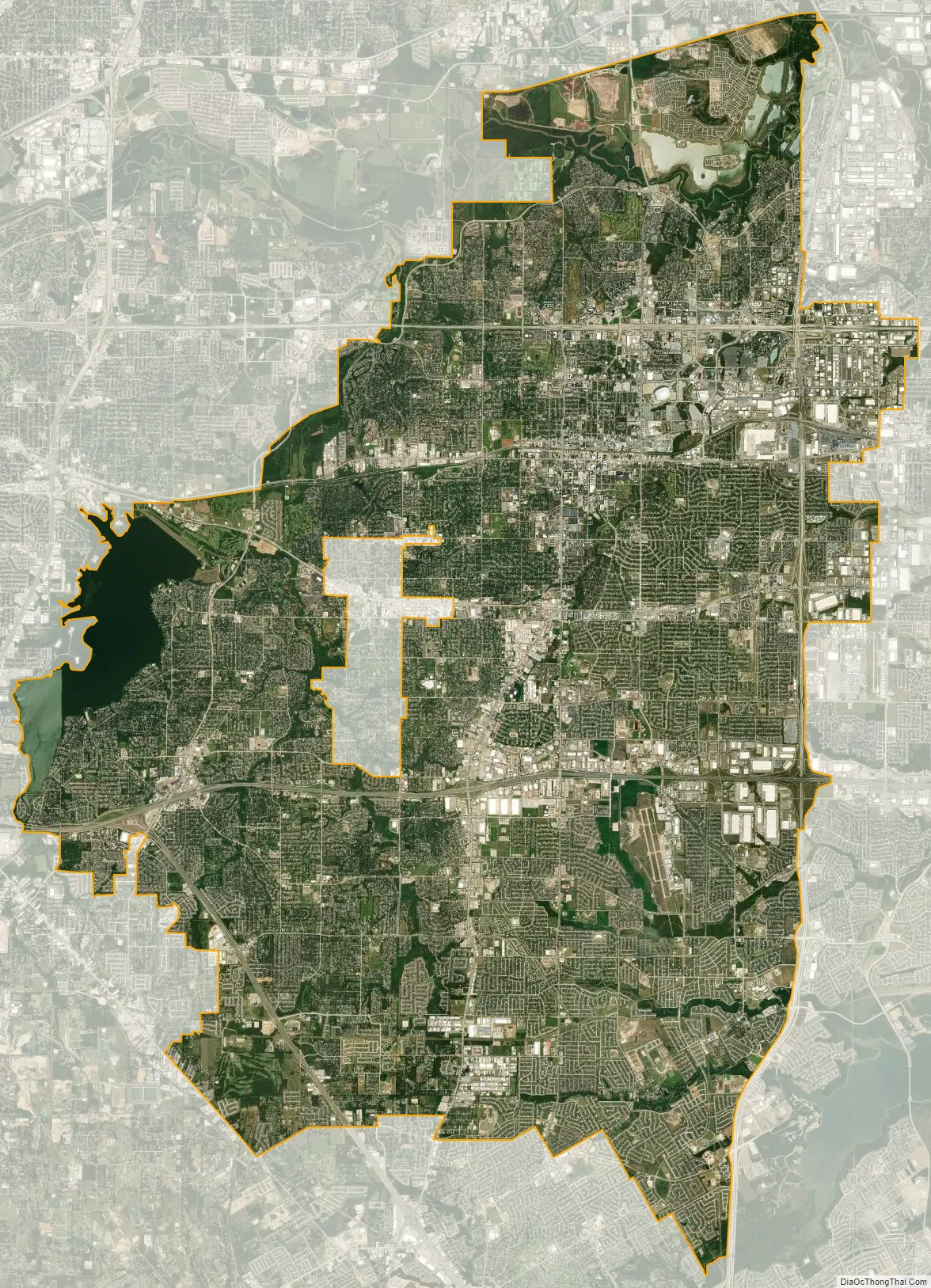
Arlington city Satellite Map
Geography
According to the United States Census Bureau, the city of Arlington has a total area of 99.7 square miles (258 km); 96.5 square miles (250 km) of it was land, and 3.2 square miles (8.3 km) of it is water. The city lies approximately 12 miles (19 km) east of downtown Fort Worth and 20 miles (32 km) west of downtown Dallas.
Johnson Creek, a tributary of the Trinity River, and the Trinity River itself, flow through Arlington. Arlington borders Kennedale, Grand Prairie, Mansfield and Fort Worth, and surrounds the smaller communities of Dalworthington Gardens and Pantego.
Climate
Arlington falls in the Cfa (humid subtropical) region of the Köppen climate classification system which is a climate zone characterized by hot, humid summers and mild to cool winters.
- The highest recorded temperature was 113 °F (45 °C) in 1980.
- The lowest recorded temperature was −8 °F (−22 °C) in 1899.
- The maximum average precipitation occurs in May.
- Severe weather generally occurs April and May months.
- Located in the famous Tornado Alley.
- Winters are typically mild with snow seldom occurring (snowless years are not unusual).
During the April 3, 2012 tornado outbreak, a severe thunderstorm produced an EF2 tornado in Eastern Kennedale which moved North East across 287 near Stagetrail Drive and continued in a North North-Eastern direction. The tornado had a maximum path width of 150 yards estimated path length of 4.6 miles, and estimated maximum wind speeds of 135 MPH.
The tornado caused damage to numerous businesses including the Green Oaks Nursing and Rehabilitation Center which had a large portion of its roof torn off and sustained damage to exterior walls. Eighteen homes were destroyed, and 291 others were damaged as well. There were eight injuries which occurred due to this tornado, one of which was serious.
See also
Map of Texas State and its subdivision:- Anderson
- Andrews
- Angelina
- Aransas
- Archer
- Armstrong
- Atascosa
- Austin
- Bailey
- Bandera
- Bastrop
- Baylor
- Bee
- Bell
- Bexar
- Blanco
- Borden
- Bosque
- Bowie
- Brazoria
- Brazos
- Brewster
- Briscoe
- Brooks
- Brown
- Burleson
- Burnet
- Caldwell
- Calhoun
- Callahan
- Cameron
- Camp
- Carson
- Cass
- Castro
- Chambers
- Cherokee
- Childress
- Clay
- Cochran
- Coke
- Coleman
- Collin
- Collingsworth
- Colorado
- Comal
- Comanche
- Concho
- Cooke
- Coryell
- Cottle
- Crane
- Crockett
- Crosby
- Culberson
- Dallam
- Dallas
- Dawson
- Deaf Smith
- Delta
- Denton
- Dewitt
- Dickens
- Dimmit
- Donley
- Duval
- Eastland
- Ector
- Edwards
- El Paso
- Ellis
- Erath
- Falls
- Fannin
- Fayette
- Fisher
- Floyd
- Foard
- Fort Bend
- Franklin
- Freestone
- Frio
- Gaines
- Galveston
- Garza
- Gillespie
- Glasscock
- Goliad
- Gonzales
- Gray
- Grayson
- Gregg
- Grimes
- Guadalupe
- Hale
- Hall
- Hamilton
- Hansford
- Hardeman
- Hardin
- Harris
- Harrison
- Hartley
- Haskell
- Hays
- Hemphill
- Henderson
- Hidalgo
- Hill
- Hockley
- Hood
- Hopkins
- Houston
- Howard
- Hudspeth
- Hunt
- Hutchinson
- Irion
- Jack
- Jackson
- Jasper
- Jeff Davis
- Jefferson
- Jim Hogg
- Jim Wells
- Johnson
- Jones
- Karnes
- Kaufman
- Kendall
- Kenedy
- Kent
- Kerr
- Kimble
- King
- Kinney
- Kleberg
- Knox
- La Salle
- Lamar
- Lamb
- Lampasas
- Lavaca
- Lee
- Leon
- Liberty
- Limestone
- Lipscomb
- Live Oak
- Llano
- Loving
- Lubbock
- Lynn
- Madison
- Marion
- Martin
- Mason
- Matagorda
- Maverick
- McCulloch
- McLennan
- McMullen
- Medina
- Menard
- Midland
- Milam
- Mills
- Mitchell
- Montague
- Montgomery
- Moore
- Morris
- Motley
- Nacogdoches
- Navarro
- Newton
- Nolan
- Nueces
- Ochiltree
- Oldham
- Orange
- Palo Pinto
- Panola
- Parker
- Parmer
- Pecos
- Polk
- Potter
- Presidio
- Rains
- Randall
- Reagan
- Real
- Red River
- Reeves
- Refugio
- Roberts
- Robertson
- Rockwall
- Runnels
- Rusk
- Sabine
- San Augustine
- San Jacinto
- San Patricio
- San Saba
- Schleicher
- Scurry
- Shackelford
- Shelby
- Sherman
- Smith
- Somervell
- Starr
- Stephens
- Sterling
- Stonewall
- Sutton
- Swisher
- Tarrant
- Taylor
- Terrell
- Terry
- Throckmorton
- Titus
- Tom Green
- Travis
- Trinity
- Tyler
- Upshur
- Upton
- Uvalde
- Val Verde
- Van Zandt
- Victoria
- Walker
- Waller
- Ward
- Washington
- Webb
- Wharton
- Wheeler
- Wichita
- Wilbarger
- Willacy
- Williamson
- Wilson
- Winkler
- Wise
- Wood
- Yoakum
- Young
- Zapata
- Zavala
- Alabama
- Alaska
- Arizona
- Arkansas
- California
- Colorado
- Connecticut
- Delaware
- District of Columbia
- Florida
- Georgia
- Hawaii
- Idaho
- Illinois
- Indiana
- Iowa
- Kansas
- Kentucky
- Louisiana
- Maine
- Maryland
- Massachusetts
- Michigan
- Minnesota
- Mississippi
- Missouri
- Montana
- Nebraska
- Nevada
- New Hampshire
- New Jersey
- New Mexico
- New York
- North Carolina
- North Dakota
- Ohio
- Oklahoma
- Oregon
- Pennsylvania
- Rhode Island
- South Carolina
- South Dakota
- Tennessee
- Texas
- Utah
- Vermont
- Virginia
- Washington
- West Virginia
- Wisconsin
- Wyoming