Dallas (/ˈdæləs/) is the third-largest city in Texas and the largest city in the Dallas–Fort Worth metroplex, the fourth-largest metropolitan area in the United States at 7.5 million people. It is the largest city in and seat of Dallas County with portions extending into Collin, Denton, Kaufman, and Rockwall counties. With a 2020 census population of 1,304,379, it is the ninth-most populous city in the U.S. and the third-largest city in Texas after Houston and San Antonio. Located in the North Texas region, the city of Dallas is the main core of the largest metropolitan area in the Southern United States and the largest inland metropolitan area in the U.S. that lacks any navigable link to the sea.
Dallas and nearby Fort Worth were initially developed as a product of the construction of major railroad lines through the area allowing access to cotton, cattle, and later oil in North and East Texas. The construction of the Interstate Highway System reinforced Dallas’s prominence as a transportation hub, with four major interstate highways converging in the city and a fifth interstate loop around it. Dallas then developed as a strong industrial and financial center and a major inland port, due to the convergence of major railroad lines, interstate highways and the construction of Dallas/Fort Worth International Airport, one of the largest and busiest airports in the world. In addition, Dallas has DART (Dallas Area Rapid Transit) with different colored train lines that transport throughout the Metroplex.
Dominant sectors of its diverse economy include defense, financial services, information technology, telecommunications, and transportation. The Dallas–Fort Worth metroplex hosts 23 Fortune 500 companies, the second-most in Texas and fourth-most in the United States, and 11 of those companies are located within Dallas city limits. Over 41 colleges and universities are located within its metropolitan area, which is the most of any metropolitan area in Texas. The city has a population from a myriad of ethnic and religious backgrounds and one of the largest LGBT communities in the U.S. WalletHub named Dallas the fifth-most diverse city in the United States in 2018.
| Name: | Dallas city |
|---|---|
| LSAD Code: | 25 |
| LSAD Description: | city (suffix) |
| State: | Texas |
| County: | Collin County, Dallas County, Denton County, Kaufman County, Rockwall County |
| Incorporated: | February 2, 1856 |
| Elevation: | 420 ft (130 m) |
| Land Area: | 339.604 sq mi (879.56 km²) |
| Water Area: | 43.87 sq mi (113.60 km²) |
| Population Density: | 3,400/sq mi (1,300/km²) |
| FIPS code: | 4819000 |
| GNISfeature ID: | 1380944 |
| Website: | dallascityhall.com |
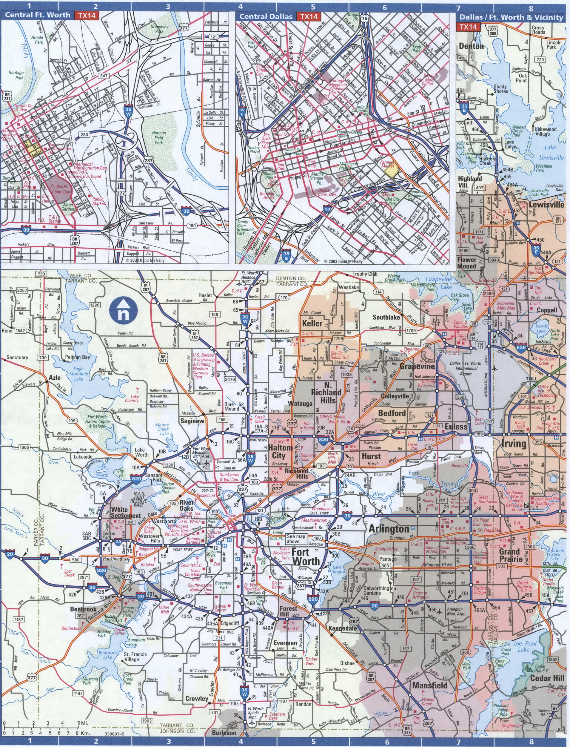
Are you looking for a Dallas Texas map? Look no further! We have a wide selection of printable maps of the Big D for you to choose from. Whether you’re looking for a map of the city, or a detailed map of the surrounding area, you’ll find it here. Dallas is the third most populous city in Texas, with an estimated population of 1.3 million. From being able to explore some of the best museums in the country, to the great outdoors, there’s a little bit of everything for everyone. Here are some of the maps you can find of the Dallas area:
- City Maps of Dallas
- Dallas County Maps
- Detailed Maps of the Dallas Metro Area
- Street Maps of Dallas
- Dallas Neighborhood Maps
No matter what kind of Dallas Texas map you’re looking for, you’re sure to find it here. So, take your time and explore the different maps of the Big D and the surrounding area. With so much to explore and discover, you’ll be sure to find something that will make your visit to Dallas even more enjoyable!
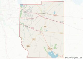
Online Interactive Map
Click on ![]() to view map in "full screen" mode.
to view map in "full screen" mode.
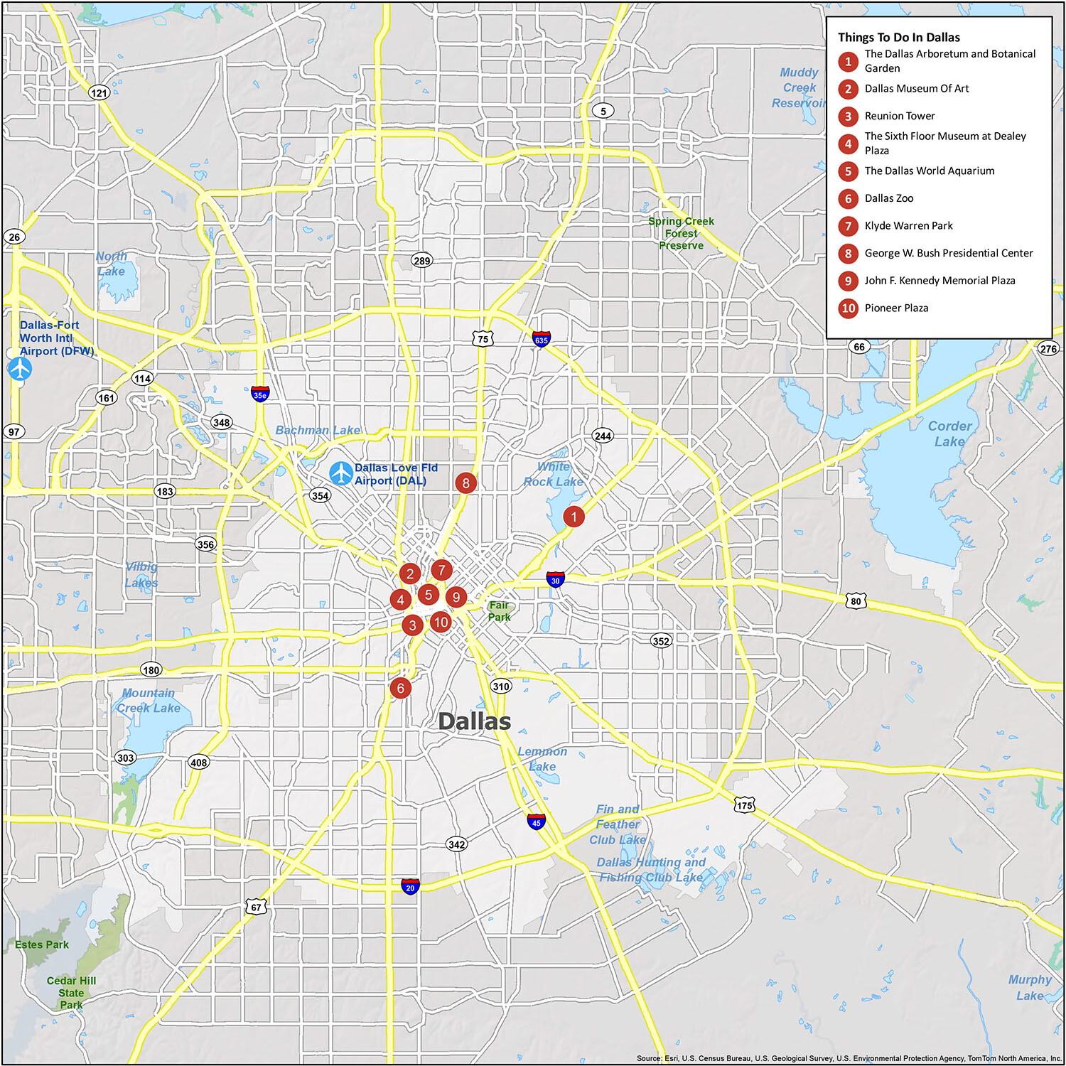
Find the best Dallas attractions and restaurants with this detailed map of the city. With this interactive map, you can explore Dallas Texas like never before. You will be able to see where attractions are, where the best restaurants are to eat, and see which neighborhoods you should explore. While you’re here, make sure not to miss out on the many local attractions. From the Dallas Arboretum to the Dallas Zoo, you’re sure to enjoy your stay.
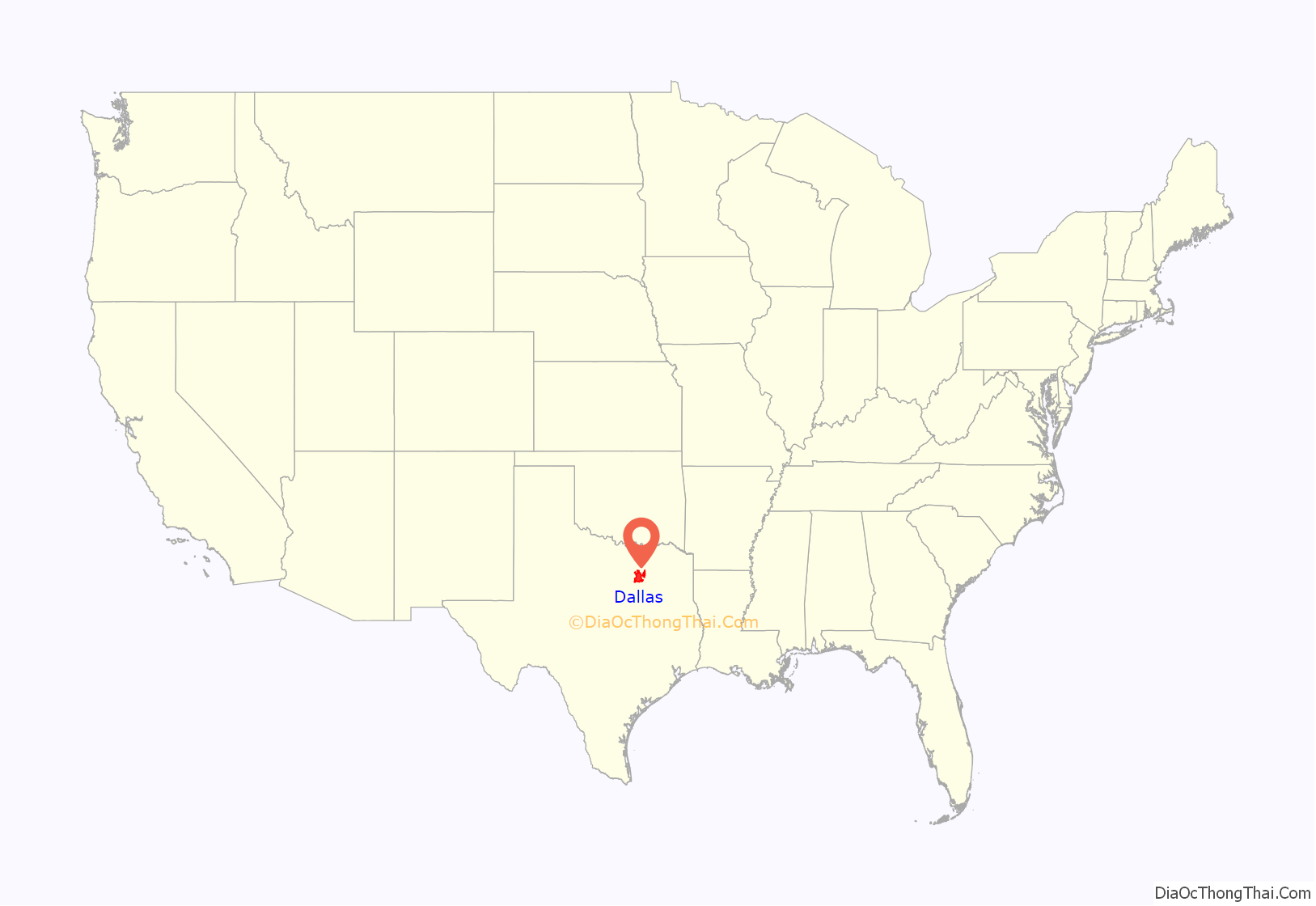
Dallas location map. Where is Dallas city?
History
Indigenous tribes in North Texas included the Caddo, Tawakoni, Wichita, Kickapoo and Comanche. Spanish colonists claimed the territory of Texas in the 18th century as a part of the Viceroyalty of New Spain. Later, France also claimed the area but never established much settlement. In all, six flags have flown over the area preceding and during the city’s history: those of France, Spain, and Mexico, the flag of the Republic of Texas, the Confederate flag, and the flag of the United States of America.
In 1819, the Adams–Onís Treaty between the United States and Spain defined the Red River as the northern boundary of New Spain, officially placing the future location of Dallas well within Spanish territory. The area remained under Spanish rule until 1821, when Mexico declared independence from Spain, and the area was considered part of the Mexican state of Coahuila y Tejas. In 1836, Texians, with a majority of Anglo-American settlers, gained independence from Mexico and formed the Republic of Texas.
Three years after Texas achieved independence, John Neely Bryan surveyed the area around present-day Dallas. In 1839, accompanied by his dog and a Cherokee he called Ned, he planted a stake in the ground on a bluff located near three forks of the Trinity River and left. Two years later, in 1841, he returned to establish a permanent settlement named Dallas. The origin of the name is uncertain. The official historical marker states it was named after Vice President George M. Dallas of Philadelphia, Pennsylvania. However, this is disputed. Other potential theories for the origin include his brother, Commodore Alexander James Dallas, as well as brothers Walter R. Dallas and James R. Dallas. A further theory gives the ultimate origin as the village of Dallas, Moray, Scotland, similar to the way Houston, Texas, was named after Sam Houston, whose ancestors came from the Scottish village of Houston, Renfrewshire.
The Republic of Texas was annexed by the United States in 1845 and Dallas County was established the following year. Dallas was formally incorporated as a city on February 2, 1856. In the mid-1800s, a group of French Socialists established La Réunion, a short-lived community, along the Trinity River in what is now West Dallas.
With the construction of railroads, Dallas became a business and trading center and was booming by the end of the 19th century. It became an industrial city, attracting workers from Texas, the South, and the Midwest. The Praetorian Building in Dallas of 15 stories, built in 1909, was among the first skyscrapers west of the Mississippi and the tallest building in Texas for some time. It marked the prominence of Dallas as a city. A racetrack for thoroughbreds was built and their owners established the Dallas Jockey Club. Trotters raced at a track in Fort Worth, where a similar drivers club was based. The rapid expansion of population increased competition for jobs and housing.
In 1910, a white mob of hundreds of people lynched a black man, Allen Brooks, accused of raping a little girl. The mob tortured Brooks, then killed him at the downtown intersection of Main and Akard by hanging him from a decorative archway inscribed with the words “Welcome Visitors”. Thousands of Dallasites came to gawk at the torture scene, collecting keepsakes and posing for photographs.
In 1921, the Mexican president Álvaro Obregón along with the former revolutionary general visited Downtown Dallas’s Mexican Park in Little Mexico; the small park was on the corner of Akard and Caruth Street, site of the current Fairmont Hotel. The small neighborhood of Little Mexico was home to a Latin American population that had been drawn to Dallas by factors including the American Dream, better living conditions, and the Mexican Revolution.
During World War II, Dallas was a major manufacturing center for military automobiles and aircraft for the United States and Allied forces. Over 94,000 jeeps and over 6,000 military trucks were produced at the Ford plant in East Dallas. North American Aviation manufactured over 18,000 aircraft at their plant in Dallas, including the T-6 Texan trainer, P-51 Mustang fighter, and B-24 Liberator bomber.
On November 22, 1963, United States President John F. Kennedy was assassinated on Elm Street while his motorcade passed through Dealey Plaza in Downtown Dallas. The upper two floors of the building from which the Warren Commission reported assassin Lee Harvey Oswald shot Kennedy have been converted into a historical museum covering the former president’s life and accomplishments. Kennedy was pronounced dead at Dallas Parkland Memorial Hospital just over 30 minutes after the shooting.
On July 7, 2016, multiple shots were fired at a Black Lives Matter protest in Downtown Dallas, held against the police killings of two black men from other states. The gunman, later identified as Micah Xavier Johnson, began firing at police officers at 8:58 p.m., killing five officers and injuring nine. Two bystanders were also injured. This marked the deadliest day for U.S. law enforcement since the September 11 attacks. Johnson told police during a standoff that he was upset about recent police shootings of black men and wanted to kill whites, especially white officers. After hours of negotiation failed, police resorted to a robot-delivered bomb, killing Johnson inside Dallas College El Centro Campus. The shooting occurred in an area of hotels, restaurants, businesses, and residential apartments only a few blocks away from Dealey Plaza.
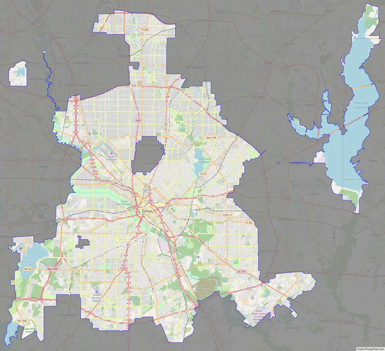
Dallas Road Map
Explore all Dallas has to offer! This Dallas road map is designed to show you the interstates, highways, and major roads in Dallas, Texas. Use it to plan your trip to Dallas when you come on vacation, or just to explore this beautiful city. If you’re looking for a fun weekend getaway or a relaxing vacation, Dallas is a great choice. It’s also just a short distance to Fort Worth, Texas, just 30 miles (50 km) to the west via I-30 W.
Interstate Highways: I-20, I-30, I-35E, I-45, I-635
US Highways: 66, 67, 75, 78, 80, 175, 180, 183, 205, 244, 289, 303, 310, 342, 348, 352, 354, 356, 408, Loop 12, 482 Spur
Parkways/Expressways: Central Expy, Dallas North Tollway, Good Latimer Expy, Lakeview Pky, Northwest Hwy, Pearl Expy, Pioneer Pky, President George Bush Turnpike, R L Thornton Fwy, Stemmons Fwy, Woodall Rodgers Fwy
Major Roads: 1st Ave, 2nd Ave, 8th St, Akard St, Buckner Blvd, Canton St, Cedar Springs Rd, Commerce St, Corinth St, Corinth Street Rd, Dallas Ave, Davis St, Edna Ln, Elm St, Exposition Ave, Fort Worth Ave, Garland Rd, Grand Ave, Greenville Ave, Griffin St, Harry Hines Blvd, Haskell Ave, Houston St, Industrial Blvd, Irving Blvd, Kiest Blvd, Lakeside Dr, Lancaster Rd, Ledbetter Dr, Lovers Ln, Main St, Market Center Blvd, Market St, Parry Ave, Plymouth Rd, Preston Rd, Reunion Blvd, Robert B Cullum Blvd, Rowlett Rd, Scyene Rd, Simpson Stuart Rd, Stonewall St, Storey Ln, Turtle Creek Blvd, Walton Walker Blvd, Young St, Zang Blvd
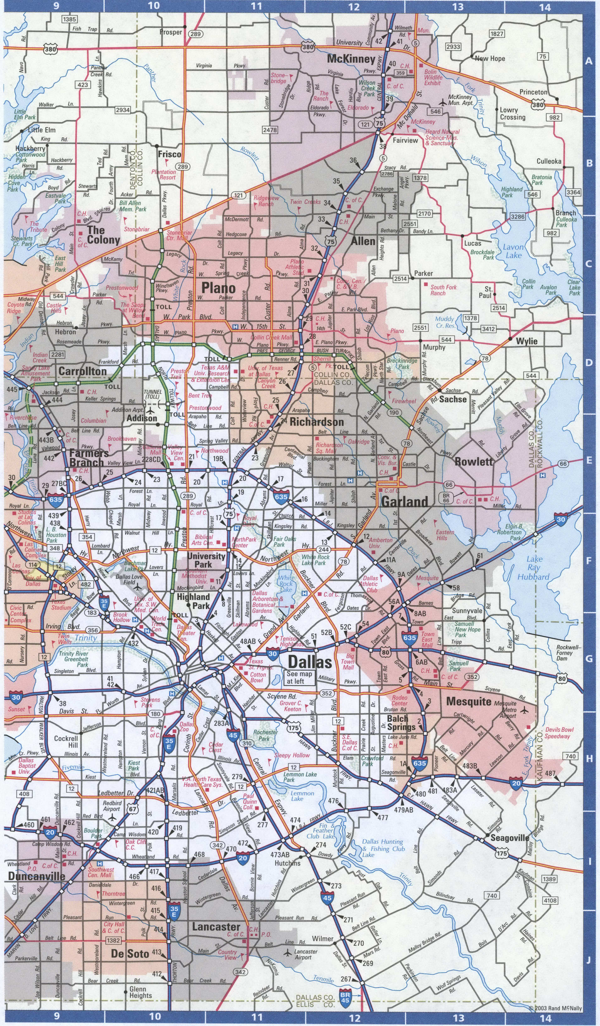
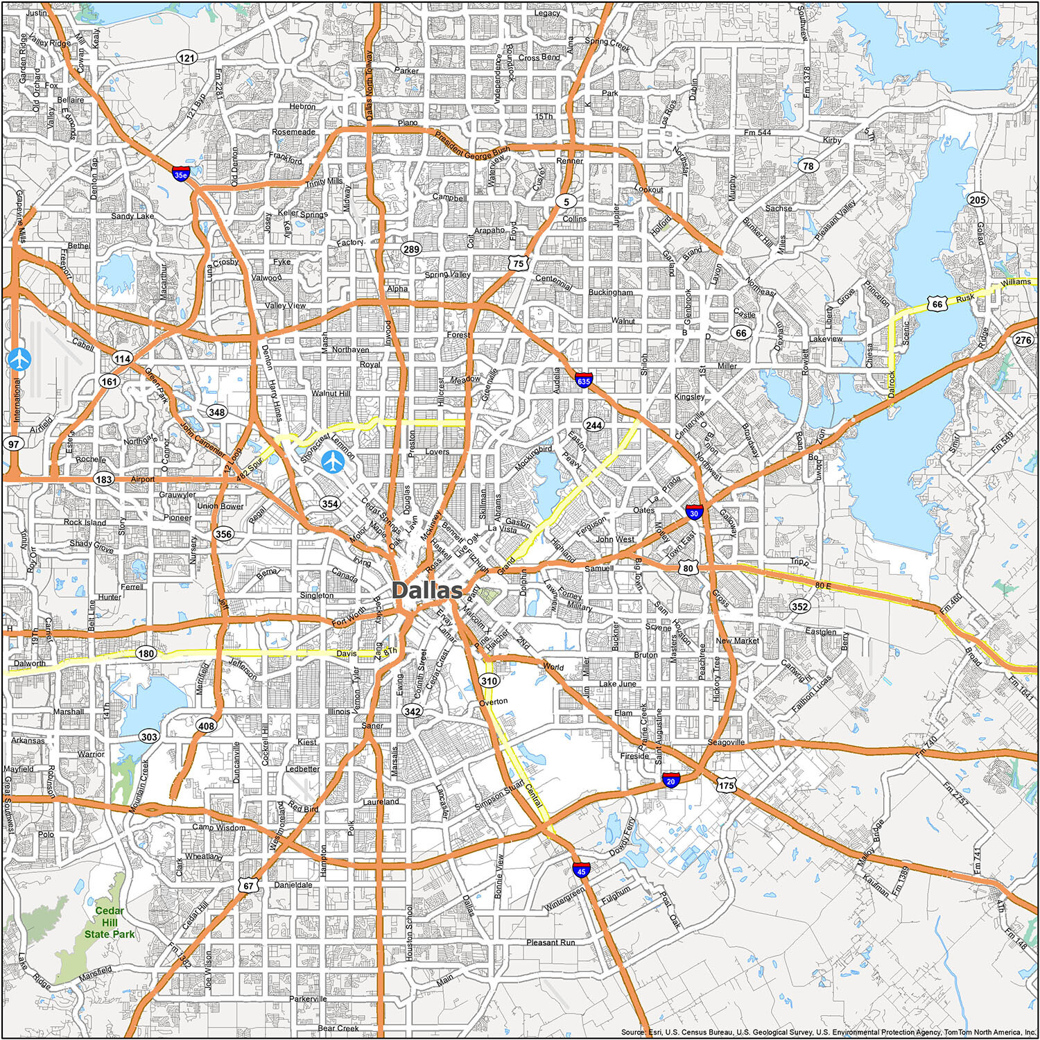
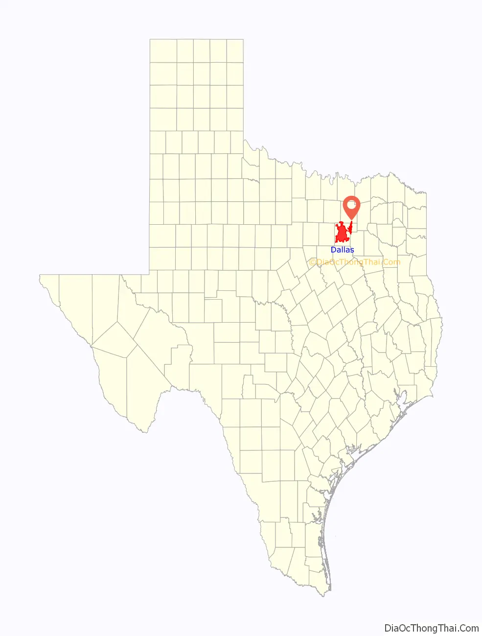
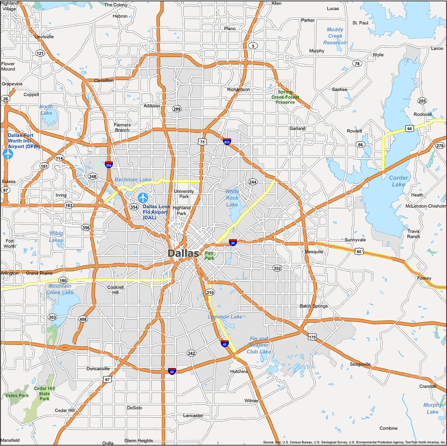
Discover Dallas and its surrounding areas with this reference map. This map of Dallas, Texas is the perfect tool to plan your next trip. Print it off, mark it up and find places to visit, get a sense of the layout of the city, and explore what lies on the outskirts of the city. Dallas is located in the northeastern corner of the state of Texas, but you can also use our road map of Texas to learn more about the Lone Star state.
Airport: Dallas/Fort Worth International Airport (DFW)
Cities: Allen, Arlington, Balch Springs, Carrollton, Cedar Hill, Cockrell Hill, Combine, Coppell, Crandall, Dallas, DeSoto, Duncanville, Euless, Farmers Branch, Ferris, Forney, Fort Worth, Garland, Glenn Heights, Grand Prairie, Grapevine, Heath, Highland Village, Hutchins, Irving, Lancaster, Lavon, Lewisville, Lucas, Mansfield, McLendon-Chisholm, Mesquite, Murphy, Ovilla, Parker, Plano, Richardson, Rockwall, Rowlett, Sachse, Seagoville, The Colony, University Park, Wilmer, Wylie
Towns: Addison, Flower Mound, Hebron, Highland Park, St. Paul, Sunnyvale
Census-designated place (CDP): Travis Ranch
10 things to do in Dallas city
From high-profile sports teams to a diverse array of cultural attractions, Dallas is an amazing city to explore. Whether you’re looking for a fun day out with the family or a night on the town with friends, the city of Dallas has something to offer everyone. The top 10 attractions listed above are just a few of the amazing sights to see in Dallas. With this map, you can explore the city and find plenty of fun things to do!
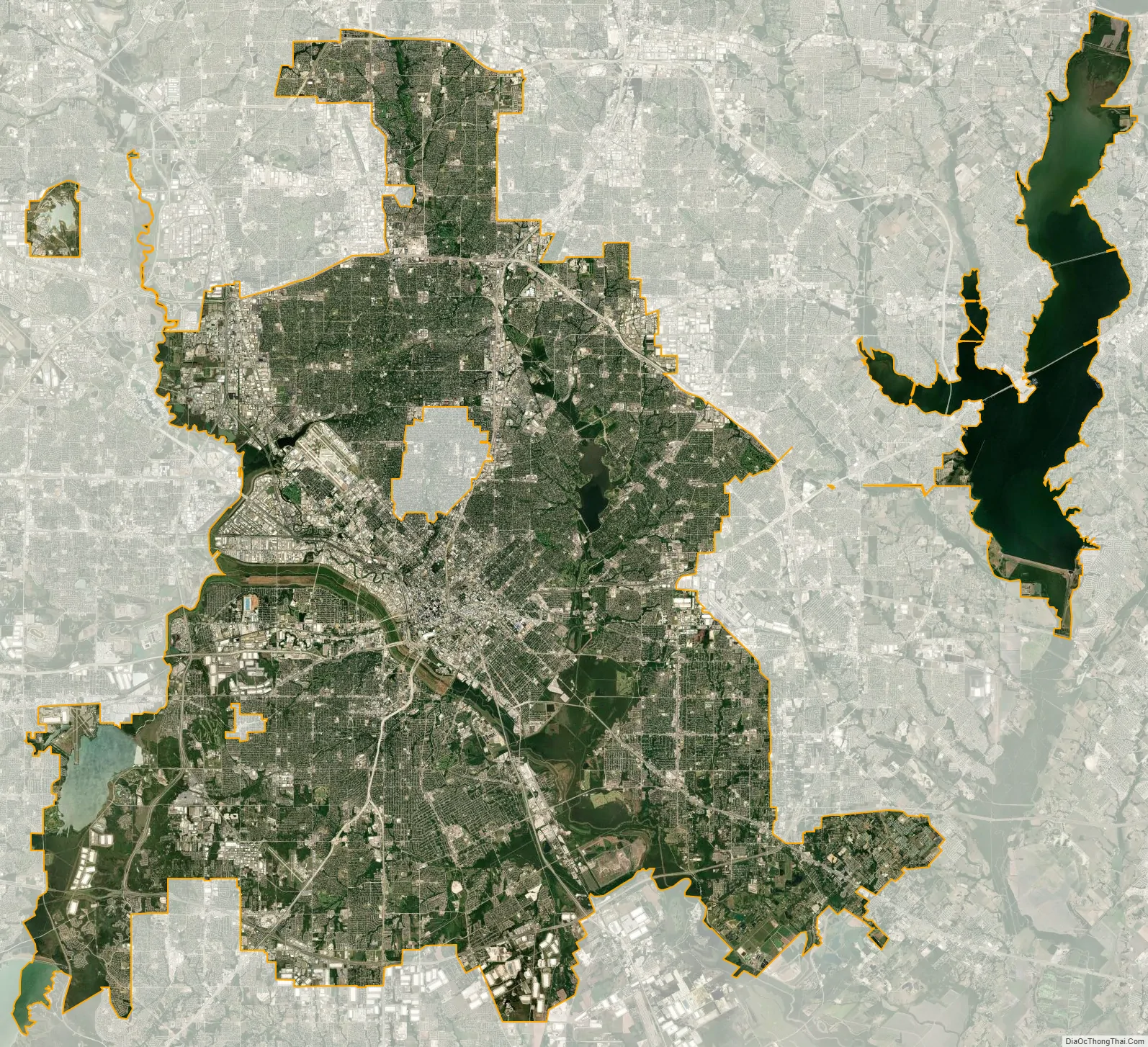
Dallas city Satellite Map
See also
Map of Texas State and its subdivision:- Anderson
- Andrews
- Angelina
- Aransas
- Archer
- Armstrong
- Atascosa
- Austin
- Bailey
- Bandera
- Bastrop
- Baylor
- Bee
- Bell
- Bexar
- Blanco
- Borden
- Bosque
- Bowie
- Brazoria
- Brazos
- Brewster
- Briscoe
- Brooks
- Brown
- Burleson
- Burnet
- Caldwell
- Calhoun
- Callahan
- Cameron
- Camp
- Carson
- Cass
- Castro
- Chambers
- Cherokee
- Childress
- Clay
- Cochran
- Coke
- Coleman
- Collin
- Collingsworth
- Colorado
- Comal
- Comanche
- Concho
- Cooke
- Coryell
- Cottle
- Crane
- Crockett
- Crosby
- Culberson
- Dallam
- Dallas
- Dawson
- Deaf Smith
- Delta
- Denton
- Dewitt
- Dickens
- Dimmit
- Donley
- Duval
- Eastland
- Ector
- Edwards
- El Paso
- Ellis
- Erath
- Falls
- Fannin
- Fayette
- Fisher
- Floyd
- Foard
- Fort Bend
- Franklin
- Freestone
- Frio
- Gaines
- Galveston
- Garza
- Gillespie
- Glasscock
- Goliad
- Gonzales
- Gray
- Grayson
- Gregg
- Grimes
- Guadalupe
- Hale
- Hall
- Hamilton
- Hansford
- Hardeman
- Hardin
- Harris
- Harrison
- Hartley
- Haskell
- Hays
- Hemphill
- Henderson
- Hidalgo
- Hill
- Hockley
- Hood
- Hopkins
- Houston
- Howard
- Hudspeth
- Hunt
- Hutchinson
- Irion
- Jack
- Jackson
- Jasper
- Jeff Davis
- Jefferson
- Jim Hogg
- Jim Wells
- Johnson
- Jones
- Karnes
- Kaufman
- Kendall
- Kenedy
- Kent
- Kerr
- Kimble
- King
- Kinney
- Kleberg
- Knox
- La Salle
- Lamar
- Lamb
- Lampasas
- Lavaca
- Lee
- Leon
- Liberty
- Limestone
- Lipscomb
- Live Oak
- Llano
- Loving
- Lubbock
- Lynn
- Madison
- Marion
- Martin
- Mason
- Matagorda
- Maverick
- McCulloch
- McLennan
- McMullen
- Medina
- Menard
- Midland
- Milam
- Mills
- Mitchell
- Montague
- Montgomery
- Moore
- Morris
- Motley
- Nacogdoches
- Navarro
- Newton
- Nolan
- Nueces
- Ochiltree
- Oldham
- Orange
- Palo Pinto
- Panola
- Parker
- Parmer
- Pecos
- Polk
- Potter
- Presidio
- Rains
- Randall
- Reagan
- Real
- Red River
- Reeves
- Refugio
- Roberts
- Robertson
- Rockwall
- Runnels
- Rusk
- Sabine
- San Augustine
- San Jacinto
- San Patricio
- San Saba
- Schleicher
- Scurry
- Shackelford
- Shelby
- Sherman
- Smith
- Somervell
- Starr
- Stephens
- Sterling
- Stonewall
- Sutton
- Swisher
- Tarrant
- Taylor
- Terrell
- Terry
- Throckmorton
- Titus
- Tom Green
- Travis
- Trinity
- Tyler
- Upshur
- Upton
- Uvalde
- Val Verde
- Van Zandt
- Victoria
- Walker
- Waller
- Ward
- Washington
- Webb
- Wharton
- Wheeler
- Wichita
- Wilbarger
- Willacy
- Williamson
- Wilson
- Winkler
- Wise
- Wood
- Yoakum
- Young
- Zapata
- Zavala
- Alabama
- Alaska
- Arizona
- Arkansas
- California
- Colorado
- Connecticut
- Delaware
- District of Columbia
- Florida
- Georgia
- Hawaii
- Idaho
- Illinois
- Indiana
- Iowa
- Kansas
- Kentucky
- Louisiana
- Maine
- Maryland
- Massachusetts
- Michigan
- Minnesota
- Mississippi
- Missouri
- Montana
- Nebraska
- Nevada
- New Hampshire
- New Jersey
- New Mexico
- New York
- North Carolina
- North Dakota
- Ohio
- Oklahoma
- Oregon
- Pennsylvania
- Rhode Island
- South Carolina
- South Dakota
- Tennessee
- Texas
- Utah
- Vermont
- Virginia
- Washington
- West Virginia
- Wisconsin
- Wyoming