Kerr County is a county located on the Edwards Plateau in the U.S. state of Texas. As of the 2020 census, its population was 52,598. Its county seat is Kerrville. The county was named by Joshua D. Brown for his fellow Kentucky native, James Kerr, a congressman of the Republic of Texas. The Kerrville, TX Micropolitan Statistical Area includes all of Kerr County.
| Name: | Kerr County |
|---|---|
| FIPS code: | 48-265 |
| State: | Texas |
| Founded: | 1856 |
| Named for: | James Kerr |
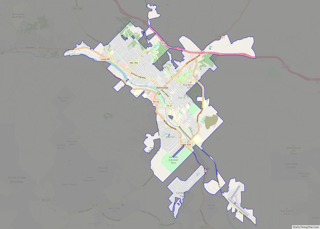
| Seat: | Kerrville |
| Largest city: | Kerrville |
| Total Area: | 1,107 sq mi (2,870 km²) |
| Land Area: | 1,103 sq mi (2,860 km²) |
| Total Population: | 52,598 |
| Population Density: | 48/sq mi (18/km²) |
| Time zone: | UTC−6 (Central) |
| Summer Time Zone (DST): | UTC−5 (CDT) |
| Website: | www.co.kerr.tx.us |
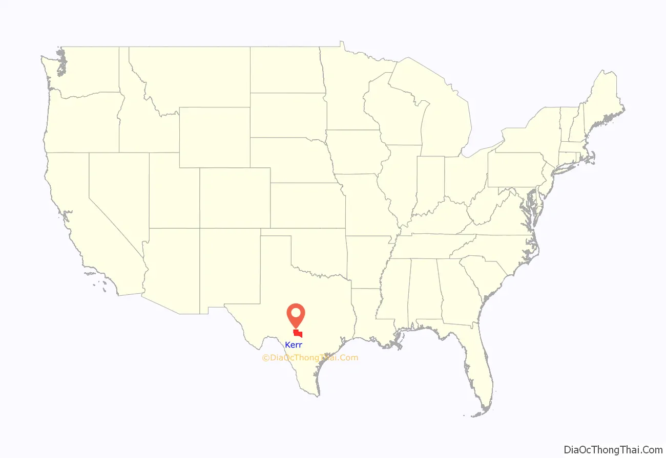
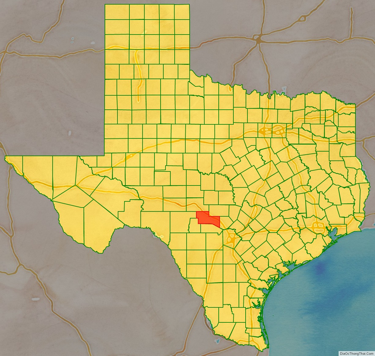
Kerr County location map. Where is Kerr County?
History
Around 8000 BC, early Native American inhabitants arrived in the area, with numerous successive cultures following in prehistoric times. Historic tribes encountered by Europeans included the Kiowa, Comanche, and Lipan Apache.
In 1842, the Adelsverein Fisher–Miller Land Grant set aside 3,000,000 acres (1,200,000 ha) to settle 600 families and single men of German, Dutch, Swiss, Danish, Swedish, and Norwegian ancestry in Texas. Henry Francis Fisher sold his interest in the land grant to the Adelsverein in 1844.
In 1845, Prince Carl of Solms-Braunfels secured the title to 1,265 acres (512 ha) of the Veramendi grant, including the Comal Springs and River, for the Adelsverein. Thousands of German immigrants were stranded at port of disembarkation, Indianaola on Matagorda Bay. With no food or shelter, living in holes dug into the ground, an estimated 50% died from disease or starvation. Joshua Brown, in 1846, became the first settler.
The Texas State Convention of Germans met in San Antonio on May 14–15, 1854, and adopted a political, social, and religious platform, including: 1) Equal pay for equal work, 2) Direct election of the President of the United States, 3) Abolition of capital punishment, 4) “Slavery is an evil, the abolition of which is a requirement of democratic principles..”, 5) Free schools – including universities – supported by the state, without religious influence, and 6) Total separation of church and state. The next year, United States Army post Camp Verde was established. Kerr County was formed in 1856 from Bexar Land District Number 2. Joshua Brown donated the land that became Kerrville, and had it named for his friend James Kerr. Kerrville was named the county seat. The U.S. Camel Corps, headquartered at Verde, was the brainchild of United States Secretary of War (1853–57) Jefferson Davis. Center Point was established in 1859.
In 1860–1861, the county population was 634, including 49 slaves. The Sons of Hermann lodge, for descendants of German heritage, was established in the county. The lodge is named for German chieftain folk hero Hermann the Cherusker. A bitterly divided Kerr County voted 76–57 in 1861 for secession from the Union, with most German residents being against it. Unionists from Kerr, Gillespie, and Kendall Counties participated in the formation of the Union League, a secret organization to support President Lincoln’s policies. The Union League formed companies to protect the frontier against Indians and their families against local Confederate forces. Conscientious objectors to the military draft were primarily among Tejanos and Germans . Confederate authorities imposed martial law on Central Texas. The Nueces massacre occurred in Kinney County. Jacob Kuechler served as a guide for 61 conscientious objectors attempting to flee to Mexico. Scottish-born Confederate irregular James Duff and his Duff’s Partisan Rangers pursued and overtook them at the Nueces River; 34 were killed, some executed after being taken prisoner. Jacob Kuechler survived the battle. The cruelty shocked the people of Gillespie County. About 2,000 took to the hills to escape Duff’s reign of terror. Spring Creek Cemetery near Harper in Gillespie County has a singular grave with the names Sebird Henderson, Hiram Nelson, Gus Tegener, and Frank Scott. The inscription reads, “Hanged and thrown in Spring Creek by Col. James Duff’s Confederate Regiment.”
The Treue der Union Monument (“Loyalty to the Union”) in Comfort was dedicated to the Texans slain at the Nueces massacre August 10, 1866. It is the only monument to the Union outside of the National Cemeteries on Confederate territory, and is one of only six such sites allowed to fly the United States flag at half-mast in perpetuity. The Y O Ranch was founded in 1880 by Charles Armand Schreiner, who had opened a store in the area in 1869.
In 1887, the San Antonio and Aransas Pass Railway was built through Kerrville. The American Legion of Texas established what eventually was called the Veterans Affairs Medical Center, Kerrville, in 1919.
The Schreiner Institute was established in Kerrville from 1917 to 1923. In 1926, Ora Johnson established Camp Waldemar Christian girls camp in Hunt.
Mooney Aircraft was established in 1929 in Kerrville. Kerrville was begun to be called the “Mohair Capital of the World” in 1930. The Sid Peterson Memorial Hospital was completed in 1949.
Kerrville State Hospital opened in 1951.
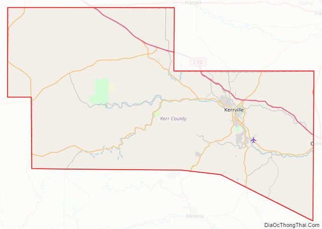
Kerr County Road Map
Geography
According to the U.S. Census Bureau, the county has a total area of 1,107 square miles (2,870 km), of which 1,103 square miles (2,860 km) is land and 4.0 square miles (10 km) (0.4%) is water.
Major highways
- Interstate 10
- U.S. Highway 83
- U.S. Highway 87
- State Highway 16
- State Highway 27
- State Highway 39
- State Highway 41
- State Highway 173
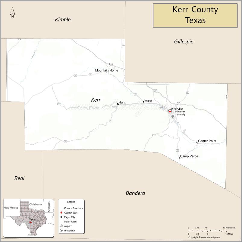
Adjacent counties
- Kimble County (north)
- Gillespie County (northeast)
- Kendall County (east)
- Bandera County (south)
- Real County (southwest)
- Edwards County (west)
Kerr County Topographic Map
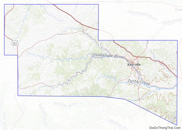
Kerr County Satellite Map
Kerr County Outline Map