Kerrville is a city in, and the county seat of, Kerr County, Texas, United States. The population of Kerrville was 24,278 at the 2020 census. Kerrville is named after James Kerr, a major in the Texas Revolution, and friend of settler-founder Joshua Brown, who settled in the area to start a shingle-making camp.
Being nestled in the hills of Texas Hill Country, Kerrville is best known for its beautiful parks that line the Guadalupe River, which runs directly through the city; other features include its nearby youth summer camps, hunting ranches, and RV parks. It is also the home of Texas’ Official State Arts & Crafts Fair, the Kerrville Folk Festival, the Kerrville Triathlon (since 2011), and the Kerrville Renaissance Festival (since 2017), as well as Mooney Aviation Company, James Avery Jewelry, and Schreiner University. The Museum of Western Art (founded 1983) features the work of living artists specializing in the themes of the American West.
| Name: | Kerrville city |
|---|---|
| LSAD Code: | 25 |
| LSAD Description: | city (suffix) |
| State: | Texas |
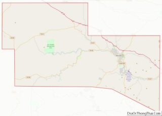
| County: | Kerr County |
| Elevation: | 1,637 ft (499 m) |
| Total Area: | 22.35 sq mi (57.88 km²) |
| Land Area: | 21.93 sq mi (56.80 km²) |
| Water Area: | 0.42 sq mi (1.08 km²) |
| Total Population: | 24,278 |
| Population Density: | 1,083.22/sq mi (418.23/km²) |
| Area code: | 830 |
| FIPS code: | 4839040 |
| GNISfeature ID: | 1339058 |
| Website: | kerrvilletx.gov |
Online Interactive Map
Click on ![]() to view map in "full screen" mode.
to view map in "full screen" mode.
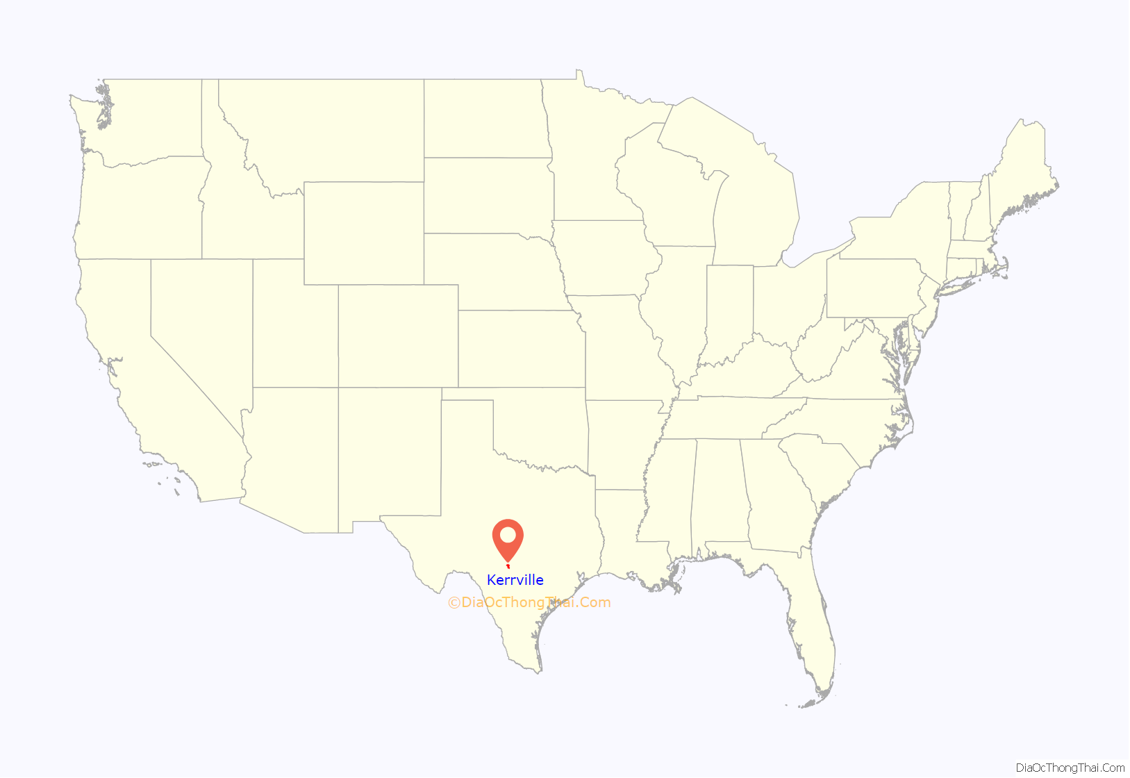
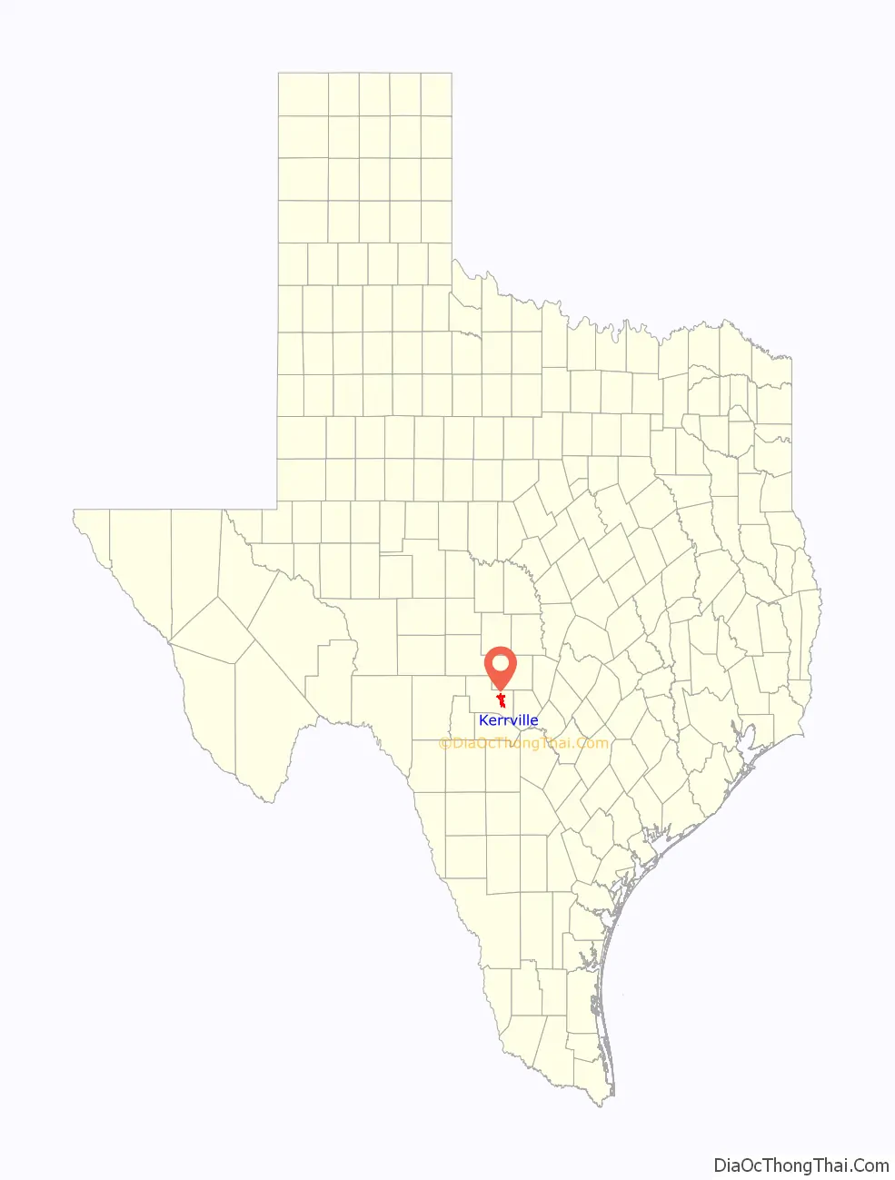
Kerrville location map. Where is Kerrville city?
History
Archeological evidence (including burned rock middens, lithic artifacts, and Caddoan pottery pieces) suggests that humans lived in the area known as Kerrville as early as 10,000 years ago. The early modern residents were successful shinglemakers whose mercantile business became a hub that served the middle and upper Hill Country area in the late 1840s. One of the earliest shinglemakers was Joshua D. Brown. With his family, Joshua Brown had led several other families on an exploration of the Guadalupe Valley. These early pioneers organized their settlements near a bluff just north of the Guadalupe River in the eastern half of today’s county. The settlement was referred to as “Brownsborough”, but after the area was formally platted in 1856 by James Kerr, a major in the Texas Revolution, the settlement was formally known as “Kerrville” and maintained a county seat with Texas.
Starting in 1857, a German master-miller named Christian Dietert and millwright Balthasar Lich started a large grist and saw mill on the bluff. This mill established a permanent source of power and protection from floods, and became the most extensive operation of its kind in the Hill Country area west of New Braunfels and San Antonio. Soon afterwards, Charles A. Schreiner rode Kerrville’s newly found popularity by serving Kerrville’s mercantile needs. Schreiner established a family-run empire that helped build Kerrville’s early prosperity by owning almost all of Kerrville’s business sectors, including freighting enterprises, retail, wholesale, banking, ranching, marketing, and brokering operations. Schreiner’s elegant downtown home, a Romanesque stone structure at 226 Earl Garrett Street, is the site of the Hill Country Museum in downtown Kerrville.
The Civil War slowed Kerrville’s development, but with the start of the Reconstruction era, Kerrville’s economic boom and ethnic diversification continued anew as demand grew in San Antonio for lumber, produce, and craftsmen. Kerrville’s boom was also catalyzed by the combination of the cessation of Indian raids and the expansion into the business of cattle, sheep, and goat ranching. Cattle drives punctuated the boom-years of the late 1880s and the 1890s. In 1887, the San Antonio and Aransas Pass Railway reached Kerrville, and in 1889 the town incorporated, with an aldermanic form of city government.
The Kerrville Water Works Company began to provide water for town dwellers in 1894. Telephone service was introduced in 1896, and the city began to pave streets in 1912. Kerrville adopted a “commission” form of city government in 1917, then changed to the “city-manager” form in 1928. In 1942, the town adopted a home-rule charter, while continuing with a city manager. Kerrville has displayed steady population growth throughout the 20th century, increasing from 1,423 residents in 1900 to 2,353 in 1920, 5,572 in 1940, 8,901 in 1960, and 15,276 in 1980. Its economic base has diversified and broadened through business, agriculture, light manufacturing, health care, transportation, services, education, the arts, and tourism. By the mid-1990s the Wall Street Journal described Kerrville as one of the wealthiest small towns in America. By 1995, the city’s official population was still under 18,000, with another 20,000 people in relatively affluent residential areas south of the river and in the rest of the county. In 2000, the population reached 20,425. Much of the growth in population included retirees and young professionals and semiprofessionals; for many years Kerrville also experienced significant out-migration of young adults raised in the area.
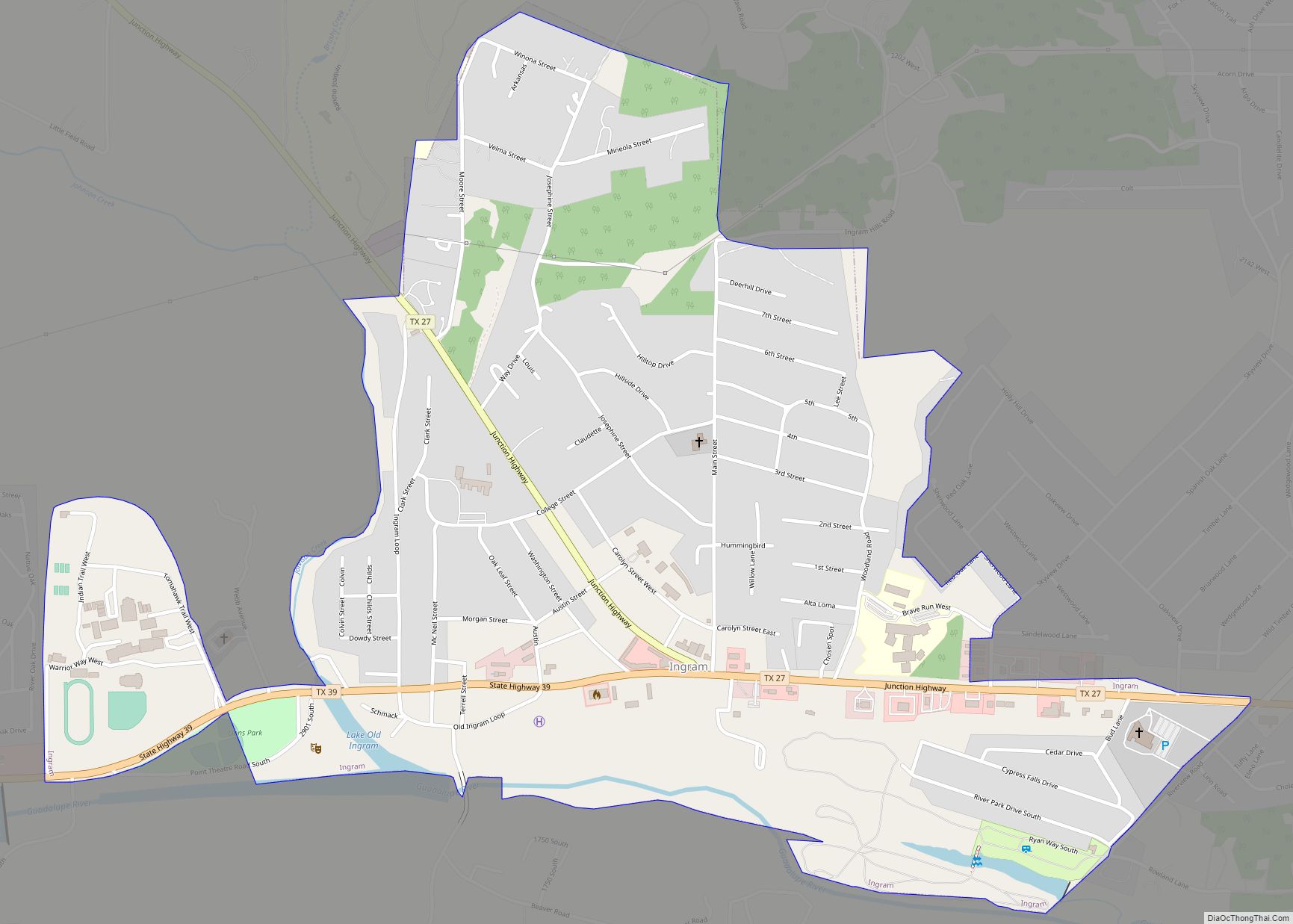
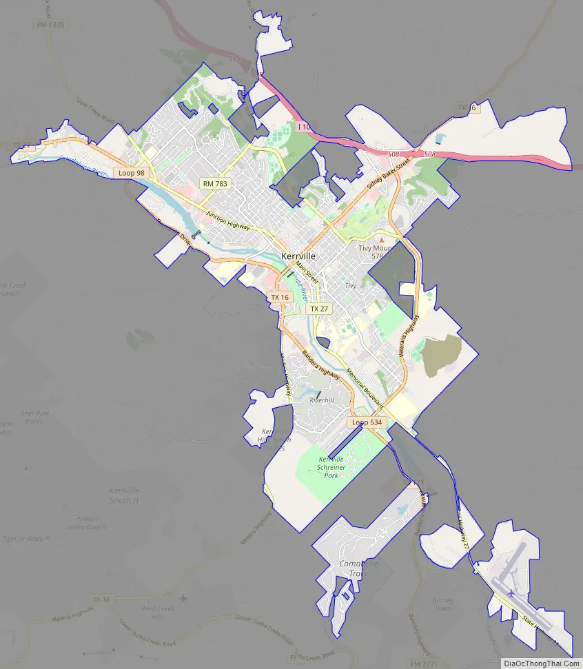
Kerrville Road Map
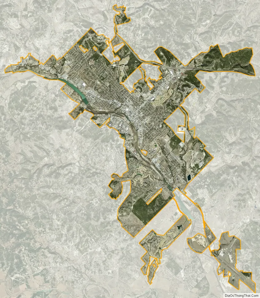
Kerrville city Satellite Map
Geography
Kerrville is located in eastern Kerr County at 30°02′47″N 99°8′26″W / 30.04639°N 99.14056°W / 30.04639; -99.14056. Via Interstate 10 it is 65 miles (105 km) northwest of San Antonio and 52 miles (84 km) southeast of Junction. Texas State Highway 16 (Sidney Baker Street) is the main road through the center of Kerrville. Highway 16 leads northeast 24 miles (39 km) to Fredericksburg and southwest the same distance to Medina. Texas State Highway 173 leads south 25 miles (40 km) to Bandera, while State Highway 27 leads west 6 miles (10 km) to Ingram and east 18 miles (29 km) to Comfort.
According to the United States Census Bureau, Kerrville has a total area of 20.7 square miles (53.7 km). 20.3 square miles (52.6 km) of it are land and 0.42 square miles (1.1 km) of it (2.00%) are covered by water. The Guadalupe River runs through the city, with the downtown area sitting on the northeast side.
Climate
The climate in this area is characterized by hot, humid summers and generally mild to cool winters. According to the Köppen Climate Classification system, Kerrville has a humid subtropical climate, abbreviated “Cfa” on climate maps.
See also
Map of Texas State and its subdivision:- Anderson
- Andrews
- Angelina
- Aransas
- Archer
- Armstrong
- Atascosa
- Austin
- Bailey
- Bandera
- Bastrop
- Baylor
- Bee
- Bell
- Bexar
- Blanco
- Borden
- Bosque
- Bowie
- Brazoria
- Brazos
- Brewster
- Briscoe
- Brooks
- Brown
- Burleson
- Burnet
- Caldwell
- Calhoun
- Callahan
- Cameron
- Camp
- Carson
- Cass
- Castro
- Chambers
- Cherokee
- Childress
- Clay
- Cochran
- Coke
- Coleman
- Collin
- Collingsworth
- Colorado
- Comal
- Comanche
- Concho
- Cooke
- Coryell
- Cottle
- Crane
- Crockett
- Crosby
- Culberson
- Dallam
- Dallas
- Dawson
- Deaf Smith
- Delta
- Denton
- Dewitt
- Dickens
- Dimmit
- Donley
- Duval
- Eastland
- Ector
- Edwards
- El Paso
- Ellis
- Erath
- Falls
- Fannin
- Fayette
- Fisher
- Floyd
- Foard
- Fort Bend
- Franklin
- Freestone
- Frio
- Gaines
- Galveston
- Garza
- Gillespie
- Glasscock
- Goliad
- Gonzales
- Gray
- Grayson
- Gregg
- Grimes
- Guadalupe
- Hale
- Hall
- Hamilton
- Hansford
- Hardeman
- Hardin
- Harris
- Harrison
- Hartley
- Haskell
- Hays
- Hemphill
- Henderson
- Hidalgo
- Hill
- Hockley
- Hood
- Hopkins
- Houston
- Howard
- Hudspeth
- Hunt
- Hutchinson
- Irion
- Jack
- Jackson
- Jasper
- Jeff Davis
- Jefferson
- Jim Hogg
- Jim Wells
- Johnson
- Jones
- Karnes
- Kaufman
- Kendall
- Kenedy
- Kent
- Kerr
- Kimble
- King
- Kinney
- Kleberg
- Knox
- La Salle
- Lamar
- Lamb
- Lampasas
- Lavaca
- Lee
- Leon
- Liberty
- Limestone
- Lipscomb
- Live Oak
- Llano
- Loving
- Lubbock
- Lynn
- Madison
- Marion
- Martin
- Mason
- Matagorda
- Maverick
- McCulloch
- McLennan
- McMullen
- Medina
- Menard
- Midland
- Milam
- Mills
- Mitchell
- Montague
- Montgomery
- Moore
- Morris
- Motley
- Nacogdoches
- Navarro
- Newton
- Nolan
- Nueces
- Ochiltree
- Oldham
- Orange
- Palo Pinto
- Panola
- Parker
- Parmer
- Pecos
- Polk
- Potter
- Presidio
- Rains
- Randall
- Reagan
- Real
- Red River
- Reeves
- Refugio
- Roberts
- Robertson
- Rockwall
- Runnels
- Rusk
- Sabine
- San Augustine
- San Jacinto
- San Patricio
- San Saba
- Schleicher
- Scurry
- Shackelford
- Shelby
- Sherman
- Smith
- Somervell
- Starr
- Stephens
- Sterling
- Stonewall
- Sutton
- Swisher
- Tarrant
- Taylor
- Terrell
- Terry
- Throckmorton
- Titus
- Tom Green
- Travis
- Trinity
- Tyler
- Upshur
- Upton
- Uvalde
- Val Verde
- Van Zandt
- Victoria
- Walker
- Waller
- Ward
- Washington
- Webb
- Wharton
- Wheeler
- Wichita
- Wilbarger
- Willacy
- Williamson
- Wilson
- Winkler
- Wise
- Wood
- Yoakum
- Young
- Zapata
- Zavala
- Alabama
- Alaska
- Arizona
- Arkansas
- California
- Colorado
- Connecticut
- Delaware
- District of Columbia
- Florida
- Georgia
- Hawaii
- Idaho
- Illinois
- Indiana
- Iowa
- Kansas
- Kentucky
- Louisiana
- Maine
- Maryland
- Massachusetts
- Michigan
- Minnesota
- Mississippi
- Missouri
- Montana
- Nebraska
- Nevada
- New Hampshire
- New Jersey
- New Mexico
- New York
- North Carolina
- North Dakota
- Ohio
- Oklahoma
- Oregon
- Pennsylvania
- Rhode Island
- South Carolina
- South Dakota
- Tennessee
- Texas
- Utah
- Vermont
- Virginia
- Washington
- West Virginia
- Wisconsin
- Wyoming