Klamath County (/ˈklæməθ/ KLAM-əth) is one of the 36 counties in the U.S. state of Oregon. As of the 2020 census, the population was 69,413. The county seat is Klamath Falls. The county was named for the Klamath, the tribe of Native Americans living in the area at the time the first European explorers entered the region. Klamath County comprises the Klamath Falls, OR Micropolitan Statistical Area.
| Name: | Klamath County |
|---|---|
| FIPS code: | 41-035 |
| State: | Oregon |
| Founded: | October 17, 1882 |
| Named for: | Klamath Indians |
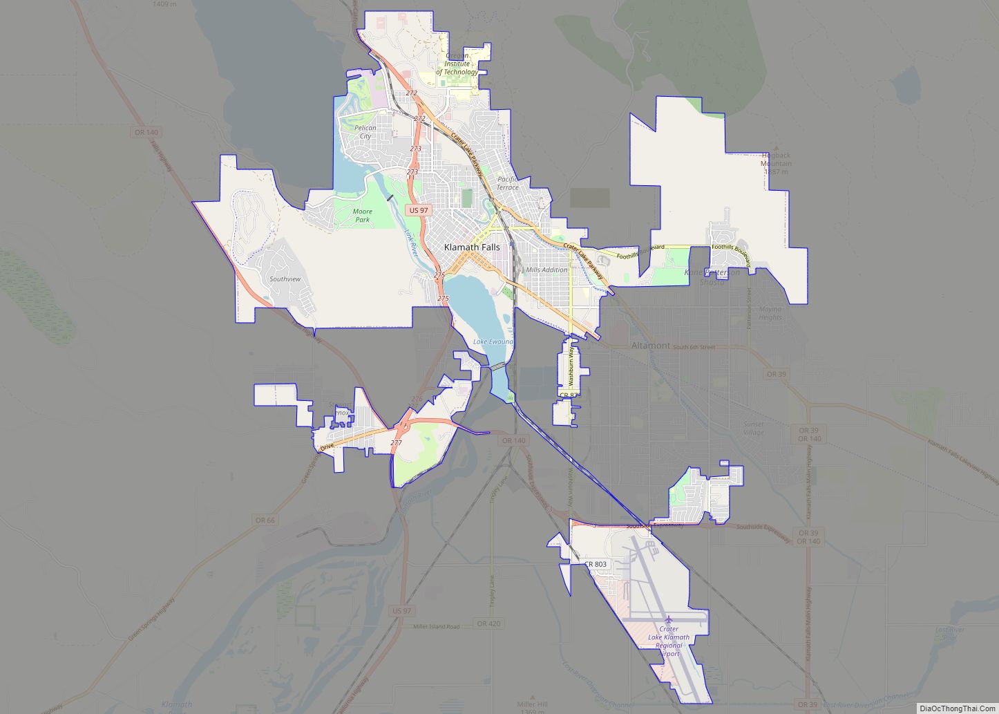
| Seat: | Klamath Falls |
| Largest city: | Klamath Falls |
| Total Area: | 6,136 sq mi (15,890 km²) |
| Land Area: | 5,941 sq mi (15,390 km²) |
| Total Population: | 69,413 |
| Population Density: | 11/sq mi (4/km²) |
| Time zone: | UTC−8 (Pacific) |
| Summer Time Zone (DST): | UTC−7 (PDT) |
| Website: | www.co.klamath.or.us |
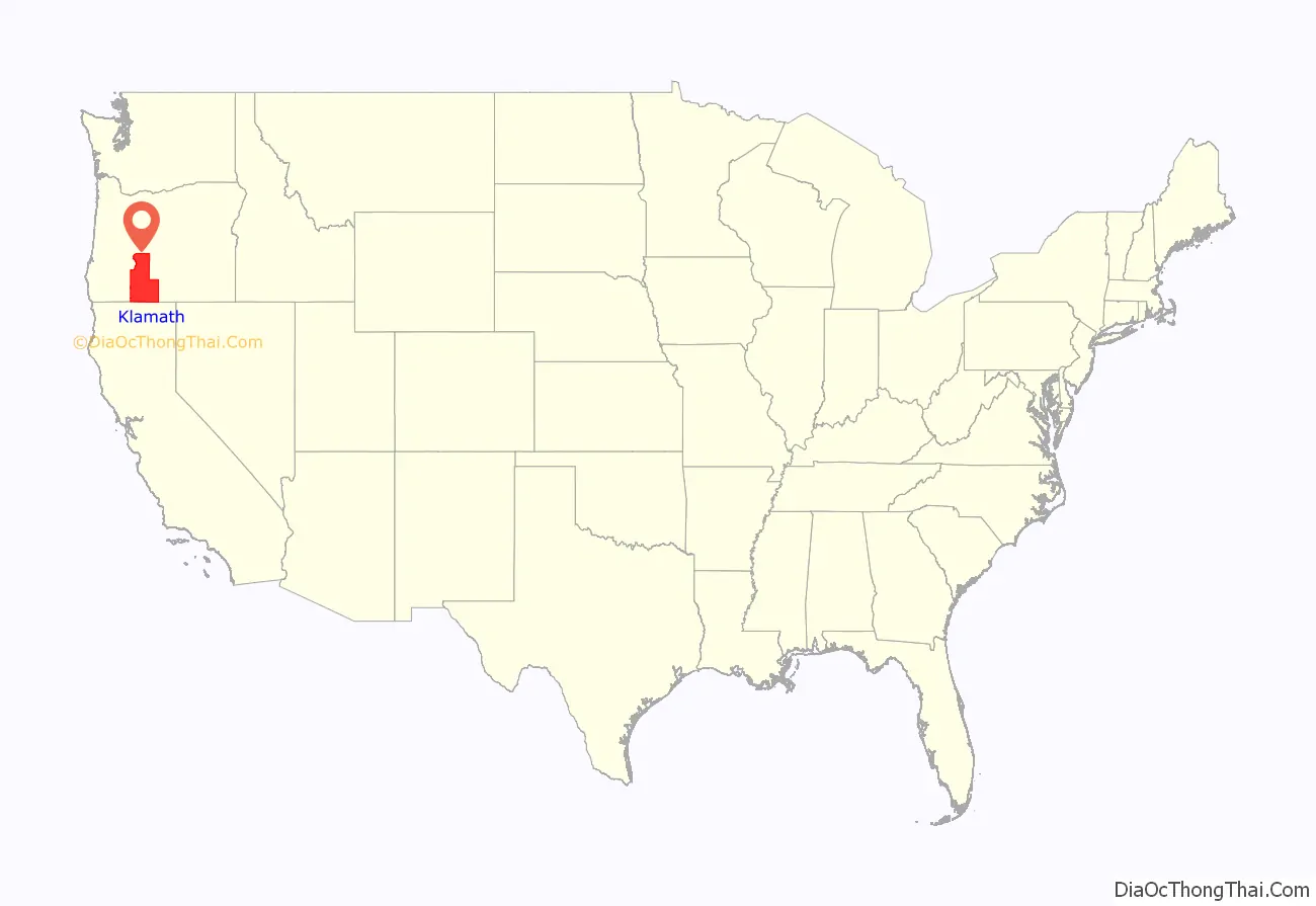
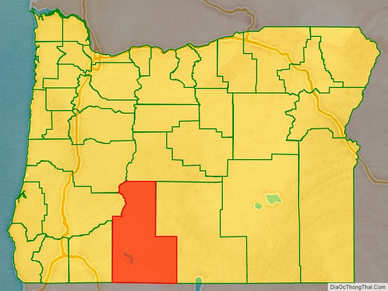
Klamath County location map. Where is Klamath County?
History
The Klamath or Clamitte tribe of Indians, for which Klamath County was named, are the descendants of varying cultures of indigenous peoples, who have lived in the area for more than 10,000 years.
When European-Americans began to travel through the area in 1846 along the Applegate Trail, they competed with the Klamath for game and water, which precipitated clashes between the peoples. This was exacerbated by European-American settlers, who cleared the land to farm and encroached on hunting territory. They were successful in demanding the removal of American Indians to reservations.
The Modoc people, having been removed to Oregon to share a reservation with the Klamath, traditional rivals, wanted a reservation created on Lost River, near present-day Merrill, Oregon. Captain Jack led his band back to Lost River, but the US Army, accompanied by militia and citizens of Linkville (present-day Klamath Falls) arrived and convinced Captain Jack to return. An argument broke out, shots were fired, and the Modoc War began as the Modoc fled to Captain Jack’s Stronghold in northern California.
A treaty was signed with the Klamath on October 14, 1864, which led to the establishment of the Klamath Reservation. At various times over the next 40 years, different individuals of the Modoc tribe were settled within the reservation.
Because of the extensive tracts of forest, the Klamath were very well off as a people until the termination of the reservation by the U.S. government in 1954. Termination parceled the communally managed land into individual sections, which tribe members could not manage on their own and were largely forced to sell to speculators.
A few of the Klamath refused to accept the buyout money, most notably Edison Chiloquin (1924–2003). Instead of cash, he insisted on receiving the title to ancestral land along the Sprague River where he lived. On December 5, 1980, the Chiloquin Act was signed into law, giving him title to the properties he wanted.
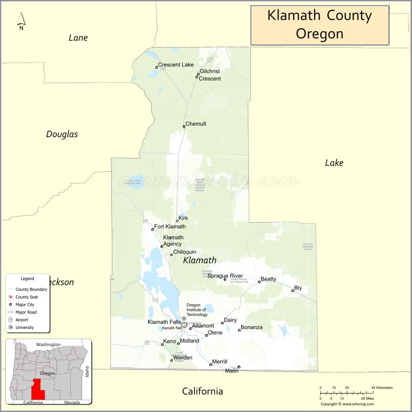
Klamath County Road Map
Geography
According to the United States Census Bureau, the county has a total area of 6,136 square miles (15,890 km), of which 5,941 square miles (15,390 km) is land and 194 square miles (500 km) (3.2%) is water. It is the fourth-largest county in Oregon.
Adjacent counties
- Douglas County (northwest)
- Lane County (northwest)
- Deschutes County (north)
- Lake County (east)
- Siskiyou County, California (south)
- Modoc County, California (south)
- Jackson County (west)
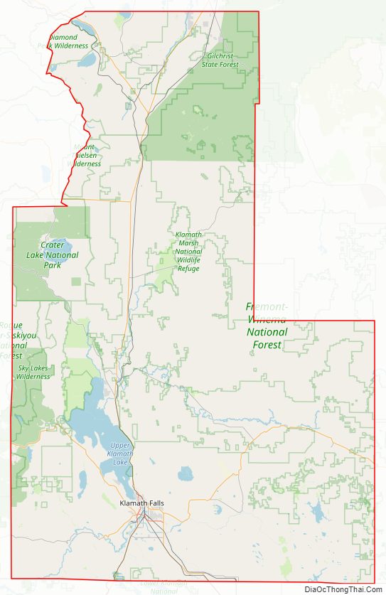
National protected areas
- Bear Valley National Wildlife Refuge
- Crater Lake National Park (part)
- Deschutes National Forest (part)
- Fremont National Forest (part)
- Klamath Marsh National Wildlife Refuge
- Lower Klamath National Wildlife Refuge (part)
- Rogue River – Siskiyou National Forest (part)
- Upper Klamath National Wildlife Refuge
- Winema National Forest (part)
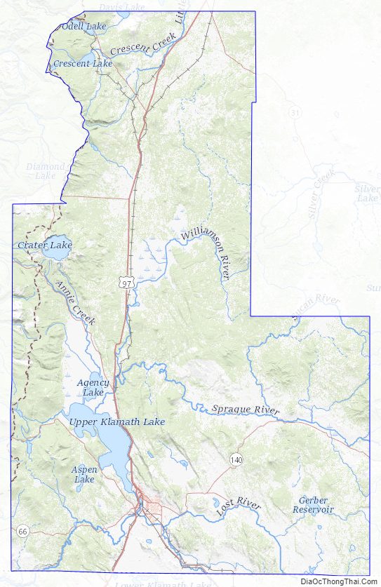
Klamath County Topographic Map
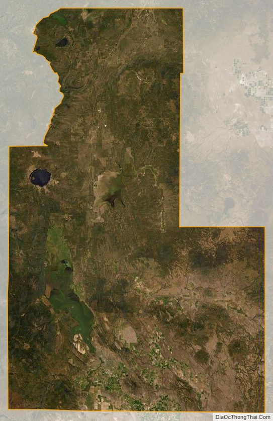
Klamath County Satellite Map
Klamath County Outline Map