Klamath Falls (/ˈklæməθ/ KLAM-əth) is a city in, and the county seat of, Klamath County, Oregon, United States. The city was originally called Linkville when George Nurse founded the town in 1867. It was named after the Link River, on whose falls the city was sited. The name was changed to Klamath Falls in 1893. The population was 21,813 at the 2020 census. The city is on the southeastern shore of the Upper Klamath Lake located about 246 miles (396 km) northwest of Reno, Nevada, and approximately 17 miles (27 km) north of the California–Oregon border.
Logging was Klamath Falls’s first major industry.
| Name: | Klamath Falls city |
|---|---|
| LSAD Code: | 25 |
| LSAD Description: | city (suffix) |
| State: | Oregon |
| County: | Klamath County |
| Incorporated: | 1905 |
| Elevation: | 4,094 ft (1,248 m) |
| Total Area: | 20.96 sq mi (54.27 km²) |
| Land Area: | 20.08 sq mi (52.01 km²) |
| Water Area: | 0.88 sq mi (2.27 km²) |
| Total Population: | 21,813 |
| Population Density: | 1,086.30/sq mi (419.43/km²) |
| ZIP code: | 97601, 97603 |
| Area code: | 541 |
| FIPS code: | 4139700 |
| GNISfeature ID: | 2411554 |
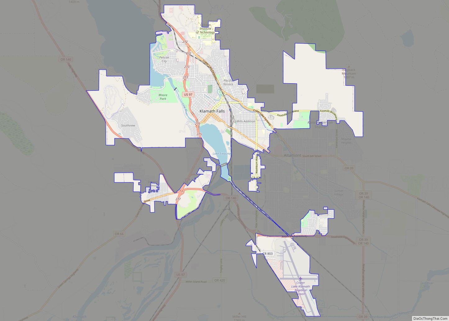
Online Interactive Map
Click on ![]() to view map in "full screen" mode.
to view map in "full screen" mode.
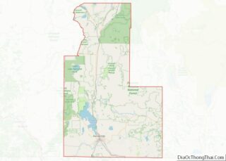
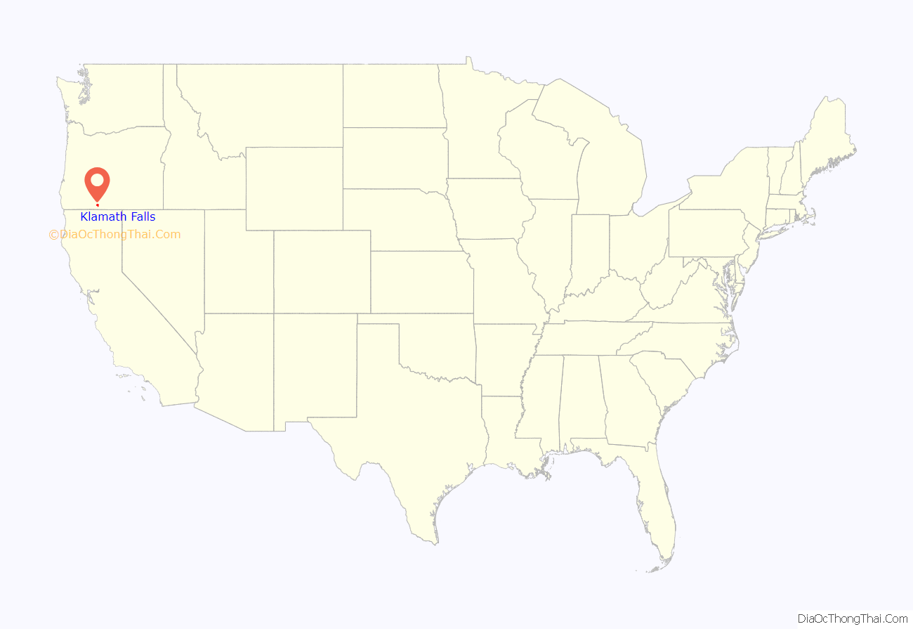
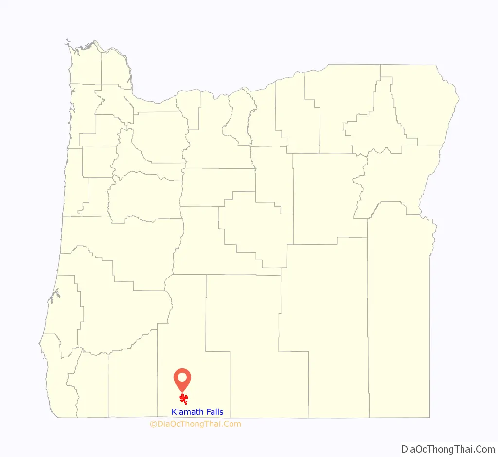
Klamath Falls location map. Where is Klamath Falls city?
History
The Klamath and Modoc peoples were the first known inhabitants of the area. The Modocs’ homeland is about 20 miles (32 km) south of Klamath Falls, but when they were forced onto a reservation with their adversaries, the Klamath, a rebellion ensued and they hid out in nearby lava beds. This led to the Modoc War of 1872–1873, which was a hugely expensive campaign for the US Cavalry, costing an estimated $500,000, the equivalent of over $8 million in 2000. 17 Indigenous people and 83 whites were killed.
The Applegate Trail, which passes through the lower Klamath area, was blazed in 1846 from west to east in an attempt to provide a safer route for emigrants on the Oregon Trail. The first non-Indigenous colonizer is considered to have been Wallace Baldwin, a 19-year-old civilian who drove fifty head of horses in the valley in 1852. In 1867, George Nurse, named the small settlement “Linkville”, because of Link River north of Lake Ewauna.
The Klamath Reclamation Project began in 1906 to drain marshland and move water to allow for agriculture. With the building of the main “A” Canal, water was first made available on May 22, 1907. Veterans of World War I and World War II were given homesteading opportunities on the reclaimed land.
During World War II, a Japanese-American internment camp, the Tule Lake War Relocation Center, was located in nearby Newell, California, and a satellite of the Camp White, Oregon, POW camp was located just on the Oregon-California border near the town of Tulelake, California. In May 1945, about 30 miles (48 km) east of Klamath Falls, (near Bly, Oregon) a Japanese Fu-Go balloon bomb killed a woman and five children on a church outing. This is said to be the only Japanese-inflicted casualty on the US mainland during the war.
Timber harvesting through the use of railroad was extensive in Klamath County for the first few decades of the 20th century. With the arrival of the Southern Pacific Transportation Company in 1909, Klamath Falls grew quickly from a few hundred to several thousand. Dozens of lumber mills cut fir and pine lumber, and the industry flourished until the late 1980s when the northern spotted owl and other endangered species were driving forces in changing western forest policy.
On September 20, 1993, a series of earthquakes struck near Klamath Falls. Many downtown buildings, including the county courthouse and the former Sacred Heart Academy and Convent, were damaged or destroyed, and two people were killed.
Water rights controversy
The city made national headlines in 2001 when a court decision was made to shut off Klamath Project irrigation water on April 6 because of Endangered Species Act requirements. The Lost River sucker and shortnose sucker were listed on the Federal Endangered Species List in 1988, and when drought struck in 2001, a panel of scientists stated that further diversion of water for agriculture would be detrimental to these species, which reside in the Upper Klamath Lake, as well as to the protected Coho salmon which spawn in the Klamath River. Many protests by farmers and citizens culminated in a “Bucket Brigade” on Main Street May 7, 2001, in Klamath Falls. The event was attended by 18,000 farmers, ranchers, citizens, and politicians. Two giant bucket monuments have since been constructed and erected in town to commemorate the event. Such universal criticism resulted in a new plan implemented in early 2002 to resume irrigation to farmers.
Low river flows in the Klamath and Trinity rivers and high temperatures led to a mass die-off of at least 33,000 salmon in 2002. Dwindling salmon numbers have practically shut down the fishing industry in the region and caused over $60m in disaster aid being given to fishermen to offset losses. 90% of Trinity River water is diverted for California agriculture. As much as 90% of the Trinity’s water, which would otherwise flow into the Klamath and out to sea, instead rushes south toward California’s thirsty center.
According to a National Academy of Sciences report of October 22, 2003, limiting irrigation water did little if anything to help endangered fish and may have hurt the populations. A contrary report has criticized the National Academy of Sciences report. The Chiloquin Dam has been removed to help improve sucker spawning habitat.
In 2021 tensions between locals and the Federal Government led to two local farmers to purchase land at the headgates in Klamath Falls, OR. These farmers have ties to the Ammon Bundy People’s Rights organization and are preparing for a potential standoff situation with the government.
Geothermal heating
Klamath Falls is located in a known geothermal resource area. Geothermal power has been used directly for geothermal heating in the area since the early 1900s. A downtown district heating system was constructed in 1981 and extended in 1982. There was public opposition to the scheme. Many homes were heated by private geothermal wells, and owners were concerned that the city system could lower the water level and/or reduce water temperatures. System operation was delayed until 1984 following an aquifer study. Full operational testing showed no negative impact on the private wells. The system was shut down again in 1986 after multiple distribution piping failures were discovered. By 1991, the distribution piping had been reconstructed, and the system was again operating. The system has been expanded since then, and according to the Oregon Institute of Technology, the operation is “at or near operational break-even”. The system is used to provide direct heat for homes, city schools, greenhouses, government and commercial buildings, geothermally heated snowmelt systems for sidewalks and roads, and process heat for the wastewater treatment plant.
Air quality
According to the Oregon Department of Environmental Quality (DEQ) significant efforts are being made to improve the air quality in the Klamath Basin. The following excerpts are from a report produced by DEQ in September 2012.
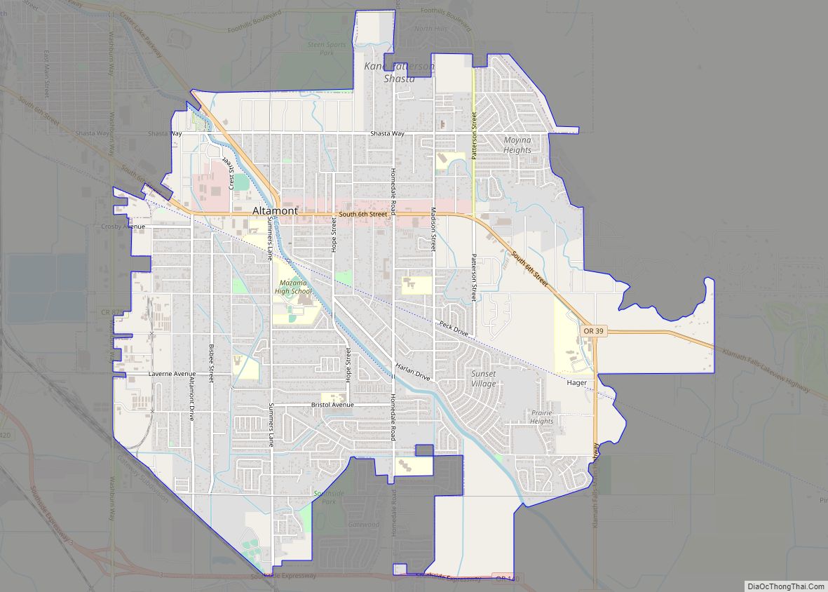
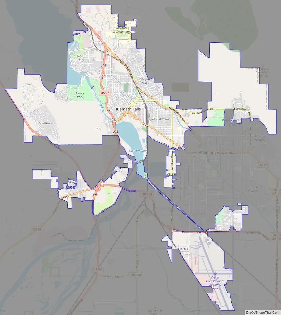
Klamath Falls Road Map
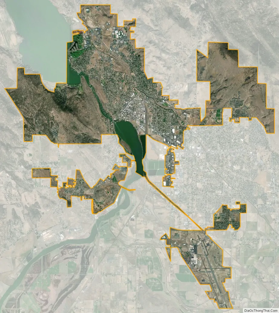
Klamath Falls city Satellite Map
Geography
According to the United States Census Bureau, the city has a total area of 20.66 square miles (53.51 km), of which 19.81 square miles (51.31 km) is land and 0.85 square miles (2.20 km) is water. The elevation is 4,094 feet (1,248 m).
Klamath Falls has a high desert landscape. The older part of the city is located above natural geothermal springs. These have been used for the heating of homes and streets, primarily in the downtown area.
Climate
Klamath Falls is known as “Oregon’s City of Sunshine” because the area enjoys 300 days of sun per year. The Klamath Falls area is a high desert and features a climate with cold, snowy winters along with hot summer afternoons and cool summer nights. Under the Köppen climate classification the city’s climate type is Csb, often described as warm summer Mediterranean. Using the 0 °C (32 °F) isotherm preferred by some climatologists, Klamath Falls is a Dsb climate, often described as warm summer humid continental.
Typical of its region, Klamath Falls has a dry season in summertime, with the greatest precipitation occurring in wintertime, a substantial proportion falling as snow. Although it is not arid or semi-arid, total precipitation is still low, at 13.41 inches (340.6 mm) per year, due to Klamath Falls being in the rain shadow of the Cascade Mountains to the west. The wettest “rain year” has been from July 1955 to June 1956 with 21.78 inches (553.2 mm) and the driest from July 1954 to June 1955 with 6.09 inches (154.7 mm). Annual snowfall averages around 36.5 inches (93 cm), with the most on record being 100.6 inches (256 cm) between July 1955 and June 1956; in contrast, only a trace of snow fell between July 1991 and June 1992. The maximum snow depth has been 36 inches (91 cm) on January 3, 1901.
The all-time record high is 105 °F (40.6 °C), set on July 27, 1911, and the all-time record low is −24 °F (−31.1 °C), set on January 15, 1888. The freeze-free season averages around 120 days, with the first freeze in a typical year being on September 21, and the last freeze being on June 1. On average 18.2 days per year reach 90 °F (32.2 °C) or higher, and 1.9 nights per year reach temperatures of 0 °F (−17.8 °C) or lower.
See also
Map of Oregon State and its subdivision: Map of other states:- Alabama
- Alaska
- Arizona
- Arkansas
- California
- Colorado
- Connecticut
- Delaware
- District of Columbia
- Florida
- Georgia
- Hawaii
- Idaho
- Illinois
- Indiana
- Iowa
- Kansas
- Kentucky
- Louisiana
- Maine
- Maryland
- Massachusetts
- Michigan
- Minnesota
- Mississippi
- Missouri
- Montana
- Nebraska
- Nevada
- New Hampshire
- New Jersey
- New Mexico
- New York
- North Carolina
- North Dakota
- Ohio
- Oklahoma
- Oregon
- Pennsylvania
- Rhode Island
- South Carolina
- South Dakota
- Tennessee
- Texas
- Utah
- Vermont
- Virginia
- Washington
- West Virginia
- Wisconsin
- Wyoming