| Name: | Clackamas County |
|---|---|
| FIPS code: | 41-005 |
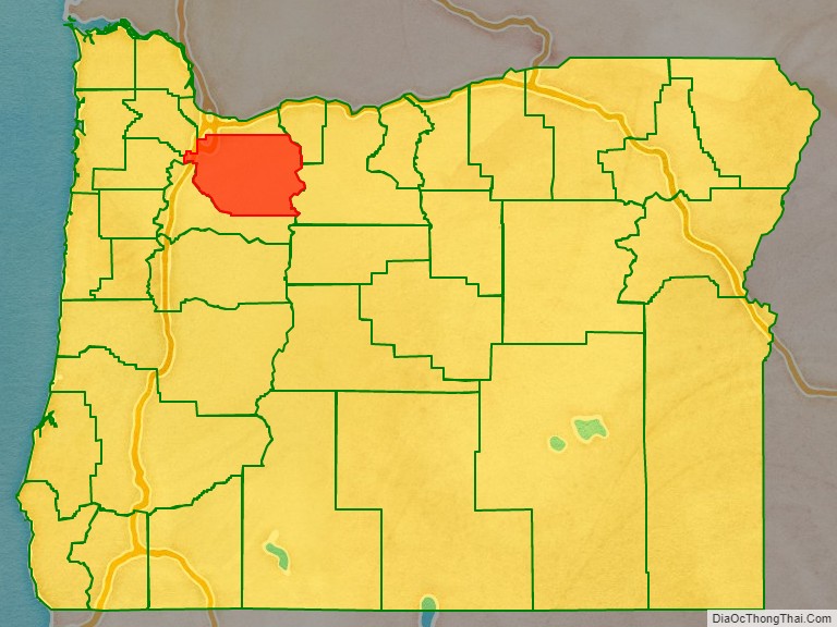
| State: | Oregon |
| Founded: | July 5, 1843 |
| Named for: | Clackamas people |
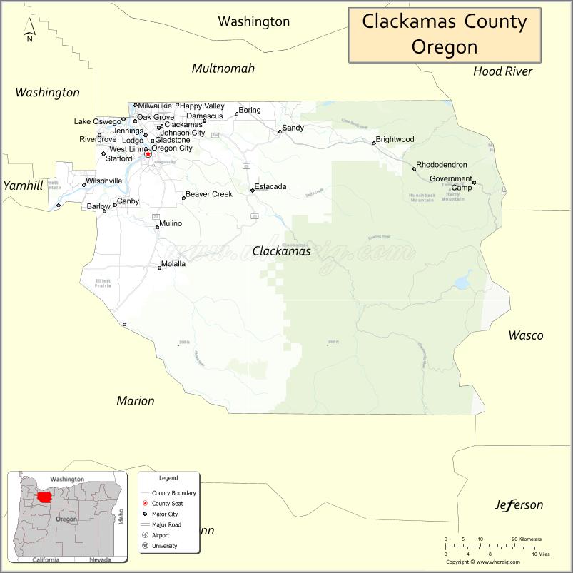
| Seat: | Oregon City |
| Largest city: | Lake Oswego |
| Total Area: | 1,883 sq mi (4,880 km²) |
| Land Area: | 1,870 sq mi (4,800 km²) |
| Total Population: | 421,401 |
| Population Density: | 220/sq mi (86/km²) |
| Time zone: | UTC−8 (Pacific) |
| Summer Time Zone (DST): | UTC−7 (PDT) |
| Website: | www.clackamas.us |
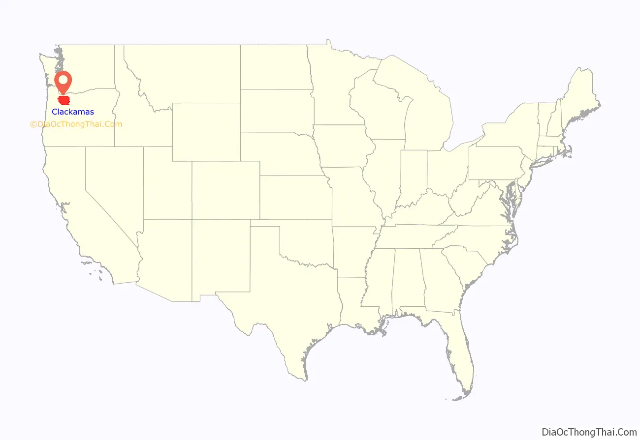
Clackamas County location map. Where is Clackamas County?
History
Originally named Clackamas District, it was one of the four original Oregon districts created by Oregon’s Provisional Legislature on July 5, 1843, along with Twality (later Washington), Champooick (later Marion), and Yamhill. The four districts were redesignated as counties in 1845. At the time of its creation, Clackamas County covered portions of four present-day U.S. states and a Canadian province. The Columbia River became the northern boundary of the county in 1844. Soon after, John McLoughlin staked a land claim in Oregon City and built a house that in 2003 became a unit of the Fort Vancouver National Historic Site.
Most of the indigenous people of the Wil-lamet Valley were forcibly removed in February 1859, to the reservation of the Confederated Tribes of Grand Ronde. Most were moved without treaty or compensation for lost lands or resources. Some 22 tribes were moved during the cold winter. It is estimated that 30% did not survive the first year. The tribes eventually prospered, but outside of Clackamas County. They also never received any revenue or compensation from the logging of their homeland forests.
In addition, the Tribes of the Cascades Mountains were isolated to a Reservation after the signing of a treaty in 1859. Confederated Tribes of Warmsprings was established and remains a strong and vital player in actions that concern the Federal forests of the Cascades Range.
Oregon City was also the site of the only federal court west of the Rockies in 1849, when San Francisco, California, was platted. The plat was filed in 1850 in the first plat book of the first office of records in the West Coast and is still in Oregon City.
In 1902, the Willamette Meteorite was recovered from a field near present-day West Linn.
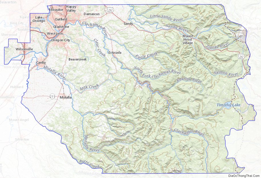
Clackamas County Road Map
Geography
According to the United States Census Bureau, the county has a total area of 1,883 square miles (4,880 km), of which 1,870 square miles (4,800 km) is land and 12 square miles (31 km) (0.7%) is water.
Major highways
- Interstate 5
- Interstate 205
- U.S. Route 26
- Oregon Route 35
- Oregon Route 99E
- Oregon Route 212
- Oregon Route 213
- Oregon Route 224
Adjacent counties
- Multnomah County – north
- Hood River County – northeast
- Wasco County – east
- Marion County – south
- Yamhill County – west
- Washington County – northwest
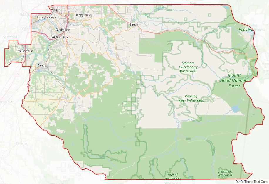
The county includes parts of two national forests: Mount Hood National Forest and Willamette National Forest.
Clackamas County Topographic Map
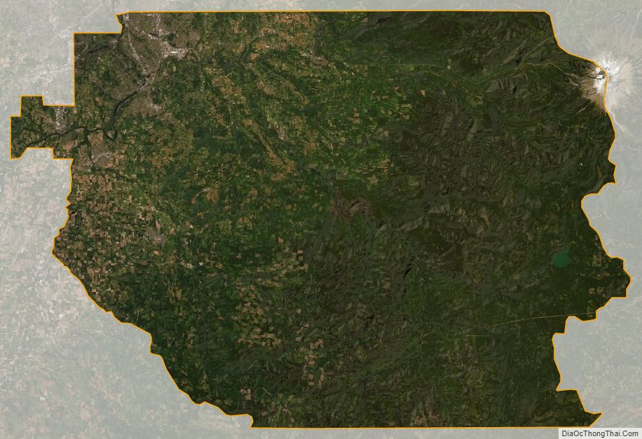
Clackamas County Satellite Map
Clackamas County Outline Map