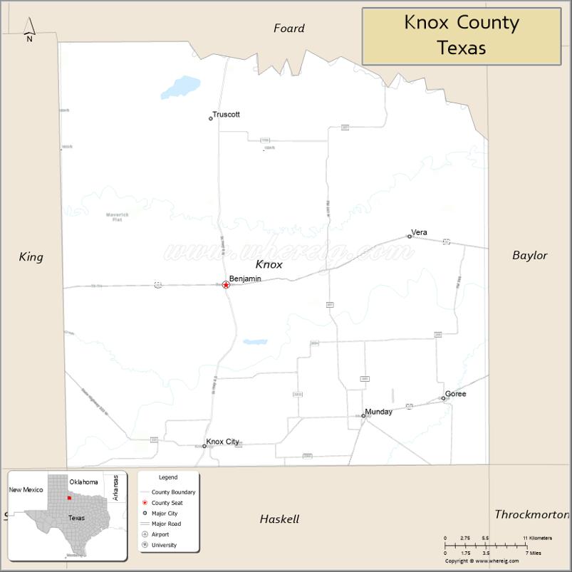
Knox County is a county located in the U.S. state of Texas. As of the 2020 census, its population was 3,353. Its county seat is Benjamin. The county was created in 1858 and later organized in 1886. It is named for Henry Knox, an American Revolutionary War general.
| Name: | Knox County |
|---|---|
| FIPS code: | 48-275 |
| State: | Texas |
| Founded: | 1886 |
| Named for: | Henry Knox |
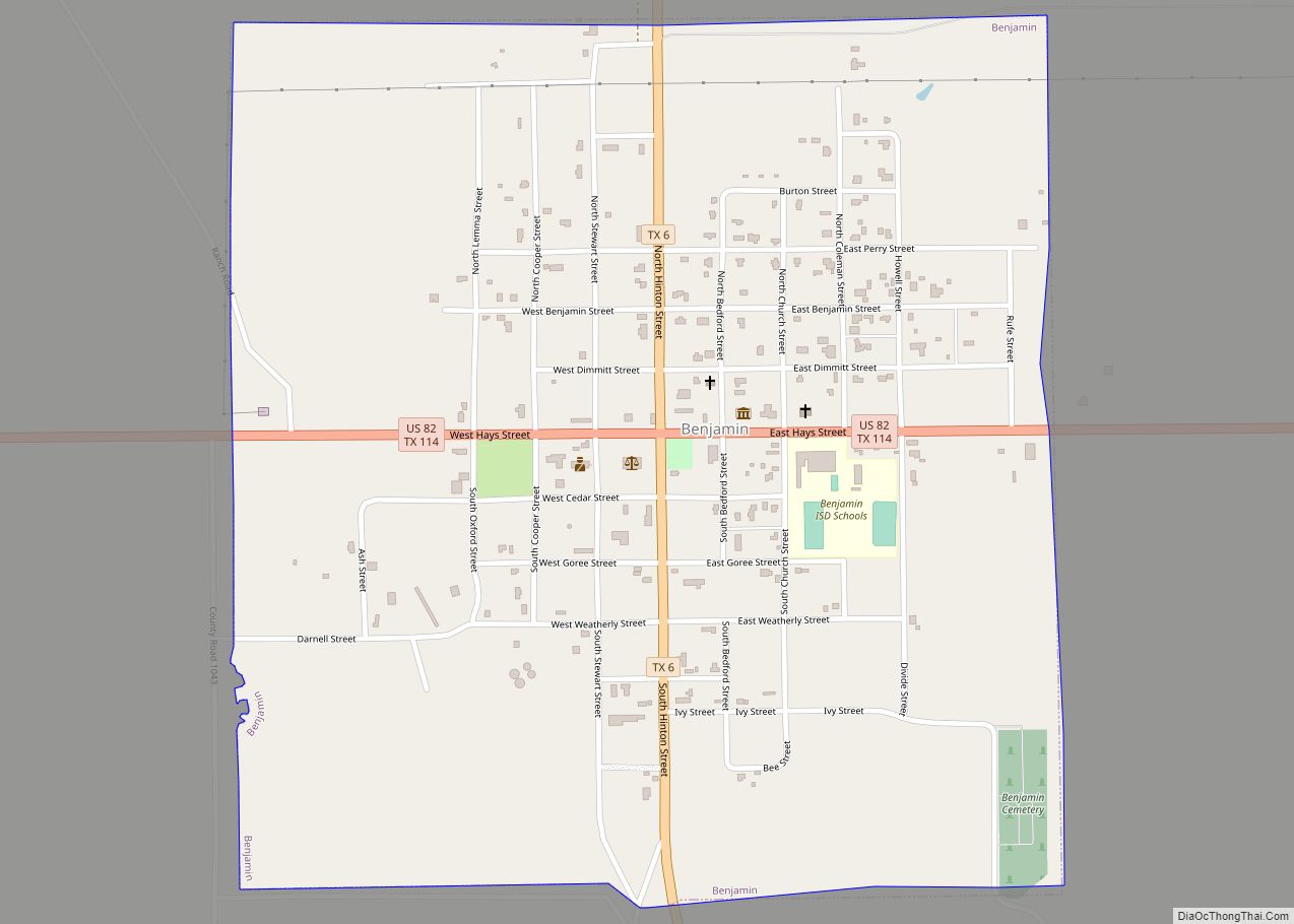
| Seat: | Benjamin |
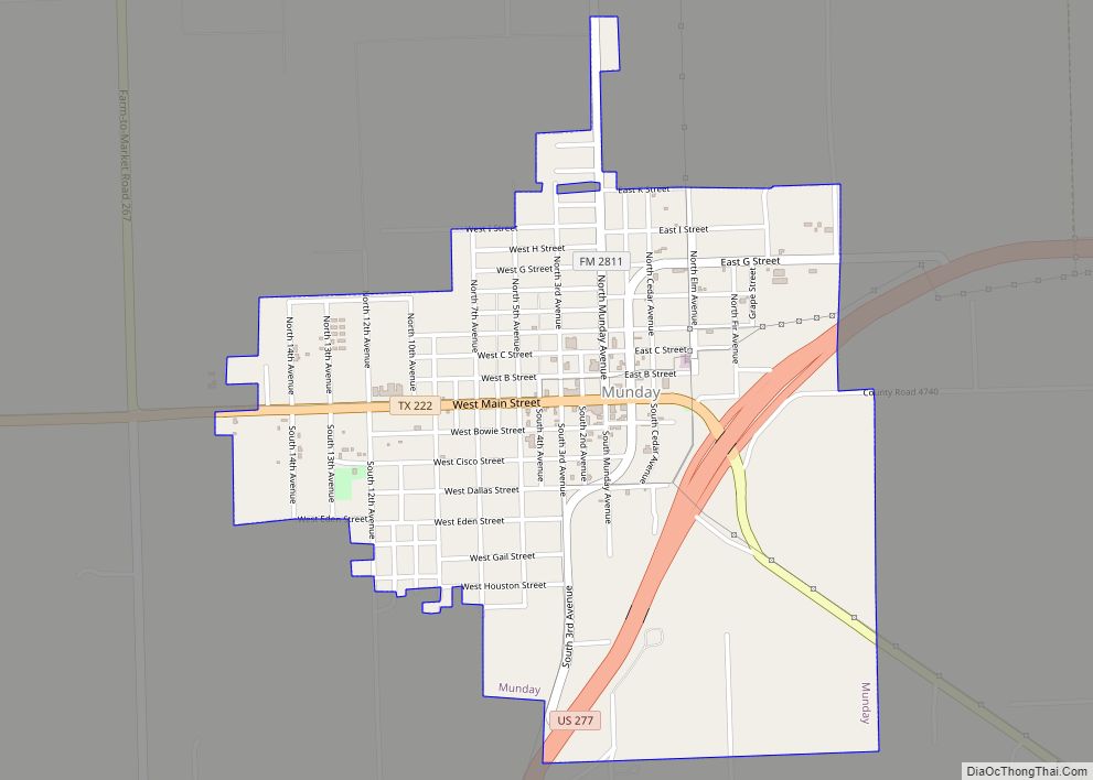
| Largest city: | Munday |
| Total Area: | 855 sq mi (2,210 km²) |
| Land Area: | 851 sq mi (2,200 km²) |
| Total Population: | 3,353 |
| Population Density: | 3.9/sq mi (1.5/km²) |
| Time zone: | UTC−6 (Central) |
| Summer Time Zone (DST): | UTC−5 (CDT) |
| Website: | www.knoxcountytexas.org |
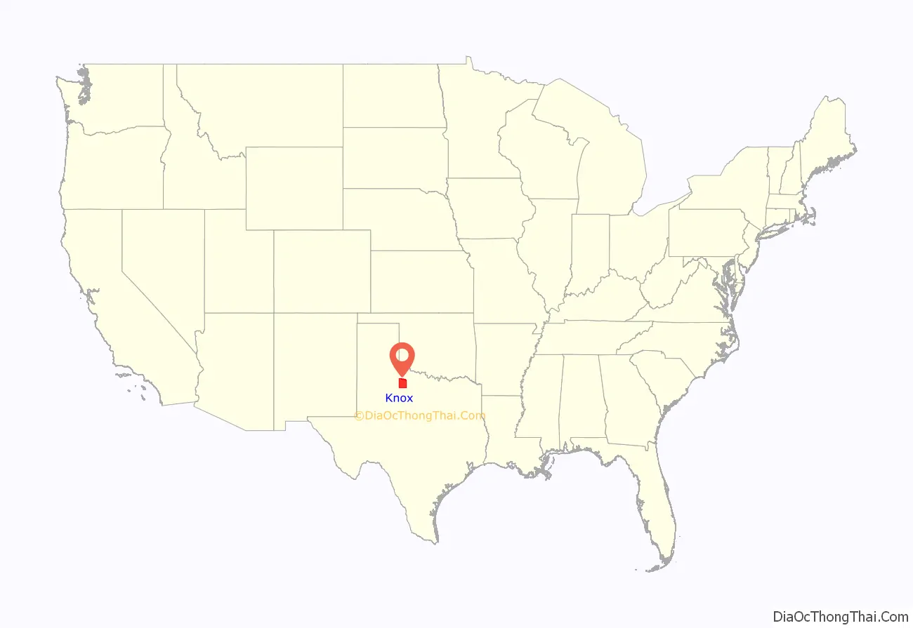
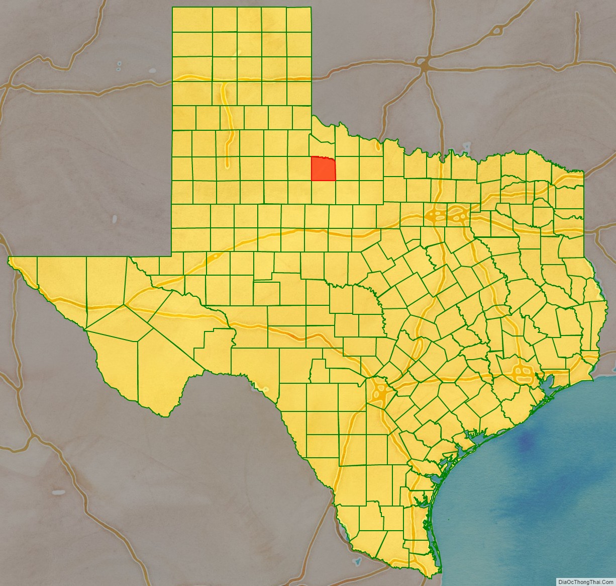
Knox County location map. Where is Knox County?
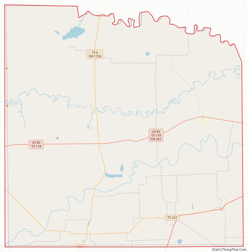
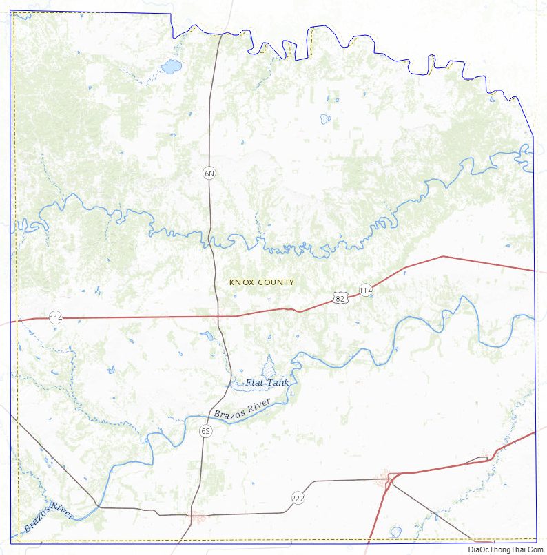
Knox County Road Map
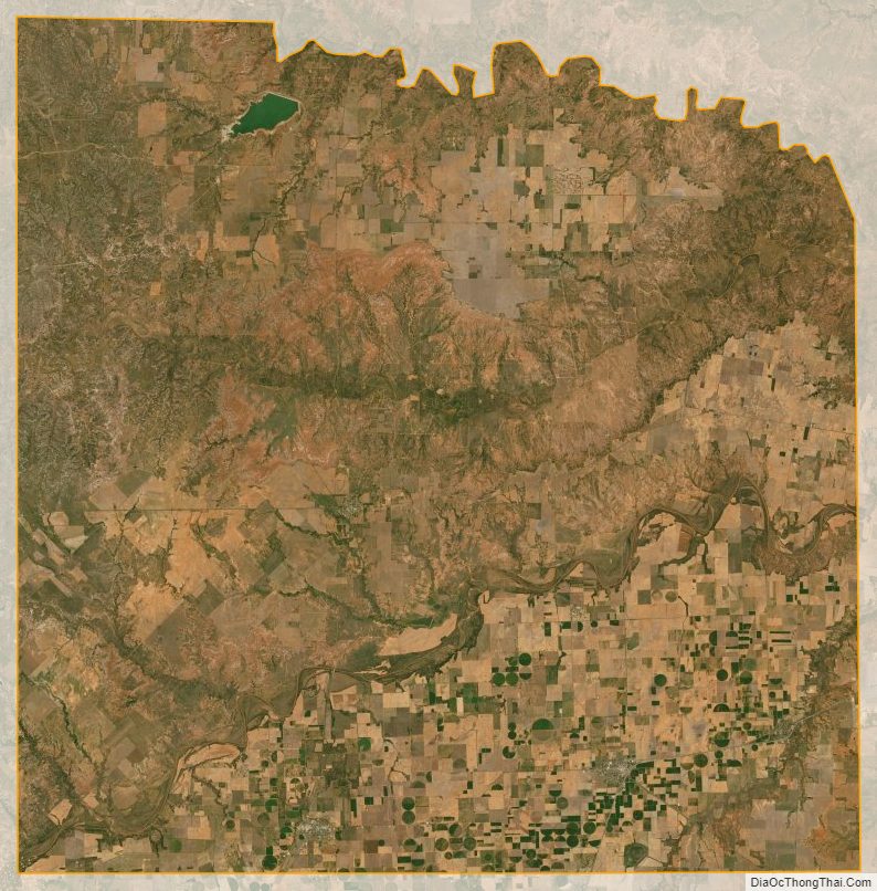
Geography
According to the U.S. Census Bureau, the county has a total area of 855 sq mi (2,210 km), of which 4.9 square miles (13 km) (0.6%) are covered by water.
Major highways
- U.S. Highway 82/State Highway 114
- U.S. Highway 277
- State Highway 6
- State Highway 222
Adjacent counties
- Foard County (north)
- Baylor County (east)
- Haskell County (south)
- King County (west)
- Stonewall County (southwest)
- Throckmorton County (southeast)
Notable geographic features
- The Narrows
Knox County Topographic Map
Knox County Satellite Map
Knox County Outline Map