Munday (/ˈmʌndi/ MUN-dee) is a city in Knox County, Texas, United States. The population was 1,246 at the 2020 census.
| Name: | Munday city |
|---|---|
| LSAD Code: | 25 |
| LSAD Description: | city (suffix) |
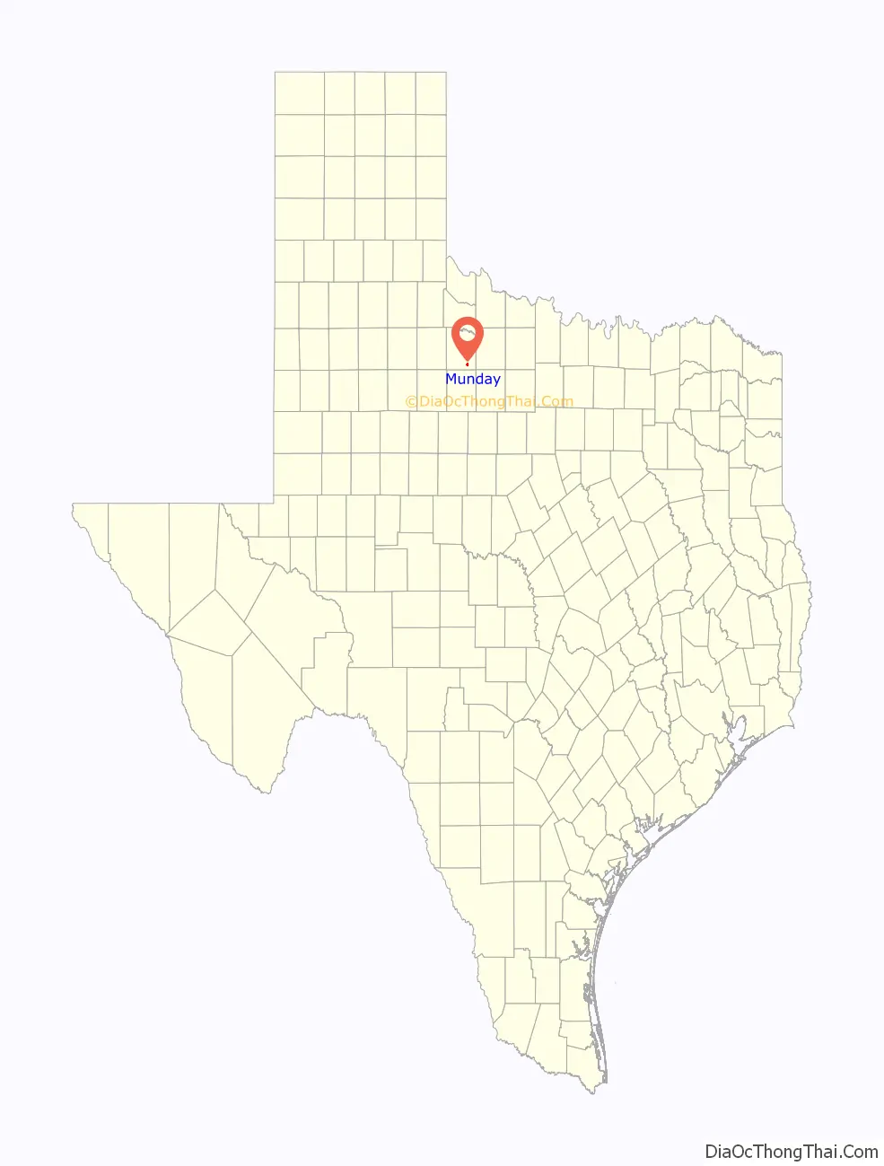
| State: | Texas |
| County: | Knox County |
| Elevation: | 1,480 ft (451 m) |
| Total Area: | 1.43 sq mi (3.70 km²) |
| Land Area: | 1.43 sq mi (3.70 km²) |
| Water Area: | 0.00 sq mi (0.00 km²) |
| Total Population: | 1,246 |
| Population Density: | 893.48/sq mi (344.94/km²) |
| ZIP code: | 76371 |
| Area code: | 940 |
| FIPS code: | 4850040 |
| GNISfeature ID: | 1363481 |
| Website: | www.mundaytexas.com |
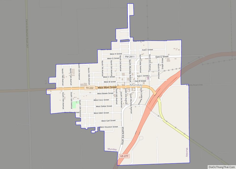
Online Interactive Map
Click on ![]() to view map in "full screen" mode.
to view map in "full screen" mode.
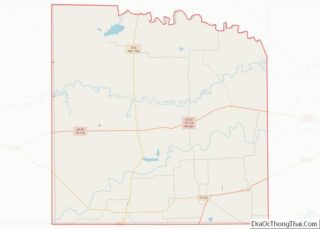
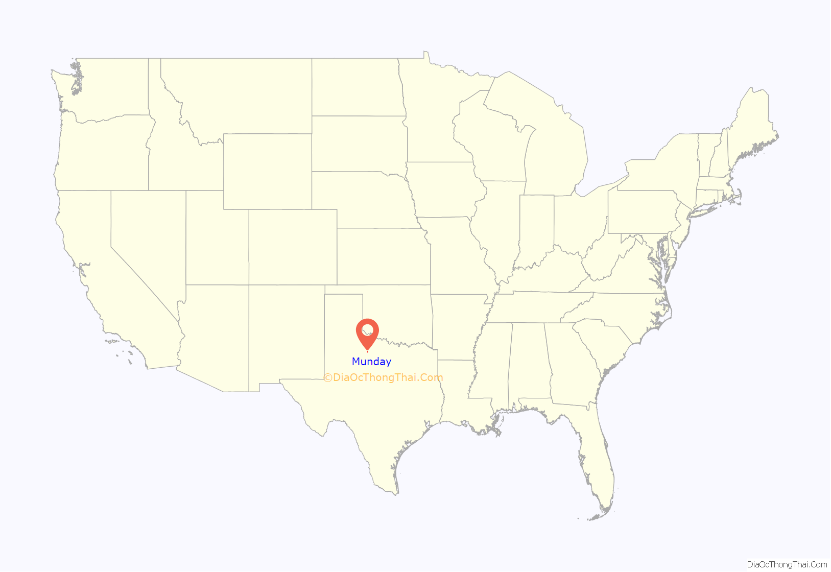
Munday location map. Where is Munday city?
History
The community dates from 1893, when a store was built at the site. Originally known as Maud, it was renamed for postmaster R.P. Munday when the first post office was established in 1894. In 1903, West Munday merchants—separated by a thousand yards from East Munday—moved their buildings to the east. The Wichita Valley Railroad arrived in 1906, the same year that the community incorporated. With 968 residents in 1910, Munday was easily the largest town in Knox County. By 1950, the population reached 2,270. The population slowly decreased throughout the latter half of the twentieth century. Attractions in Munday include a nine-hole golf course, county library, city park, and antique shops.
Cotton has continued to major agricultural crop in the Munday area and continues to be a significant component of the local economy. W. A. Earnest built a gin in 1900, and thereafter cotton processing remained significant, but Munday also became a center for vegetable processing, since irrigation encouraged local farmers to raise onions, potatoes, cucumbers, melons, and other produce. Texas A&M University opened a vegetable research center in Munday in 1971.
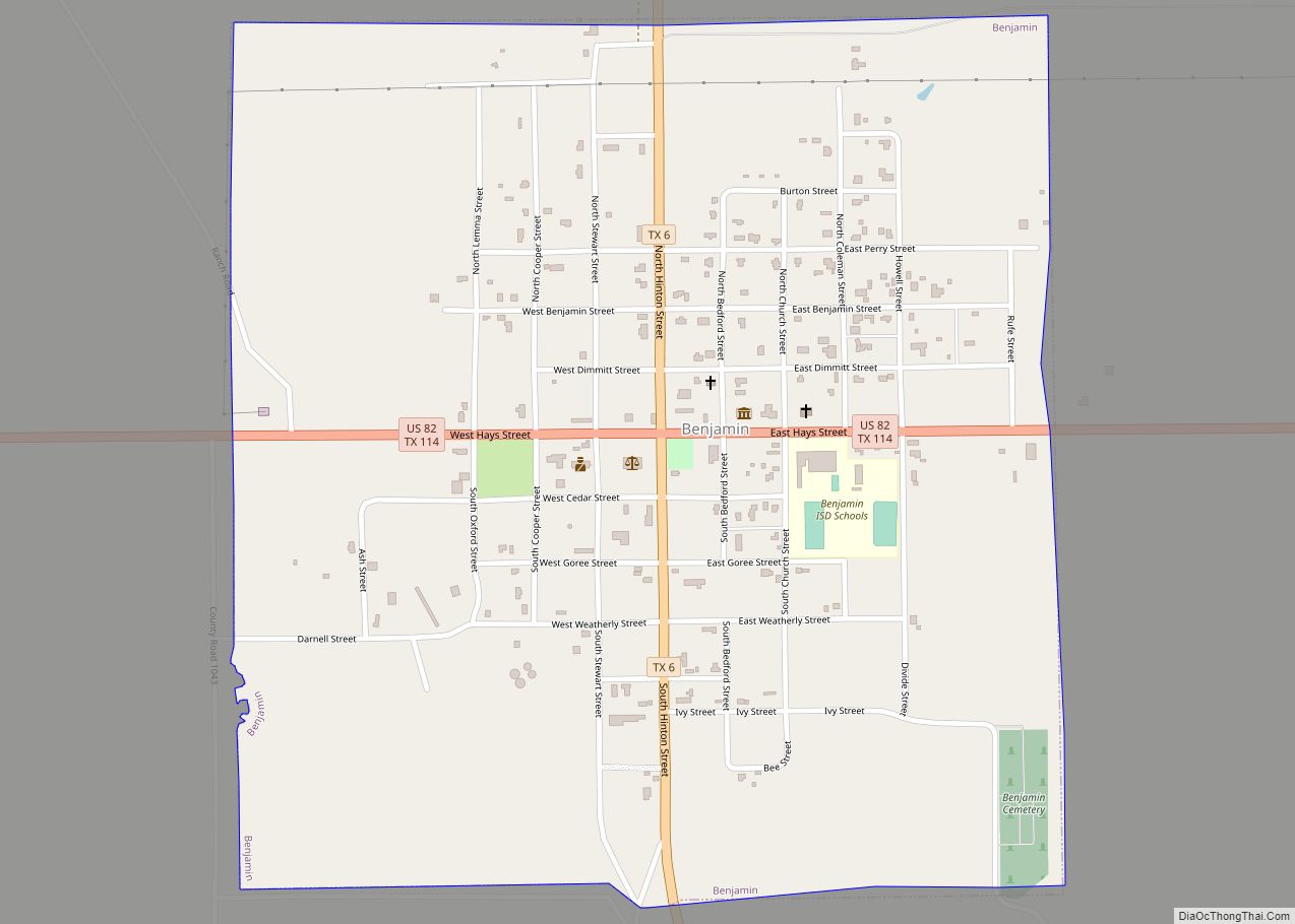
Munday Road Map
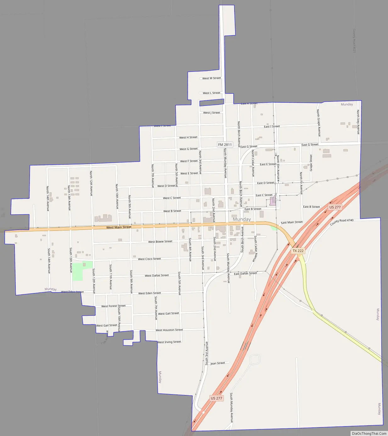
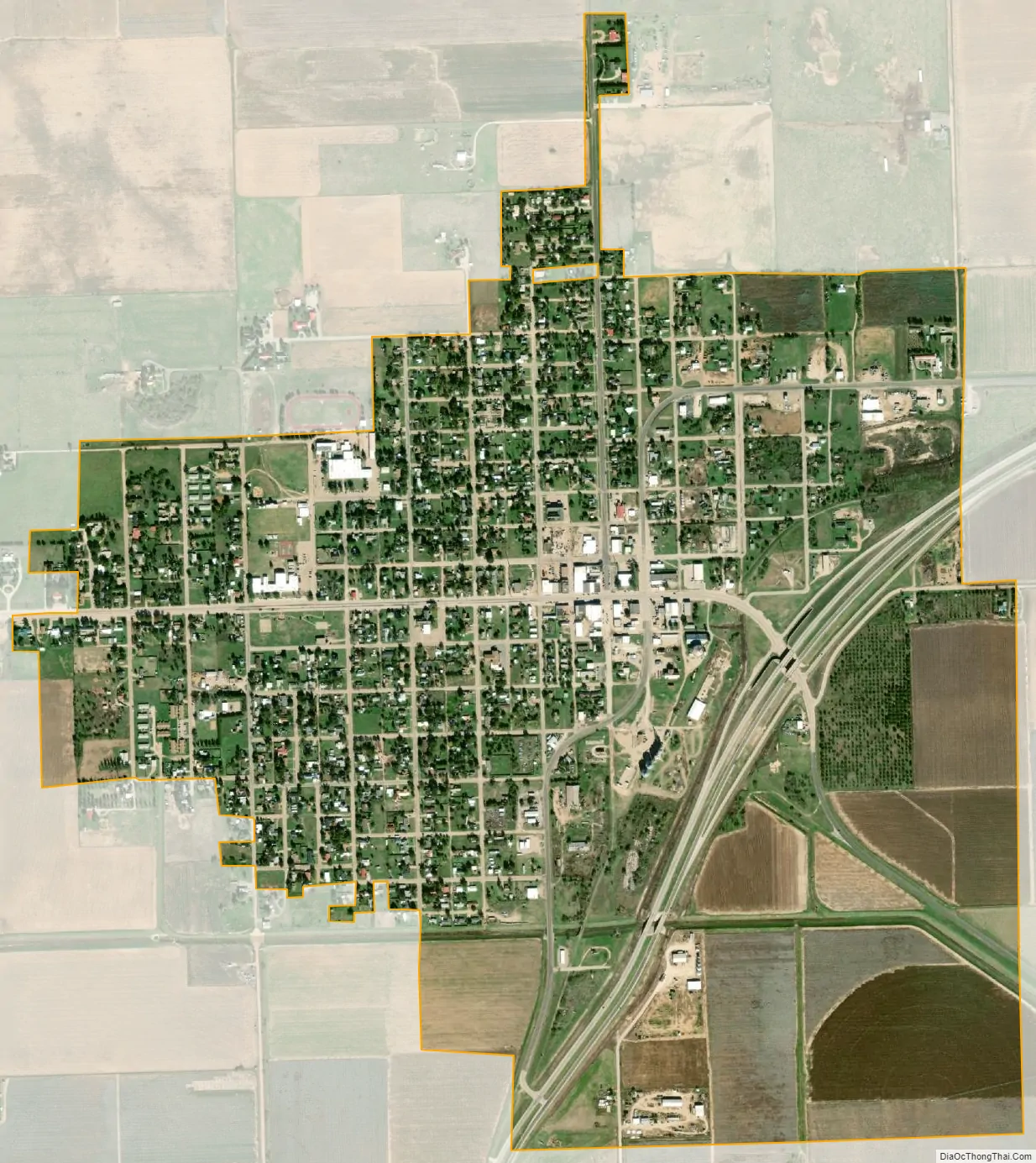
Munday city Satellite Map
Geography
Munday is located at 33°26′57″N 99°37′34″W / 33.44917°N 99.62611°W / 33.44917; -99.62611 (33.449292, –99.626028). It is situated at the junction of U.S. Highway 277, State Highway 222, and Farm Roads 1581 and 2811 in southeastern Knox County.
Munday is approximately 75 miles from both Abilene and Wichita Falls.
According to the United States Census Bureau, the city has a total area of 1.4 square miles (3.6 km), all of it land.
See also
Map of Texas State and its subdivision:- Anderson
- Andrews
- Angelina
- Aransas
- Archer
- Armstrong
- Atascosa
- Austin
- Bailey
- Bandera
- Bastrop
- Baylor
- Bee
- Bell
- Bexar
- Blanco
- Borden
- Bosque
- Bowie
- Brazoria
- Brazos
- Brewster
- Briscoe
- Brooks
- Brown
- Burleson
- Burnet
- Caldwell
- Calhoun
- Callahan
- Cameron
- Camp
- Carson
- Cass
- Castro
- Chambers
- Cherokee
- Childress
- Clay
- Cochran
- Coke
- Coleman
- Collin
- Collingsworth
- Colorado
- Comal
- Comanche
- Concho
- Cooke
- Coryell
- Cottle
- Crane
- Crockett
- Crosby
- Culberson
- Dallam
- Dallas
- Dawson
- Deaf Smith
- Delta
- Denton
- Dewitt
- Dickens
- Dimmit
- Donley
- Duval
- Eastland
- Ector
- Edwards
- El Paso
- Ellis
- Erath
- Falls
- Fannin
- Fayette
- Fisher
- Floyd
- Foard
- Fort Bend
- Franklin
- Freestone
- Frio
- Gaines
- Galveston
- Garza
- Gillespie
- Glasscock
- Goliad
- Gonzales
- Gray
- Grayson
- Gregg
- Grimes
- Guadalupe
- Hale
- Hall
- Hamilton
- Hansford
- Hardeman
- Hardin
- Harris
- Harrison
- Hartley
- Haskell
- Hays
- Hemphill
- Henderson
- Hidalgo
- Hill
- Hockley
- Hood
- Hopkins
- Houston
- Howard
- Hudspeth
- Hunt
- Hutchinson
- Irion
- Jack
- Jackson
- Jasper
- Jeff Davis
- Jefferson
- Jim Hogg
- Jim Wells
- Johnson
- Jones
- Karnes
- Kaufman
- Kendall
- Kenedy
- Kent
- Kerr
- Kimble
- King
- Kinney
- Kleberg
- Knox
- La Salle
- Lamar
- Lamb
- Lampasas
- Lavaca
- Lee
- Leon
- Liberty
- Limestone
- Lipscomb
- Live Oak
- Llano
- Loving
- Lubbock
- Lynn
- Madison
- Marion
- Martin
- Mason
- Matagorda
- Maverick
- McCulloch
- McLennan
- McMullen
- Medina
- Menard
- Midland
- Milam
- Mills
- Mitchell
- Montague
- Montgomery
- Moore
- Morris
- Motley
- Nacogdoches
- Navarro
- Newton
- Nolan
- Nueces
- Ochiltree
- Oldham
- Orange
- Palo Pinto
- Panola
- Parker
- Parmer
- Pecos
- Polk
- Potter
- Presidio
- Rains
- Randall
- Reagan
- Real
- Red River
- Reeves
- Refugio
- Roberts
- Robertson
- Rockwall
- Runnels
- Rusk
- Sabine
- San Augustine
- San Jacinto
- San Patricio
- San Saba
- Schleicher
- Scurry
- Shackelford
- Shelby
- Sherman
- Smith
- Somervell
- Starr
- Stephens
- Sterling
- Stonewall
- Sutton
- Swisher
- Tarrant
- Taylor
- Terrell
- Terry
- Throckmorton
- Titus
- Tom Green
- Travis
- Trinity
- Tyler
- Upshur
- Upton
- Uvalde
- Val Verde
- Van Zandt
- Victoria
- Walker
- Waller
- Ward
- Washington
- Webb
- Wharton
- Wheeler
- Wichita
- Wilbarger
- Willacy
- Williamson
- Wilson
- Winkler
- Wise
- Wood
- Yoakum
- Young
- Zapata
- Zavala
- Alabama
- Alaska
- Arizona
- Arkansas
- California
- Colorado
- Connecticut
- Delaware
- District of Columbia
- Florida
- Georgia
- Hawaii
- Idaho
- Illinois
- Indiana
- Iowa
- Kansas
- Kentucky
- Louisiana
- Maine
- Maryland
- Massachusetts
- Michigan
- Minnesota
- Mississippi
- Missouri
- Montana
- Nebraska
- Nevada
- New Hampshire
- New Jersey
- New Mexico
- New York
- North Carolina
- North Dakota
- Ohio
- Oklahoma
- Oregon
- Pennsylvania
- Rhode Island
- South Carolina
- South Dakota
- Tennessee
- Texas
- Utah
- Vermont
- Virginia
- Washington
- West Virginia
- Wisconsin
- Wyoming