Stonewall County is a county located in the U.S. state of Texas. As of the 2020 census, its population was 1,245. Its county seat is Aspermont. The county was created in 1876 and organized in 1888. It is named for Stonewall Jackson, a general of the Confederate States Army.
Republican Drew Springer, Jr., a businessman from Muenster in Cooke County, represented Stonewall County in the Texas House of Representatives from January 2013, and as of January 2021, represents District 30 in the Texas Senate.
| Name: | Stonewall County |
|---|---|
| FIPS code: | 48-433 |
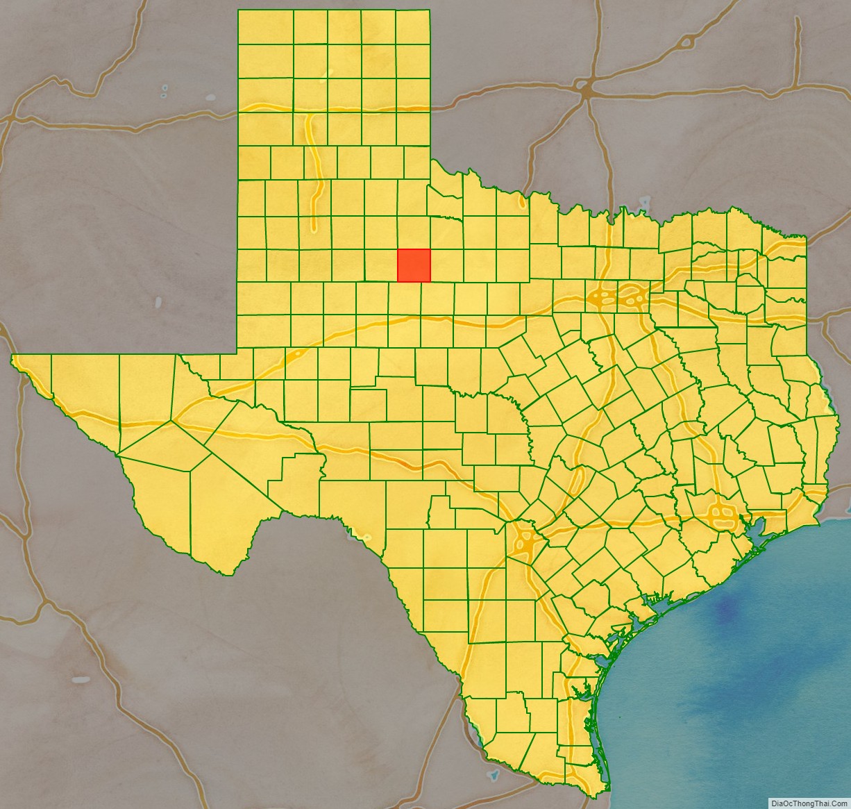
| State: | Texas |
| Founded: | 1888 |
| Named for: | Stonewall Jackson |
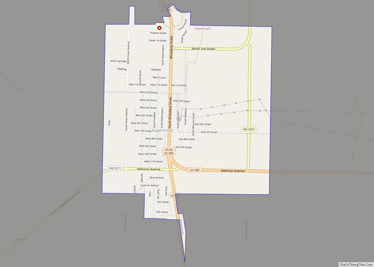
| Seat: | Aspermont |
| Largest town: | Aspermont |
| Total Area: | 920 sq mi (2,400 km²) |
| Land Area: | 916 sq mi (2,370 km²) |
| Total Population: | 1,245 |
| Population Density: | 1.4/sq mi (0.52/km²) |
| Time zone: | UTC−6 (Central) |
| Summer Time Zone (DST): | UTC−5 (CDT) |
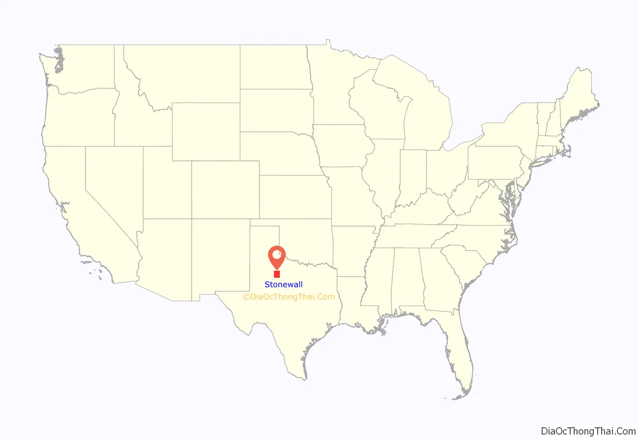
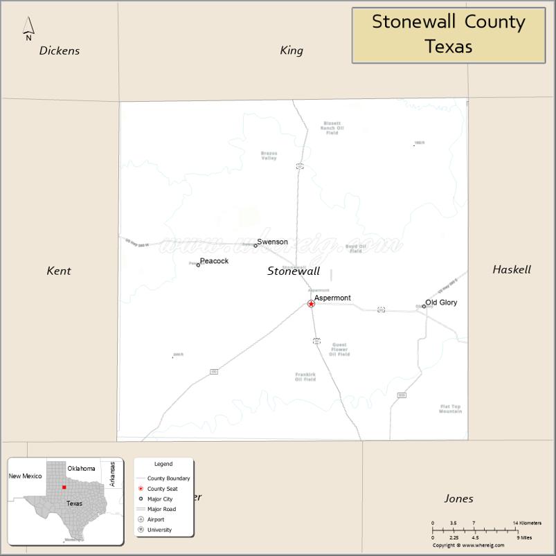
Stonewall County location map. Where is Stonewall County?
History
Stonewall County was formed in 1876 from the Young Territory. It was initially attached to Young County, Throckmorton County, and then Jones County, before finally becoming fully organized in 1889.
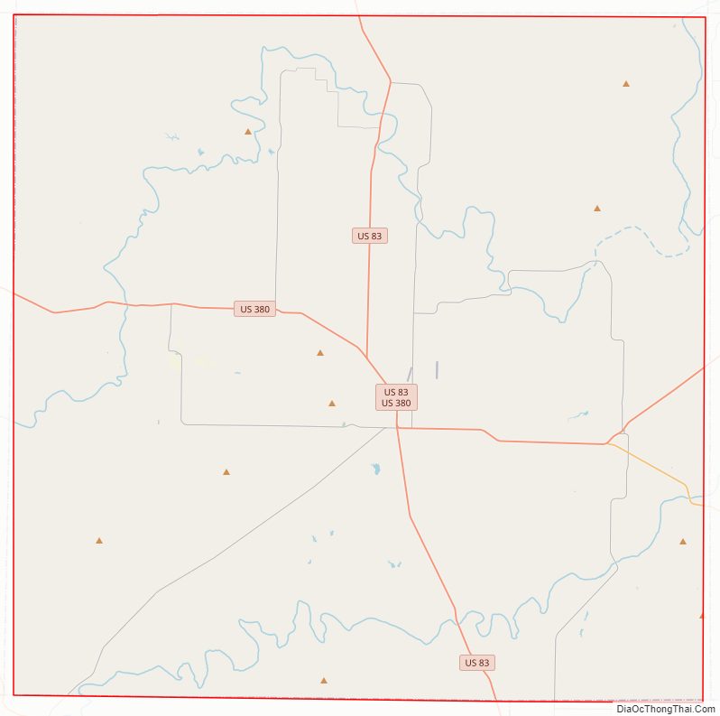
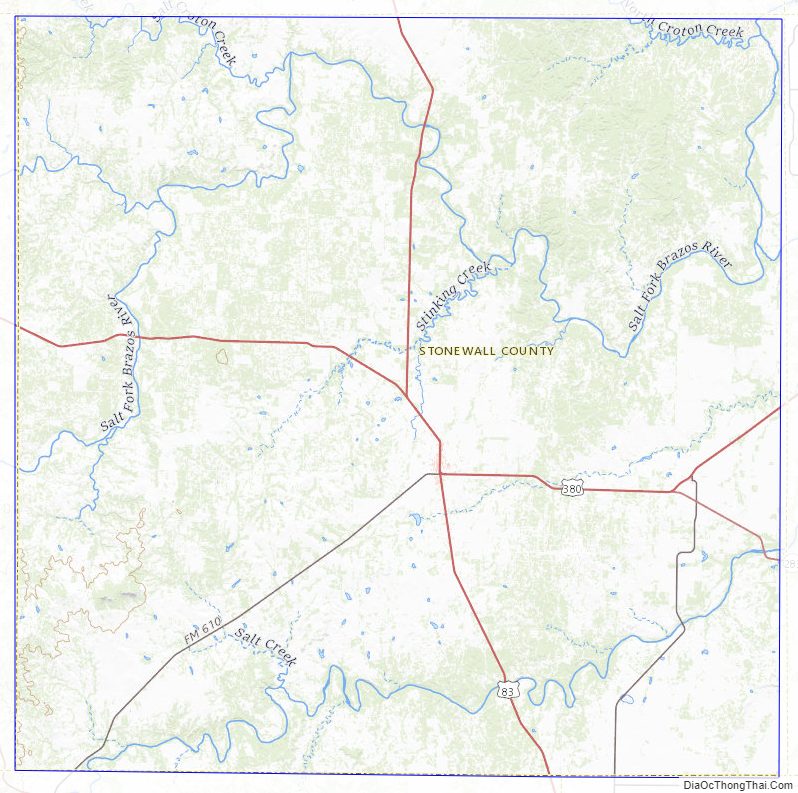
Stonewall County Road Map
Geography
According to the U.S. Census Bureau, the county has a total area of 920 square miles (2,400 km), of which 916 square miles (2,370 km) are land and 3.9 square miles (10 km) (0.4%) are covered by water.
Geographic features
- Double Mountain (county high point and most topographically prominent point for almost 160 miles (260 km)
- The Brazos River begins in Stonewall County at the confluence of the Double Mountain Fork and Salt Fork Brazos River, about 3 miles (4.8 km) west of Jud, Texas, now a ghost town.
Major highways
- U.S. Highway 83
- U.S. Highway 380
- State Highway 283
Adjacent counties
- King County (north)
- Haskell County (east)
- Jones County (southeast)
- Fisher County (south)
- Kent County (west)
Stonewall County Topographic Map
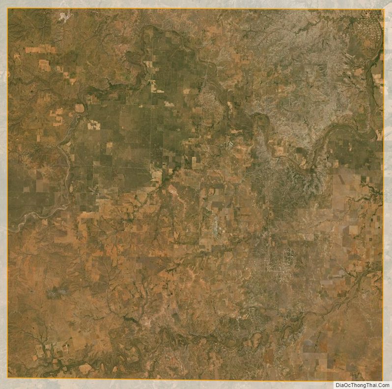
Stonewall County Satellite Map
Stonewall County Outline Map