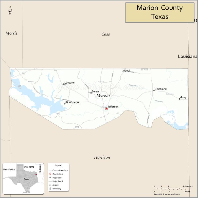
Marion County is a county located in the U.S. state of Texas. As of the 2020 census, its population was 9,725. Its county seat is Jefferson. Marion County is in East Texas and is named for Francis Marion, the Revolutionary War general from South Carolina who was nicknamed the “Swamp Fox”.
| Name: | Marion County |
|---|---|
| FIPS code: | 48-315 |
| State: | Texas |
| Founded: | 1860 |
| Named for: | Francis Marion |
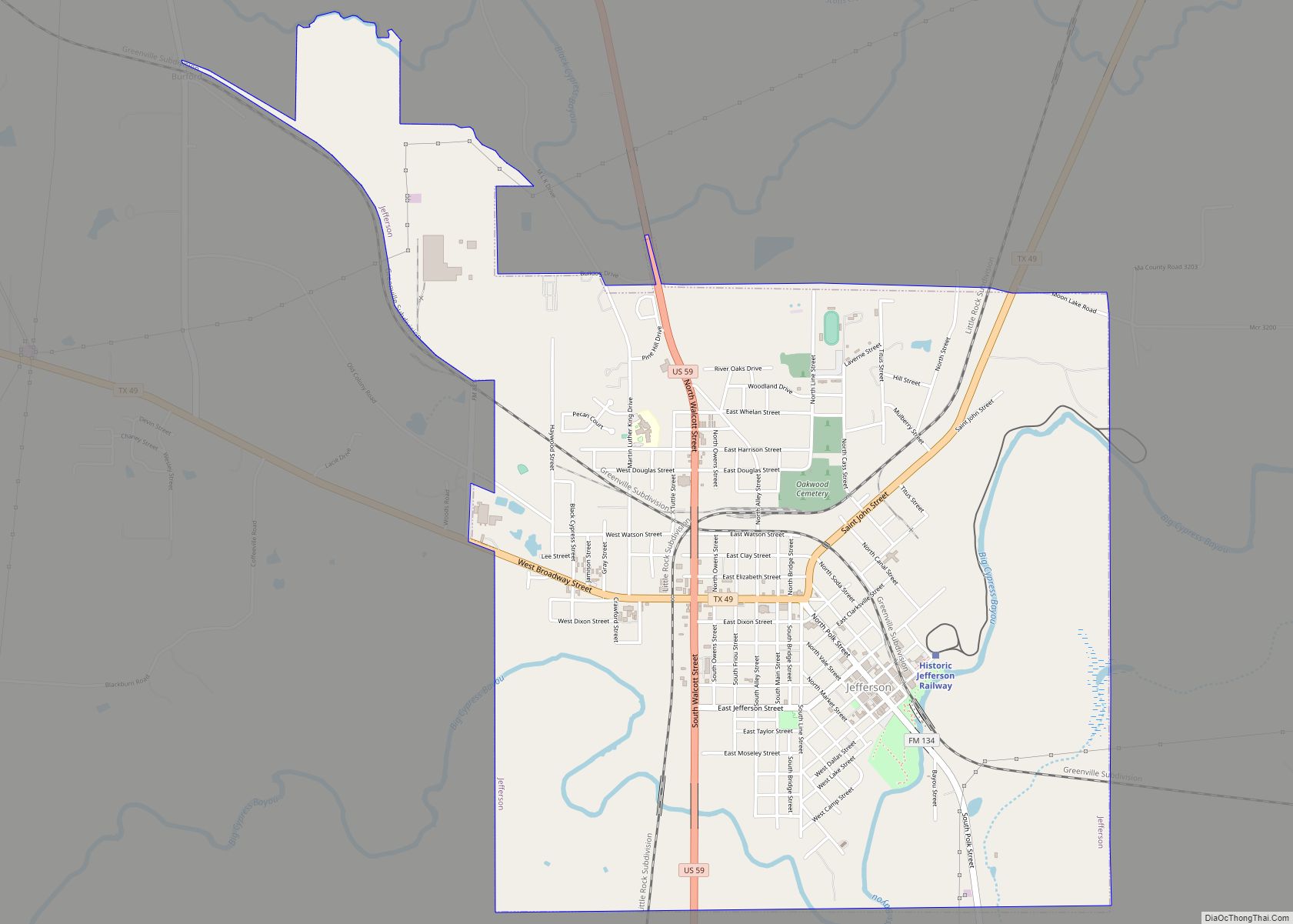
| Seat: | Jefferson |
| Largest city: | Jefferson |
| Total Area: | 420 sq mi (1,100 km²) |
| Land Area: | 381 sq mi (990 km²) |
| Total Population: | 9,725 |
| Population Density: | 23/sq mi (8.9/km²) |
| Time zone: | UTC−6 (Central) |
| Summer Time Zone (DST): | UTC−5 (CDT) |
| Website: | www.co.marion.tx.us |
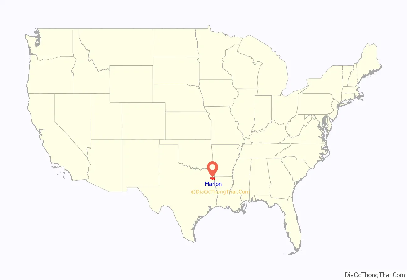
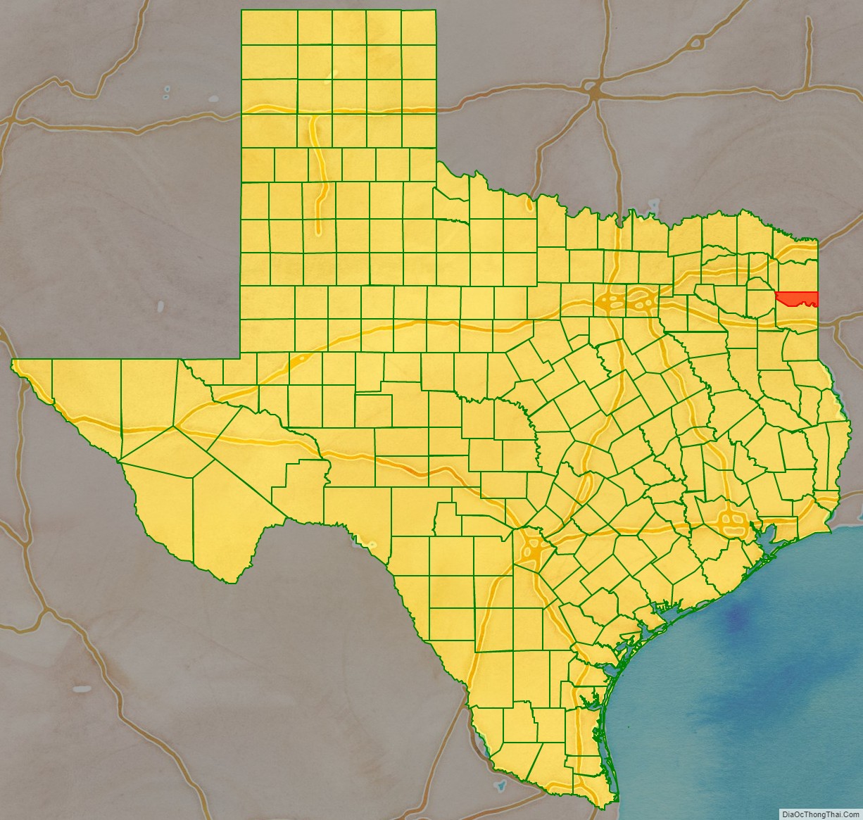
Marion County location map. Where is Marion County?
History
Native Americans
The indigenous farming Caddoan Mississippian culture has been dated to 200 BCE in the area. The Hernando de Soto expedition of 1541 resulted in violent encounters with Native Americans. Spanish and French missionaries carried endemic diseases: resulting in epidemics of smallpox, measles malaria, and influenza among the Caddo. Eventually, the Caddo were forced to reservations. Shashidahnee (Timber Hill) is the last known permanent Marion County settlement of the Caddo people. During the 19th century, Shawnee, Delaware, and Kickapoo migrated to the area and settled here.
County established
The legislature formed Marion County from Cass County in 1860 and named it for Revolutionary War Swamp Fox Francis Marion. Jefferson, named after Thomas Jefferson became the county seat.
The majority of the settlers had migrated from other southern states and brought enslaved African Americans with them as workers, or purchased them in slave markets. The county was developed as cotton plantations, and enslaved African Americans made up 51 percent of the population in 1860. In 1861, the white male voters in the county voted unanimously for secession from the Union. The county benefited financially from Confederate government contracts.
In February 1869 the river steamboat Mittie Stephens caught fire from a torch basket that ignited a hay stack on board. Sixty-one people died, either from the fire or from being caught in the boat’s paddlewheel as they jumped overboard.
Following the Civil War, the white minority used violence to impose dominance on the freedmen. On October 4, 1869, George Washington Smith, a delegate to the state Constitutional Convention, was murdered by a band of vigilantes while incarcerated in Jefferson. Smith’s slaying resulted in the federal government assigning military troops to Jefferson. They offered some protection for the black majority during the Reconstruction era.
During Reconstruction, Republican presidential races were supported by the black majority voters in the county. However, with the end of Reconstruction, white conservative Democrats regained control of the state legislature and, in 1898, passed various restrictions on voter registration and voting, including establishing White primaries. Because the Democratic Party dominated the state, its primaries afforded the only true competitive political races. Blacks were unable to vote in these primaries and were thus disenfranchised. Various forms of the white primary survived until 1944 when a US Supreme Court ruling overturned the practice as racially discriminatory and unconstitutional.
The Marion County brick courthouse was erected in 1914, designed by architect Elmer George Withers. In the early 20th century, the Dick Taylor Camp of Confederate veterans erected a monument to honor the county’s dead in the American Civil War, placing it outside the courthouse.
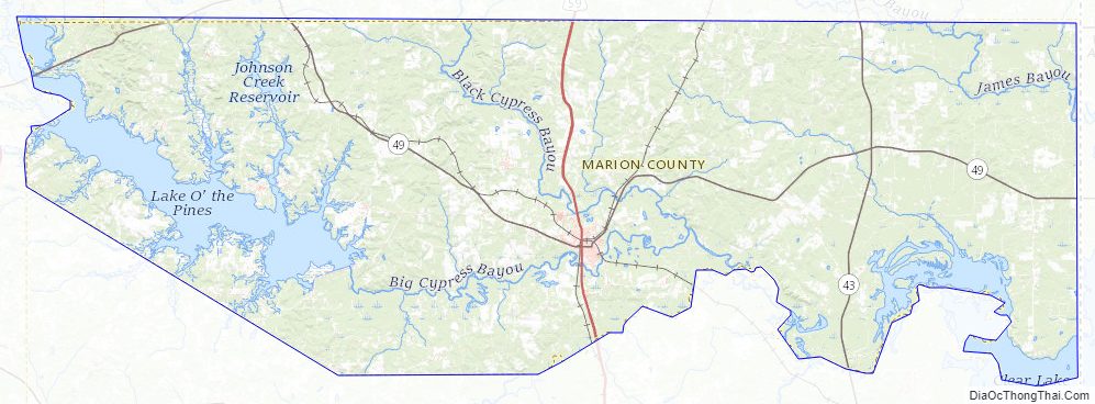
Caddo Lake State Park was first proposed in 1924. From 1933 to 1937, during the Great Depression, men were hired into the Civilian Conservation Corps and made improvements to the park. The former army barracks and mess hall were converted to log cabins and a recreation hall for park goers.
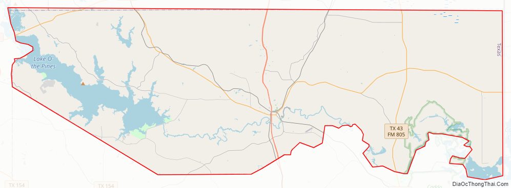
Marion County Road Map
Geography
According to the U.S. Census Bureau, the county has a total area of 420 square miles (1,100 km), of which 381 square miles (990 km) is land and 39 square miles (100 km) (9.4%) is water.
Major highways
- U.S. Highway 59
- Interstate 369 is under construction and will follow the current route of U.S. 59 in most places.
- State Highway 43
- State Highway 49
- State Highway 155
- Farm to Market Road 134
- Farm to Market Road 248
- Farm to Market Road 2208
- Farm to Market Road 726
- Farm to Market Road 729
- Farm to Market Road 727
- Farm to Market Road 805
- Farm to Market Road 2683
The TTC-69 component (recommended preferred) of the once-planned Trans-Texas Corridor went through Marion County.
Adjacent counties and parish
- Cass County (north)
- Caddo Parish, Louisiana (east)
- Harrison County (south)
- Upshur County (west)
- Morris County (northwest)
Marion County Topographic Map
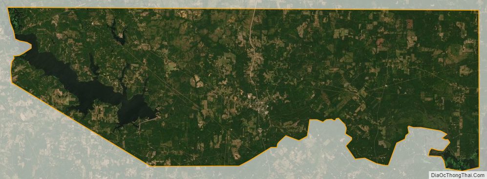
Marion County Satellite Map
Marion County Outline Map