McLennan County is a county located on the Edwards Plateau in Central Texas. As of the 2020 census, its population was 260,579 . Its county seat and largest city is Waco. The U.S. census 2021 county population estimate is 263,115. The county is named for Neil McLennan, an early Scottish settler who worked to evict the Indians in frontier Texas. McLennan County is included in the Waco Metropolitan Statistical Area.
| Name: | McLennan County |
|---|---|
| FIPS code: | 48-309 |
| State: | Texas |
| Founded: | 1850 |
| Named for: | Neil McLennan |
| Seat: | Waco |
| Largest city: | Waco |
| Total Area: | 1,060 sq mi (2,700 km²) |
| Land Area: | 1,037 sq mi (2,690 km²) |
| Total Population: | 260,579 |
| Population Density: | 250/sq mi (95/km²) |
| Time zone: | UTC−6 (Central) |
| Summer Time Zone (DST): | UTC−5 (CDT) |
| Website: | www.co.mclennan.tx.us |
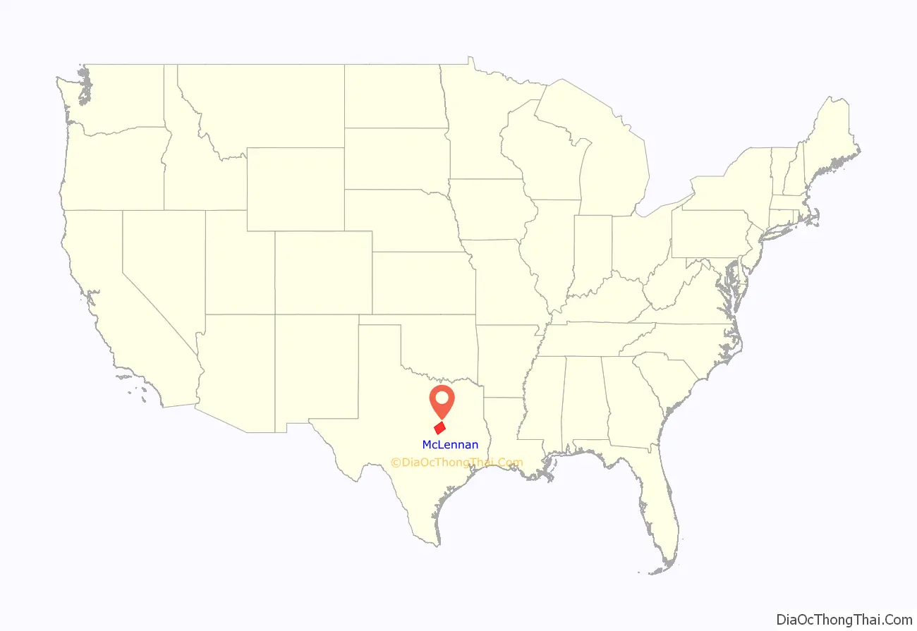
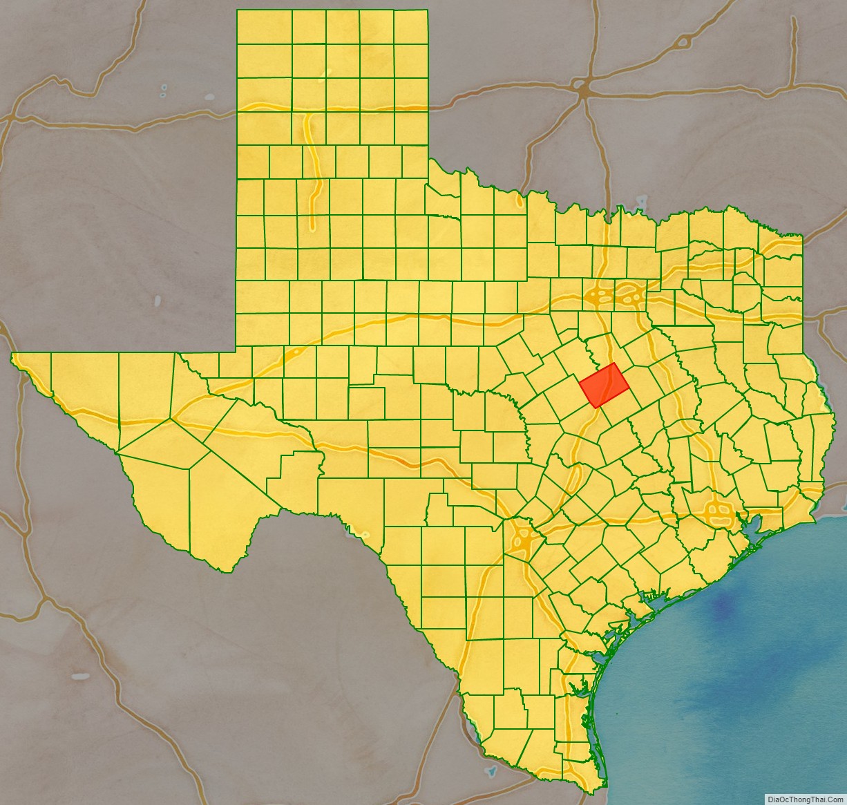
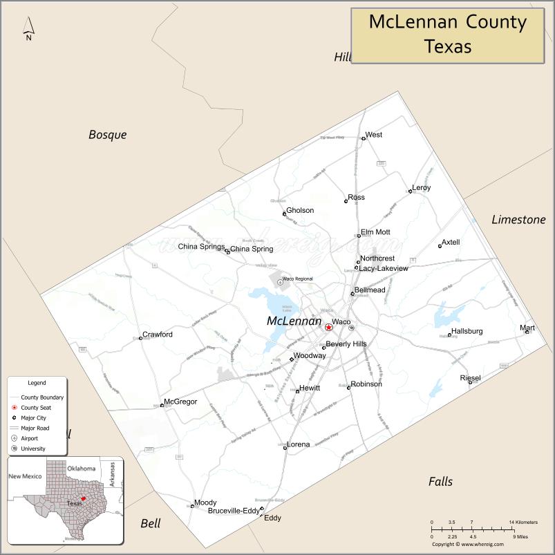
McLennan County location map. Where is McLennan County?
History
McLennan County was created by the Texas Legislature in 1850 out of Milam County. The county seat, Waco, had been founded as an outpost of the Texas Rangers. It was laid out by George B. Erath, and was known by 1850 as Waco Village.
In the 1880s, pharmacist Charles Alderton developed the carbonated beverage that became known as Dr Pepper. The Dr Pepper business was headquartered in Waco, until it moved to Dallas, Texas. Waco is also home to the Dr Pepper Museum, housed in the 1906 building that was the first stand-alone facility used to bottle Dr Pepper.
According to local lore, the first sustained flight did not occur in Kitty Hawk, North Carolina, but just outside Tokio (a small community in McLennan County) by a man flying a gyrocopter. During World War I, McLennan County was home to at least one military airfield, Rich Field. In the aftermath of World War I, when social tensions were high as veterans returned, white racial violence broke out against blacks. The county had 15 lynchings, the second-highest number of any county in the state.
McLennan County’s contributions to World War II include the reopening of Rich Field for use by the Air Force, and the opening of James Connally Air Force Base. The latter is now used as the TSTC Waco Airport and Texas State Technical College. County resident Doris Miller was awarded the Navy Cross for his heroism at Pearl Harbor; he was the first African American to earn such distinction. Local man James Connally became known as a World War II fighter pilot.
County Courthouse
The current County Courthouse is located in the county seat, Waco, Texas, and is the county’s fourth courthouse. Completed in 1902 in the Beaux Arts Style, it is the next-to-last example of Architect James Riely Gordon’s Texas courthouses. Of the eighteen he designed, thirteen remain standing. The first county courthouse was completed in 1851 for $500, and was a two-story log cabin that was 30′ x 30′. McLennan’s second courthouse was a two-story brick building completed in 1857 for $11,000. The third courthouse was styled after Second Empire by architect W.C. Dodson, and completed in 1877 at a cost of $24,894.50.
Institutions of higher education
In 1886, Baylor University relocated from Independence, Texas, to Waco and absorbed Waco University. During the early 20th century, McLennan County was home to as many as five colleges. In addition to Baylor, the other colleges included the predecessor to what is now known as Texas Christian University (now in Fort Worth), Paul Quinn College (relocated since to Dallas), and two other short-lived colleges.
In the 1960s, the Texas Legislature authorized McLennan Community College, the first community college to use those words in the name. Around the same time, what is now the flagship institution of Texas State Technical College was founded as James Connally Technical Institute, as a member of the Texas A&M University System. Today, Baylor, McLennan Community College, and Texas State Technical College continue to operate in McLennan County. They educate a large portion of the college-bound high-school graduates from the county and the surrounding areas. McLennan Community College has also partnered with Tarleton State University, Texas Tech University, University of Texas Medical Branch in Galveston, and Midwestern State University to offer more than 50 bachelor’s or master’s degrees.
1896 Crash at Crush
Crush, Texas, was a temporary “city” in McLennan County, about 15 miles (24 km) north of Waco. It was established to stage a publicity stunt concocted by William George Crush and the Missouri-Kansas-Texas Railroad. The stunt involved the collision of two 35-ton steam locomotives in front of spectators, whom the railway transported to the event for $2 each. After strong promotion, on September 15, 1896, the event was delayed by an hour as the police maneuvered the crowd of more than 40,000 back to what was thought to be a safe distance.
The crews of the two engines tied the throttles open and jumped off. The two engines, pulling wagons filled with railroad ties, traveled a 4-mile (6.4 km) track and thunderously crashed into each other at a combined speed up to 120 mph (190 km/h). The boilers exploded and sent steam and flying debris into the crowd. Three people were killed and about six were injured, including event photographer Jarvis “Joe” Deane, who lost an eye because of a flying bolt.
Ragtime composer Scott Joplin commemorated the event with “The Great Crush Collision March”; Joplin dedicated the composition to the Missouri-Kansas-Texas Railway. Texas composer and singer Brian Burns wrote and recorded a song about the collision, “The Crash at Crush” (2001).
West fertilizer plant explosion
Waco siege
Twin Peaks biker shootout
On May 17, 2015, motorcycle clubs gathered at the Twin Peaks Restaurant in Waco for a Confederation of Clubs meeting. Upon arrival of a large contingent of the Bandidos Motorcycle Club, mass violence erupted in the parking lot of Twin Peaks between members of the Bandidos and members of the Cossasks Motorcycle Club. This resulted in 9 dead and 18 wounded in the melee between the rival outlaw motorcycle gangs. In 2019, all remaining charges were dropped by the new District Attorney, Barry Johnson.
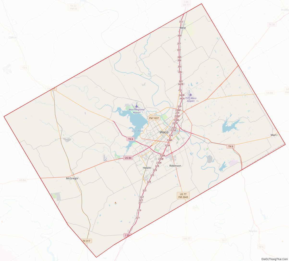
McLennan County Road Map
Geography
According to the U.S. Census Bureau, the county has a total area of 1,060 square miles (2,700 km), of which 1,037 square miles (2,690 km) are land and 23 square miles (60 km) (2.2%) are covered by water.
Major highways
- Interstate 35
- U.S. Highway 77
- U.S. Highway 84
- State Highway 6
- State Highway 31
- State Highway 164
- State Highway 317
Adjacent counties
- Hill County (north)
- Limestone County (east)
- Falls County (southeast)
- Bell County (south)
- Coryell County (southwest)
- Bosque County (northwest)
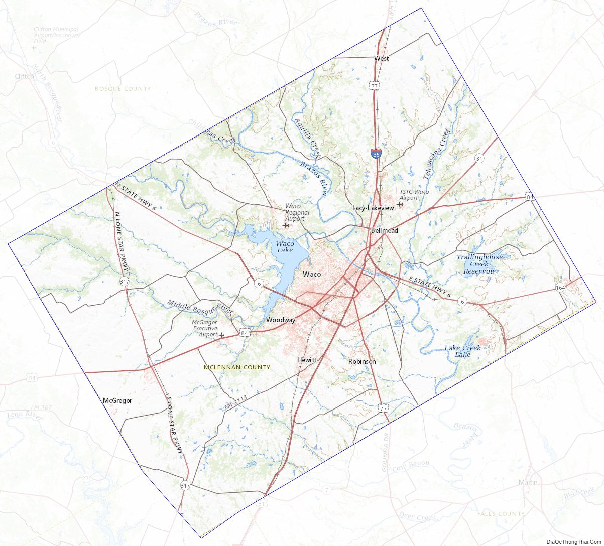
McLennan County Topographic Map
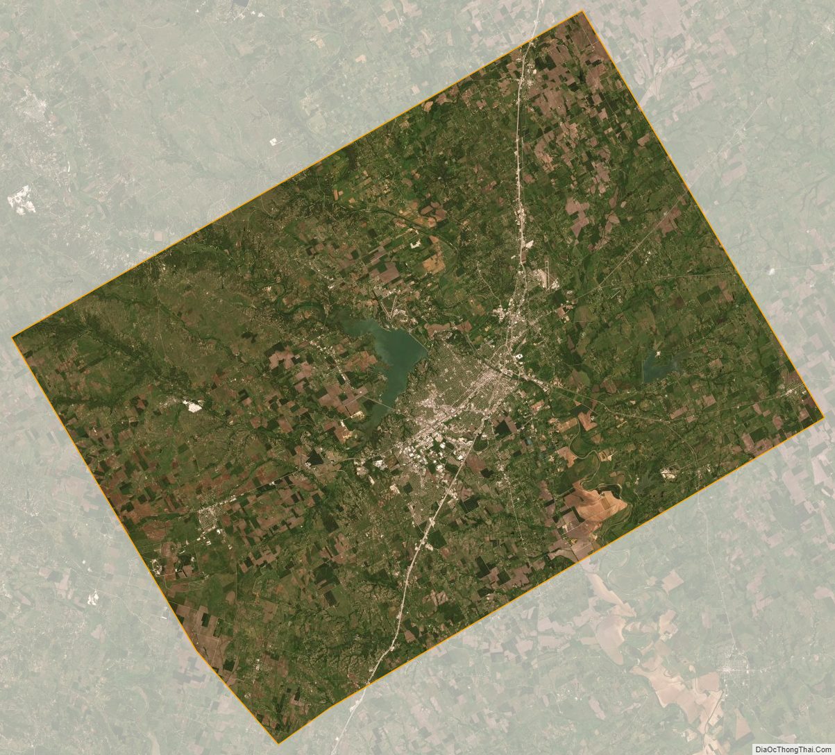
McLennan County Satellite Map
McLennan County Outline Map