McMullen County is a county located in the U.S. state of Texas. As of the 2020 census, its population was 600, making it the fourth-least populous county in Texas. Its county seat is Tilden. The county was established from parts of Bexar County, Atascosa County, and Live Oak County in 1858 and later organized in 1877. It is named for John McMullen, founder of a colony in Texas. The McMullen County Courthouse was designed by the architect W.C. Stephenson, originally from Buffalo, New York. Stephenson also designed some 50 buildings in Beeville, including the Bee County Courthouse.
| Name: | McMullen County |
|---|---|
| FIPS code: | 48-311 |
| State: | Texas |
| Founded: | 1877 |
| Named for: | John McMullen |
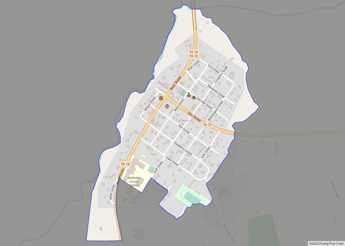
| Seat: | Tilden |
| Total Area: | 1,157 sq mi (3,000 km²) |
| Land Area: | 1,140 sq mi (3,000 km²) |
| Total Population: | 600 |
| Population Density: | 0.5/sq mi (0.2/km²) |
| Time zone: | UTC−6 (Central) |
| Summer Time Zone (DST): | UTC−5 (CDT) |
| Website: | www.co.mcmullen.tx.us |
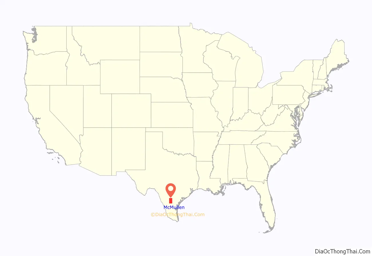
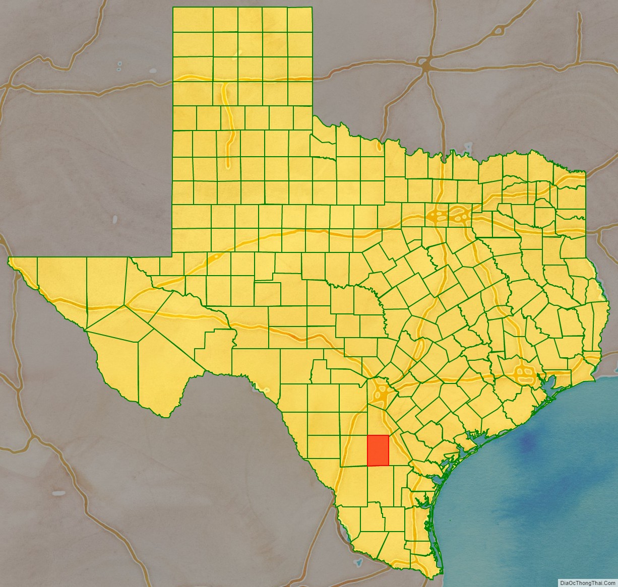
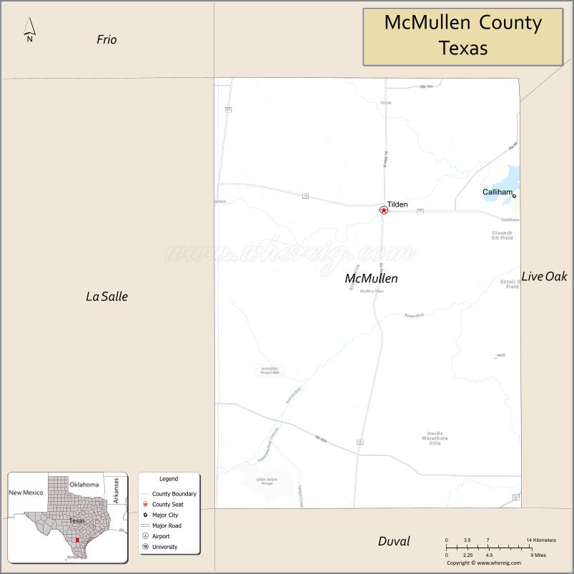
McMullen County location map. Where is McMullen County?
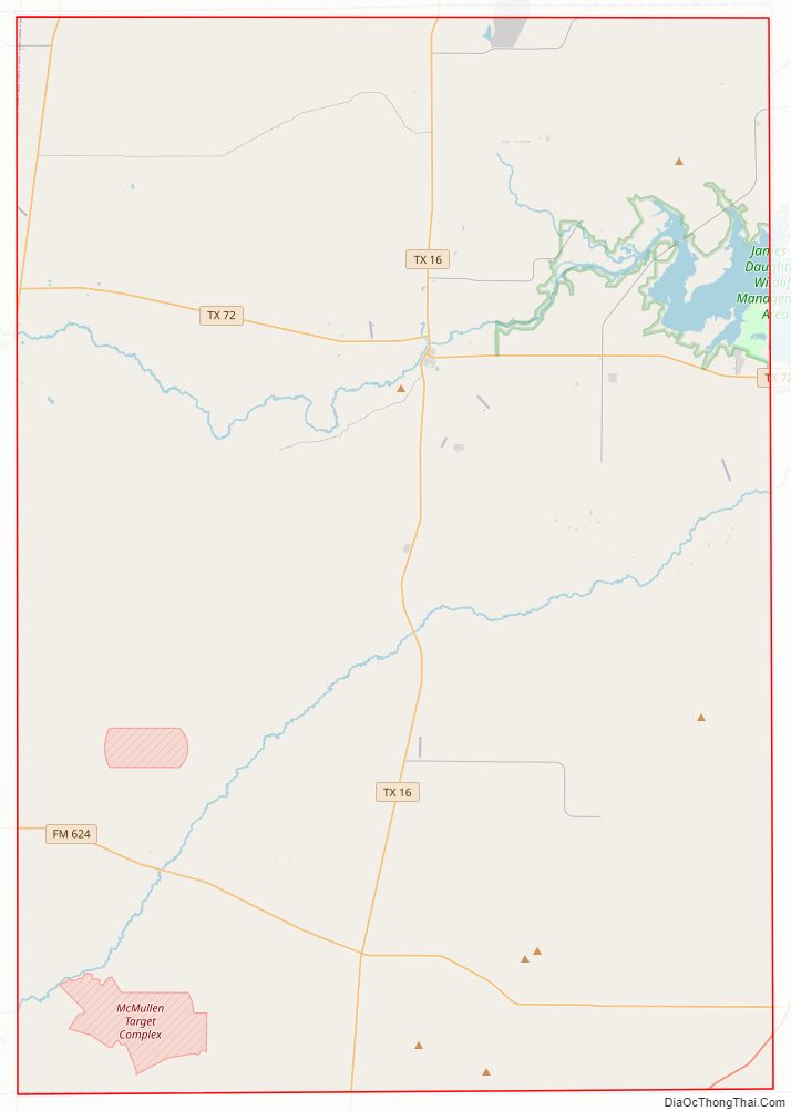
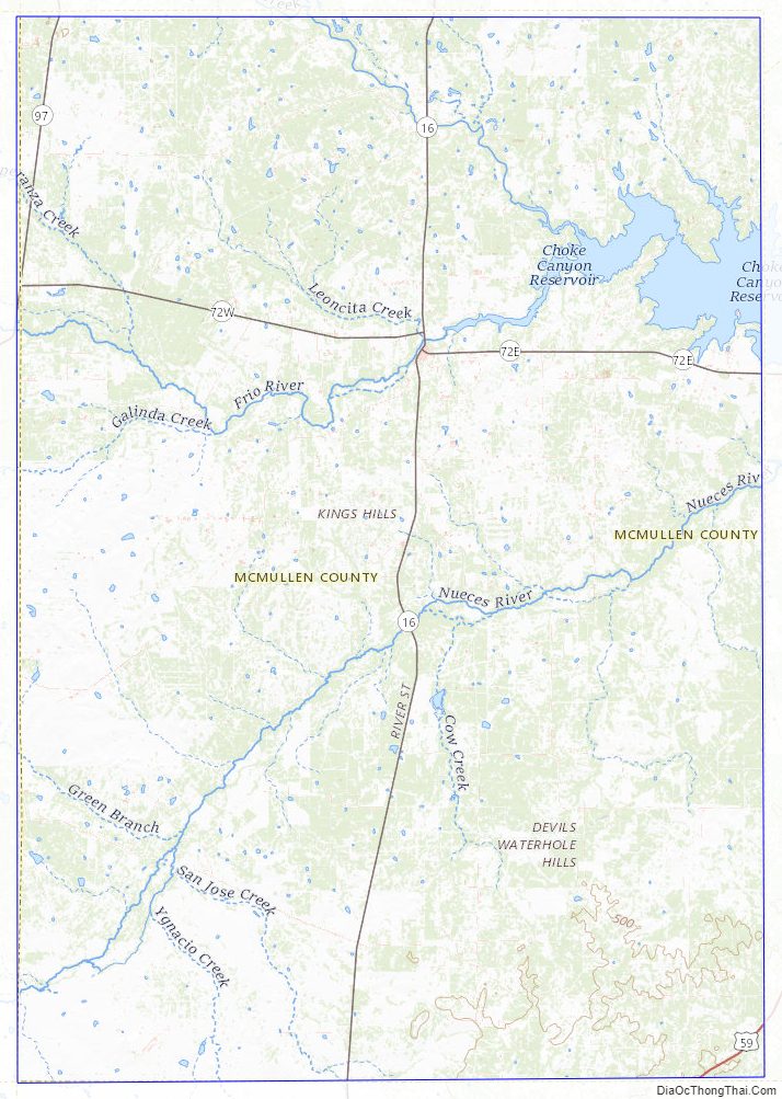
McMullen County Road Map
Geography
According to the U.S. Census Bureau, the county has a total area of 1,157 square miles (3,000 km), of which 1,137 square miles (2,940 km) is land and 17 square miles (44 km) (1.5%) is water.
Major highways
- State Highway 16
- State Highway 72
- State Highway 97
- Farm to Market Road 99
- Farm to Market Road 624
- Farm to Market Road 791
- Farm to Market Road 1582
Adjacent counties
- Atascosa County (north)
- Live Oak County (east)
- Duval County (south)
- La Salle County (west)
- Frio County (northwest)
McMullen County Topographic Map
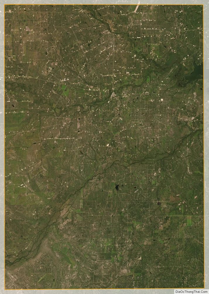
McMullen County Satellite Map
McMullen County Outline Map