Beeville is a city in Bee County, Texas, United States, with a population of 13,669 at the 2020 census. It is the county seat of Bee County and home to the main campus of Coastal Bend College. The area around the city contains three prisons operated by the Texas Department of Criminal Justice.
Many of the stately homes, commercial buildings, and schools in the area, including the Bee County Courthouse, were designed by architect William Charles Stephenson, who came to Beeville in 1908 from Buffalo, New York. Beeville is a national Main Street city. Gutzon Borglum, the sculptor of Mount Rushmore, and his son Lincoln, lived in the city during the time Rushmore was being sculpted.
| Name: | Beeville city |
|---|---|
| LSAD Code: | 25 |
| LSAD Description: | city (suffix) |
| State: | Texas |
| County: | Bee County |
| Incorporated: | 1890 |
| Elevation: | 210 ft (60 m) |
| Total Area: | 6.38 sq mi (16.52 km²) |
| Land Area: | 6.38 sq mi (16.52 km²) |
| Water Area: | 0.00 sq mi (0.00 km²) |
| Total Population: | 13,669 |
| Population Density: | 2,006.12/sq mi (774.58/km²) |
| ZIP code: | 78102, 78104 |
| Area code: | 361 |
| FIPS code: | 4807192 |
| GNISfeature ID: | 1330346 |
| Website: | http://www.beevilletx.org/ |
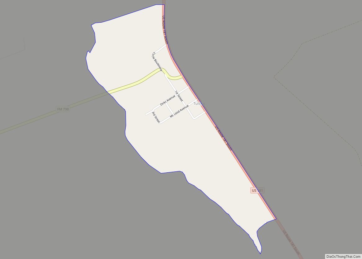
Online Interactive Map
Click on ![]() to view map in "full screen" mode.
to view map in "full screen" mode.
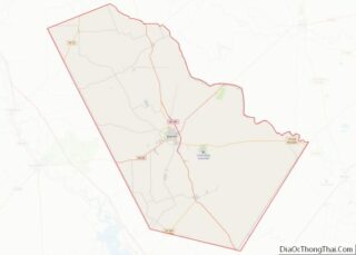
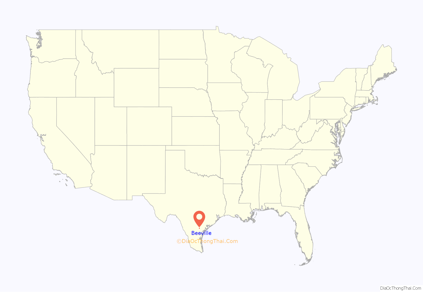
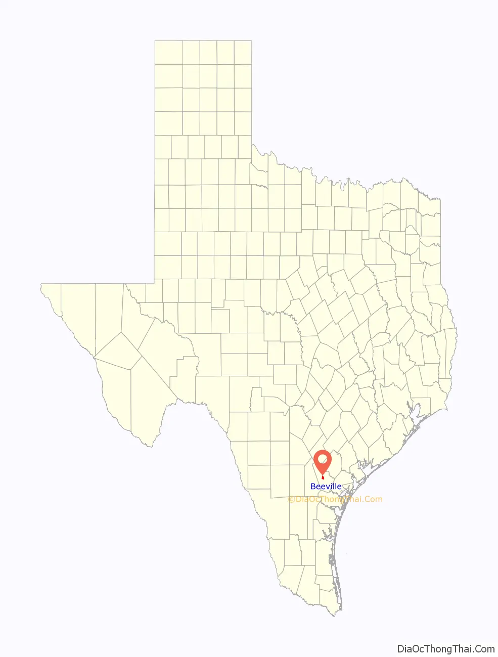
Beeville location map. Where is Beeville city?
History
The original and official site on the Poesta River was first settled by the Burke, Carroll, and Heffernan families in the 1830s. Present-day Beeville was established on a 150-acre land donation made by Ann Burke in May 1859, after the Republic of Texas was annexed by the United States. It was first named “Maryville” for pioneer Mary Heffernan.
It was renamed “Beeville” after Barnard E. Bee, Sr., who had served as Secretary of State and Secretary of War for the Republic of Texas. It was called “Beeville-on-the-Poesta,” with a nearby community called “Beeville-on-the-Medio” seven miles (11 km) to the west. The first post office opened in 1859.
In 1886, the first railroad was constructed through Beeville, stimulating the growth of the economy and population. The Southern Pacific Transportation Company operated these railroads until the early 1970s.
In September 1942, Alfred Irving, who is believed to be one of the final chattel slaves in the United States, was freed at a farm near Beeville. Alex L. Skrobarcek and his daughter, Susie, were arraigned and eventually convicted for their crimes.
The United States Navy operated the Beeville Naval Air Station, which trained Navy airplane pilots during World War II from 1943 through 1946. The base was reopened in 1952 as Naval Air Station Chase Field, continuing in operation until 1992.
By 1950, the population more than doubled to 9,348.
Beeville was served by Trans-Texas Airways (TTA) during the 1950s. TTA operated scheduled passenger flights with Douglas DC-3 prop airliners from Chase Field with service to Brownsville, Corpus Christi, Harlingen, Houston, San Antonio and other destinations in Texas.
In 1967, the town was inundated by 30 inches (760 mm) of rain during Hurricane Beulah.
Beeville calls itself “A Honey of a Town”, referencing its name.
Cattle grazing on ranch lands between Beeville and Goliad, Texas
Entrance sign at Beeville, Texas
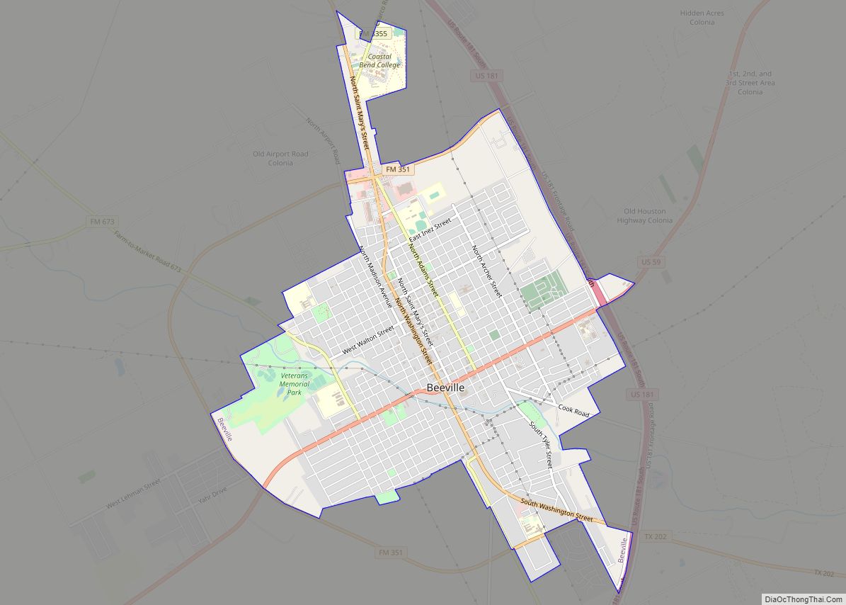
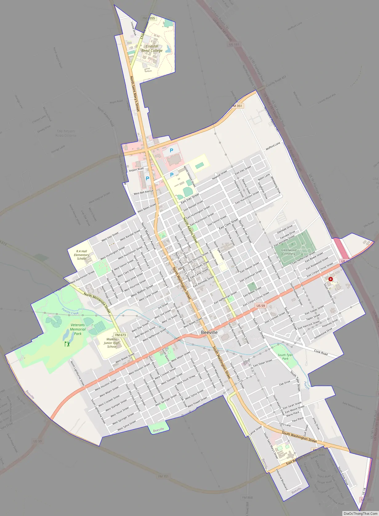
Beeville Road Map
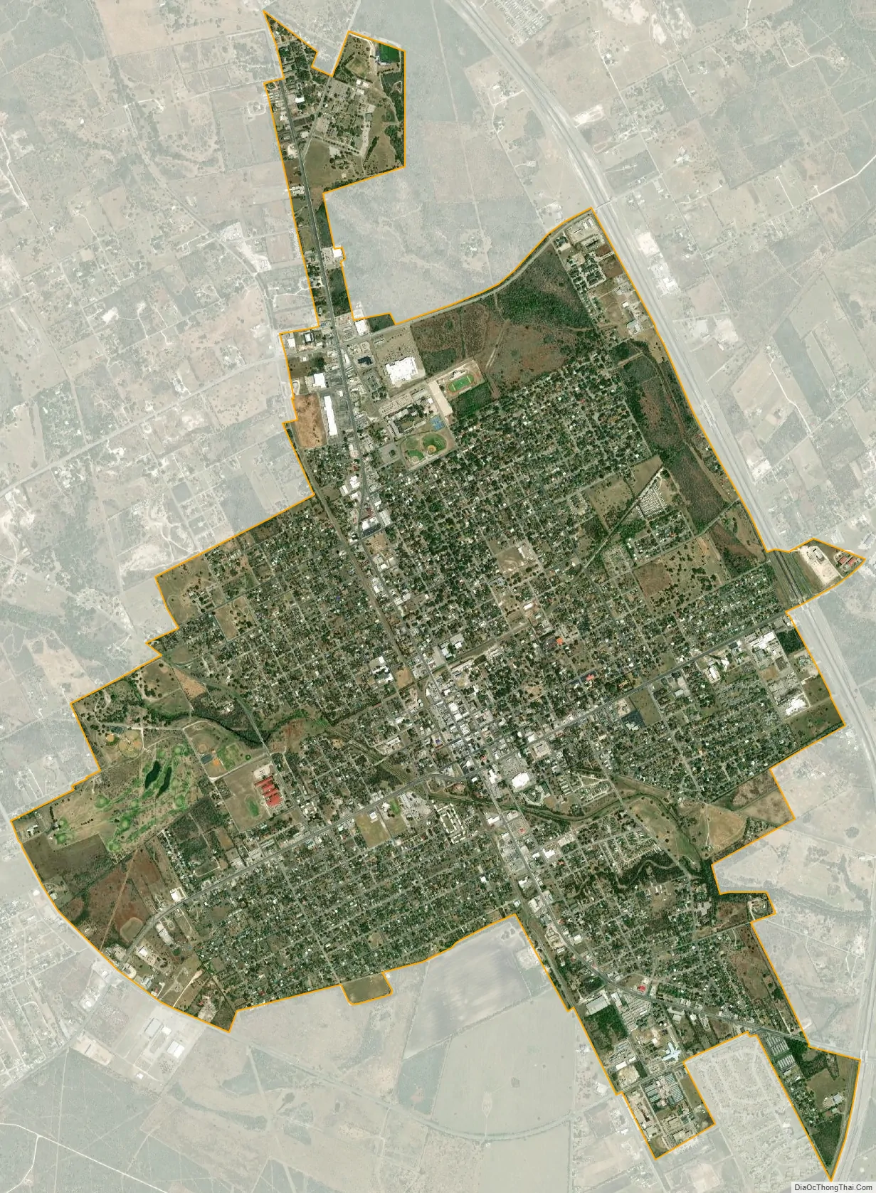
Beeville city Satellite Map
Geography
The city’s terrain ranges from flat to gently rolling slopes, set in the South Texas Brush Country.
Beeville is located between San Antonio and Corpus Christi. Travel time to Corpus Christi is approximately one hour by car, and travel time to San Antonio is approximately 11⁄2 hours by car.
According to the United States Census Bureau, the city has a total area of 6.1 square miles (16 km), all of it land.
See also
Map of Texas State and its subdivision:- Anderson
- Andrews
- Angelina
- Aransas
- Archer
- Armstrong
- Atascosa
- Austin
- Bailey
- Bandera
- Bastrop
- Baylor
- Bee
- Bell
- Bexar
- Blanco
- Borden
- Bosque
- Bowie
- Brazoria
- Brazos
- Brewster
- Briscoe
- Brooks
- Brown
- Burleson
- Burnet
- Caldwell
- Calhoun
- Callahan
- Cameron
- Camp
- Carson
- Cass
- Castro
- Chambers
- Cherokee
- Childress
- Clay
- Cochran
- Coke
- Coleman
- Collin
- Collingsworth
- Colorado
- Comal
- Comanche
- Concho
- Cooke
- Coryell
- Cottle
- Crane
- Crockett
- Crosby
- Culberson
- Dallam
- Dallas
- Dawson
- Deaf Smith
- Delta
- Denton
- Dewitt
- Dickens
- Dimmit
- Donley
- Duval
- Eastland
- Ector
- Edwards
- El Paso
- Ellis
- Erath
- Falls
- Fannin
- Fayette
- Fisher
- Floyd
- Foard
- Fort Bend
- Franklin
- Freestone
- Frio
- Gaines
- Galveston
- Garza
- Gillespie
- Glasscock
- Goliad
- Gonzales
- Gray
- Grayson
- Gregg
- Grimes
- Guadalupe
- Hale
- Hall
- Hamilton
- Hansford
- Hardeman
- Hardin
- Harris
- Harrison
- Hartley
- Haskell
- Hays
- Hemphill
- Henderson
- Hidalgo
- Hill
- Hockley
- Hood
- Hopkins
- Houston
- Howard
- Hudspeth
- Hunt
- Hutchinson
- Irion
- Jack
- Jackson
- Jasper
- Jeff Davis
- Jefferson
- Jim Hogg
- Jim Wells
- Johnson
- Jones
- Karnes
- Kaufman
- Kendall
- Kenedy
- Kent
- Kerr
- Kimble
- King
- Kinney
- Kleberg
- Knox
- La Salle
- Lamar
- Lamb
- Lampasas
- Lavaca
- Lee
- Leon
- Liberty
- Limestone
- Lipscomb
- Live Oak
- Llano
- Loving
- Lubbock
- Lynn
- Madison
- Marion
- Martin
- Mason
- Matagorda
- Maverick
- McCulloch
- McLennan
- McMullen
- Medina
- Menard
- Midland
- Milam
- Mills
- Mitchell
- Montague
- Montgomery
- Moore
- Morris
- Motley
- Nacogdoches
- Navarro
- Newton
- Nolan
- Nueces
- Ochiltree
- Oldham
- Orange
- Palo Pinto
- Panola
- Parker
- Parmer
- Pecos
- Polk
- Potter
- Presidio
- Rains
- Randall
- Reagan
- Real
- Red River
- Reeves
- Refugio
- Roberts
- Robertson
- Rockwall
- Runnels
- Rusk
- Sabine
- San Augustine
- San Jacinto
- San Patricio
- San Saba
- Schleicher
- Scurry
- Shackelford
- Shelby
- Sherman
- Smith
- Somervell
- Starr
- Stephens
- Sterling
- Stonewall
- Sutton
- Swisher
- Tarrant
- Taylor
- Terrell
- Terry
- Throckmorton
- Titus
- Tom Green
- Travis
- Trinity
- Tyler
- Upshur
- Upton
- Uvalde
- Val Verde
- Van Zandt
- Victoria
- Walker
- Waller
- Ward
- Washington
- Webb
- Wharton
- Wheeler
- Wichita
- Wilbarger
- Willacy
- Williamson
- Wilson
- Winkler
- Wise
- Wood
- Yoakum
- Young
- Zapata
- Zavala
- Alabama
- Alaska
- Arizona
- Arkansas
- California
- Colorado
- Connecticut
- Delaware
- District of Columbia
- Florida
- Georgia
- Hawaii
- Idaho
- Illinois
- Indiana
- Iowa
- Kansas
- Kentucky
- Louisiana
- Maine
- Maryland
- Massachusetts
- Michigan
- Minnesota
- Mississippi
- Missouri
- Montana
- Nebraska
- Nevada
- New Hampshire
- New Jersey
- New Mexico
- New York
- North Carolina
- North Dakota
- Ohio
- Oklahoma
- Oregon
- Pennsylvania
- Rhode Island
- South Carolina
- South Dakota
- Tennessee
- Texas
- Utah
- Vermont
- Virginia
- Washington
- West Virginia
- Wisconsin
- Wyoming