Peru is a city in, and the county seat of, Miami County, Indiana, United States. It is 73 miles (117 km) north of Indianapolis. The population was 11,073 at the 2020 census, making it the most populous community in Miami County. Peru is located along the Wabash River and is part of the Kokomo-Peru Combined Statistical Area.
Residents of Peru usually pronounce the name of Peru like the name of the nation of Peru as it is commonly pronounced in American English. Elderly Hoosiers commonly use the archaic pronunciation of /ˈpiːru/ PEE-roo.
| Name: | Peru city |
|---|---|
| LSAD Code: | 25 |
| LSAD Description: | city (suffix) |
| State: | Indiana |
| County: | Miami County |
| Founded: | 1834 |
| Elevation: | 653 ft (199 m) |
| Total Area: | 5.14 sq mi (13.32 km²) |
| Land Area: | 5.06 sq mi (13.09 km²) |
| Water Area: | 0.09 sq mi (2.27 km²) 1.69% |
| Total Population: | 11,073 |
| Population Density: | 2,190.1/sq mi (845.6/km²) |
| ZIP code: | 46970-46971 |
| Area code: | 765 |
| FIPS code: | 1859328 |
| GNISfeature ID: | 441047 |
| Website: | www.cityofperu.org |
Online Interactive Map
Click on ![]() to view map in "full screen" mode.
to view map in "full screen" mode.
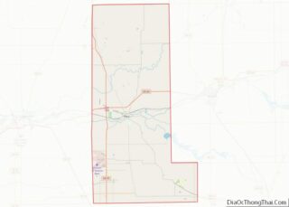
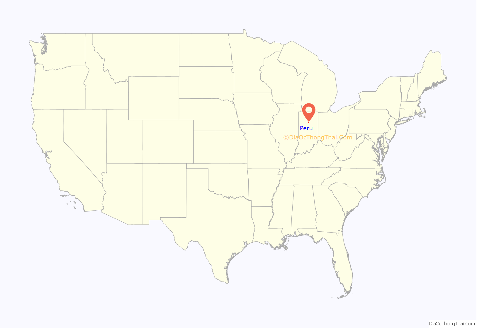
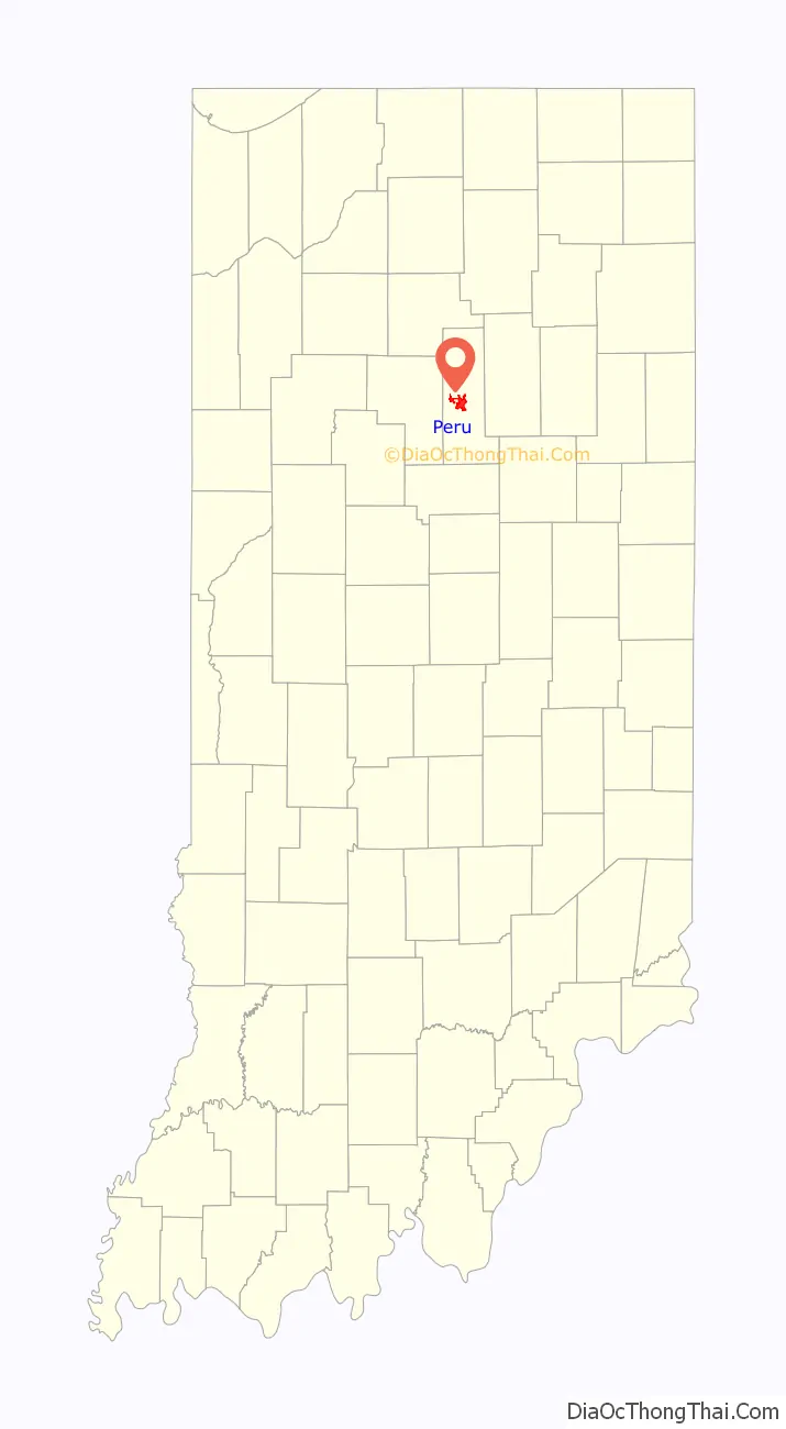
Peru location map. Where is Peru city?
History
On August 18, 1827, Joseph Holman bought land near the confluence of the Mississinewa and Wabash rivers from Jean Baptiste “Pechewa” (Wildcat) Drouet de Richardville, the chief of the Miami people. The sale was approved on March 3, 1828, by President John Quincy Adams. On March 12, 1829, Holman had the land surveyed and laid out into the town of Miamisport.
Peru was founded in 1834 by William N. Hood, who had bought 210 acres (85 hectares) of land from Miamisport’s founder Joseph Holman five years earlier. By 1835, court was being held in Peru rather than Miamisport, and the name “Miamisport” quietly disappeared as Peru became the dominant community in the area. Frances Slocum was reunited with members of her family near Peru in 1837, after nearly sixty years of captivity among Native Americans.
Early in the 20th century, Peru was home to a pioneering automobile maker, Model Automobile Company; like many other early automobile manufacturers, Model did not survive.
In 1913, Peru suffered a massive flood, the worst of its time. Between March 24 and March 27, 6 inches (150 mm) of rain fell on Peru, and sent water from the Wabash and Mississinewa rivers rushing down its streets at speeds of 20 miles per hour (32 km/h), destroying everything in its path. Before the flood of 1913, Peru was a busy town, full of activity and jobs, with 15,000 inhabitants, 100 factories, a trolley service, railroads, a new hospital (Duke’s), a circus (which employed 1,000 people on the road), and a new concrete bridge (largest of its kind in the world at the time). The total loss for Peru was estimated at $3,000,000 (1913 figures). Many people died, as well as many of the circus animals.
Public enemy John Dillinger and his gang robbed the Peru police department armory on October 21, 1933. They acquired one Thompson submachine gun, two Winchester rifles, two shotguns, four .38 revolvers and a half-dozen bulletproof vests.
On June 23, 1972, Martin J. McNally hijacked American Airlines Flight 119 while in flight from St. Louis to Tulsa. After receiving a ransom of $502,500, he jumped out of the back of the Boeing 727 in what was the ninth copycat hijacking in the style of D. B. Cooper. The entire ransom as well as a weapon were found near Peru. A fingerprint led to his arrest. The money was found in a 45-pound (20 kg) sealed canvas mail bag by local farmer Lowell Elliott while he was working in his soybean field. Another farmer, Ronald Miller, discovered a Spitfire submachine gun in his corn field when a blade hit it while applying liquid nitrogen fertilizer.
The movie Little Big Top, which starred Sid Haig, was shot and directed in the town of Peru by Peru native Ward Roberts who also wrote the movie. Scenes show the famous drive up to the “Mr. Weenie” restaurant and the Circus building.
The Brownell Block/Senger Dry Goods Company Building, James Omar Cole House, Miami County Courthouse, Peru High School Historic District, and Shirk-Edwards House are listed on the National Register of Historic Places.
Circuses
Peru was the winter headquarters for several famous circuses, including Ringling Brothers, Hagenbeck–Wallace, Buffalo Bill’s Wild West Show, and others. The International Circus Hall of Fame is located in Peru. Annually during the third week of July, the Peru Amateur Circus holds performances for the whole week, ending with the Circus City Festival and Parade. All of the performers are amateurs, ranging in age from 7 to 21 years. Peru is also the home of the world’s only remaining manufacturer of steam calliopes.
Mariya Rasputina, daughter of Grigori Rasputin, was mauled by a bear in Peru while working for the Hagenback-Wallace Circus, but survived.
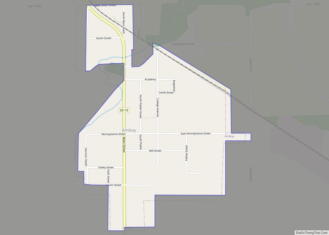
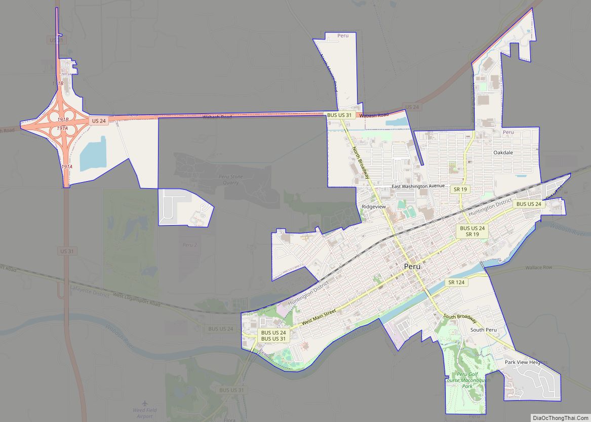
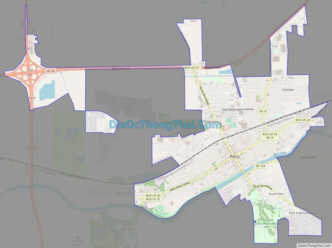
Peru Road Map
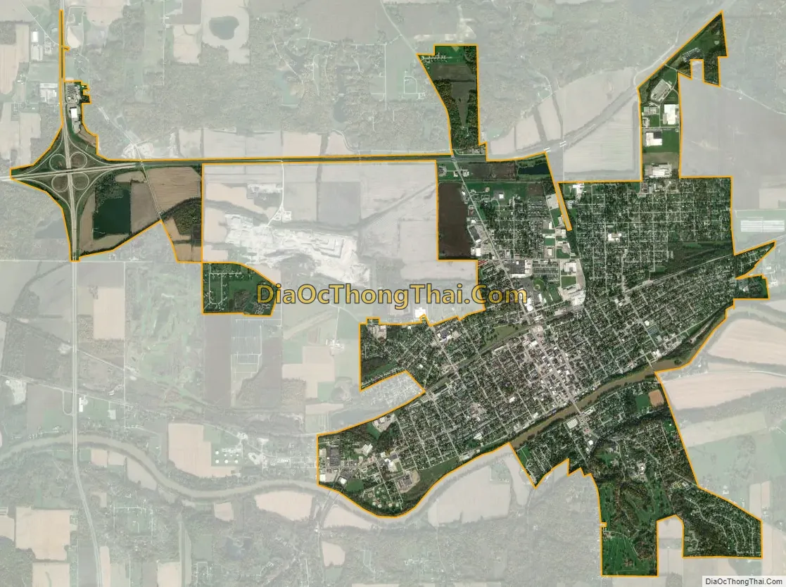
Peru city Satellite Map
Geography
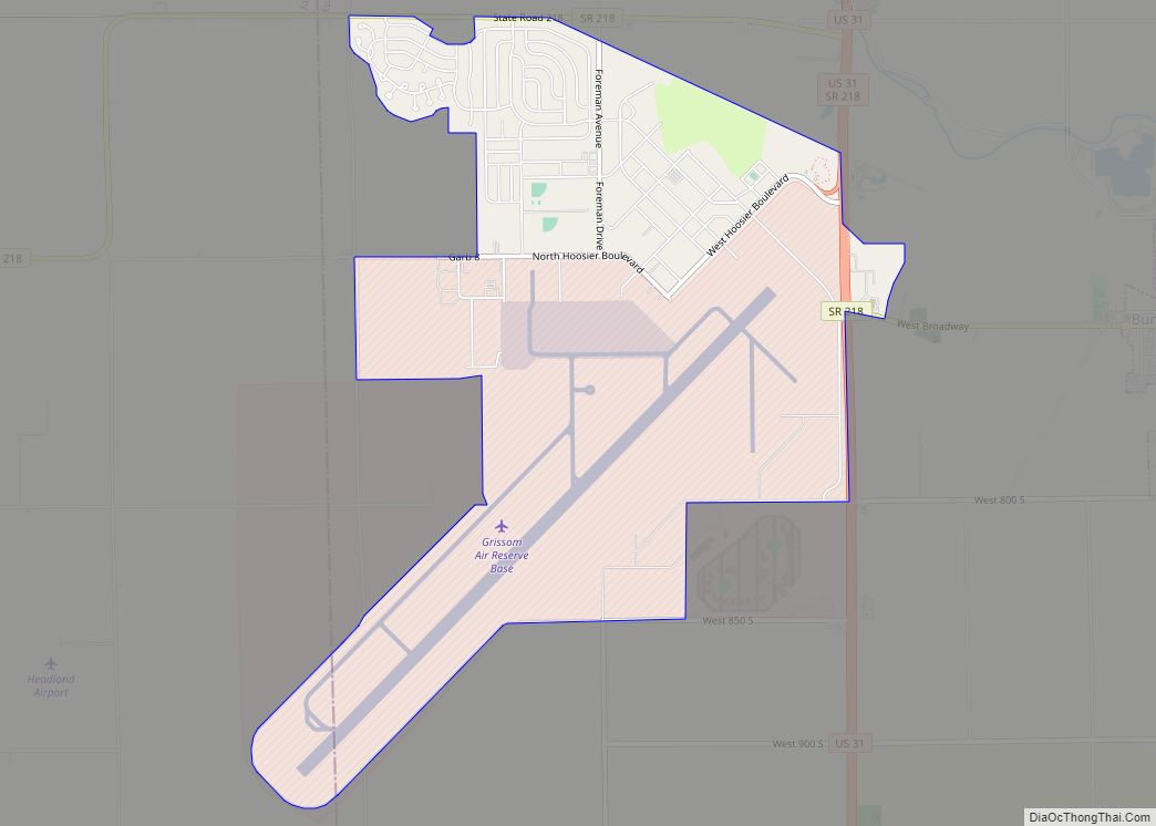
Peru is located in north-central Indiana, in central Miami County, 14 miles (23 km) west of Wabash and 16 miles (26 km) east of Logansport. Indianapolis, the state capital, is 73 miles (117 km) to the south, and South Bend is 71 miles (114 km) to the north.
According to the U.S. Census Bureau, Peru has a total area of 5.14 square miles (13.31 km), of which 5.06 square miles (13.11 km) are land and 0.09 square miles (0.23 km), or 1.69%, are water. The Wabash River flows east to west through the city, south of the downtown area. Across the river, within the city limits, is the neighborhood of South Peru. The Mississinewa River joins the Wabash 1 mile (1.6 km) east (upstream) of the city limits.
Peru is the largest town or city in Miami County and is the site of the tribal headquarters of the Miami Nation.
Peru’s water treatment plant tested negative for PFC in September 2015.
See also
Map of Indiana State and its subdivision:- Adams
- Allen
- Bartholomew
- Benton
- Blackford
- Boone
- Brown
- Carroll
- Cass
- Clark
- Clay
- Clinton
- Crawford
- Daviess
- De Kalb
- Dearborn
- Decatur
- Delaware
- Dubois
- Elkhart
- Fayette
- Floyd
- Fountain
- Franklin
- Fulton
- Gibson
- Grant
- Greene
- Hamilton
- Hancock
- Harrison
- Hendricks
- Henry
- Howard
- Huntington
- Jackson
- Jasper
- Jay
- Jefferson
- Jennings
- Johnson
- Knox
- Kosciusko
- LaGrange
- Lake
- Lake Michigan
- LaPorte
- Lawrence
- Madison
- Marion
- Marshall
- Martin
- Miami
- Monroe
- Montgomery
- Morgan
- Newton
- Noble
- Ohio
- Orange
- Owen
- Parke
- Perry
- Pike
- Porter
- Posey
- Pulaski
- Putnam
- Randolph
- Ripley
- Rush
- Saint Joseph
- Scott
- Shelby
- Spencer
- Starke
- Steuben
- Sullivan
- Switzerland
- Tippecanoe
- Tipton
- Union
- Vanderburgh
- Vermillion
- Vigo
- Wabash
- Warren
- Warrick
- Washington
- Wayne
- Wells
- White
- Whitley
- Alabama
- Alaska
- Arizona
- Arkansas
- California
- Colorado
- Connecticut
- Delaware
- District of Columbia
- Florida
- Georgia
- Hawaii
- Idaho
- Illinois
- Indiana
- Iowa
- Kansas
- Kentucky
- Louisiana
- Maine
- Maryland
- Massachusetts
- Michigan
- Minnesota
- Mississippi
- Missouri
- Montana
- Nebraska
- Nevada
- New Hampshire
- New Jersey
- New Mexico
- New York
- North Carolina
- North Dakota
- Ohio
- Oklahoma
- Oregon
- Pennsylvania
- Rhode Island
- South Carolina
- South Dakota
- Tennessee
- Texas
- Utah
- Vermont
- Virginia
- Washington
- West Virginia
- Wisconsin
- Wyoming