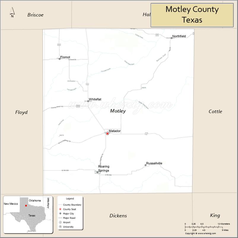
| Name: | Motley County |
|---|---|
| FIPS code: | 48-345 |
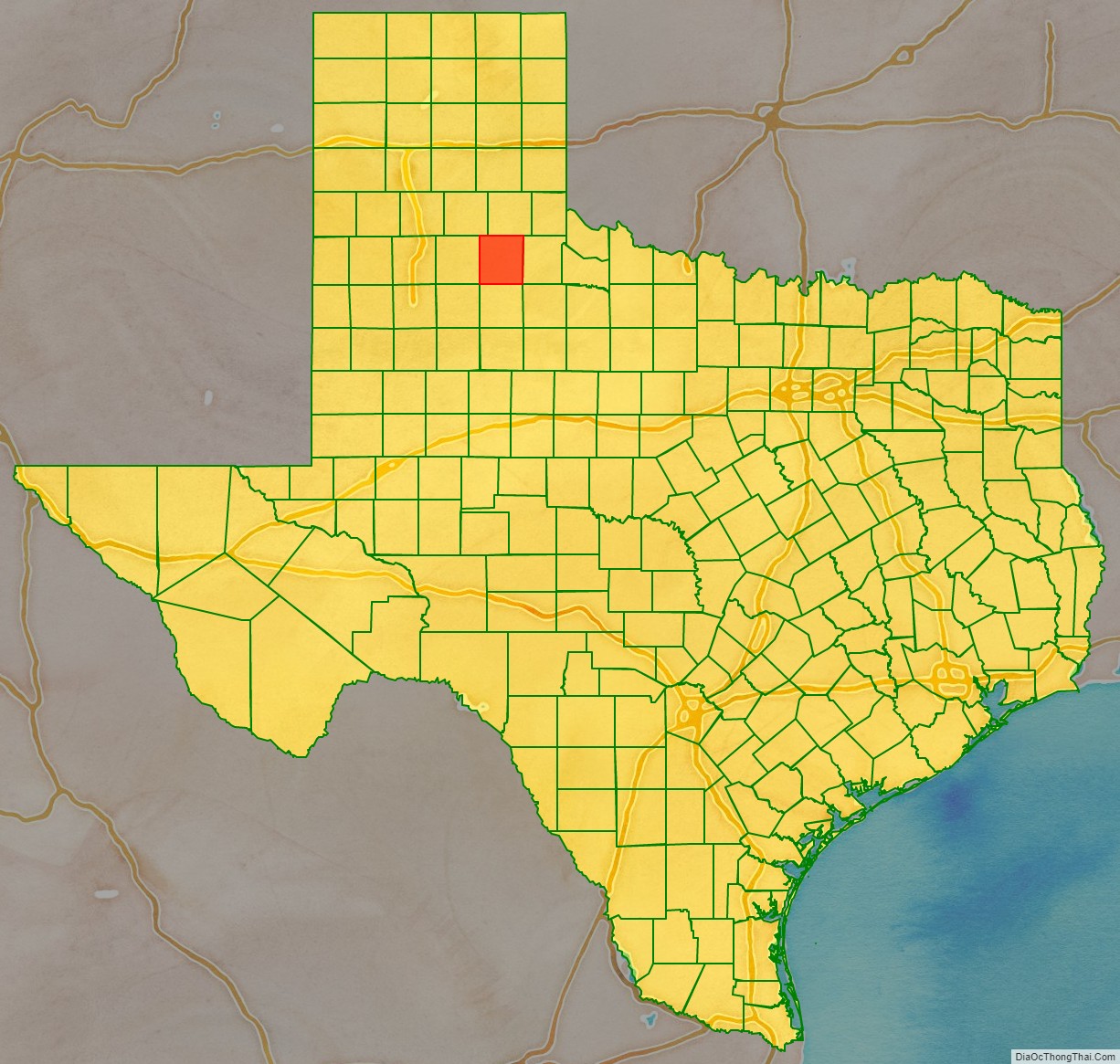
| State: | Texas |
| Founded: | 1891 |
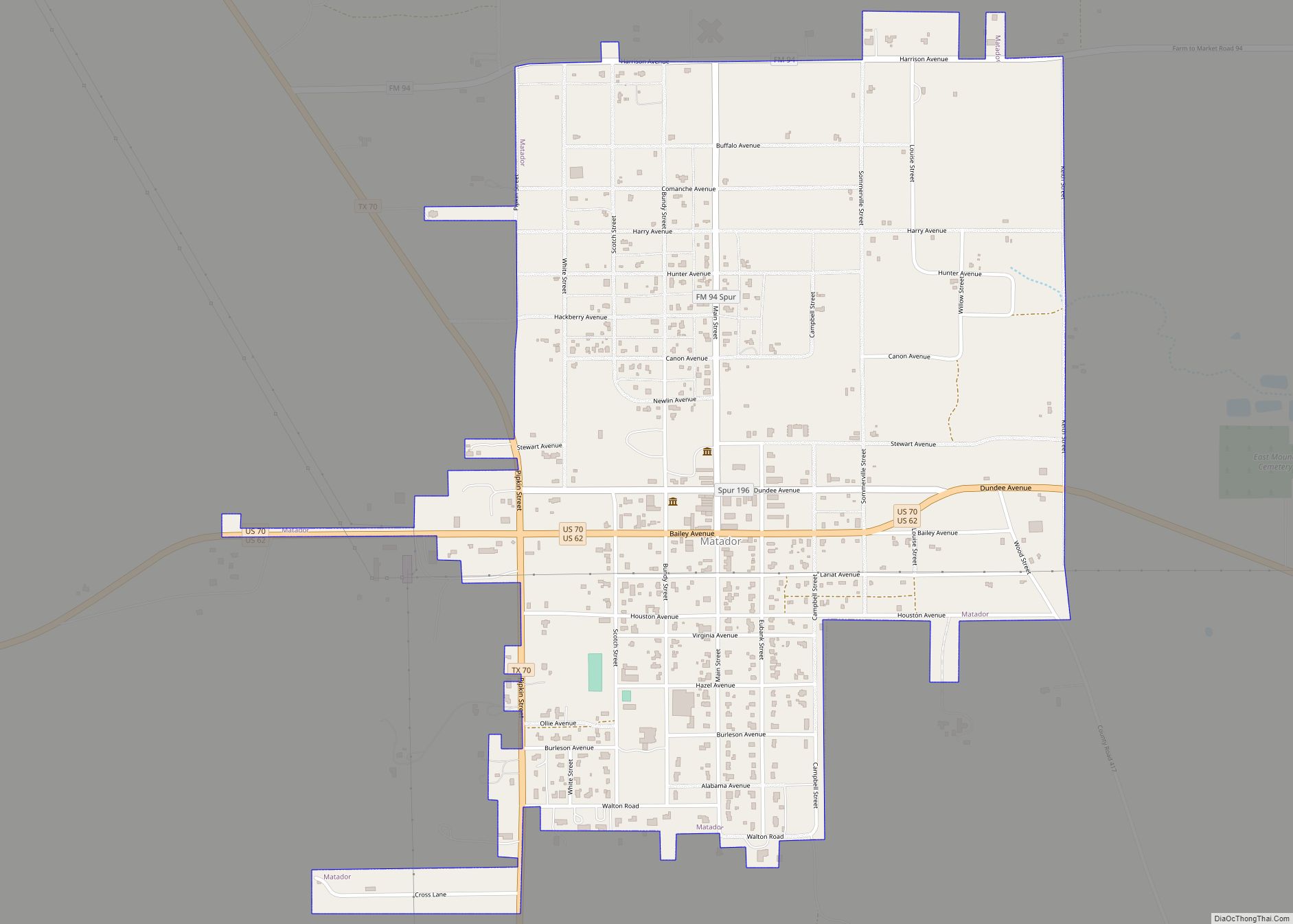
| Seat: | Matador |
| Largest town: | Matador |
| Total Area: | 990 sq mi (2,600 km²) |
| Land Area: | 990 sq mi (2,600 km²) |
| Total Population: | 1,063 |
| Population Density: | 1.1/sq mi (0.41/km²) |
| Time zone: | UTC−6 (Central) |
| Summer Time Zone (DST): | UTC−5 (CDT) |
| Website: | www.co.motley.tx.us |
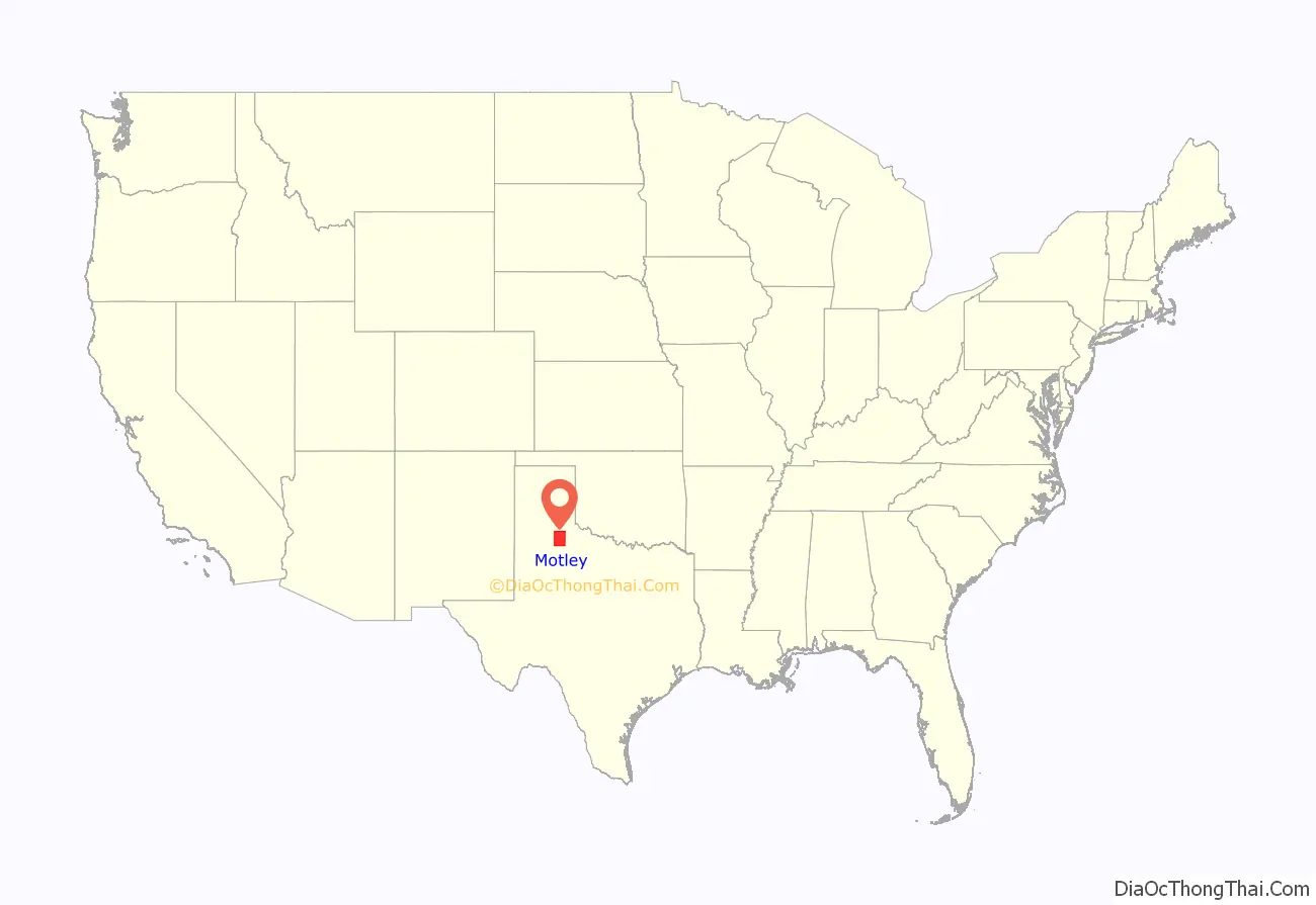
Motley County location map. Where is Motley County?
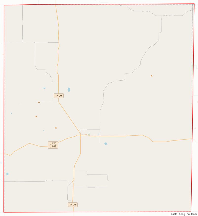
Motley County Road Map
Geography
According to the U.S. Census Bureau, the county has a total area of 990 sq mi (2,600 km), of which 990 sq mi (2,600 km) are land and 0.2 sq mi (0.52 km) (0.03%) is covered by water.
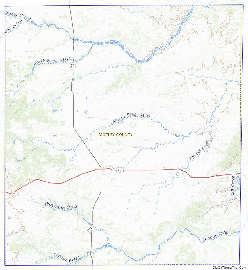
Major highways
- U.S. Highway 62/U.S. Highway 70
- State Highway 70
Adjacent counties
- Hall County (north)
- Cottle County (east)
- Dickens County (south)
- Floyd County (west)
- Briscoe County (northwest)
- King County (northwest)
Motley County Topographic Map
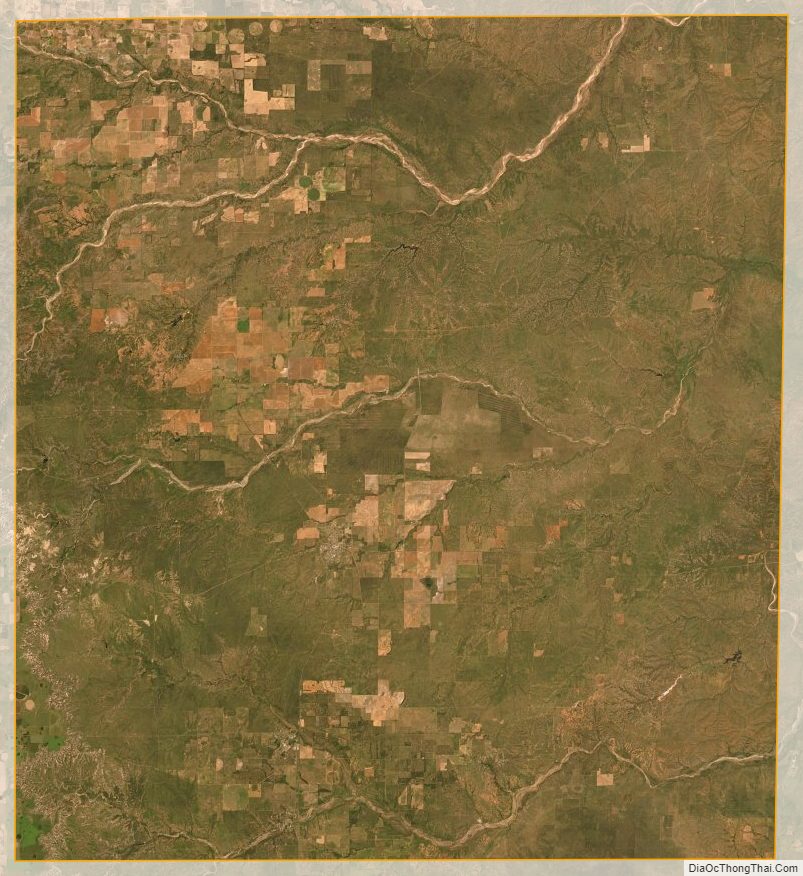
Motley County Satellite Map
Motley County Outline Map