Falmouth is a home rule-class city in, and the county seat of, Pendleton County, Kentucky, in the United States. The population was 2,169 according to the 2010 census. It lies at the confluence of the South and Main forks of the Licking River and is home to Kincaid Regional Theatre.
| Name: | Falmouth city |
|---|---|
| LSAD Code: | 25 |
| LSAD Description: | city (suffix) |
| State: | Kentucky |
| County: | Pendleton County |
| Elevation: | 551 ft (168 m) |
| Total Area: | 1.38 sq mi (3.58 km²) |
| Land Area: | 1.36 sq mi (3.52 km²) |
| Water Area: | 0.02 sq mi (0.05 km²) |
| Total Population: | 2,216 |
| Population Density: | 1,629.41/sq mi (629.21/km²) |
| ZIP code: | 41040 |
| Area code: | 859 |
| FIPS code: | 2126434 |
| GNISfeature ID: | 0491967 |
| Website: | cityoffalmouth.com |
Online Interactive Map
Click on ![]() to view map in "full screen" mode.
to view map in "full screen" mode.
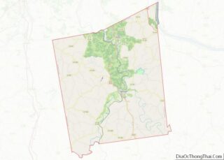
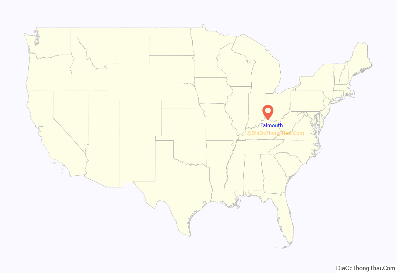
Falmouth location map. Where is Falmouth city?
History
Possibly settled as early as 1780, Falmouth was laid out by John Waller (1758–1823) and formally established by the state assembly in 1793. Waller named the new settlement after his native Falmouth, Virginia. It was incorporated as a city in 1856.
The town is perhaps best remembered for natural disasters that have devastated the town over the last half of the 20th century. In 1964, the Licking River reached 47 feet (19 feet above flood stage) and left much of the town under water. On April 23, 1968 an F4 (possibly F5) tornado leveled many homes in the town, killing four people. On March 2, 1997, a major flood on the Licking River again left the town crippled. The river reached 52 feet (24 feet above flood stage) and left 80% of the town under several feet of water. Many homes and businesses were damaged and five residents were killed.
Charity’s House and Elzey Hughes House were both part of the historically African-American “Happy Hollow” neighborhood and each is listed on the National Register of Historic Places.
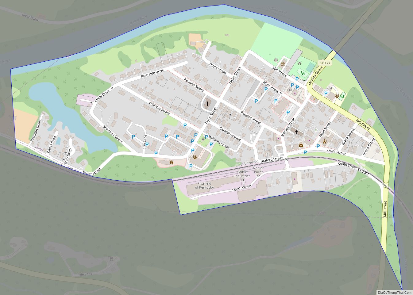
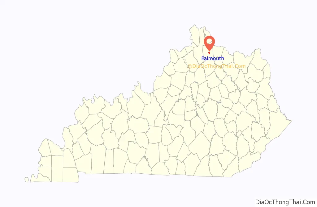
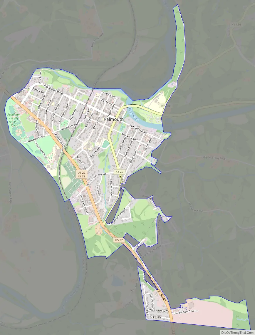
Falmouth Road Map
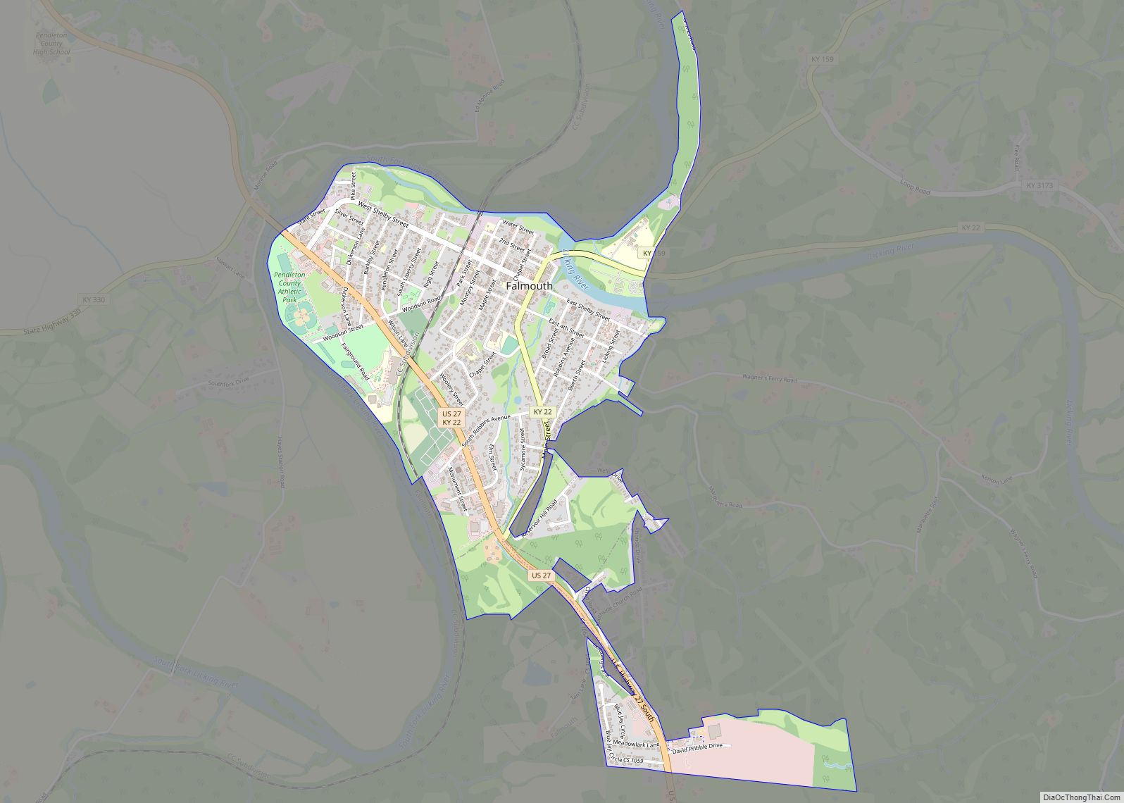
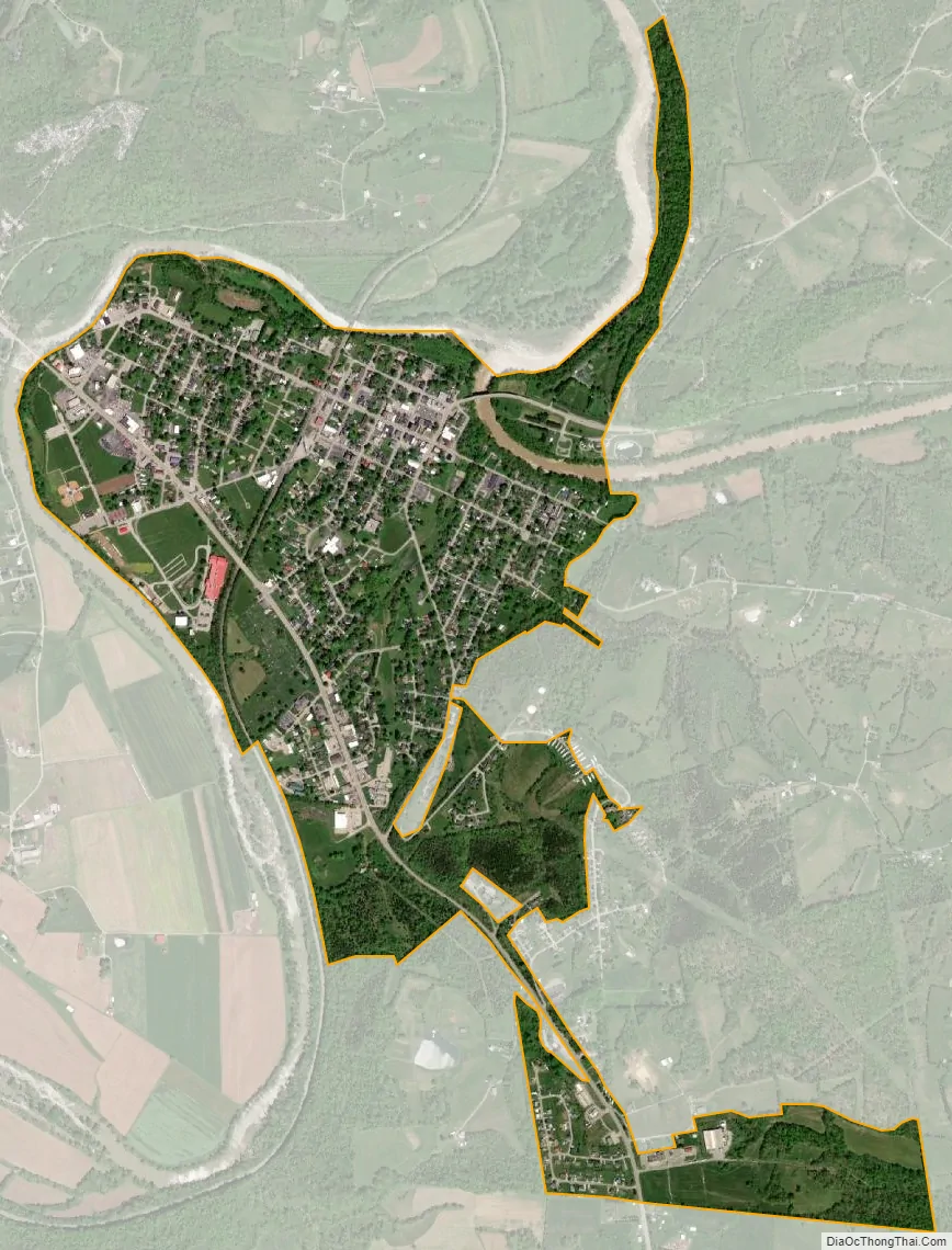
Falmouth city Satellite Map
Geography
Falmouth is located at 38°40′26″N 84°20′3″W / 38.67389°N 84.33417°W / 38.67389; -84.33417 (38.673860, -84.334213).
According to the United States Census Bureau, the city has a total area of 1.3 square miles (3.4 km), all land.
See also
Map of Kentucky State and its subdivision:- Adair
- Allen
- Anderson
- Ballard
- Barren
- Bath
- Bell
- Boone
- Bourbon
- Boyd
- Boyle
- Bracken
- Breathitt
- Breckinridge
- Bullitt
- Butler
- Caldwell
- Calloway
- Campbell
- Carlisle
- Carroll
- Carter
- Casey
- Christian
- Clark
- Clay
- Clinton
- Crittenden
- Cumberland
- Daviess
- Edmonson
- Elliott
- Estill
- Fayette
- Fleming
- Floyd
- Franklin
- Fulton
- Gallatin
- Garrard
- Grant
- Graves
- Grayson
- Green
- Greenup
- Hancock
- Hardin
- Harlan
- Harrison
- Hart
- Henderson
- Henry
- Hickman
- Hopkins
- Jackson
- Jefferson
- Jessamine
- Johnson
- Kenton
- Knott
- Knox
- Larue
- Laurel
- Lawrence
- Lee
- Leslie
- Letcher
- Lewis
- Lincoln
- Livingston
- Logan
- Lyon
- Madison
- Magoffin
- Marion
- Marshall
- Martin
- Mason
- McCracken
- McCreary
- McLean
- Meade
- Menifee
- Mercer
- Metcalfe
- Monroe
- Montgomery
- Morgan
- Muhlenberg
- Nelson
- Nicholas
- Ohio
- Oldham
- Owen
- Owsley
- Pendleton
- Perry
- Pike
- Powell
- Pulaski
- Robertson
- Rockcastle
- Rowan
- Russell
- Scott
- Shelby
- Simpson
- Spencer
- Taylor
- Todd
- Trigg
- Trimble
- Union
- Warren
- Washington
- Wayne
- Webster
- Whitley
- Wolfe
- Woodford
- Alabama
- Alaska
- Arizona
- Arkansas
- California
- Colorado
- Connecticut
- Delaware
- District of Columbia
- Florida
- Georgia
- Hawaii
- Idaho
- Illinois
- Indiana
- Iowa
- Kansas
- Kentucky
- Louisiana
- Maine
- Maryland
- Massachusetts
- Michigan
- Minnesota
- Mississippi
- Missouri
- Montana
- Nebraska
- Nevada
- New Hampshire
- New Jersey
- New Mexico
- New York
- North Carolina
- North Dakota
- Ohio
- Oklahoma
- Oregon
- Pennsylvania
- Rhode Island
- South Carolina
- South Dakota
- Tennessee
- Texas
- Utah
- Vermont
- Virginia
- Washington
- West Virginia
- Wisconsin
- Wyoming